*For Thursday, 28 December 2006.
LEGEND for OVERVIEW: Size = My surety of area for quake.
Red Circle = Probable quake to STRONG quake.
Triangle = Very Strong/Stronger quake (Usually takes extra days).
Blue Circle, etc. = Uncertainty of symptom area for probable quake.

Places to watch.
Good luck to all.
For Thursday, 28 December 2006.
--------------------------------------
Youngstown, N.Y area (43.459N 79.465W)
--------------------------------------
2006/12/27 17:51:02 52.38N 79.64W 18.0* 2.6MN James Bay.
(This may be the right quake for the symptom.)
Loyalty Islands area (20.30S 168.80E)
(Second day symptom - STRONG)
--------------------------------------
(Nothing found)
Switzerland to Central Italy (Strong)
--------------------------------------
2006-12-28 14:10:27.8 46.08N 12.32E 2 ML3.8 NORTHERN ITALY
Alamo, Nevada area (37.001 -115.148)
--------------------------------------
2.3 2006/12/30 22:43:15 36.046 -115.255 0.0 5 km ( 3 mi) WNW of Enterprise, NV
(2 extra days)
Strait of Gibraltar to Algeria
(Very Strong)
www.soschildrensvillages.org.uk
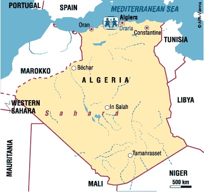
--------------------------------------
2006-12-28 01:09:17.6 34.93N 3.95W mb3.3 MOROCCO
2006-12-30 23:50:51 4.7mb 34.93N 3.17E 20 Northern Algeria
(2 extra days and not so big. There is more coming and may just mean a swarm.)
The Geysers area
--------------------------------------
1.6 2006/12/27 09:55:52 38.809 -122.793 4.1 2 km ( 1 mi) NE of The Geysers, CA
1.9 2006/12/27 17:17:00 38.802 -122.797 3.9 1 km ( 1 mi) ENE of The Geysers, CA
2.2 2006/12/27 20:55:23 38.808 -122.790 2.4 2 km ( 1 mi) NE of The Geysers, CA
1.3 2006/12/27 21:05:04 38.831 -122.797 2.1 4 km ( 2 mi) NNE of The Geysers, CA
1.5 2006/12/27 21:38:15 38.814 -122.816 3.2 2 km ( 1 mi) NNW of The Geysers, CA
1.3 2006/12/28 05:40:16 38.818 -122.797 3.0 2 km ( 1 mi) NNE of The Geysers, CA
1.7 2006/12/28 06:21:19 38.576 -122.799 2.8 3 km ( 2 mi) N of Windsor, CA
1.8 2006/12/28 15:36:16 38.800 -122.737 0.4 4 km ( 3 mi) SSW of Cobb, CA
1.2 2006/12/28 15:39:04 38.727 -122.713 19.5 6 km ( 4 mi) SSW of Anderson Springs, CA
2.7 2006/12/28 20:02:30 38.824 -122.827 2.7 3 km ( 2 mi) NNW of The Geysers, CA
1.7 2006/12/28 22:24:52 38.411 -122.626 7.6 8 km ( 5 mi) ESE of Santa Rosa, CA
1.1 2006/12/28 23:23:58 38.831 -122.794 2.2 4 km ( 2 mi) NNE of The Geysers, CA
1.9 2006/12/28 23:22:56 38.830 -122.794 1.7 4 km ( 2 mi) NNE of The Geysers, CA
East Carbon, Utah
--------------------------------------
06/12/28 20:51:28 39.74N 110.75W 0.0 1.3 6.7 mi NE of Helper
06/12/28 21:43:26 39.74N 110.75W 0.2 1.4 7.0 mi NE of Helper
06/12/28 21:48:26 39.73N 110.75W 0.5 1.4 6.8 mi NE of Helper
06/12/28 23:43:51 39.73N 110.75W 0.1 1.3 6.4 mi NE of Helper
06/12/29 06:25:50 39.67N 110.49W 1.8 1.2 9.1 mi NW of E. Carbon City
06/12/29 16:07:34 39.73N 110.75W 0.0 1.4 6.2 mi NE of Helper
MOLUCCA SEA (2.72N 126.83E)
--------------------------------------
28Dec2006 08:08:31.7 6.5N 124.4E350 mb=4.7 M GSR MINDANAO, PHILIPPINE ISLAN
Puerto Rico/Virgin Islands
(Very Strong)
www.pbase.com

--------------------------------------
3.0 2006/12/28 19:23:52 18.377N -64.519W 113.7 11 km ( 7 mi) SSE of East End-Long Look, Tortola, British Virgin Islands
2.7 2006/12/28 02:12:32 19.136N -66.455W 25.0 75 km (47 mi) N of Breñas, PR
2.4 2006/12/28 01:11:19 18.159N -67.436W 15.7 27 km (17 mi) SW of Stella, PR
1.7 2006/12/29 08:24:29 18.105N -66.059W 26.4 5 km ( 3 mi) ESE of G. L. García, PR
1.9 2006/12/29 06:57:39 18.220N -64.990W 33.3 15 km (10 mi) SSW of Charlotte Amalie, Saint Thomas, US Virgin Islands
2.7 2006/12/29 06:08:11 18.894N -65.177W 16.2 65 km (41 mi) NNW of Charlotte Amalie, Saint Thomas, US Virgin Islands
2.2 2006/12/29 01:16:08 18.694N -66.480W 13.7 26 km (16 mi) N of Tierras Nuevas Poniente, PR
(Nothing big - just a swarm)
Poland
--------------------------------------
2006-12-28 11:10:57.6 50.17N 18.89E 6 ML2.3 POLAND
2006-12-29 04:39:51.6 51.00N 15.32E 10 ML2.4 POLAND
2006-12-29 04:39:51.6 51.00N 15.32E 10 ML2.4 POLAND
2006-12-29 22:12:58.1 50.03N 18.46E 2 ML2.5 POLAND
Washington State/Greenwater area
--------------------------------------
1.8 2006/12/28 20:28:17 46.502N 122.315W 21.8 7 km ( 4 mi) SSW of Morton, WA
1.8 2006/12/28 16:52:48 46.855N 121.599W 6.2 32 km (20 mi) S of Greenwater, WA
1.6 2006/12/28 14:13:14 45.339N 122.797W 0.0 4 km ( 3 mi) ESE of Sherwood, OR
1.9 2006/12/28 13:10:08 48.088N 121.948W 0.0 2 km(1 mi) ENE of Granite Falls, WA
The New Madrid
--------------------------------------
1.4 2006/12/28 04:25:59 36.140 -89.400 6.6 11 km ( 7 mi) N of Dyersburg, TN
Kermadec Islands (Medium)
--------------------------------------
(Nothing found)
France/Spain
--------------------------------------
2006-12-28 11:46:55.2 42.84N 7.96W 10 ML2.3 SPAIN
2006-12-28 13:19:53.7 46.87N 5.80E 10 ML2.4 FRANCE
2006-12-29 06:33:52.7 37.46N 2.37W 12 ML2.5 SPAIN
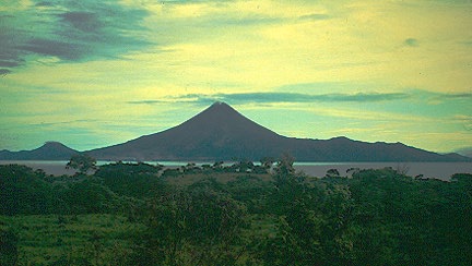
Near El Salvador (12.57N 89.30W)
(Second day symptom - Strong)
--------------------------------------
06/12/27 19:32:42 12.35N 86.50W 5.5 2.1ML Cerca del volcan Momotombo
06/12/27 18:58:08 12.35N 86.50W 5.0 2.6MC Cerca del volcan Momotombo
06/12/27 04:42:19 12.35N 86.53W 6.0 0.0 Cerca del volcan Momotombo
06/12/27 03:56:06 12.34N 86.50W 5.3 2.8ML Cerca del volcan Momotombo
06/12/27 03:54:21 12.35N 86.50W 3.8 1.7ML Cerca del volcan Momotombo
06/12/27 03:21:15 12.35N 86.50W 5.4 2.6ML Cerca del volcan Momotombo
06/12/27 03:13:57 12.34N 86.50W 4.1 3.2ML Cerca del volcan Momotombo
06/12/27 03:08:18 12.35N 86.50W 4.6 1.4ML Cerca del volcan Momotombo
06/12/27 02:47:12 12.35N 86.51W 5.5 1.7ML Cerca del volcan Momotombo
06/12/27 02:10:12 12.36N 86.50W 9.1 3.5ML Cerca del volcan Momotombo
06/12/28 13:55:19 12.35N 86.51W 5.9 1.7MC Cerca del volcan Momotombo
06/12/29 21:55:23 12.44N 86.49W 5.9 2.1MC Cerca del volcan Momotombo
06/12/29 18:44:36 12.34N 86.51W 2.2 2.1MC Cerca del volcan Momotombo
06/12/29 18:30:55 12.33N 86.53W 2.6 2.0MC Cerca del volcan Momotombo
06/12/29 11:35:07 12.34N 86.51W 6.1 2.0ML Cerca del volcan Momotombo
06/12/29 09:42:11 12.35N 86.52W 5.4 2.3ML Cerca del volcan Momotombo
06/12/30 00:25:07 12.35N 86.50W 2.9 2.6MC Cerca del volcan Momotombo
http://volcano.und.edu/vwdocs/current_volcs/momotombo/momotombo.html
(Hope they update their URL soon.)
Saint-Michel-des-Saints,Q area
(46.95N 73.69W)
--------------------------------------
2006/12/28 22:13:03 46.91N 76.25W 18.0* 1.9MN 63 km N from Maniwaki,QC
2006/12/28 12:18:50 45.18N 73.93W 18.0* 1.7MN 18 km SE from Salaberry-de-Valleyfield,
2006/12/28 06:19:35 47.12N 70.50W 18.0* 1.5MN 16 km N from Montmagny,QC
2006/12/29 07:57:47 49.69N 65.42W 18.0* 1.7MN 73 km SE from Moisie,QC
2006/12/29 06:00:15 47.36N 69.94W 18.0* 2.5MN 5 km S from Saint-Pacome,QC
2006/12/29 04:38:56 45.99N 64.91W 5.0* 1.4MN 12 km SE from Salisbury,NB
Coso Junction
--------------------------------------
1.4 2006/12/27 02:35:19 36.078 -117.885 3.8 7 km ( 4 mi) ENE of Coso Junction, CA
1.3 2006/12/28 03:52:14 36.068 -117.885 5.2 6 km ( 4 mi) ENE of Coso Junction, CA
1.9 2006/12/28 09:57:36 36.293 -118.324 4.9 27 km ( 17 mi) W of Cartago, CA
1.8 2006/12/28 09:57:02 36.294 -118.323 5.2 27 km ( 17 mi) W of Cartago, CA
Turkey
--------------------------------------
2006-12-28 02:44:13.1 40.62N 33.05E 11 MD2.9 CENTRAL TURKEY
2006-12-28 03:02:50.2 39.98N 23.28E 2G ML2.3 AEGEAN SEA
2006-12-28 04:02:57.8 39.98N 23.31E 10G ML2.4 AEGEAN SEA
2006-12-28 04:57:37.5 40.40N 25.83E 2 ML3.2 AEGEAN SEA
2006-12-28 07:04:04.8 40.45N 30.30E 7 MD2.8 WESTERN TURKEY
2006-12-28 09:32:30.1 40.72N 22.93E 5G ML2.1 GREECE
2006-12-28 12:29:51.3 39.49N 23.64E 2G ML2.9 AEGEAN SEA
2006-12-28 14:44:36.9 37.03N 28.23E 5 MD3.1 WESTERN TURKEY
2006-12-28 15:06:15.1 39.16N 23.58E 15G ML2.7 AEGEAN SEA
2006-12-28 19:30:15.0 38.70N 23.00E ML3.7 GREECE
2006-12-28 20:36:23.9 39.38N 33.12E 5 MD3.0 CENTRAL TURKEY
2006-12-28 20:54:19.9 41.41N 25.50E 32G ML2.6 GREECE-BULGARIA BORDER REGION
2006-12-28 22:26:39.0 39.30N 23.60E ML2.3 AEGEAN SEA
2006-12-28 22:52:25.3 39.29N 24.19E 12G ML2.9 AEGEAN SEA
2006-12-28 23:05:53.8 38.34N 30.44E 4 MD2.9 WESTERN TURKEY
Honshu, Japan
--------------------------------------
2006-12-27 18:39:12.5 27.11N 140.21E 409 mb4.4 BONIN ISLANDS, JAPAN REGION
28Dec2006 00:24:55.2 38.8N 141.5E 60 mb=5.0 M*GSR NEAR EAST COAST OF HONSHU,
Peace to all.

posted by Unknown @ 3:56 PM
0 comments
![]()
![]()
