*For Sunday, 2 July 2006.
LEGEND for OVERVIEW: Size = My surety of area for quake.
Red Circle = Probable quake to STRONG quake.
Triangle = Very Strong/Stronger quake (Usually takes extra days).
Blue Circle, etc. = Uncertainty of symptom area for probable quake.
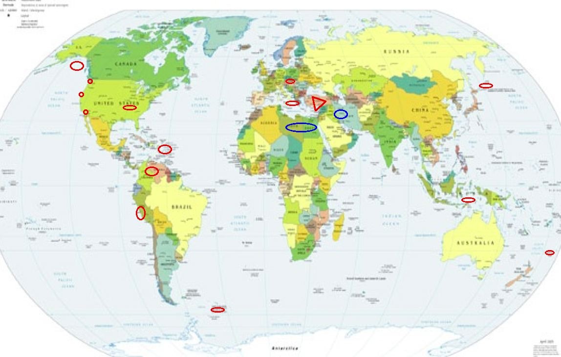
Places to watch.
Good luck to all.
For Sunday, 2 July 2006.
----------------------------------------
Colombia/Venezuela Border area
(7.021 -72.749)(STRONG)
----------------------------------------
4.4 2006/07/06 07:34:24 6.784 -72.962 156.4 NORTHERN COLOMBIA
(4 extra days)
Near the Coast of Northern Peru
(-8.564 -79.700) (STRONG)
----------------------------------------
2006-07-02 21:38:27 6.3 15.70S 96.89W Southeast Central Pacific Ocean
Sicily, Italy/Ionian Sea (Medium)
----------------------------------------
2006-07-02 17:52:00.0 38.16N 15.13E 8 ML2.8 SICILY, ITALY
Puerto Rico/Virgin Islands
----------------------------------------
2006/07/02 00:07:22.73 19.254N 68.949W 14.8 3.8 D Septentrional Fault Zone
2006/07/02 02:54:15.20 17.795N 66.611W 27.0 1.9 C Southern Puerto Rico
2006/07/02 06:13:29.09 18.857N 67.409W 24.7 2.4 D Mona Canyon
2006/07/02 07:00:42.11 18.257N 67.493W 20.5 2.9 C Mona Passage
2006/07/02 07:38:31.83 18.235N 67.071W 37.9 2.4 C West Puerto Rico
Petrolia (This symptom was only
annoying when moving.)
----------------------------------------
3.2 2006/06/29 17:22:08 40.378 -125.112 7.7 70 km ( 44 mi) W of Petrolia, CA
(3 days early?)
ESE of Alger, WA (48.614 -122.288)
(Second day symptom - Strong)
----------------------------------------
1.7 2006/07/02 13:29:04 48.760N 121.835W 0.0 16 km (10 mi) SSE of Glacier, WA
1.3 2006/07/02 14:32:02 48.249 -121.939 14.1 3 km ( 2 mi) SSW of Oso, WA
Possibly Libya/Egypt (New symptom
and third day symptom - STRONG.)
----------------------------------------
(Nothing found)
Timor area (8.54S 125.80E)
(Medium)
----------------------------------------
2006-07-03 11:22:01.2 3.21S 127.10E 94 mb5.2 SERAM, INDONESIA
Possibly Western Iran (33.83N 48.47E)
(Unproven Symptom)
----------------------------------------
2006-07-03 05:01:57.6 32.00N 49.50E 10 M3.5 WESTERN IRAN
2006-07-03 08:19:05.8 36.71N 43.75E 26 MD3.7 IRAQ
Kermadec Islands
----------------------------------------
2006-07-04 13:52:36 5.7 31.36S 179.54W Kermadec Islands Region
(2 extra days)
Borrego Springs area (33.441 -116.362)
(Medium)
----------------------------------------
1.9 2006/07/03 15:28:58 33.245N 116.025W 3.6 9 km ( 5 mi) SW of Salton City, CA
2.4 2006/07/03 15:24:20 33.245N 116.026W 3.5 9 km ( 5 mi) SW of Salton City, CA
2.3 2006/07/03 16:21:58 33.245N 116.029W 3.0 9 km ( 5 mi) SW of Salton City, CA
1.1 2006/07/03 16:07:51 33.241N 116.031W 3.0 9 km ( 6 mi) SW of Salton City, CA
2.4 2006/07/03 16:06:34 33.245N 116.028W 3.5 9 km ( 5 mi) SW of Salton City, CA
2.4 2006/07/03 16:00:54 33.244N 116.028W 3.3 9 km ( 5 mi) SW of Salton City, CA
1.1 2006/07/03 16:29:29 33.238N 116.027W 2.8 9 km ( 6 mi) SW of Salton City, CA
1.6 2006/07/03 17:29:28 33.251N 116.029W 4.0 8 km ( 5 mi) SW of Salton City, CA
1.4 2006/07/03 17:10:00 33.229N 116.040W 6.5 11 km ( 7 mi) SW of Salton City, CA
(This area swarm fits the symptom intensity.)
South Sandwich Islands (55.75S 29.81W)
(Medium)
----------------------------------------
2006-07-01 20:12:06 5.1 56.16S 24.59W South Sandwich Islands Region
Kuril Islands area (45.20N 155.25E)
(Indication of depth - Strong)
----------------------------------------
2006-07-03 04:12:17.0 55.17N 162.59E 33 Ms3.9 NEAR E. CST KAMCHATKA PEN.
Czech and Slovak Republics (49.57N 18.59E)
----------------------------------------
2006-07-03 09:42:57.4 49.95N 14.23E ML2.1 CZECH AND SLOVAK REPUBLICS
2006-07-03 09:34:41.5 50.52N 13.53E 8 ML2.1 CZECH AND SLOVAK REPUBLICS
Gulf of Alaska
----------------------------------------
3.3 2006/06/30 03:45:18 58.513 -146.935 50.0 GULF OF ALASKA
(2 days early)
3.6 2006/07/03 17:08:33 56.172 -144.427 35.0 GULF OF ALASKA
The New Madrid Fault (Strong - but
non-specific)
----------------------------------------
Region: SOUTHEASTERN MISSOURI
Geographic coordinates: 36.680N, 89.530W
Magnitude: 2.4 Mcd
Region: TENNESSEE
Geographic coordinates: 36.080N, 89.430W
Magnitude: 1.5 Mcd
Depth: 11 km
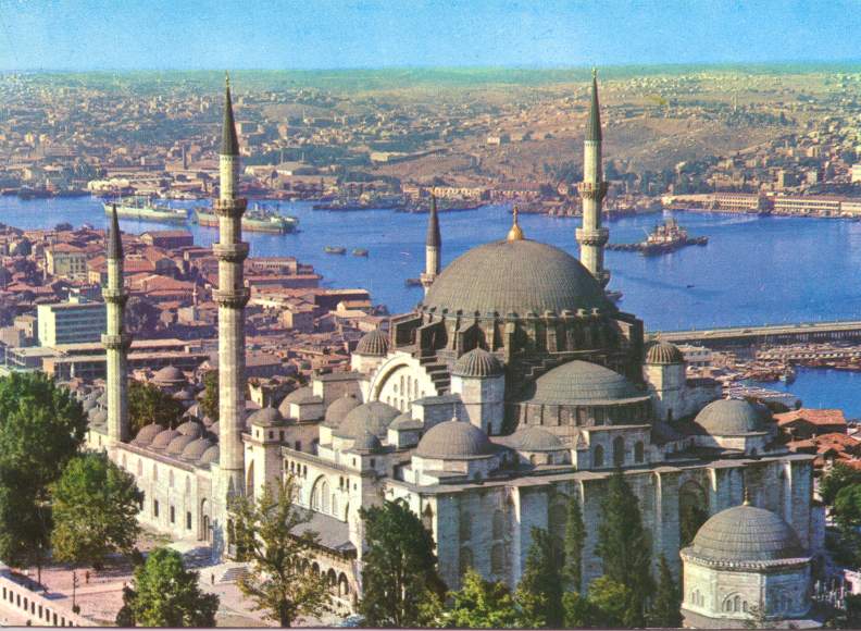
Turkey (EXTREMELY STRONG)
http://www.turkeytravelplanner.com/galeri/>turkeytravelplanner
----------------------------------------
2006-07-02 19:39:39.1 39.33N 40.91E 10 mb4.8 TURKEY
2006-07-02 19:39:38.2 39.33N 40.91E 5 ML4.9 TURKEY
2006-07-03 01:19:31.0 38.99N 27.23E ML3.5 TURKEY
2006-07-03 05:59:33.6 39.14N 28.07E 10 ML3.7 TURKEY
2006-07-03 10:00:33.6 37.27N 28.21E 5 MD2.8 TURKEY
2006-07-03 09:54:15.6 37.21N 28.17E 20 MD2.7 TURKEY
Peace to all.

posted by Unknown @ 1:02 PM
0 comments
![]()
![]()
