*For Monday, 10 April 2006.
LEGEND for OVERVIEW: Size = My surety of area for quake.
Red Circle = Probable quake to STRONG quake.
Triangle = Very Strong or Stronger quake (And usually takes extra days).
Blue Circle, etc. = Uncertainty of symptom area for probable quake.
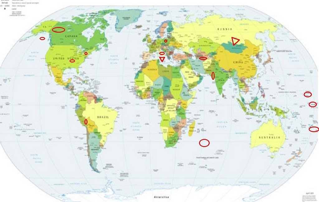
Places to watch.
Good luck to all.
For Monday, 10 April 2006.
----------------------------------------
Peru/Bolivia border area (Volcanic - Strong)
----------------------------------------
2006-04-11 02:37:00.3 14.82 S 73.97 W 100 G M 4.6 CENTRAL PERU
MAP 4.2 2006/04/15 00:17:20 -21.372 -66.851 224.6 POTOSI, BOLIVIA
(4 extra days)
Mariana Islands then Caroline Islands area (STRONG for Caroline Islands)
----------------------------------------
MAP 4.7 2006/04/11 23:14:57 11.712 143.495 21.4 SOUTH OF THE MARIANA ISLANDS
Sicily, Italy (38.14N 15.18E) (Second day symptom for this area - VERY STRONG. Also Central Italy symptoms.)
http://www.sicilyvillas.com/>sicilyvillas

----------------------------------------
2006-04-10 19:03:35.5 43.47 N 13.52 E 60 ML 4.3 CENTRAL ITALY
Yukon/Northwest Territories
----------------------------------------
(Nothing found)
Southwest Indian Ridge (33.08 S 56.83 E) (Indication of depth - Strong)
----------------------------------------
2006-04-10 23:03:41 4.9 1.43 S 67.59 E Carlsberg Ridge
(If this is the right quake - way off in cooridinates.)
Lake Erie/Rochester, N.Y. area (43.141 -77.724) (Second day of symptoms and stronger - STRONG.)
----------------------------------------
2006/04/10 05:55:51 41.87N 80.87W 5.0g 2.1MN GSC South shore Lake Erie
Southern India/Pakistan border (23.93N 70.65E) (STRONG)
----------------------------------------
2006-04-10 22:05:45 5.0 23.65 N 70.03 E Southern India
Poland
----------------------------------------
(Nothing found)
Tonga/Fiji region (Medium)
----------------------------------------
10Apr2006 14:18:11.5 15.5S 176.1E350 mb=4.6 M GSR FIJI ISLANDS REGION
Turkmenistan (39.91 N 55.24 E) (Medium)
----------------------------------------
2006-04-10 12:47:55.4 38.65N 74.28E 33 Ms3.8 TAJIKISTAN-XINJIANG BORDER REG
The New Madrid Fault/Missouri area (36.480 -89.510 )
----------------------------------------
MAP 1.4 2006/04/09 05:43:23 36.210 -83.620 18.7 10 km ( 6 mi) NE of Blaine, TN
MAP 1.6 2006/04/10 07:43:07 35.600 -83.950 20.8 17 km ( 10 mi) S of Maryville, TN
MAP 3.3 2006/04/11 03:29:21 35.360 -84.480 19.8 6 km ( 3 mi) NE of Etowah, TN
(Not Missouri.)
Gulf of Alaska (Medium)
----------------------------------------
MAP 3.8 2006/04/11 21:26:49 53.289 -161.176 33.3 SOUTH OF ALASKA
Lake Baykal, Russia area (55.23N 110.31E) (Second day of symptoms and this time stronger - VERY STRONG.)
Quote from: http://www.seagrant.wisc.edu/communications/greatlakes/GlacialGift/lake_superior.html>seagrant
Roughly the same shape and slightly larger than South Carolina, Lake Superior has a surface area of more than 31,000 square miles -- the largest of any freshwater lake in the world. Only Siberia's Lake Baykal, because it is deeper, holds more water.
http://www.blogger.com/img/gl.link.gif
----------------------------------------
10Apr2006 03:56:08.4 51.3N 97.8E 33 MS=4.0 M*GSR RUSSIA-MONGOLIA BORDER REG
Peace to all.

posted by Unknown @ 12:10 PM
0 comments
![]()
![]()
