Earthquake Prediction by Tiempe

Earth Sensitive quake predictions

Saturday, December 31, 2005

*For Tuesday, 3 January 2006.

Places to watch.

Good luck to all.

For Tuesday, 3 January 2006.
----------------------------------------

Kamchatka
----------------------------------------
2006/01/03 04:11:56.6 56.55 N 162.38 E 33 mb5.1 NEAR E. CST KAMCHATKA PEN.
2006/01/04 07:19:08.7 52.42 N 159.63 E 80 mb4.8 OFF E. CST KAMCHATKA PEN.

San Francisco area
----------------------------------------
map 1.8 2006/01/03 03:21:29 38.208 -122.163 10.6 6 km ( 4 mi) S of Green Valley, CA

Petrolia
----------------------------------------
map 2.2 2006/01/03 20:06:31 39.661 -123.525 0.6 3 km ( 2 mi) WSW of Laytonville, CA

The Philippines (Medium)
----------------------------------------
2006/01/03 19:52:54.9 9.31 N 124.04 E 583 mb4.8 MINDANAO, PHILIPPINE ISLANDS

Ludlow, California and South of (Medium)
----------------------------------------
map 1.5 2006/01/03 01:02:22 34.200 -116.235 5.9 11 km ( 7 mi) NE of Joshua Tree, CA
map 1.5 2006/01/03 04:15:30 34.361 -116.470 8.6 27 km ( 16 mi) N of Yucca Valley, CA

Mt. St. Helen's (Medium)
----------------------------------------
map 2.3 2006/01/03 09:38:18 46.197 -122.192 0.0 1 km ( 1 mi) WSW of Mount St. Helens Volcano, WA
map 1.5 2006/01/03 12:50:23 46.194 -122.190 0.0 1 km ( 1 mi) SW of Mount St. Helens Volcano, WA

Poland (Strong)
----------------------------------------
2006/01/03 16:54:55.6 51.02 N 15.88 E 2 ML2.6 POLAND
2006/01/03 19:10:27.8 51.39 N 16.28 E 10 ML3.0 POLAND

Southwestern Siberia (Strong)
----------------------------------------
2006-01-03 12:39:18 5.1 62.31 N 74.14 E Northwestern Siberia, Russia
(Not southern)

West Yellowstone, Montana (44.451 -110.998) and East of (EXTREMELY STRONG)
West Yellowstone


----------------------------------------
map 1.4 2006/01/03 20:15:47 44.667 -110.461 2.9 46 km ( 28 mi) SSE of Gardiner, MT
map 2.1 2006/01/04 03:53:36 44.681 -110.009 13.6 38 km ( 23 mi) S of Cooke City-Silver Gate, MT
MAP 3.2 2006/01/05 14:44:45 40.972 -109.981 4.8 9 km ( 6 mi) SW of McKinnon, WY
(I am including anything close to West Yellowstone. This may take until the 8th of January to finish.)

Irian Jaya to Moluccas (Back of left knee gave out with pain - VERY STRONG)
Indonesia


----------------------------------------
2006/01/03 17:58:36.2 4.59 N 125.58 E 163 M 5.0 TALAUD ISLANDS, INDONESIA

New Madrid Fault
----------------------------------------
map 2.5 2006/01/03 19:21:39 36.410N 90.910W 8.2 2 km ( 1 mi) SW of Maynard, AR

Pakistan/Hindu Kush (Medium)
----------------------------------------
02Jan2006 21:38:35.7 35.8N 70.0E 60 mb=4.8 M GSR HINDU KUSH REGION, AFGHANI2322

Western Arabian Peninsula (MEDIUM)
----------------------------------------
(Nothing found)

Kyushu to Ryukyu, Japan area (Medium)
----------------------------------------
2006/01/03 01:10:52.1 29.14 N 139.40 E 418 mb4.9 SOUTHEAST OF HONSHU, JAPAN

North Sea to Denmark area then near Iceland (Medium for Iceland area)
----------------------------------------
NORTHERN NORTH SEA
Origin time Lat Lon Azres Timres Wres Nphase Ntot Nsta Netmag
2006-002:13.57.37.0 61.22 4.48 3.88 0.73 1.70 6 15 3 2.64
(Nothing found for Iceland)

Pacific/Antarctic area (STRONG)
----------------------------------------
(Nothing found)

Hawaii
----------------------------------------
map 1.9 2006/01/03 04:40:41 18.931 -155.555 40.5 15 km ( 10 mi) SSE of Naalehu, HI
MAP 3.2 2006/01/03 06:25:37 19.356 -155.024 8.8 17 km ( 11 mi) SW of Leilani Estates, HI
MAP 3.2 2006/01/03 06:25:38 19.350 -155.031 2.5 17 km ( 11 mi) SE of Fern Forest, HI

Greece/Turkey area (Strong)
----------------------------------------
2006/01/03 00:58:51.0 38.84 N 27.24 E ML3.2 TURKEY
2006/01/03 01:16:59.1 38.16 N 26.73 E 5 MD3.2 AEGEAN SEA
2006/01/03 03:05:47.4 36.88 N 27.76 E 13 MD3.1 DODECANESE ISLANDS, GREECE
2006/01/03 05:45:10.1 38.49 N 39.28 E 11 MD2.8 TURKEY
2006/01/03 07:47:25.2 39.89 N 27.00 E 22 MD2.9 TURKEY
2006/01/03 12:09:31.2 39.80 N 39.24 E 26 MD2.9 TURKEY
2006/01/03 17:10:32.1 37.79 N 26.04 E 15 ML3.3 DODECANESE ISLANDS, GREECE
2006/01/03 20:02:53.6 37.09 N 28.94 E 29 MD3.0 TURKEY
2006/01/03 21:18:23.9 37.57 N 36.40 E 5 MD2.9 TURKEY
2006/01/04 00:13:20.9 39.21 N 28.71 E 16 MD3.1 TURKEY
2006/01/04 00:33:42.7 39.60 N 33.86 E 4 MD3.3 TURKEY
2006/01/04 03:36:05.9 38.75 N 31.76 E 29 MD2.9 TURKEY
2006/01/04 09:22:39.6 36.14 N 27.82 E 71 ML3.5 DODECANESE ISLANDS, GREECE
2006/01/04 11:04:17.1 41.75 N 35.49 E 19 MD3.0 TURKEY
2006/01/04 17:49:39.6 39.46 N 33.16 E 5 MD3.1 TURKEY
2006/01/04 17:46:50.9 39.44 N 33.15 E 5 MD3.5 TURKEY
2006/01/04 16:22:30.9 38.04 N 20.97 E 8 ML3.4 GREECE
2006/01/04 16:16:42.2 38.53 N 22.05 E 7G ML2.2 GREECE
2006/01/04 15:48:42.2 38.90 N 35.77 E 5 MD2.8 TURKEY
2006/01/04 13:03:00.2 38.11 N 26.83 E 8 MD3.4 AEGEAN SEA
2006/01/04 17:52:23.2 39.40 N 33.17 E 6 MD3.1 TURKEY
2006/01/04 20:01:47.1 38.11 N 26.78 E 2 MD3.2 AEGEAN SEA
2006/01/04 20:08:24.7 39.94 N 23.20 E 4G ML2.0 AEGEAN SEA
2006/01/04 22:24:57.8 38.20 N 26.78 E 9 MD3.0 AEGEAN SEA

Ecuador (Medium)
----------------------------------------
4.2 2006/01/02 15:43 2006/01/02 20:43 -1.5322 -77.7492 210.10

Yukon Territories (Medium)
----------------------------------------
2006/01/02 20:09:36 65.80N 134.89W 1F 3.5 184 km S Ft. McPherson NT
2006/01/02 17:36:21 60.94N 138.55W 5F 2.4 59 km WNW Haines Jct. YT
2006/01/02 16:17:38 61.73N 132.68W 10F 1.6 171 km NE Whitehorse YT
2006/01/02 10:46:10 61.45N 140.57W 1F 1.3 182 km WNW Haines Jct. YT

South Sandwich Islands (Strong)
----------------------------------------
2006/01/05 08:40:49.9 57.36 S 25.54 W 33 mb5.8 SOUTH SANDWICH ISLANDS REGION
(2 extra days)

Yunnan, China area (23.68 N 104.08 E) (STRONG)
----------------------------------------
(Nothing found)

Nevada
----------------------------------------
MAP 3.1 2006/01/03 18:21:09 37.440 -117.084 5.5 22 km ( 14 mi) NE of Tokop, NV

Canary Islands area
----------------------------------------
(Nothing found)

Peace to all.

Friday, December 30, 2005

*For Monday, 2 January 2006.

Places to watch.

Good luck to all.

For Monday, 2 January 2006.
----------------------------------------

Hokkaido and Kurils (Strong for both)
----------------------------------------
2006/01/03 12:26:05.7 42.31 N 142.24 E 49 mb5.1 HOKKAIDO, JAPAN, REGION

Algeria (Strong)
----------------------------------------
2006/01/03 17:58:42.5 36.91 N 4.18 E 20 mb4.0 NORTHERN ALGERIA
2006/01/04 01:51:11.6 36.81 N 1.50 E 1 mb3.0 NORTHERN ALGERIA
(2 extra days)

Aegean Sea/Turkey (Strong for both)
----------------------------------------
2006/01/02 07:06:38.8 36.11 N 27.54 E 28 MD3.1 DODECANESE ISLANDS, GREECE
2006/01/02 10:58:15.1 38.97 N 23.31 E 5G ML2.7 GREECE
2006/01/02 11:55:03.8 38.11 N 26.60 E 12 MD2.9 AEGEAN SEA
2006/01/02 12:30:29.2 35.70 N 27.74 E 18 MD3.4 DODECANESE ISLANDS, GREECE
2006/01/02 17:57:43.5 37.86 N 29.25 E 5 MD3.2 TURKEY
2006/01/02 18:49:22.4 38.23 N 26.57 E 12 MD3.0 AEGEAN SEA
2006/01/02 21:20:02.4 39.11 N 21.69 E 7G ML2.8 GREECE
2006/01/02 22:29:23.2 37.14 N 29.75 E 31 MD3.1 TURKEY
2006/01/02 23:45:44.2 38.83 N 27.80 E 5 MD3.0 TURKEY

Puerto Rico and into Atlantic Ocean/possibly Canary Islands (New symptom for old area - a jolt - EXTREMELY STRONG.)...Left forearm just above elbow (Puerto Rico area) - top inside a jolt 6:02am then more jolts at 6:35am then jolts closer to middle that made fingers contract (making it non-specific but EXTREME) and off and on more than 6 times at 6:39am and then 10 more jolts at 6:42am. Then left forearm middle/inside - Canary Islands area) light jolts of muscle that pulls the middle fingers down off and on during morning 11:53am.

http://www.blogger.com/img/gl.link.gifCanary Islands Threat


----------------------------------------
map 2.7 2006/01/02 00:04:30 18.794 -66.372 51.0 36 km ( 22 mi) N of Breñas, PR
map 2.8 2006/01/02 01:28:00 17.962 -66.878 4.6 2 km ( 1 mi) SSE of María Antonia, PR
map 1.7 2006/01/02 01:29:55 17.948 -66.894 8.4 3 km ( 2 mi) S of María Antonia, PR
map 2.1 2006/01/02 06:28:03 18.098 -67.207 25.5 3 km ( 2 mi) NW of Puerto Real, PR
map 1.9 2006/01/02 08:32:58 17.954 -66.905 8.4 3 km ( 2 mi) SE of Guánica, PR
2006/01/02 21:33:23.6 24.55 N 45.02 W 33 mb5.0 NORTHERN MID-ATLANTIC RIDGE
2006/01/02 06:10:52.4 61.05 S 21.82 W 33 Mw7.3 SOUTHWESTERN ATLANTIC OCEAN ???
(This jolting of my left forearm seems to have the intensity of the Southern Atlantic earthquake but I did not get the symptom for the Southern Atlantic as hard as this Northern Atlantic Ocean symptom. I am thinking that something is still about to hit in the Northern Atlantic area which may be as big or bigger than the 7.3 quake and might be affecting more civilization. Please be on alert until after the 7th or 8th of January.)

Utah/Nevada (Medium)
----------------------------------------
map 1.5 2006/01/02 00:52:40 38.714 -118.917 5.0 18 km ( 11 mi) NNE of Wichman, NV
map 2.7 2006/01/02 06:29:12 38.549 -115.004 15.0 22 km ( 14 mi) NE of Hot Creek, NV
map 1.2 2006/01/02 13:11:33 39.704 -110.594 1.2 22 km ( 13 mi) ENE of Price, UT
map 1.4 2006/01/03 06:01:18 39.737 -110.729 0.5 12 km ( 8 mi) ENE of Helper, UT
map 1.2 2006/01/03 13:48:07 39.291 -111.974 6.9 12 km ( 8 mi) ENE of Scipio, UT
map 1.4 2006/01/03 16:10:22 39.693 -110.459 6.8 16 km ( 10 mi) NNW of Sunnyside, UT
map 1.4 2006/01/03 17:10:43 39.730 -110.729 0.5 12 km ( 7 mi) ENE of Helper, UT
map 1.6 2006/01/03 23:34:46 38.936 -112.929 2.2 45 km ( 28 mi) WNW of Kanosh, UT

Ludlow/Yucca Valley area
----------------------------------------
(Nothing found)

South Sandwich Islands (Medium)
----------------------------------------
2006/01/02 06:10:52.4 61.05 S 21.82 W 33 Mw7.3 SOUTHWESTERN ATLANTIC OCEAN ???

Hawaii area/possibly Waimea (Medium)
----------------------------------------
map 2.8 2006/01/02 19:43:12 19.346 -155.084 2.9 15 km ( 9 mi) SSE of Fern Forest, HI
map 2.8 2006/01/02 19:43:11 19.346 -155.072 8.4 15 km ( 10 mi) SSE of Fern Forest, HI
map 2.6 2006/01/02 20:57:10 20.258 -155.133 1.9 32 km ( 20 mi) NNE of Laupahoehoe, HI
MAP 3.4 2006/01/02 22:20:59 19.140 -155.564 14.4 9 km ( 5 mi) NNE of Naalehu, HI

Kendall, Washington area then Mt. St. Helen's (Medium for Kendall. ERUPTION and STRONG for Mt. St. Helen's - I had 2 right neck side middle sparkle pinches that caused goose bumps.)
Thumbnail Photos


----------------------------------------
map 2.3 2006/01/03 09:38:18 46.197 -122.192 0.0 1 km ( 1 mi) WSW of Mount St. Helens Volcano, WA
map 1.5 2006/01/03 12:50:23 46.194 -122.190 0.0 1 km ( 1 mi) SW of Mount St. Helens Volcano, WA
map 2.2 2006/01/02 15:19:54 46.198 -122.190 0.0 1 km ( 1 mi) WSW of Mount St. Helens Volcano, WA
(Found nothing about eruption. Might still be coming as late as the 6th of January.)

Kyushu to Bonnin (Medium)
----------------------------------------
02Jan2006 14:28:15.4 26.8N 140.9E 33 mb=4.8 M GSR BONIN ISLANDS REGION 1526

Ukraine-Moldova-Southwestern (STRONG)
----------------------------------------
(Nothing found)

Sulawessi/Moluccas (Medium)
----------------------------------------
2006/01/01 19:32:24.5 7.01 S 129.26 E 30 mb5.3 BANDA SEA

Los Lagos, Chile area (-42.811 -74.175) (Very Strong)
----------------------------------------
MAP 4.5 2006/01/01 10:36:29 -32.467 -71.549 61.6 OFFSHORE VALPARAISO, CHILE

Peace to all.

Thursday, December 29, 2005

*For Sunday, 1 January 2006.

Places to watch.

Good luck and Happy New Year to all.

For Sunday, 1 January 2006.
----------------------------------------

Kyushu area (MEDIUM
----------------------------------------
MAP 5.5 2006/01/01 07:12:00 31.307 139.870 20.0 IZU ISLANDS, JAPAN REGION

Alaska Peninsula/Unimak Island (MEDIUM)
----------------------------------------
map 2.6 2005/12/31 03:04:36 53.682 -163.690 1.0 UNIMAK ISLAND REGION, ALASKA
map 2.7 2005/12/31 13:47:04 53.527 -163.638 1.0 UNIMAK ISLAND REGION, ALASKA
map 2.9 2005/12/31 15:47:56 60.621 -150.027 15.0 KENAI PENINSULA, ALASKA
map 3.0 2006/01/01 11:58:35 58.524 -152.586 20.0 KODIAK ISLAND REGION, ALASKA
map 3.0 2006/01/01 20:04:01 54.587 -162.255 100.0 ALASKA PENINSULA
map 2.5 2006/01/02 04:27:29 54.171 -164.962 80.0 UNIMAK ISLAND REGION, ALASKA
map 3.5 2006/01/02 06:05:38 54.735 -156.881 15.0 SOUTH OF ALASKA
map 3.4 2006/01/02 19:04:19 59.765 -151.983 50.0 KENAI PENINSULA, ALASKA
map 3.8 2006/01/02 19:13:36 54.843 -161.486 15.0 ALASKA PENINSULA
map 3.4 2006/01/02 21:36:37 53.064 -164.639 1.0 UNIMAK ISLAND REGION, ALASKA
map 3.3 2006/01/02 22:22:32 52.472 -163.690 1.0 SOUTH OF ALASKA

Possibly Serbia (New symptom)
----------------------------------------
2005/12/31 03:38:11.0 49.78 N 17.17 E 10 ML2.6 CZECH AND SLOVAK REPUBLICS
2006/01/02 17:53:46.1 45.90 N 15.33 E ML2.3 NORTHWESTERN BALKAN PEN.

Puerto Rico (Medium)
----------------------------------------
MAP 3.0 2006/01/01 04:41:51 18.611 -66.683 14.1 17 km ( 11 mi) NNE of Arecibo, PR
MAP 3.0 2006/01/01 15:56:35 18.779 -67.306 47.3 41 km ( 26 mi) NNW of Cabán, PR

Nicaragua/Costa Rica area
----------------------------------------
05/12/31 23:55:16 12.02N 86.98W 59.5 4.6ML Frente a Puerto Sandino
05/12/31 14:48:12 12.69N 86.96W 2.0 2.5MC Cerca del Volcan San Cristóba
05/12/31 11:43:13 11.44N 87.10W 21.5 3.0MC Frente a Masachapa
05/12/31 06:02:08 12.01N 87.20W 39.3 2.7MC Frente a Poneloya
05/12/31 02:42:07 11.44N 87.09W 21.0 2.3ML Frente a Masachapa
05/12/31 01:24:18 12.15N 87.07W 66.6 2.5MC Frente a Poneloya
05/12/31 00:30:45 11.43N 85.34W 2.1 3.5MB Nicaragua
06/01/01 13:44:40 11.27N 85.56W 2.0 1.5MC Rivas
06/01/01 02:26:31 12.10N 87.40W 1.0 2.8MC Frente a Corinto

Vanuatu (STRONG)
----------------------------------------
2006/01/02 08:18:38.6 15.26 S 167.22 E 33 mb5.6 VANUATU ISLANDS

British Columbia, Canada (STRONG)
----------------------------------------
2006/01/01 19:48:12 60.38N 116.64W 10F 2.9 70 km SW Hay R. NT
2006/01/01 18:35:58 49.51N 122.62W 4 0.9 37 km NW Mission BC
2006/01/01 07:16:21 52.45N 131.54W 20F 1.2 91 km SSE Sandspit BC

Pakistan/Hindu Kush area (STRONG)
----------------------------------------
2006/01/01 08:56:16.0 39.79 N 73.78 E ML4.1 TAJIKISTAN-XINJIANG BORDER REG
2006/01/02 21:38:35.7 35.76 N 70.00 E 60 mb4.8 HINDU KUSH, AFGHANISTAN, REG

San Simeon/Nacimiento (Something - weird tight feeling)
----------------------------------------
(Nothing found)

Aegean/Turkey (Non-specific - STRONG)
----------------------------------------
2006/01/01 08:45:42.2 38.80 N 26.78 E 28 MD3.0 AEGEAN SEA
2006/01/01 09:53:37.4 36.72 N 29.19 E 11 MD3.0 TURKEY
2006/01/01 12:05:10.7 37.04 N 35.60 E 26 MD3.0 TURKEY
2006/01/01 14:15:03.1 38.13 N 26.59 E 16 MD3.0 AEGEAN SEA
2006/01/01 17:24:10.0 39.62 N 26.68 E ML3.4 TURKEY

Challenge-Brownsville area (39.509°N, 121.222°W)
----------------------------------------
MAP 3.3 2006/01/02 22:24:29 40.810 -122.947 5.0 8 km ( 5 mi) N of Weaverville, CA
(Some degrees off but it is a difficult symptom for pinpointing - backside of right upperarm.)

Nicobar/Andaman/Sri Lanka or more North (New symptom)
----------------------------------------
(Nothing found)

Ludlow/Yucca Valley then North into Olancha area
----------------------------------------
(Nothing found)

Beijing area of China (STRONG)
----------------------------------------
2005-12-31 16:33:49 4.8 57.48 N 121.03 E Southeastern Siberia, Russia
03Jan2006 12:37:02.5 56.9N 106.2E 10 mb=5.7 A*SED LAKE BAYKAL REGION, RUSSIA1250

Hawaii (Medium)
----------------------------------------
map 2.0 2006/01/01 07:55:01 19.771 -156.001 10.0 5 km ( 3 mi) N of Kalaoa, HI
map 1.8 2006/01/01 09:02:23 18.902 -155.226 9.4 42 km ( 26 mi) ESE of Naalehu, HI
map 2.8 2006/01/01 12:15:41 19.413 -155.623 2.5 28 km ( 17 mi) NNW of Pahala, HI

Poland/Germany (Very Strong)
Poland Information


----------------------------------------
2006/01/02 13:51:37.7 49.36 N 6.88 E 5f ML3.2 GERMANY
2006/01/02 22:13:59.8 51.39 N 16.28 E 10 ML2.4 POLAND
(Not so strong as expected)

The New Madrid
----------------------------------------
map 1.7 2006/01/02 06:56:23 35.820N 90.050W 10.2 4 km ( 2 mi) S of Dell, AR
map 1.5 2006/01/02 06:41:02 35.850N 90.060W 18.8 2 km ( 1 mi) WSW of Dell, AR
MAP 3.6 2006/01/02 21:48:56 37.767 -88.355 5.0 4 km ( 2 mi) NNW of Equality, IL

Eastern North Atlantic Ocean (Medium)
----------------------------------------
2006/01/01 11:13:45.5 35.21 N 4.13 W 80 ML2.9 STRAIT OF GIBRALTAR

Northern Sumatra (Very Strong)


----------------------------------------
2006/01/01 08:47:13.5 4.85 N 95.14 E 60 mb5.8 NORTHERN SUMATERA, INDONESIA

Peace to all.

Wednesday, December 28, 2005

*For Saturday, 31 December 2005.

Places to watch.

Good luck to all.

For Saturday, 31 December 2005.
----------------------------------------

Guadalupe Victoria, Mexico (Strong)
----------------------------------------
(Nothing found)

Caucasus/Ukraine/possibly Moscow area (Medium)
----------------------------------------
2005/12/31 07:43:42.0 54.46 N 72.36 E ML3.1 SOUTHWESTERN SIBERIA, RUSSIA

Middle North Atlantic/possibly Canary Islands area (Medium)
----------------------------------------
2005/12/30 22:26:57.8 39.04 N 10.62 W mb2.8 NORTH ATLANTIC OCEAN
2005/12/31 17:49:24.3 35.90 N 8.52 W 10 ML2.9 WEST OF GIBRALTAR

Merrill, Oregon (42.039 -121.620)
----------------------------------------
(Nothin found)

Parkfield area then Pinnacles area (Strong for Parkfield area and Medium for Pinnacles)
----------------------------------------
map 1.5 2005/12/30 09:06:31 35.985 -120.538 4.0 13 km ( 8 mi) NW of Parkfield, CA
map 2.1 2005/12/30 15:29:05 36.575 -121.170 5.8 5 km ( 3 mi) NNW of Pinnacles, CA
map 2.3 2005/12/31 01:44:01 36.661 -121.295 1.2 15 km ( 9 mi) S of Tres Pinos, CA
map 1.4 2005/12/31 07:12:47 35.860 -120.403 5.6 5 km ( 3 mi) SSE of Parkfield, CA

Finland/Norway/Sweden
----------------------------------------
KUUSAMO AREA FINLAND
Origin time Lat Lon Azres Timres Wres Nphase Ntot Nsta Netmag
2005-364:00.18.19.0 66.05 29.74 6.25 0.10 1.66 2 2 1 2.39
KOPPARBERG REGION SWEDEN
Origin time Lat Lon Azres Timres Wres Nphase Ntot Nsta Netmag
2005-364:07.22.58.0 62.25 13.94 8.30 0.12 2.19 2 4 1 2.91
AGDER NORWAY
Origin time Lat Lon Azres Timres Wres Nphase Ntot Nsta Netmag
2005-364:22.57.22.0 58.60 7.28 13.18 4.26 7.55 3 3 2 2.68

Greece/Turkey/Aegean area (Strong)
----------------------------------------
2005/12/30 00:27:02.0 35.62 N 27.23 E ML3.0 DODECANESE ISLANDS, GREECE
2005/12/30 01:31:46.0 35.54 N 27.37 E ML3.0 DODECANESE ISLANDS, GREECE
2005/12/30 10:38:23.1 38.72 N 44.44 E 28 MD3.4 TURKEY-IRAN BORDER REGION
2005/12/30 13:54:41.0 39.96 N 40.21 E 32 MD2.9 TURKEY
2005/12/31 00:06:25.0 37.85 N 27.07 E ML3.3 TURKEY
2005/12/31 02:52:21.0 38.89 N 27.40 E ML3.2 TURKEY
2005/12/31 06:07:43.7 38.15 N 26.67 E 18 MD3.0 AEGEAN SEA
2005/12/31 14:02:38.9 38.50 N 39.27 E 5 MD3.4 TURKEY
2005/12/31 17:58:45.2 37.94 N 29.05 E 3 MD3.2 TURKEY

Southern Olympic Peninsula then Mt. St. Helen's (Medium for Mt. St. Helen's)
----------------------------------------
map 1.5 2005/12/31 06:02:33 47.334 -122.008 19.5 2 km ( 1 mi) NNE of Black Diamond, WA
map 2.0 2005/12/31 07:34:47 47.331 -122.011 18.7 2 km ( 1 mi) NNE of Black Diamond, WA
map 1.7 2005/12/31 07:52:57 47.342 -121.938 26.3 3 km ( 2 mi) ESE of Ravensdale, WA

Salta Province, Argentina (24.05 S 66.79 W) then Peru. (Medium for both areas)
----------------------------------------
MAP 4.5 2005/12/30 11:40:22 -10.230 -78.222 55.0 NEAR THE COAST OF CENTRAL PERU
E 31/12/2005 09:14:2 -29.139 -71.092 3.9 4.9 Mc GUC 5.3 Ml GUC 71 km al SO de Vallenar

San Simeon/Lake Nacimiento (Something weird - instead of usual pain or bubble, this felt like a tightness. Don't know what will show.)
----------------------------------------
(Nothing found)

Sumatra to Sulawessi then The Philippines area (VERY STRONG for Sumatra to Sulawessi area and Medium for The Philippines area.)
Sumatra


----------------------------------------
2005-12-31 17:16:39 5.0 2.34 S 138.04 E Irian Jaya, Indonesia
2006-01-01 11:13:26 4.7 3.99 S 128.95 E Seram, Indonesia
(Nothing found for the Philippines)

Caroline Islands area (STRONG)
----------------------------------------
MAP 5.7 2006/01/02 01:01:25 12.479 144.304 35.0 GUAM REGION

Kyushu, Japan area then Ryukyu Islands (Strong for Ryukyu area)
----------------------------------------
2005-12-30 21:15:37 5.1 31.64 N 140.34 E Southeast of Honshu, Japan
2005/12/31 10:22:25.6 25.12 N 141.08 E 33 mb4.8 VOLCANO ISLANDS, JAPAN, REGION
2005/12/31 13:26:46.6 33.47 N 131.25 E 165 mb4.7 KYUSHU, JAPAN

Puerto Rico (Medium)
----------------------------------------
MAP 3.3 2005/12/30 02:04:20 17.959 -66.114 18.6 2 km ( 2 mi) S of Guayama, PR
map 2.0 2005/12/30 02:27:22 17.951 -66.104 14.3 3 km ( 2 mi) SSE of Guayama, PR
MAP 3.4 2005/12/30 03:40:41 19.512 -65.334 57.0 132 km ( 82 mi) NNE of Vieques, PR
MAP 3.3 2005/12/30 03:56:31 19.487 -65.788 10.0 118 km ( 73 mi) N of Suárez, PR
MAP 3.6 2005/12/30 04:22:05 19.246 -65.410 103.3 102 km ( 63 mi) NNE of Vieques, PR
MAP 3.6 2005/12/30 04:29:22 19.442 -65.344 52.4 124 km ( 77 mi) NNE of Vieques, PR
MAP 3.5 2005/12/30 10:02:26 19.311 -65.297 98.8 112 km ( 69 mi) N of Culebra, PR
map 2.4 2005/12/31 20:53:19 17.811 -65.978 13.8 19 km ( 12 mi) S of Lamboglia, PR

San Francisco Bay area (Medium)
----------------------------------------
map 2.6 2005/12/30 17:03:45 37.400 -121.788 1.8 5 km ( 3 mi) NE of Alum Rock, CA

Kuril Islands/Kamchatka (STRONG)
----------------------------------------
2005/12/31 21:20:25.8 52.79 N 159.38 E 40 Ms3.6 OFF E. CST KAMCHATKA PEN.

Hawaii
----------------------------------------
map 2.0 2005/12/30 01:54:50 19.387 -155.248 3.2 7 km ( 4 mi) S of Volcano, HI
map 1.8 2005/12/30 02:05:34 19.224 -155.456 0.1 3 km ( 2 mi) NE of Pahala, HI
map 1.8 2005/12/30 02:05:35 19.212 -155.453 5.3 3 km ( 2 mi) ENE of Pahala, HI
map 1.9 2005/12/30 03:50:22 19.358 -155.208 3.8 11 km ( 7 mi) SSE of Volcano, HI
map 2.1 2005/12/30 09:46:11 19.360 -155.214 0.9 10 km ( 6 mi) SSE of Volcano, HI
map 2.1 2005/12/30 10:58:40 19.365 -155.180 2.7 11 km ( 7 mi) SSE of Volcano, HI
map 1.9 2005/12/30 12:09:06 19.185 -155.691 0.4 12 km ( 7 mi) NE of Hawaiian Ocean View, HI
map 1.9 2005/12/30 12:09:07 19.164 -155.672 3.6 12 km ( 7 mi) ENE of Hawaiian Ocean View, HI
map 2.6 2005/12/30 15:43:31 19.960 -155.848 0.1 4 km ( 2 mi) NNE of Puako, HI
map 1.7 2005/12/30 17:28:46 19.565 -155.690 5.3 24 km ( 15 mi) ENE of Captain Cook, HI
map 2.2 2005/12/31 13:20:22 19.334 -155.178 6.9 14 km ( 9 mi) SSE of Volcano, HI
map 2.3 2005/12/31 13:20:23 19.345 -155.178 4.0 13 km ( 8 mi) SSE of Volcano, HI
map 2.0 2005/12/31 14:36:23 19.045 -155.298 8.4 26 km ( 16 mi) SE of Pahala, HI

Western Kazakhstan area (Medium)
----------------------------------------
(Nothing found)

Possibly North Dakota (New symptom - Medium)
----------------------------------------
(Nothing found)

Peace to all.

Tuesday, December 27, 2005

*For Friday, 30 December 2005.

Places to watch.

(This day of symptoms was a BIG family day - making it difficult to notice delicate symptoms. Those that DID come to my attention are below and may be stronger than marked for that reason.)

Good luck to all.

For Friday, 30 December 2005.
----------------------------------------

Northern Sumatra (STRONG)
----------------------------------------
30Dec2005 23:55:59.5 5.3N 94.3E 33 mb=4.8 M GSR NORTHERN SUMATERA, INDONES0555

Tonga area (STRONG)
----------------------------------------
2005/12/30 00:46:14.6 19.94 S 177.42 W 33 mb5.5 FIJI ISLANDS REGION
2005/12/31 09:29:26.5 27.01 S 176.60 W 33 mb5.6 KERMADEC ISLANDS REGION

Kurils and South of
----------------------------------------
(Nothing found)

Pakistan/Hindu Kush area (Medium)
----------------------------------------
MAP 5.2 2005/12/28 22:04:31 34.778 73.338 10.0 PAKISTAN
2005/12/30 11:13:41.2 36.56 N 70.66 E 170 mb4.4 HINDU KUSH, AFGHANISTAN, REG

Gulf of Alaska (Medium)
----------------------------------------
map 2.7 2005/12/30 09:54:57 53.751 -164.833 30.0 UNIMAK ISLAND REGION, ALASKA
map 3.7 2005/12/30 13:28:48 53.531 -164.738 15.0 UNIMAK ISLAND REGION, ALASKA

Coast of Central Chile (Very Strong)
http://www.factmonster.com/ipka/A0107407.htmlChile


----------------------------------------
2005/12/31 12:14:06.4 29.79 S 71.83 W 60 mb5.1 NEAR COAST OF CENTRAL CHILE

Caucasus/Ukraine area (Strong)
----------------------------------------
2005/12/28 17:17:46.0 45.10 N 47.84 E ML3.8 UKRAINE-MOLDOVA-SOUTHWESTERN

Ludlow to Yucca Valley, California area (Medium)
----------------------------------------
map 2.5 2005/12/30 00:22:44 34.645 -116.519 3.7 34 km ( 21 mi) WSW of Ludlow, CA
map 1.6 2005/12/30 06:01:25 34.804 -116.261 5.2 13 km ( 8 mi) NW of Ludlow, CA
map 1.7 2005/12/30 08:47:11 34.844 -116.409 3.6 27 km ( 16 mi) WNW of Ludlow, CA

Peace to all.

Monday, December 26, 2005

*For Thursday, 29 December 2005.

Places to watch.

Good luck to all.

For Thursday, 29 December 2005.
----------------------------------------

Eastern Sea of Japan
----------------------------------------
(Came in on 28th and posted there.)

New Madrid Fault
----------------------------------------
map 1.5 2005/12/30 03:15:20 35.170 -84.850 9.4 2 km ( 1 mi) NNE of East Cleveland, TN
map 1.5 2005/12/29 21:15:20 35.170N 84.850W 9.4 1 km ( 1 mi) NE of East Cleveland, TN
map 1.6 2005/12/29 01:21:22 36.520N 89.560W 9.6 8 km ( 5 mi) SSW of New Madrid, MO
map 1.5 2005/12/28 06:12:56 36.320N 89.540W 9.6 8 km ( 5 mi) NW of Ridgely, TN

(Many people believe Sorcha Faal is a hoax and not even Russian but there are often interesting news articles at this site which are not reported in main stream news.)
http://www.whatdoesitmean.com/index866.htm>LINK for Sorcha Faal

December 28, 2005

Massive North American Plate Fractures Fuel Horrific Fires In Oklahoma and Texas Regions for Second Time In 6 Weeks As Fears Of New Madrid Ocean Basin Forming Grows

By: Sorcha Faal, and as reported to her Russian Subscribers

Russian Scientists are reporting today that the fracturing of the North American Plate is violently increasing, and leading to outbursts of inner Earth methane deposits, and which in turn are fueling massive fires in both the United States Oklahoma and Texas Regions for the second time in six weeks.

To the massive fires in these Regions six weeks ago we can read as reported by the CNN News Service in their November 28th article titled "Winds fuel wildfires in Oklahoma, Texas" and which said, "High winds on Monday hampered crews who for a second day battled wildfires that destroyed homes, forced hundreds to evacuate and injured firefighters in parts of Oklahoma and Texas."

To the massive fires raging in these same exact Regions today we can read as reported by the MSNBC News Service in their article titled "Oklahoma, Texas told to expect more fires", and which says, "Texas Gov. Rick Perry issued a disaster declaration Tuesday after more than 70 fires were reported in the northern and central parts of the state. Firefighters from surrounding states were called in to help. At least 50 homes were destroyed in Texas, along with at least five homes and nearly two-dozen other buildings in Oklahoma."

The causing of these massive fires we had previously reported upon in our December 14th report titled "North American Plate Factures Reported As Major US Hydro Electric Dam Fails and Oklahoma Meer’s Fault Zone Begins Outgassing", and wherein we had stated:

“The collapse of this dam also coincides with reports from the near Meer’s Fault Zone Region in Oklahoma where a major outgassing event is currently taking place, and as we can read as reported by the Enid News and Eagle News Service in their article titled "Mysterious Kingfisher-area gas geysers leave officials puzzled" and which says:

“Mysterious unrefined natural gas leaks erupting in rural Kingfisher County in recent days continue to have officials puzzled as to their cause. "We originally thought a pipeline had exploded," said Matt Skinner, Oklahoma Corporation Commission public information manager. "We had the pressure to zero pressure, and the leaks seemed to get bigger. So that's not it." Skinner had said at a press conference Monday geologists and hydrologists are beginning to study underground maps of the area to find an explanation. "We've ruled out the probables, and now we're into the unprobables," he said. "We've never seen one like this before, one that covers such a large area. It's another animal."Skinner said the leak was unusual because of its size and that it was "moving with no explanation."

To these areas in the United States Texas Region we had likewise previously reported on in our June 28th report titled "Texas Region Fault Zones Awaken as ‘Compressed’ North American Plate Ready to Break Say Russian Scientists, US Scientists Confirm Danger to Continent", and wherein we had stated:

"On the Western side of the Ouachita Tectonic Front in the United States Texas Region we can read as reported by the First Coast News Service in their June 22nd article titled "Massive Crack Opens In Earth In Texas" and which says; "A massive crack in the earth opened up last week in Claude, Texas and it's creating a stir among geologists. Geologists said Tuesday the crack was a joint in the earth's crust. They believe the opening is the result of a weak point in the joint where one spot slips away from the other. Some parts measure more than 30-feet deep and it drained what used to be a pond. Experts say earth cracks are common but the size of the crack in Claude is not."

On the Eastern side of the Ouachita Tectonic Front in the United States Texas Region we can read as reported by the KLTV News Service in their June 26th article titled "Giant Sinkhole A Mystery" and which says; "A sinkhole of historic proportions in Smith county, and its cause is still a mystery. This morning, someone passing through FM 724 saw the sinkhole in the middle of the road. It's about two miles north of Tyler Pounds Regional Airport, just outside New Harmony. Crews with TX-DOT say, ever since then, the hole has been growing steadily. They say it's now 40 to 50 feet in diameter and up to 100 feet deep. A DPS helicopter from Garland flew over the hole to try to figure out what happened. The location of that sinkhole, along a stretch of FM 724 between Highways 64 and 110 will be closed indefinitely."

Further evidence of the massive fracturing of the North American Plate can be found at its Northern juncture at the Great Lakes Tectonic Zone, and where reports from this region are showing accelerated acidification of the Great Lakes where methane pockets are being released, and as we can read in one such report from this area as reported by the Minnesota Public Radio News Service in their article titled "What's behind the mystery rust", and which says:

"Duluth port officials are laying plans for a study that might explain why underwater steel is rusting away at an astonishing rate. Some 14 miles of harbor walls are made out of sheet steel that's showing severe damage from rust in some places. Half inch thick steel forms the sides of shipping docks and harbor walls. The steel plates keep the dirt in place and out of the harbor and shipping channels. But there's a corrosion eating pits into underwater steel - basically holes in steel, that in many places is not very old. Steel plates that should last 50 years are showing damage in 10."

To the outgassing of inner earth methane from the United States Great Lakes Regions we had previously reported on in our October 1st report titled "Massive Outgassing Being Reported In United States As North American Plate Continues Fracturing, Tens of Thousands of Micro-Quakes Being Reported In New Madrid Fault Zone", and wherein we had stated:

“Russian Scientists are reporting today that the fracturing of the North American Continent is continuing unabated, and has now reached the point where trapped methane pockets deep within this tectonic plate are outgassing in various areas of the United States and Canada, and as we can read from just a few of the hundreds of reports we’ve received within the past 24 hours:

As reported by the Associated Press News Service in their article titled "Lake Erie burps and nearby residents smell it" and which says, "State and federal environmental officials are trying to determine the cause of a big stink reported along Lake Erie. Hundreds of residents called authorities or the National Weather Service yesterday to report the smell, which has been variously described as like gasoline, natural gas or even decaying garbage and rotten eggs. The smell was strongest yesterday morning when a cold front swept through the area, churning up larger than normal waves from Erie to Dunkirk, N.Y., officials said."

As reported by the Washington Post News Service in their article titled "Mysterious Stench Nauseates Northeast" and which says, "Olive Taylor first noticed the odor Tuesday night outside her Northeast Washington home. By yesterday morning, the smell had turned into a stench so bad that it woke her up. "It was so unlike anything that should have been in my home," said Taylor, 71. "It wasn't really a gas smell. My son said it was a propane smell, but a neighbor said it didn't smell like propane. Maybe it was kind of gassy. It was in fact giving me a headache. "Scores of people in the District called authorities yesterday to complain that a similar odor was invading homes, businesses, a dozen schools and two police stations."

As reported by the Thunder Bay Television News Service in their article titled "Strange smell in Longlac" and which says, "Municipal officials are urging Longlac residents to exercise caution as they investigate reports of 'gasoline-type' odours in the towns sewer system. The problem first cropped up about ten days ago in a variety of homes and businesses...and is reportedly most noticeable in basement areas. The Municipality of Greenstone says it still doesn't know if the smell is from sewer gases, natural gas or an industrial solvent. But its called in both the Ministry of Environment and the District Health Unit to try and track down the problem."

Methane used for industrial purposes, or that which is present in mining operations is almost always odorless, but methane from tectonic plate fracturing is accompanied by odors from decomposing organic materials and whose main outlet into the earths atmosphere is primarily through outgassing through mud volcanoes.

One of the top research scientist concerned with methane is the American Dr. Thomas Gold of Cornell University, and whose theories much of the world’s science in this area is now based upon, and as we can read from this 1978 report by the Geophysical Institute, University of Alaska Fairbanks titled "Goldian Methane" and which says:

"Natural gas is mostly methane, normally more than 80%. Composed of one carbon atom and four hydrogen atoms, methane is the simplest of the hydrocarbons. The hydrocarbon compounds that form the world's oil and gas reserves have long been thought to form from decomposition of vegetable material many millions of years ago, and thereby to be in limited supply.

But now a bold new idea is circulating about the source of methane. Dr. Thomas Gold of Cornell University suggests that a vast store of methane was trapped deep within the earth when the planet was formed. Under high pressure from the weight of overlying rocks composing the solid outer part of the earth, Gold's methane, according to his suggestions, is trying to move upward and to seep out of the earth, a process called outgassing. Gold's idea has major implications about the world's available fuel reserves. If he is right, new exploration and deeper drilling methods can yield a huge supply of energy that might last a million years at the current usage rate. The idea has special interest for Alaska and the Canadian Arctic, too, since the upward migration of methane can be stopped by permafrost. Alaska's frozen North Slope and other Arctic regions with extensive permafrost may be major methane traps

Professor Gold's heretic concept also involves new thoughts on how tsunamis, earthquakes and earthquake lights are generated. His new ideas may be right or they may be wrong. Like many other highly respected and innovative scientists, Gold has been wrong before: years ago he predicted that when the first lunar landings were made the spacecraft would sink out of sight in a deep layer of dust. If he is right this time, future historians will probably acclaim him as a scientific hero of our times."

Reports from the Eastern Coastal Regions of the United States are likewise showing an increase in inner earth methane, and as we can read as reported by the Associated Press News Service in their article titled "Scientists: Methane 'Burps' Mar Maine's Ocean Floor", and which says, "Scientists say gas bubbling from the ocean floor off Maine has created craters -- sometimes as big as a football stadium. University of Maine researchers believe methane gas provides the answer to the puzzling question of what created the pockmarks on the sea floor."

Of the greatest concern to Russian Scientists, according to these reports, are that the events currently unfolding in the United States are mirroring those of Ethiopia where a new Ocean Basin is beginning to form, and as we can read as reported by the Deutsche Presse-Agentur News Service in their article titled "Scientists observe rare continental rift process in Ethiopia", and which says:

"A continental rifting process that normally takes millions of years to form has developed over a span of seven weeks in the Afar region of northeastern Ethiopia.

It was a close study, using radar interferometry, of an earth rupture developing into a rare axial rift zone -- a future possible ocean basin. A continental rifting process that normally takes millions of years to form has developed over a span of seven weeks in the Afar region of northeastern Ethiopia. It was a close study, using radar interferometry, of an earth rupture developing into a rare axial rift zone -- a future possible ocean basin.

As Associate Professor Atalay Ayele of the Geophysical Observatory of the Addis Ababa University (AAU) tells it, scientists from Ethiopia and Britain made four expeditions to the Da'ure locality in the Afar Depression between mid-September and early October to collect geophysical and geological data."

To the people of the United States not being allowed to know by their Military Government the full extent of the catastrophic dangers they are facing can be evidenced in this email we have recently received from the New Madrid Fault Zone Region by one of its residents, Janice L. Hastings, and who had written us:

"Whenever we find a new quake in the New Madrid region on the USGS site ~ we flag it on our wall map (trying to see if there is a pattern and if it is moving downward) and wait to hear about it on the appropriate TV channel. IF it is reported it is always minimized as a non important news item which always frustrates us.

And the fact that USGS has a disconcerting habit of deleting earthquakes from its own map such as the New Orleans earthquake a few days ago. It is also said that government authorities have lowered the Richter scale so it won't seem like it is such a big quake ~ which is why if someone says it is, for example, a 1.5 we always add one point as we figure that is what it truly is.

We are not entirely trusting of the ones who have stolen the seat of government from the people. It hurts us that if we want to know what is going on in this land, we have to go to a source OUTSIDE this country.

We keep our ears low to the ground in listening for information and do our best to get it and share it with anyone who is interested. We have strange things going on locally as my daughter as already mentioned much of. Strange house fires that break out within houses, strange fires that break out in the forests, strange sulphur smells, suddenly appearing sinkholes, cars and trucks that all of a sudden overturn, people falling asleep on the sides of the road, people suddenly going beserk. Trees, power or phone poles falling over for no reason.

Power outages for no readily apparent reason but hastily explained as simple cause. Cows, horses and wildlife suddenly disappearing or seen heading in westerly directions in groups as seen by park service, citizens and local law enforcement. Numerous dogs all of a sudden escaping and running off with their owners searching franticly for them.

Dogs barking all over the county all night long or being very edgy, aggressive or overly nervous ~ usually just before an earthquake. Insects and squirrels, for example, acting like they were hypnotized or seem to have lost sense of direction and would spin around and around or wobble back and forh as if drunken. These things seem to be accelerating and occurring with more frequency.

South of Conway Arkansas (as well as Kingfisher Oklahoma) there appeared gas bubbles with accompanying video and we only heard about that for one days news. Rivers/streams/lakes are drying up in central Arkansas in several areas such as the Fourche River and at Woolum in the Buffalo River Area National Forest where river levels have dropped to a historic low. This was a TV report and one which FEMA did not wish to get out but when it did they had to explain it someway. People got very sick in that area at one time as they have in campgrounds in various areas in the forest. Also strange illnesses in our town too."

It is worth noting too that many of the United States older peoples and prophets have described in their dreams and visions of a New Madrid Ocean Basin forming, such as the American Prophet of last century Edgar Cayce, and who had said, "The waters of the lakes will empty into the Gulf. It would be well if the waterway were prepared, but not for that purpose for which it is at present being considered. Then the area where I am now located (Virginia Beach) will be among the safety lands, as will be portions of what is now Ohio, Indiana and Illinois, and much of the southern portion of Canada and the eastern portion of Canada, while the western land -- much of that is to be disturbed as, of course much in other lands."

To the exact timing of the catastrophic events to soon occur in this region it is not to our knowing, but the words we had quoted from the Scientists astounded by the events occurring in Ethiopia are worth all of us remembering:

"A continental rifting process that normally takes millions of years to form has developed over a span of seven weeks in the Afar region of northeastern Ethiopia.”

© December 28, 2005, EU and US all rights reserved.

Possibly Tonga (This is a new symptom for a known area - instead of pain or ache, I got lots of shimmery vibration. Vibrations have always meant local - I thought - so I am not really sure this is Tonga area or New Madrid. It was more than an hour symptom so - STRONG.)
----------------------------------------
(Nothing found for Tonga - might still be New Madrid.)

Kyushu area
----------------------------------------
2005/12/29 08:30:32.6 27.30 N 140.15 E 471 mb5.4 BONIN ISLANDS, JAPAN, REGION

Yukon Territories (Strong)
----------------------------------------
2005/12/28 20:29:34 59.37N 137.26W 10F 1.9 119 km WNW Haines AK
2005/12/28 10:49:55 61.73N 141.07W 10F 1.6 219 km WNW Haines Jct. YT
2005/12/29 21:11:04 61.20N 139.93W 1F 1.6 139 km WNW Haines Jct. YT
2005/12/29 09:24:15 63.08N 137.76W 5F 1.9 137 km SE Dawson YT

Sumatra and Central Indonesia to The Moluccas (Strong for Sumatra)
----------------------------------------
2005/12/29 05:18:40.4 6.30 S 151.86 E 100 mb5.3 NEW BRITAIN
2005-12-29 07:41:56 5.2 0.09 S 124.92 E Southern Molucca Sea
2005/12/29 07:41:53.0 0.08 S 124.89 E 100 mb4.9 MINAHASSA PENINSULA, SULAWESI
2005/12/30 07:41:16.2 4.66 S 151.95 E 111 M 4.7 NEW BRITAIN

Just North of Puerto Rico and then maybe further into the Atlantic Ocean (Medium for both areas.
----------------------------------------
2005/12/28 07:51:10.9 28.00 N 16.24 W 27 mb2.6 CANARY ISLANDS, SPAIN REG
map 2.6 2005/12/29 04:06:10 17.720 -66.937 12.3 28 km ( 18 mi) S of Guánica, PR

Mt. St. Helen's
----------------------------------------
map 2.8 2005/12/30 15:23:29 46.198N 122.194W 0.1 0 km ( 0 mi) WSW of Mount St. Helens
map 2.3 2005/12/30 04:14:04 46.203N 122.210W 1.0 2 km ( 1 mi) WNW of Mount St. Helens

Possibly Southern Arizona to Central Mexico area (Non-specific and new symptom - Strong)
----------------------------------------
(Nothing found)

Gulf of Alaska (This may be Very Strong - 2 different symptoms and heart pounding at same time.)
----------------------------------------
MAP 3.5 2005/12/29 02:10:18 53.208 -164.394 1.0 139 km ( 87 mi) SE of Akutan, AK
MAP 3.8 2005/12/29 10:02:24 56.612 -153.976 50.0 39 km ( 24 mi) SSE of Akhiok, AK

Guatamala area (Medium)
----------------------------------------
2005/12/28 15:27:51.0 9.85 N 84.30 W 49 mb5.3 COSTA RICA
(More Southern)

Coso Junction to Yucaipa area
----------------------------------------
(I was wrong, I posted this as left wrist but read it as right. - My right wrist is Coso Junction to Yucaipa and my left wrist is Pyrenees/Spain/France area. There was nothing found for Coso Junction to Yucaipa but I will post for Pyrenees/Spain/France area. )

2005/12/28 23:09:16.6 42.32 N 1.42 E 10 ML2.5 PYRENEES
2005/12/29 04:25:44.9 38.93 N 8.23 W 10 ML4.1 PORTUGAL
2005/12/29 05:01:01.7 38.90 N 8.26 W 5 ML4.2 PORTUGAL
2005/12/29 18:25:11.2 42.52 N 8.49 W 20 ML2.8 SPAIN

Peace to all.

Sunday, December 25, 2005

*For Wednesday, 28 December 2005.

Places to watch.

Good luck to all.

For Wednesday, 28 December 2005.
----------------------------------------

Enterprise, Nevada (MEDIUM)
----------------------------------------
map 1.7 2005/12/28 18:46:35 37.007 -115.320 0.0 42 km ( 26 mi) SSW of Alamo, NV
map 2.0 2005/12/28 07:02:59 38.984 -118.152 0.0 21 km ( 13 mi) E of Rawhide, NV
map 1.1 2005/12/28 06:55:54 39.352 -118.501 0.0 21 km ( 13 mi) ESE of Fallon Station, NV

Sea of Japan area (MEDIUM)
----------------------------------------
2005/12/27 10:33:42.4 37.09 N 135.70 E 326 mb4.5 SEA OF JAPAN

The Geysers
----------------------------------------
map 1.6 2005/12/28 11:54:51 38.815 -122.785 2.6 3 km ( 2 mi) NE of The Geysers, CA
map 1.5 2005/12/28 11:20:30 38.822 -122.830 3.2 3 km ( 2 mi) NW of The Geysers, CA
map 2.9 2005/12/28 09:31:21 38.812 -122.793 2.4 2 km ( 1 mi) NE of The Geysers, CA
map 2.7 2005/12/28 00:53:32 38.795 -122.765 2.8 4 km ( 2 mi) E of The Geysers, CA
map 1.6 2005/12/28 00:38:11 38.828 -122.869 1.9 6 km ( 4 mi) WNW of The Geysers, CA

map 1.7 2005/12/29 21:52:13 38.796 -122.762 2.2 4 km ( 2 mi) E of The Geysers, CA
map 1.7 2005/12/29 19:47:11 38.809 -122.803 4.0 1 km ( 1 mi) NNE of The Geysers, CA
map 1.8 2005/12/29 00:51:42 38.821 -122.792 1.7 3 km ( 2 mi) NNE of The Geysers, CA

Southern Mexico (Strong)
----------------------------------------
08 2005/12/28 06:49:37 17.30 101.10 15 3.8 COSTA DE GUERRERO
09 2005/12/28 15:27:50 16.44 98.42 42 4.3 COSTA GUERRERO-OAXACA

Gulf of California
----------------------------------------
(Nothing found)

Hawaii (Medium)
----------------------------------------
map 1.9 2005/12/28 11:14:22 19.391 -155.252 2.6 7 km ( 4 mi) SSW of Volcano, HI
MAP 3.1 2005/12/28 18:37:52 19.369 -155.086 7.7 12 km ( 8 mi) SSE of Fern Forest, HI

Shikoku to Kyushu, Japan area (Second day for this symptom - STRONG)
----------------------------------------
2005/12/28 09:45:59.6 36.24 N 139.87 E 15 mb4.9 EASTERN HONSHU, JAPAN

Sumatra, Indonesia/Malaysia area
----------------------------------------
2005-12-28 04:17:39 4.8 6.07 S 109.87 E Java, Indonesia

Jordan - Syria Region (MEDIUM)
----------------------------------------
28.12.2005 01:20:30 38.330N 38.803E 5.0 3.5 KALE (MALATYA)
28.12.2005 16:07:59 38.522N 39.307E 5.0 4.2 MOLLAKENDI- (ELAZIG)

Strait of Gibraltar area
----------------------------------------
2005/12/28 06:37:54.1 33.91 N 7.13 W mb3.1 MOROCCO
2005/12/31 13:17:20.4 36.72 N 6.98 W 14 mb3.4 STRAIT OF GIBRALTAR
2005/12/31 15:05:13.6 32.35 N 7.85 W mb3.9 MOROCCO
(3 extra days)

Northern Peru
----------------------------------------
INFORME 28/12/2005 09:22:0 -20.033 -69.233 104 5Mb NEIC 51 km al N de Pica
(Southern not Northern)

Greece/Turkey (STRONG)
----------------------------------------
2005/12/28 21:37:12.0 39.38 N 26.16 E ML3.1 TURKEY
2005/12/28 14:08:00.0 38.49 N 39.31 E 5 mb4.7 TURKEY
2005/12/28 13:28:14.5 35.55 N 27.81 E 10 ML3.6 DODECANESE ISLANDS, GREECE
2005/12/28 08:00:27.9 38.24 N 26.53 E 22 MD3.0 AEGEAN SEA
2005/12/28 05:27:53.6 38.18 N 26.64 E 5 MD3.3 AEGEAN SEA
2005/12/28 04:46:34.2 41.00 N 33.29 E 14 MD3.1 TURKEY
2005/12/28 03:47:09.5 41.01 N 33.33 E 11 MD3.2 TURKEY
2005/12/28 03:27:31.0 38.21 N 26.73 E 8 MD3.1 AEGEAN SEA
2005/12/28 03:15:45.0 38.14 N 26.67 E 5 MD3.5 AEGEAN SEA
2005/12/28 03:09:42.8 40.99 N 33.30 E 3 MD3.3 TURKEY
2005/12/28 02:40:47.2 40.97 N 33.27 E 19 MD2.9 TURKEY
2005/12/28 02:33:19.5 41.00 N 33.31 E 10 MD2.9 TURKEY
2005/12/28 02:21:25.3 41.00 N 33.32 E 7 MD2.9 TURKEY
2005/12/28 02:11:21.3 41.00 N 33.28 E 5 ML4.2 TURKEY

2005/12/29 10:43:28.2 37.57 N 29.07 E 21 MD3.0 TURKEY

Franz Josef Land
----------------------------------------
FRANZ JOSEF LAND, RUSSIA
Origin time Lat Lon Azres Timres Wres Nphase Ntot Nsta Netmag
2005-361:09.52.53.0 80.20 39.85 2.40 0.26 0.86 2 2 1 2.32

Seattle area
----------------------------------------
map 1.1 2005/12/28 14:33:54 46.979N 122.201W 2.4 13 km ( 8 mi) NNE of Eatonville, WA

Utah (Medium)
----------------------------------------
map 1.5 2005/12/27 15:15:02 38.303 -112.234 2.7 8 km ( 5 mi) N of Junction, UT
map 2.2 2005/12/27 21:55:57 40.703 -111.481 8.6 4 km ( 2 mi) E of South Snyderville Basin, UT

map 2.0 2005/12/28 11:20:05 39.669 -110.521 1.3 17 km ( 10 mi) NNW of East Carbon, UT
map 1.0 2005/12/28 13:53:57 38.309 -112.231 4.0 8 km ( 5 mi) N of Junction, UT
map 1.1 2005/12/28 23:06:11 39.335 -111.140 1.5 14 km ( 9 mi) NNW of Orangeville, UT

map 1.5 2005/12/29 14:49:39 39.670 -110.526 1.9 17 km ( 11 mi) NNW of East Carbon, UT
map 1.5 2005/12/29 14:49:48 38.309 -112.241 4.0 8 km ( 5 mi) N of Junction, UT
map 1.0 2005/12/29 16:05:10 38.370 -112.237 17.9 9 km ( 5 mi) S of Marysvale, UT
map 1.4 2005/12/29 17:59:13 38.315 -112.232 3.2 9 km ( 5 mi) N of Junction, UT
map 1.0 2005/12/29 18:36:07 42.035 -112.644 5.1 9 km ( 6 mi) NE of Snowville, UT
MAP 3.0 2005/12/29 20:07:33 38.320 -112.247 4.4 10 km ( 6 mi) NNW of Junction, UT
map 1.6 2005/12/29 20:22:24 38.309 -112.233 4.0 8 km ( 5 mi) N of Junction, UT
map 2.0 2005/12/29 21:41:33 39.729 -110.734 1.8 11 km ( 7 mi) ENE of Helper, UT
map 1.8 2005/12/29 22:01:49 39.455 -111.211 2.2 23 km ( 14 mi) ESE of Mount Pleasant, UT
map 1.2 2005/12/29 22:15:41 39.650 -110.552 3.1 16 km ( 10 mi) NW of East Carbon, UT
map 1.7 2005/12/29 23:56:58 39.605 -110.388 0.8 6 km ( 4 mi) N of Sunnyside, UT

Peace to all.

Saturday, December 24, 2005

*For Tuesday, 27 December 2005.

Places to watch.

Good luck to all.

For Tuesday, 27 December 2005.
----------------------------------------

Mt. St. Helen's
----------------------------------------
map 2.2 2005/12/27 23:25:49 46.200N 122.178W 0.0 1 km ( 1 mi) E of Mount St. Helens
map 1.1 2005/12/27 15:03:40 46.196N 122.188W 0.0 0 km ( 0 mi) SE of Mount St. Helens
map 2.3 2005/12/27 10:55:56 46.205N 122.193W 0.0 1 km ( 0 mi) N of Mount St. Helens

Gulf of Alaska and South of Aleutian area (Strong for Gulf of Alaska)
----------------------------------------
map 2.6 2005/12/27 18:37:05 53.230 -167.058 50.0 FOX ISLANDS, ALEUTIAN ISLANDS, ALASKA
MAP 5.0 2005/12/28 00:03:01 52.778 -163.958 50.0 195 km (121 mi) SE of Akutan, AK
MAP 3.0 2005/12/28 01:02:05 53.406 -164.491 20.0 119 km ( 74 mi) SE of Akutan, AK
MAP 4.3 2005/12/28 01:49:28 53.280 -164.475 50.0 130 km ( 81 mi) SE of Akutan, AK

Central North Atlantic Ocean (Strong)
----------------------------------------
2005-12-26 09:09:58 4.8 31.81 N 40.93 W Northern Mid Atlantic Ridge
2005/12/27 20:57:21.1 37.65 N 15.28 W 2 ML4.0 NORTH ATLANTIC OCEAN

Sacramento to Yuba City area (Large non-specific area - Medium.)
----------------------------------------
(Nothing found)

Yukon Territories
----------------------------------------
2005/12/26 04:00:09 66.68N 130.35W 15F 4.1 197 km ESE Ft. McPherson NT
2005/12/26 03:03:15 66.77N 130.28W 10F 4.1 195 km ESE Ft. McPherson NT

Greece/Turkey area (Medium)
----------------------------------------
2005/12/26 04:08:25.3 40.40 N 27.60 E 16 MD2.8 TURKEY
2005/12/26 02:44:36.5 39.47 N 28.41 E 32 MD2.8 TURKEY
2005/12/26 02:34:36.5 38.29 N 26.34 E 6 MD2.8 AEGEAN SEA
2005/12/26 02:15:31.5 39.41 N 27.85 E 32 MD2.7 TURKEY
2005/12/26 01:58:19.0 39.33 N 23.12 E 6G ML3.2 AEGEAN SEA
2005/12/26 01:54:55.2 38.38 N 38.83 E 3 MD3.0 TURKEY
2005/12/26 01:13:31.4 38.11 N 26.69 E 20 MD2.9 AEGEAN SEA
2005/12/26 01:08:26.4 38.23 N 26.63 E 19 MD3.1 AEGEAN SEA
2005/12/26 00:06:55.7 38.14 N 26.50 E 7 MD3.2 AEGEAN SEA
2005/12/27 00:38:56.2 37.97 N 29.09 E 13 MD3.1 TURKEY
2005/12/27 00:51:25.3 39.04 N 27.76 E 26 MD3.1 TURKEY
2005/12/27 19:39:07.2 36.97 N 27.80 E 14 MD3.0 DODECANESE ISLANDS, GREECE
2005/12/27 20:54:00.6 38.44 N 38.99 E 5 MD2.8 TURKEY
2005/12/27 21:07:43.2 38.43 N 39.02 E 5 MD3.2 TURKEY
2005/12/27 23:20:30.5 38.33 N 38.80 E 5 MD3.5 TURKEY

Redding to Burney, California area (Medium)
----------------------------------------
map 2.3 2005/12/30 13:03:58 40.170 -123.089 36.8 43 km ( 27 mi) NNE of Covelo, CA
map 2.1 2005/12/30 18:05:30 40.580 -122.327 17.1 4 km ( 2 mi) E of Redding, CA
(3 extra days)

Possibly New York/Lake Erie border area (This is a new area for me and I am guessing the probable place, but it might be closer to me - STRONG.)
Information about an Ohio/Pennsylvania earthquake in 1998:
1998Quake


----------------------------------------
map 1.2 2005/12/28 18:25:30 41.014 -74.315 3.9 1 km ( 1 mi) E of Bloomingdale, NJ (This may be the quake - sure wasn't STRONG.)

http://www.cnn.com/2005/US/12/27/vermont.rockslides.ap/index.html>Rockslide Story
Car-sized boulders slam into city street

Tuesday, December 27, 2005; Posted: 8:45 a.m. EST (13:45 GMT)

story.vermont.ap.jpg
Police evacuated about 50 residents of the North Branch apartment complex after the rock slides.

Vermont

MONTPELIER, Vermont (AP) -- A series of rock slides dumped boulders the size of cars across a downtown street Monday, forcing about 50 people to evacuate as debris spilled up to their doorsteps.

The first slide happened shortly before sundown, spreading stones and several tall trees across the road and bringing down power lines.

"There was a loud noise -- I thought it was a plow coming through -- then a flash of light, and then the big stuff started coming down," said Howard Curtis, who lives nearby.

Additional slides continued for roughly two hours. Police said no one was injured.

Rocks, trees and dirt fell some 60 feet from the cliffs that rise above the city, falling onto a block-long portion of Vermont Route 12. Officials estimated the boulders weighed from 20 to 30 tons.

Authorities evacuated about 50 residents of an apartment complex across the street from the cliffs as debris piled up to their doorsteps.

Emergency workers also evacuated several homes above where the slides began because of concern about parts of the cliff collapsing.

Stephen Gray, Montpelier's public works director, said the slide was probably caused by recent swings in the temperature combined with rain Sunday night. "We've had freeze and thaw, and then it probably froze again," he said.

Evan Shper, 16, was walking toward the center of the city when the rock slides began and dialed 911 on his cell phone.

"I stood there for about five seconds," he said. "Then we heard a huge sound. A huge part was coming down with a tree on it. I started running."

Copyright 2005 The Associated Press. All rights reserved.This material may not be published, broadcast, rewritten, or redistributed.

San Simeon/Nacimiento area (Strong)
----------------------------------------
map 2.1 2005/12/27 21:18:59 35.666 -121.072 9.8 11 km ( 7 mi) ENE of San Simeon, CA

Shikoku to Kyushu, Japan area (Strong)
----------------------------------------
12/30 13:19 ???? ???33.0? , ??132.0?? ??1 M3.5 ??10km (*)
12/27 18:09 ???????? ???35.9? , ??136.6?? ??1 M3.1 ??10km (*)
12/27 12:57 ??? ???41.8? , ??142.7?? ??1 M4.0 ??60km (*)
12/27 09:55 ???????? ???37.0? , ??140.9?? ??1 M3.5 ??100km (*

Kyrgyzstan/Tajikistan area (STRONG)
----------------------------------------
27Dec2005 00:55:30.7 42.8N 75.7E 33 MS=4.2 M GSR KYRGYZSTAN 0515
27Dec2005 10:45:33.6 40.9N 73.3E 33 MS=3.6 M GSR KYRGYZSTAN 1225
2005/12/28 01:52:54.1 43.14 N 75.29 E 33 Ms4.3 LAKE ISSYK-KUL,KYRGYZSTAN REG
2005/12/28 09:08:24.0 50.83 N 77.09 E ML3.0 EASTERN KAZAKHSTAN
2005/12/28 10:50:13.0 40.22 N 74.00 E ML3.0 KYRGYZSTAN-XINJIANG BDR REG

The Moluccas area
----------------------------------------
2005/12/27 14:24:33.1 4.51 S 144.74 E 60 mb4.8 NEAR NORTH COAST OF NEW GUINEA

Myanmar area (Second day for this symptom - STRONG)
----------------------------------------
2005/12/27 16:19:10.0 24.92 N 93.72 E 33 mb5.1 MYANMAR-INDIA BORDER REGION
2005/12/29 07:20:57.9 25.09 N 96.07 E 33 mb5.2 MYANMAR
(Took 2 extra days.)
http://web.mid-day.com/news/nation/2005/december/126996.htm>Tidal Wave Link
Tidal wave washes away 20 AP fishermen
By: PTI
December 27, 2005

Machilipatnam, Andhra Pradesh: At least 20 fishermen were washed away in the Bay of Bengal when a giant wave hit the coast this morning, preliminary reports said.

The fishermen were collecting prawn seed near Nali, a remote coastal village about 50 km from here, when the tidal wave struck the coast.

So far, the bodies of V Mariyamma (18) and S Yanadhamma (45) have been recovered by their relatives.

The police have rushed to the site for search and rescue operations. At least 20 fishermen were washed away in the Bay of Bengal when a giant wave hit the coast this morning, preliminary reports said.

The fishermen were collecting prawn seed near Nali, a remote coastal village about 50 km from here, when the tidal wave struck the coast.

So far, the bodies of V Mariyamma (18) and S Yanadhamma (45) have been recovered by their relatives.
The police have rushed to the site for search and rescue operations.

The Virgin Islands
----------------------------------------
MAP 3.2 2005/12/27 01:38:04 18.963 -65.132 25.0 71 km ( 44 mi) NNW of CHARLOTTE AMALIE, US Virgin Islands

Petrolia
----------------------------------------
(Nothing found)

South of Panama
----------------------------------------
MAP 6.0 2005/12/30 18:26:46 7.562 -82.217 20.0 SOUTH OF PANAMA
(3 extra days)

Peace to all.

Friday, December 23, 2005

*For Monday, 26 December 2005.

Places to watch.

Good luck to all.

For Monday, 26 December 2005.
----------------------------------------

Pinnacles and North of
----------------------------------------
map 2.8 2005/12/26 01:38:05 36.650 -121.270 6.7 16 km ( 10 mi) SSE of Tres Pinos, CA
map 2.4 2005/12/26 03:23:51 36.652 -121.274 6.8 16 km ( 10 mi) SSE of Tres Pinos, CA
map 2.7 2005/12/26 04:41:46 36.651 -121.272 6.7 16 km ( 10 mi) SSE of Tres Pinos, CA
map 1.4 2005/12/26 04:51:12 36.648 -121.275 5.6 16 km ( 10 mi) SSE of Tres Pinos, CA
map 1.1 2005/12/28 01:07:03 36.641 -121.236 6.8 15 km ( 9 mi) NW of Pinnacles, CA
map 2.1 2005/12/28 01:04:10 36.641 -121.234 7.4 15 km ( 9 mi) NW of Pinnacles, CA
(2 extra days)

Finland/Norway/Sweden
----------------------------------------
TROMS NORWAY
Origin time Lat Lon Azres Timres Wres Nphase Ntot Nsta Netmag
2005-358:10.39.07.0 69.97 20.56 7.81 5.20 7.15 3 4 1 2.37

Eastern Sea of Japan (STRONG)
----------------------------------------
2005-12-27 10:31:44 5.4 36.90 N 135.09 E Sea of Japan

Kurlis
----------------------------------------
(Nothing found)

Alaska Peninsula (Medium)
----------------------------------------
map 2.6 2005/12/26 02:17:17 55.869 -159.322 100.0 ALASKA PENINSULA

Mariana Islands (Medium)
----------------------------------------
2005/12/26 04:29:32.3 12.29 N 141.27 E 33 mb5.3 SOUTH OF MARIANA ISLANDS
2005/12/26 05:24:08.7 17.29 N 145.21 E 33 mb5.6 MARIANA ISLANDS
2005-12-27 09:34:04 5.1 19.21 N 146.07 E Mariana Islands Region

Virgin Islands area
----------------------------------------

South Sandwich Islands area
----------------------------------------
2005-12-25 18:47:51 5.3 57.22 S 25.73 W South Sandwich Islands Region

North of Oceanside, California (Medium)
----------------------------------------
(Nothing found)

Offshore Northern California/Petrolia level
----------------------------------------
(Nothing found)

Moluccas/Banda Sea area (EXTREMELY STRONG)
The Moluccas


----------------------------------------
2005-12-24 21:40:54 5.0 2.49 N 127.24 E Northern Molucca Sea
(2 days early - I think more is coming)

South of the Aleutians (Unusual dislocation spike of pain in the right neck backside lower part.)
----------------------------------------
MAP 4.2 2005/12/26 06:51:18 51.269 178.576 50.0 RAT ISLANDS, ALEUTIAN ISLANDS, ALASKA

Northcentral Iran (MEDIUM)
----------------------------------------
2005/12/26 00:14:02.4 31.61 N 50.14 E 50 M 4.0 NORTHERN AND CENTRAL IRAN
2005/12/26 00:52:37.7 31.61 N 50.03 E 10 M 3.6 NORTHERN AND CENTRAL IRAN
2005/12/26 04:15:23.0 31.57 N 49.92 E 4 M 3.9 WESTERN IRAN
2005/12/26 04:40:06.0 31.67 N 50.01 E 3 M 3.7 NORTHERN AND CENTRAL IRAN
2005/12/26 04:43:08.0 31.61 N 50.02 E 26 M 3.6 NORTHERN AND CENTRAL IRAN
2005/12/26 23:15:48.0 32.23 N 49.24 E 10 mb5.1 WESTERN IRAN
2005/12/27 03:36:27.1 32.04 N 49.09 E 8 M 3.0 WESTERN IRAN
2005/12/27 06:02:09.7 32.00 N 49.18 E 21 M 3.1 WESTERN IRAN
2005/12/27 08:37:15.9 33.40 N 60.11 E 20 M 4.0 NORTHERN AND CENTRAL IRAN
2005/12/27 11:01:12.2 30.93 N 56.72 E 10 M 4.1 NORTHERN AND CENTRAL IRAN
2005/12/27 11:06:22.9 33.53 N 59.88 E 7 M 3.7 NORTHERN AND CENTRAL IRAN

Tonga area
----------------------------------------
2005-12-25 23:39:12 5.3 16.40 S 172.76 W Samoa Islands Region

East of Pine Valley, California ( 32.941 -116.503) area (MEDIUM)
----------------------------------------
map 1.8 2005/12/25 22:49:31 33.186 -116.038 5.2 10 km ( 6 mi) ENE of Ocotillo Wells, CA
map 1.7 2005/12/26 00:11:35 33.042 -116.429 9.4 15 km ( 9 mi) ESE of Julian, CA
map 1.9 2005/12/26 00:58:35 32.979 -115.543 20.0 1 km ( 0 mi) WNW of Brawley, CA

Myanmar
----------------------------------------
(Came in on the 27th and posted it there.)

Irian Jaya, Indonesia (MEDIUM)
----------------------------------------
(Nothing found)

Svalbard/North Greenland area (Strong)
----------------------------------------
2005/12/27 00:39:08.6 76.85 N 6.32 E 25 mb4.0 SVALBARD, NORWAY, REGION

Gulf of Alaska to Vancouver Island area (EXTREMELY STRONG - These symptoms were right ear tones and sometimes these are a day early for me. The first quake will be the EXTREMELY STRONG one, I think with 3 following quakes in lessor degree of magnitude. This may be one of the Seamounts.)
Seamounts


----------------------------------------
map 1.9 2005/12/27 19:49:16 47.306 -124.373 43.2 8 km ( 5 mi) SW of Taholah, WA
(Started coming in on the 28th and posted there.)

Southern Mexico area (Medium)
----------------------------------------
(Nothing found)

Seattle area then Mt. St. Helen's (MEDIUM for Mt. St. Helen's.)
----------------------------------------
map 1.4 2005/12/25 06:06:10 46.193 -122.189 0.0 1 km ( 1 mi) SW of Mount St. Helens Volcano, WA
map 2.4 2005/12/27 05:46:07 47.770 -121.832 12.4 10 km ( 6 mi) NE of Lake Marcel-Stillwater, WA

Utah (Medium)
----------------------------------------
map 1.5 2005/12/26 07:27:37 39.715 -110.737 0.2 11 km ( 7 mi) ENE of Helper, UT
MAP 3.0 2005/12/26 09:29:24 38.289 -112.224 0.4 6 km ( 4 mi) N of Junction, UT
map 1.9 2005/12/26 12:34:23 38.311 -112.236 2.7 8 km ( 5 mi) N of Junction, UT
map 1.3 2005/12/26 21:59:08 39.706 -110.592 1.6 22 km ( 14 mi) ENE of Price, UT
map 1.5 2005/12/27 15:15:02 38.303 -112.234 2.7 8 km ( 5 mi) N of Junction, UT

South Atlantic Ocean (26.75 S 7.83 W)
----------------------------------------
(Nothing found)

Peace to all.

Thursday, December 22, 2005

*For Sunday, 25 December 2005.

Places to watch.

Good luck to all.

For Sunday, 25 December 2005.
----------------------------------------

New Guinea, Papua New Guinea (Strong)
----------------------------------------
2005-12-27 14:24:33 5.0 4.30 S 144.57 E Near n Coast of New Guinea, PNG.
(2 extra days)

Lake Baykal area
----------------------------------------
2005/12/26 11:14:50.9 52.95 N 107.14 E 15 Ms4.0 LAKE BAYKAL, RUSSIA, REGION

Nicaragua/San Salvador (STRONG)

Nicaragua

La Concepcion: a volcano, with cloud on top like toupee (Photographer: Brent Winebrenner)


----------------------------------------
05/12/25 21:47:37 12.54N 86.46W 1.0 1.2ML Nicaragua
05/12/25 21:46:50 12.44N 86.61W 5.2 1.6ML Cerca del volcan Momotombo
05/12/25 20:59:32 9.85N 86.74W 1.0 3.0ML Oceano Pacífico de Costa Rica
05/12/25 20:54:30 12.82N 87.19W 30.0 2.4ML Estero Real
05/12/25 20:52:28 12.82N 87.10W 5.1 3.1ML Cerca del Volcan San Cristóba
05/12/25 20:10:36 9.09N 84.42W 1.0 3.1ML Oceano Pacífico de Costa Rica
05/12/25 18:36:54 13.03N 88.58W 126.2 2.9ML Frente a El Salvador
05/12/25 12:04:38 11.34N 85.54W 181.9 2.8ML Rivas
05/12/25 11:14:16 11.36N 85.48W 5.1 2.4ML Cerca del Volcán Maderas
05/12/25 09:44:20 14.49N 91.50W 15.0 3.6ML Guatemala
05/12/25 04:27:45 11.53N 87.07W 9.5 2.9MC Frente a Masachapa

Finland/Norway/Sweden
----------------------------------------
NORWAY BASIN
Origin time Lat Lon Azres Timres Wres Nphase Ntot Nsta Netmag
2005-357:00.15.55.0 63.72 1.47 17.36 3.24 7.59 4 7 2 3.37

Sumatra/Java, Indonesia then Sri Lanka area...(Strong for both areas)
----------------------------------------
25Dec2005 03:16:39.1 4.1S 102.9E 33 mb=4.9 M GSR SOUTHERN SUMATERA, INDONES0541
25Dec2005 16:28:49.6 2.3N 128.2E180 mb=4.9 M GSR HALMAHERA, INDONESIA 1732

Syria/Jordan area (Medium)
----------------------------------------
(Nothing found)

The Geysers (Medium)
----------------------------------------
map 1.6 2005/12/24 07:01:41 38.822 -122.823 3.3 3 km ( 2 mi) NNW of The Geysers, CA
map 1.7 2005/12/25 05:50:33 38.735 -122.768 14.3 8 km ( 5 mi) SSE of The Geysers, CA
map 1.9 2005/12/25 15:05:51 38.833 -122.807 2.6 4 km ( 2 mi) N of The Geysers, CA
map 2.2 2005/12/26 02:50:56 38.818 -122.812 4.8 2 km ( 1 mi) N of The Geysers, CA
map 1.9 2005/12/26 07:38:02 38.822 -122.800 3.5 3 km ( 2 mi) NNE of The Geysers, CA
map 1.9 2005/12/26 07:45:15 38.793 -122.893 8.5 8 km ( 5 mi) W of The Geysers, CA
map 1.7 2005/12/26 08:05:22 38.807 -122.791 2.4 2 km ( 1 mi) NE of The Geysers, CA
map 2.2 2005/12/26 08:59:47 38.806 -122.789 1.7 2 km ( 1 mi) ENE of The Geysers, CA
map 2.7 2005/12/26 10:43:42 38.814 -122.815 3.0 2 km ( 1 mi) NNW of The Geysers, CA
map 1.6 2005/12/26 19:04:20 38.813 -122.784 2.4 3 km ( 2 mi) NE of The Geysers, CA
map 1.4 2005/12/26 21:05:34 38.853 -122.823 0.3 6 km ( 4 mi) NNW of The Geysers, CA

Honshu, Japan
----------------------------------------
2005-12-24 02:02:03 5.0 36.41 N 138.40 E Eastern Honshu, Japan
2005/12/25 11:07:06.7 37.27 N 139.58 E 33 mb4.8 EASTERN HONSHU, JAPAN

Mt. Hood area
----------------------------------------
(Nothing found)

Turkey/Greece area (Medium)
----------------------------------------
2005/12/24 14:21:51.1 38.79 N 27.81 E 10 MD3.3 TURKEY
2005/12/24 13:55:05.7 38.71 N 31.29 E 27 MD3.1 TURKEY
2005/12/24 08:44:25.6 39.04 N 23.27 E 12 ML3.2 AEGEAN SEA
2005/12/24 08:23:16.8 38.70 N 31.26 E 10 MD3.2 TURKEY
2005/12/24 04:23:04.6 39.06 N 23.40 E 5 ML3.0 AEGEAN SEA
2005/12/24 03:56:06.9 38.84 N 27.80 E 8 mb4.2 TURKEY
2005/12/24 03:50:33.2 39.05 N 23.24 E 10 ML3.0 AEGEAN SEA
2005/12/24 01:54:37.1 40.25 N 29.01 E 5 MD3.0 TURKEY
2005/12/24 00:40:51.4 37.81 N 29.40 E 9 MD3.1 TURKEY
2005/12/24 00:35:05.3 35.48 N 26.69 E 8 ML3.0 CRETE, GREECE
2005/12/24 00:14:24.6 39.05 N 23.38 E 8 ML3.8 AEGEAN SEA
2005/12/25 02:31:20.7 39.42 N 33.17 E 13 MD3.4 TURKEY
2005/12/25 03:50:12.4 39.64 N 37.33 E 8 MD3.3 TURKEY
2005/12/25 04:09:31.2 34.80 N 23.27 E 100f ML3.3 CRETE, GREECE
2005/12/25 06:23:24.1 36.33 N 28.37 E 32 ML3.0 DODECANESE ISLANDS, GREECE
2005/12/25 09:16:46.4 37.85 N 27.73 E 27 MD3.1 TURKEY
2005/12/25 10:54:44.9 38.12 N 26.63 E 22 MD2.8 AEGEAN SEA
2005/12/25 10:57:40.0 38.22 N 26.58 E 3 MD2.9 AEGEAN SEA
2005/12/25 11:06:20.0 35.06 N 23.31 E ML3.0 CRETE, GREECE
2005/12/25 11:12:22.0 39.89 N 40.61 E 5 MD3.1 TURKEY
2005/12/25 12:23:13.6 38.15 N 26.64 E 21 MD3.0 AEGEAN SEA
2005/12/25 13:10:25.7 37.19 N 28.76 E 23 MD2.9 TURKEY
2005/12/25 13:23:11.1 41.03 N 39.28 E 20 MD3.3 TURKEY
2005/12/25 13:58:30.1 37.89 N 29.21 E 12 MD3.3 TURKEY
2005/12/25 14:14:46.2 38.06 N 26.72 E 30 MD2.9 AEGEAN SEA
2005/12/25 15:05:35.0 37.28 N 28.26 E 28 MD2.8 TURKEY
2005/12/25 19:29:35.8 37.94 N 27.71 E 24 MD2.9 TURKEY
2005/12/25 20:01:08.1 38.16 N 26.53 E 7 MD2.9 AEGEAN SEA
2005/12/25 20:41:12.4 38.22 N 26.56 E 16 MD2.9 AEGEAN SEA
2005/12/25 22:04:30.4 38.27 N 26.58 E 27 MD2.8 AEGEAN SEA
2005/12/25 22:09:48.4 38.36 N 26.52 E 26 MD2.8 AEGEAN SEA
2005/12/25 22:20:30.2 38.32 N 26.48 E 23 MD3.1 AEGEAN SEA
2005/12/25 22:39:09.3 38.22 N 26.55 E 11 MD2.7 AEGEAN SEA
2005/12/25 23:04:43.6 38.18 N 26.47 E 6 MD3.0 AEGEAN SEA
2005/12/25 23:17:36.5 38.25 N 26.52 E 9 MD2.8 AEGEAN SEA

Sea of Japan are then Northeast China area (Strong for both areas)
----------------------------------------
12/25 23:08 新潟県沖 (北緯38度1分 , 東経138度51分) 震度2 M4.2 深さ23km (**)

Pakistan/Hindu Kush area (STRONG)
----------------------------------------
2005/12/25 08:02:10.7 34.79 N 73.17 E 60 mb5.2 PAKISTAN
25Dec2005 17:31:05.6 37.3N 71.2E130 mb=4.5 M*GSR AFGHANISTAN-TAJIKISTAN BOR1822
2005/12/26 08:56:05.5 36.41 N 69.27 E 60 mb4.9 HINDU KUSH, AFGHANISTAN, REG
2005/12/27 16:56:12.3 36.64 N 70.78 E 200 mb4.9 HINDU KUSH, AFGHANISTAN, REG
(2 extra days)

Chile/Bolivia border area (Second day with symptom - STRONG) then COQUIMBO, CHILE area
----------------------------------------
COQUIMBO, CHILE area...Right shin middle 1:51pm. Then left elbow bottom outside 9:30pm.
2005/12/25 04:56:43.2 31.45 S 68.51 W 33 mb5.4 SAN JUAN PROVINCE, ARGENTINA
2005-12-26 00:56:11 5.3 39.18 S 73.52 W Near Coast of Central Chile

Tonga area (STRONG)
----------------------------------------
2005/12/24 12:59:18.4 21.60 S 178.53 W 33 mb5.3 FIJI ISLANDS REGION
2005-12-24 01:36:20 5.5 22.20 S 179.85 W South of Fiji Islands
2005-12-25 00:04:47 5.0 16.32 S 177.85 E Fiji Islands

Volcano Islands area and North of (STRONG)
----------------------------------------
2005/12/25 04:43:08.4 23.33 N 142.22 E 33 mb5.1 VOLCANO ISLANDS, JAPAN, REGION
2005/12/25 05:21:04.0 22.13 N 143.89 E 180 mb4.7 VOLCANO ISLANDS, JAPAN, REGION

British Virgin Islands (STRONG)
----------------------------------------
MAP 3.5 2005/12/25 07:09:29 19.503 -64.789 24.9 99 km ( 62 mi) NNW of Settlement, British Virgin Islands

Greenland/Baffin Bay area then South to Labrador area (Medium)
----------------------------------------
GREENLAND SEA
Origin time Lat Lon Azres Timres Wres Nphase Ntot Nsta Netmag
2005-357:21.29.24.0 74.15 5.56 11.55 0.34 3.23 3 4 2 1.71

2005/12/24 08:25:13 61.03N 78.64W 18.0g 2.1MN GSC 35 km NW from Akulivik, QC
(Could only find a Hudson Bay area small quake from the Canada list.)

Kamchatka to Kurils
----------------------------------------
2005/12/24 08:09:39.1 44.93 N 149.32 E 33 mb5.0 KURIL ISLANDS, RUSSIA
2005/12/25 06:54:43.1 55.53 N 160.04 E 200 mb3.5 KAMCHATKA PENINSULA, RUSSIA
2005/12/25 10:12:07.9 51.03 N 157.77 E 60 mb3.6 NEAR E. CST KAMCHATKA PEN.

Gulf of Alaska and South of then Alaska Peninsula
----------------------------------------
map 3.6 2005/12/24 12:28:41 55.807 -153.354 50.0 SOUTH OF ALASKA
map 3.6 2005/12/24 20:02:40 57.068 -141.134 15.0 OFF THE COAST OF SOUTHEASTERN ALASKA

Pinnacles and North of
----------------------------------------
map 1.4 2005/12/25 18:21:48 36.885 -121.398 8.0 4 km ( 3 mi) N of Hollister, CA
(Most of this came in on the 26th.)

Costa Guerrero-Oaxaca (16.51 -98.41)
----------------------------------------
(Nothing found)

Peace to all.

Wednesday, December 21, 2005

*For Saturday, 24 December 2005.

Places to watch.

Good luck to all.

For Saturday, 24 December 2005.
----------------------------------------

Pinnacles and East of then further down the Parkfield Fault. (This will be mostly at the Northern Part of Parkfield Fault at the Pinnacles area - STRONG.)
This is a picture tour with information about the Northern "creeping" part of the Parkfield Fault.
http://geology.about.com/library/weekly/aa091204a.htmFault


----------------------------------------
map 1.6 2005/12/23 02:23:55 36.470 -121.046 5.3 11 km ( 7 mi) SE of Pinnacles, CA
map 1.7 2005/12/23 02:23:32 36.469 -121.044 5.7 11 km ( 7 mi) SE of Pinnacles, CA
map 1.7 2005/12/23 19:24:30 36.540 -121.125 2.7 2 km ( 1 mi) ENE of Pinnacles, CA
map 1.2 2005/12/23 23:13:25 36.548 -121.142 6.2 2 km ( 1 mi) N of Pinnacles, CA
map 1.6 2005/12/24 00:03:21 36.435 -121.013 5.5 16 km ( 10 mi) SE of Pinnacles, CA
map 2.0 2005/12/24 11:52:22 36.540 -121.124 2.8 2 km ( 1 mi) ENE of Pinnacles, CA
map 1.0 2005/12/24 12:12:43 36.670 -121.298 3.6 13 km ( 8 mi) S of Tres Pinos, CA
map 1.9 2005/12/25 01:33:55 35.824 -120.371 6.8 10 km ( 6 mi) SSE of Parkfield, CA
map 2.2 2005/12/25 04:14:24 36.003 -120.562 4.3 16 km ( 10 mi) NW of Parkfield, CA
map 2.0 2005/12/25 12:47:11 36.003 -120.559 3.2 16 km ( 10 mi) NW of Parkfield, CA
map 1.6 2005/12/25 13:26:54 36.001 -120.562 3.1 16 km ( 10 mi) NW of Parkfield, CA
map 1.9 2005/12/25 15:55:23 36.000 -120.561 3.1 16 km ( 10 mi) NW of Parkfield, CA
map 1.6 2005/12/25 20:02:18 36.003 -120.561 2.5 16 km ( 10 mi) NW of Parkfield, CA

Sumatra then another part of Indonesia to the East (STRONG for both areas)
----------------------------------------
2005-12-25 02:49:21 4.6 1.38 N 97.39 E Northern Sumatra, Indonesia
25Dec2005 03:16:39.1 4.1S 102.9E 33 mb=4.9 M GSR SOUTHERN SUMATERA, INDONES0541

Peru (Medium)
----------------------------------------
2005-12-23 21:47:26 6.2 1.43 S 77.49 W Ecuador

Kazakhstan into Russia (Medium)
----------------------------------------
2005/12/25 11:56:02.0 44.32 N 80.41 E ML3.3 KAZAKHSTAN-XINJIANG BDR REG

Chile/Bolivia border (Medium)
----------------------------------------
INFORME 24/12/2005 14:56:18 -32.66 -71.667 32.5 4.2 Mc GUC 3.7 Ml GUC 47 km al N de Valparaíso
(More South than I thought.)

The New Madrid Fault (Medium)
----------------------------------------
map 1.8 2005/12/23 05:50:10 36.220 -89.610 8.6 6 km ( 4 mi) NE of Caruthersville, MO

Sweden into Russia (Strong)
----------------------------------------
CENTRAL NORBOTTEN SWEDEN
Origin time Lat Lon Azres Timres Wres Nphase Ntot Nsta Netmag
2005-356:19.30.57.0 67.14 21.18 2.90 1.59 2.31 9 21 6 2.02

Southern Mexico area
----------------------------------------
(Nothing found)

Eastern Sea of Japan area
----------------------------------------
12/24 10:15 新潟県沖 (北緯38度1分 , 東経138度51分) 震度1 M3.9 深さ23km (**)
12/24 21:20 佐渡付近 (北緯38度04分 , 東経138度36分) 震度2 M4.4 深さ16km (**)

Poland
----------------------------------------
2005/12/23 00:11:01.5 50.19 N 18.61 E 2 ML2.9 POLAND
2005/12/23 04:59:25.5 51.17 N 15.78 E 4 ML2.5 POLAND
2005/12/24 00:59:41.6 51.20 N 16.10 E 4 ML2.1 POLAND
2005/12/24 12:19:32.1 51.40 N 15.96 E 10 ML2.9 POLAND
2005/12/24 18:48:06.6 51.42 N 16.18 E ML2.3 POLAND

Czech and Slovak Republic area (STRONG)
----------------------------------------
2005/12/25 08:24:21.9 41.04 N 21.02 E 8 ML2.8 NORTHWESTERN BALKAN PEN.

Peace to all.

Tuesday, December 20, 2005

*For Friday, 23 December 2005.

Places to watch.

Good luck to all.

For Friday, 23 December 2005.
----------------------------------------

Possibly Central Northern Africa
----------------------------------------
(Not able to determine this symptom - 3 possiblities but will have to have a repeat.)
2005-12-23 06:07:21 4.8 26.75 S 7.83 W South Atlantic Ocean?
2005/12/24 04:09:44.8 10.42 S 66.41 E 10 mb5.0 MID-INDIAN RIDGE?
2005/12/24 10:42:19.2 12.15 N 44.82 E 9 ML3.6 WESTERN ARABIAN PENINSULA ?

Off the Coast of Ecuador then Guatamala area
----------------------------------------
2005/12/23 21:47:23.4 1.43 S 77.60 W 162 mb5.8 ECUADOR
05/12/23 10:57:16 11.54N 86.92W 8.0 3.1MC Frente a Masachapa
05/12/23 10:55:41 11.08N 86.53W 4.6 3.2MC Frente a El Astillero
05/12/23 04:18:37 12.44N 89.47W 5.0 3.3ML Frente a El Salvador
05/12/23 00:04:37 11.04N 86.84W 13.3 2.5ML Frente a La Boquita y Casares

Tajikistan then Kazakhstan to Kyrgyzstan than Pakistan/Hindu Kush area (STRONG for each area.)
----------------------------------------
2005/12/22 01:13:31.0 37.76 N 69.72 E ML3.6 AFGHANISTAN-TAJIKISTAN BDR REG
2005/12/22 01:36:25.0 37.51 N 69.11 E ML3.3 AFGHANISTAN-TAJIKISTAN BDR REG
(Nothing specific for Pakistan/Hindu Kush)

Northern Sumatra and Nicobar/Andaman area (Extremely Strong - one symptom happened at the same time as a symptom for Myanmar/China. I am wondering if there is a fault connection. I will post it if I find one.)


----------------------------------------
2005/12/22 19:40:09.8 4.68 S 133.58 E 2 mb4.7 IRIAN JAYA, INDONESIA, REGION
2005-12-22 19:40:18 4.9 5.02 S 133.76 E Aru Islands Region, Indonesia
(This is the Moluccas area to me but I can call it Irian Jaya. Nothing found for Nicobar/Andaman area.)

Papua New Guinea area (STRONG)
----------------------------------------
2005-12-23 02:59:01 4.9 0.53 S 124.82 E Southern Molucca Sea

Vanuatu/Solomon Islands (EXTREMELY STRONG)
----------------------------------------
2005/12/22 18:01:35.5 19.07 S 169.24 E 280 mb4.7 VANUATU ISLANDS
(Sure felt like this would be worse.)

Spring City, Utah area and Junction, Utah area (Strong for Spring City)
----------------------------------------
map 1.1 2005/12/22 11:30:57 38.301 -112.243 5.2 7 km ( 5 mi) NNW of Junction, UT
map 1.1 2005/12/22 15:06:35 38.307 -112.218 10.2 8 km ( 5 mi) N of Junction, UT
map 1.8 2005/12/22 18:59:06 38.302 -112.219 3.9 7 km ( 5 mi) N of Junction, UT
map 1.1 2005/12/23 08:55:29 39.732 -110.733 1.0 12 km ( 7 mi) ENE of Helper, UT
map 1.7 2005/12/23 18:02:14 38.956 -111.348 7.9 9 km ( 6 mi) WNW of Emery, UT
map 2.1 2005/12/23 18:30:29 37.303 -113.820 2.1 19 km ( 12 mi) NW of Ivins, UT
map 1.2 2005/12/23 19:56:47 38.288 -112.236 5.3 6 km ( 4 mi) N of Junction, UT
map 1.4 2005/12/23 23:08:28 39.673 -110.527 1.0 17 km ( 11 mi) NNW of East Carbon, UT

Mt. St. Helen's (Something weird - usually I just get pain in the middle of my right neck side - this time it was a specific squiggle line of pain and then uncomfortable. STRONG)
----------------------------------------
map 2.4 2005/12/23 17:46:57 46.194N 122.191W 0.0 0 km ( 0 mi) S of Mount St. Helens
map 2.1 2005/12/24 06:04:32 46.196N 122.188W 0.0 0 km ( 0 mi) SE of Mount St. Helens
map 1.4 2005/12/24 22:06:10 46.193N 122.189W 0.0 1 km ( 0 mi) SSE of Mount St. Helens
(Didn't find anything weird.)

Los Angeles (Medium)
----------------------------------------
map 1.7 2005/12/22 19:41:03 34.322 -118.586 13.3 7 km ( 5 mi) NNE of Chatsworth, CA
map 1.5 2005/12/23 08:49:51 33.819 -117.628 6.2 8 km ( 5 mi) SW of Corona, CA
map 1.5 2005/12/23 16:38:35 33.921 -117.775 13.1 4 km ( 3 mi) NNE of Yorba Linda, CA
map 1.6 2005/12/23 19:55:05 33.664 -117.130 2.8 6 km ( 4 mi) SW of Winchester, CA
map 1.4 2005/12/24 16:45:54 34.487 -117.525 6.4 13 km ( 8 mi) SW of Adelanto, CA
map 2.5 2005/12/24 17:39:22 34.041 -117.221 15.2 3 km ( 2 mi) ESE of Loma Linda, CA
map 1.9 2005/12/24 20:33:45 33.860 -117.753 7.7 4 km ( 3 mi) SE of Yorba Linda, CA

Myanmar/China border area (Medium)
----------------------------------------
(Nothing found)

Peace to all.

Monday, December 19, 2005

*For Thursday, 22 December 2005.

Places to watch.

Good luck to all.

For Thursday, 22 December 2005.
----------------------------------------

Central Caribbean Sea to Venezuela area (Strong)
----------------------------------------
MAP 3.0 2005/12/22 04:22:48 18.351 -67.415 5.0 17 km ( 11 mi) W of Rincón, PR
MAP 4.0 2005/12/22 05:32:11 18.325 -68.731 172.8 28 km ( 17 mi) ESE of La Romana, Dominican Republic
MAP 3.8 2005/12/22 16:06:01 18.137 -68.194 118.1 76 km ( 48 mi) SE of Higüey, Dominican Republic
map 1.6 2005/12/22 04:18:50 18.097 -67.018 8.2 3 km ( 2 mi) NE of San Germán, PR

Finland/Sweden/Norway
----------------------------------------
CENTRAL NORBOTTEN SWEDEN
Origin time Lat Lon Azres Timres Wres Nphase Ntot Nsta Netmag
2005-354:00.20.56.0 68.49 18.27 15.01 5.74 9.49 6 10 4 2.32

Northern Sumatra then possibly as far west as Sri Lanka (Very Strong for Northern Sumatra)
----------------------------------------
2005-12-22 09:06:20 5.5 17.16 N 84.10 E Bay of Bengal

Mt. Hood area then Seattle area
----------------------------------------
(Nothing found)

British Virgin Islands
----------------------------------------
MAP 3.3 2005/12/22 07:01:32 18.988 -64.767 6.3 55 km ( 34 mi) WNW of Settlement, British Virgin Islands
MAP 3.4 2005/12/22 10:52:57 19.381 -64.861 39.2 92 km ( 57 mi) NW of Settlement, British Virgin Islands

The New Madrid Fault (More than one place)
----------------------------------------
map 1.8 2005/12/22 23:50:10 36.220N 89.610W 8.6 5 km ( 3 mi) NE of Caruthersville, MO

Northern New York State/Quebec border area (STRONG)
----------------------------------------
(Possibly another symptom for Missouri - not sure.)

Off shore El Salvador/Guatamala (Strong)
----------------------------------------
MAP 4.2 2005/12/21 19:18:33 12.521 -87.073 71.7 NEAR THE COAST OF NICARAGUA

Coso Junction (Very Strong - seems like a few small ones and then the bigger one.)


----------------------------------------
map 1.0 2005/12/21 11:53:21 36.015 -117.803 2.4 14 km ( 8 mi) ESE of Coso Junction, CA
map 1.3 2005/12/21 22:43:33 36.016 -117.808 2.2 13 km ( 8 mi) ESE of Coso Junction, CA
map 1.0 2005/12/21 22:50:25 36.010 -117.804 0.9 14 km ( 8 mi) ESE of Coso Junction, CA
map 1.2 2005/12/22 01:16:08 36.141 -117.930 3.6 11 km ( 7 mi) N of Coso Junction, CA
map 1.9 2005/12/25 00:02:13 36.007 -117.639 14.3 28 km ( 17 mi) E of Coso Junction, CA
map 1.7 2005/12/25 01:10:32 36.024 -117.772 2.7 16 km ( 10 mi) E of Coso Junction, CA
map 1.4 2005/12/25 01:22:08 36.029 -117.766 3.6 16 km ( 10 mi) E of Coso Junction, CA
map 1.4 2005/12/25 01:22:27 36.029 -117.769 3.2 16 km ( 10 mi) E of Coso Junction, CA
(Some took 3 extra days)

Northcentral Iran (Strong and deep)
----------------------------------------
(Nothing found)

Puerto Rico
----------------------------------------
MAP 3.2 2005/12/22 02:01:48 19.122 -66.511 25.4 73 km ( 46 mi) N of Tierras Nuevas Poniente, PR

Ludlow to Yucca Valley, California area
----------------------------------------
map 2.1 2005/12/21 11:37:52 34.731 -115.983 1.8 16 km ( 10 mi) E of Ludlow, CA
map 1.9 2005/12/22 02:38:24 34.840 -116.419 0.4 27 km ( 17 mi) WNW of Ludlow, CA
map 1.4 2005/12/22 18:08:33 34.358 -116.843 1.6 11 km ( 7 mi) N of Big Bear City, CA
map 1.2 2005/12/22 20:03:51 34.058 -116.820 16.7 5 km ( 3 mi) S of Mt. San Gorgonio, CA
map 2.2 2005/12/22 21:09:22 34.806 -116.699 0.0 32 km ( 20 mi) ESE of Barstow, CA

Southwestern Siberia (STRONG)
----------------------------------------
22Dec2005 04:04:28.5 43.2N 47.0E 20 MS=3.7 M*GSR EASTERN CAUCASUS 0634

Southern Alaska
----------------------------------------
map 3.5 2005/12/21 07:08:02 61.192 -145.165 13.6 SOUTHERN ALASKA
map 3.4 2005/12/21 14:58:58 59.467 -152.953 1.0 SOUTHERN ALASKA

Kamchatka/Kurils area
----------------------------------------
2005-12-23 05:25:01 5.1 54.80 N 165.85 E Komandorskiye Ostrova Region

Between Volcano Islands and Minami Tori
----------------------------------------
(Nothing found)

Guererro, Mexico area (Medium)
----------------------------------------
2005/12/23 12:51:02.4 15.37 N 105.05 W 46 M 4.5 OFF COAST OF MICHOACAN, MEXICO

Off shore Peru (MEDIUM)
----------------------------------------
2005/12/22 03:13:49.8 7.11 S 76.00 W 108 M 4.5 NORTHERN PERU

North China between Kazakhstan and Mongola (Medium)
----------------------------------------
2005-12-21 08:32:00 4.9 35.84 N 93.17 E Qinghai, China
2005/12/24 02:44:17.0 42.11 N 87.60 E ML3.4 NORTHERN XINJIANG, CHINA
(2 extra days)

Lake Baykal, Russia area (MEDIUM)
----------------------------------------
(Nothing found)

Peace to all.

Sunday, December 18, 2005

*For Wednesday, 21 December 2005.

Places to watch.

Good luck to all.

For Wednesday, 21 December 2005.
----------------------------------------

Guererro, Mexico area (Medium)
----------------------------------------
(Nothing found)

Kyushu, Japan and South of (May be deep) then Honshu area (Strong for Honshu)
----------------------------------------
2005/12/20 05:34:05.9 34.63 N 136.53 E 33 mb5.4 WESTERN HONSHU, JAPAN
2005/12/20 22:58:02.2 37.88 N 143.09 E 33 Ms4.6 OFF EAST COAST OF HONSHU, JAPAN
2005/12/22 09:06:12.4 22.58 N 129.22 E 33 mb4.2 PHILIPPINE SEA

Pine Valley, California ( 32.941 -116.503)
----------------------------------------
map 1.5 2005/12/20 23:28:50 32.938 -116.502 12.6 12 km ( 8 mi) N of Pine Valley, CA

British Virgin Islands then Puerto Rico (STRONG for both)
----------------------------------------
MAP 3.5 2005/12/21 04:05:04 17.688 -68.174 25.3 109 km ( 68 mi) WSW of Pole Ojea, PR
MAP 3.4 2005/12/21 08:07:05 18.198 -68.061 98.4 83 km ( 52 mi) SE of Higüey, Dominican Republic
MAP 3.2 2005/12/21 09:07:09 18.921 -64.998 47.5 62 km ( 39 mi) NNW of Little Harbour, British Virgin Islands

Mariana Islands/Bonnin Islands (May go with the Kyushu symptom - STRONG)
----------------------------------------
2005-12-21 20:45:46 5.2 31.37 N 148.60 E North Pacific Ocean

Turkey area (Very Strong - probably multiples not just one big one.)
http://www.blogger.com/img/gl.link.gifIzmir


----------------------------------------
2005/12/21 09:32:02.4 37.43 N 21.06 E 15 ML3.3 SOUTHERN GREECE
2005/12/21 10:09:36.7 38.73 N 31.25 E 29 MD3.1 TURKEY
2005/12/21 12:25:17.1 38.82 N 31.05 E 30 MD3.0 TURKEY
2005/12/21 12:41:15.5 41.93 N 34.22 E 20 MD3.0 TURKEY
2005/12/21 17:05:01.0 37.38 N 22.58 E ML3.5 SOUTHERN GREECE
2005/12/22 04:28:19.0 34.60 N 26.76 E ML3.0 CRETE, GREECE
2005/12/22 09:13:07.2 35.86 N 26.95 E 87 ML3.8 CRETE, GREECE
2005/12/22 11:27:25.6 38.41 N 21.81 E 2 ML3.0 GREECE

The New Madrid Fault/Tennessee (STRONG for Tennessee - then other places)
----------------------------------------
map 1.6 2005/12/20 10:29:31 36.360 -89.530 9.2 5 km ( 3 mi) WSW of Tiptonville, TN

Sumatra (Medium)
----------------------------------------
2005/12/21 22:35:21.8 1.77 S 88.30 E 33 mb5.0 SOUTH INDIAN OCEAN

Valparaiso, Chile (-32.733 -70.308) (STRONG)
----------------------------------------
MAP 4.9 2005/12/21 22:19:46 -42.811 -74.175 25.8 OFFSHORE LOS LAGOS, CHILE

Hawaii (Very Strong)
Oahu by Helicopter


----------------------------------------
map 2.6 2005/12/22 09:05:02 19.427 -155.641 35.6 26 km ( 16 mi) E of Honaunau-Napoopoo, HI
map 2.6 2005/12/22 09:05:03 19.453 -155.641 29.4 26 km ( 16 mi) E of Honaunau-Napoopoo, HI

Hokkaido/Kurils area (Something deep)
----------------------------------------
2005/12/21 20:46:49.6 43.43 N 143.84 E 60 mb5.0 HOKKAIDO, JAPAN, REGION

Mammoth Lakes/Tom's Place (Medium)
----------------------------------------
map 1.9 2005/12/21 16:20:24 37.532 -118.890 3.1 14 km ( 9 mi) SE of Mammoth Lakes, CA
map 1.4 2005/12/22 10:28:46 37.481 -118.833 3.8 16 km ( 10 mi) WSW of Toms Place, CA
map 1.1 2005/12/22 17:35:27 37.441 -118.844 8.8 20 km ( 12 mi) SW of Toms Place, CA
map 1.6 2005/12/22 18:38:27 37.443 -118.845 8.9 20 km ( 12 mi) SW of Toms Place, CA

Mt. St. Helen's
----------------------------------------
(Nothing found)

The Geysers (Something deep)
----------------------------------------
map 2.6 2005/12/21 15:28:25 38.796 -122.753 2.8 5 km ( 3 mi) E of The Geysers, CA
map 1.6 2005/12/21 19:38:34 38.800 -122.804 1.1 0 km ( 0 mi) NE of The Geysers, CA

Peace to all.

Saturday, December 17, 2005

*For Tuesday, 20 December 2005.

Places to watch.

Good luck to all.

For Tuesday, 20 December 2005.
----------------------------------------

Central/Southern Peru (VERY STRONG and DEEP)
Subduction Zone


----------------------------------------
MAP 4.6 2005/12/20 20:37:14 -21.391 -68.465 113.2 ANTOFAGASTA, CHILE

Northern Sumatra (2 different symptoms - VERY STRONG)
----------------------------------------
MAP 4.5 2005/12/20 19:07:58 4.453 96.617 30.0 NORTHERN SUMATRA, INDONESIA

British Virgin Islands
----------------------------------------
map 2.9 2005/12/20 02:44:12 18.737 -67.412 5.0 43 km ( 27 mi) NW of Aguadilla, PR

Jordan/Syria/Dead Sea area (Still nothing found for this area but again a STRONG symptom - STRONG)
----------------------------------------
(Nothing found)

Ethiopia
----------------------------------------
(Nothing found)

Italy (Strong)
----------------------------------------
20Dec2005 23:57:35.7 44.0N 7.0E 0 ML=3.9 M*LDG NORTHERN ITALY 0101
2005/12/21 17:07:08.0 43.25 N 11.37 E 3 ML2.5 CENTRAL ITALY

Hokkaido area
----------------------------------------
2005/12/20 22:58:35.6 41.84 N 140.62 E 33 mb4.9 HOKKAIDO, JAPAN, REGION

Mongolia area (Strong)
----------------------------------------
2005/12/20 07:23:20.0 51.10 N 78.02 E ML3.2 EASTERN KAZAKHSTAN

Iran/afghanistan border area then into Northcentral Iran
----------------------------------------
2005/12/20 01:15:20.0 42.25 N 49.19 E ML3.7 CASPIAN SEA
2005/12/20 16:20:13.0 38.77 N 70.22 E ML3.0 AFGHANISTAN-TAJIKISTAN BDR REG

Parkfield (Medium)
----------------------------------------
(Nothing found)

Possibly Newport, Nebraska (May be further West)
----------------------------------------
map 2.9 2005/12/20 12:11:09 42.907 -100.426 5.0 11 km ( 7 mi) ENE of Valentine, NE

Alaska Peninsula and South of/May go as far south as Olympic Peninsula then Mt. Hood (These quakes seem to aggravate Mt. Hood area. Strong for Mt. Hood.)
NOAA Explorations


----------------------------------------
map 2.5 2005/12/20 19:16:54 57.381 -154.106 50.0 KODIAK ISLAND REGION, ALASKA
map 3.1 2005/12/21 18:57:17 54.294 -161.448 1.0 ALASKA PENINSULA

Peace to all.

Friday, December 16, 2005

*For Monday, 19 December 2005.

Places to watch.

Good luck to all.

For Monday, 19 December 2005.
----------------------------------------

Utah (Medium)
----------------------------------------
map 1.5 2005/12/18 00:28:54 39.667 -110.540 3.3 17 km ( 11 mi) NW of East Carbon, UT
map 1.1 2005/12/18 07:29:09 38.304 -112.237 2.9 8 km ( 5 mi) N of Junction, UT
map 2.2 2005/12/18 07:45:56 38.301 -112.240 3.6 7 km ( 5 mi) NNW of Junction, UT
map 1.7 2005/12/18 09:50:17 39.727 -110.809 0.0 6 km ( 4 mi) NE of Helper, UT
map 1.2 2005/12/18 11:09:02 37.809 -113.117 7.4 9 km ( 5 mi) NW of Enoch, UT
map 2.1 2005/12/18 19:34:01 39.709 -110.594 1.0 22 km ( 14 mi) NE of Price, UT
map 1.7 2005/12/19 12:07:14 39.735 -110.726 0.4 12 km ( 8 mi) ENE of Helper, UT

Southern Peru then Off the Coast of Peru (Medium for both)
----------------------------------------
2005/12/20 16:34:53.0 1.94 S 80.95 W 55 mb5.2 NEAR COAST OF ECUADOR
(I was getting lots of symptoms for the general area - going to post this one here.)

Possibly Jordan/Syria area (Original EXTREME SYMPTOM from early December never materialized - this is a different area - STRONG.)
----------------------------------------
2005/12/19 17:44:47.3 39.26 N 20.87 E 5 Mw4.1 GREECE-ALBANIA BORDER REGION
2005/12/19 17:48:13.3 39.22 N 20.82 E 10 ML3.6 GREECE-ALBANIA BORDER REGION
2005/12/19 18:03:07.7 39.15 N 20.83 E 2 ML3.5 GREECE-ALBANIA BORDER REGION
(Not quite where I expected but might be the right area - will watch for a repeat)

Pinnacles/Parkfield Fault (Medium)
----------------------------------------
map 2.2 2005/12/19 13:01:26 36.468 -121.049 5.9 11 km ( 7 mi) SE of Pinnacles, CA
map 1.5 2005/12/20 09:04:52 36.552 -121.141 4.0 2 km ( 1 mi) N of Pinnacles, CA
map 2.9 2005/12/20 10:49:57 36.168 -120.739 9.5 22 km ( 14 mi) NE of San Ardo, CA
MAP 3.0 2005/12/20 11:26:21 36.167 -120.737 9.5 22 km ( 14 mi) NE of San Ardo, CA
map 1.5 2005/12/20 11:56:10 36.697 -121.145 3.1 18 km ( 11 mi) N of Pinnacles, CA
map 1.6 2005/12/20 14:29:30 36.219 -120.798 5.1 22 km ( 14 mi) ENE of San Lucas, CA

Turkey area (Strong)
----------------------------------------
2005/12/19 05:53:54.0 36.13 N 22.49 E ML3.5 SOUTHERN GREECE
2005/12/19 08:58:54.0 35.96 N 27.02 E ML3.1 DODECANESE ISLANDS, GREECE
2005/12/20 00:29:29.0 38.03 N 25.32 E ML3.2 AEGEAN SEA
2005/12/20 11:22:01.8 36.67 N 27.11 E 51 ML3.3 DODECANESE ISLANDS, GREECE
2005/12/20 12:55:44.0 39.58 N 27.11 E 19 MD3.2 TURKEY
2005/12/20 13:36:35.0 38.36 N 26.80 E 10 MD3.2 AEGEAN SEA
2005/12/20 13:47:47.7 36.59 N 28.78 E 15 MD3.3 DODECANESE ISLANDS, GREECE

Southern Alaska (Strong)
----------------------------------------
map 3.6 2005/12/19 10:23:29 61.759 -150.641 200.0 SOUTHERN ALASKA

Seattle area (Medium)
----------------------------------------
map 2.1 2005/12/19 20:04:14 47.609 -121.323 4.8 11 km ( 7 mi) SSE of Skykomish, WA

North Atlantic Ocean (May go with the Canary Island symptom)
----------------------------------------
2005/12/18 13:54:52.0 39.25 N 11.45 W 10 ML2.5 NORTH ATLANTIC OCEAN

Puerto Rico (Medium)
----------------------------------------
map 2.7 2005/12/19 02:12:51 18.759 -66.099 34.1 36 km ( 22 mi) N of Cataño, PR
MAP 3.3 2005/12/19 22:06:50 17.825 -65.990 5.1 17 km ( 11 mi) S of Lamboglia, PR

Pakistan/Hindu Kush area (STRONG)
----------------------------------------
2005/12/19 09:04:35.8 35.26 N 73.92 E 60 mb4.3 NORTHWESTERN KASHMIR

Canary Islands area
----------------------------------------
2005/12/19 14:44:51.4 3.20 N 31.44 W 33f mb5.0 CENTRAL MID-ATLANTIC RIDGE

Coso Junction
----------------------------------------
map 1.8 2005/12/19 01:08:35 36.016 -117.768 3.1 17 km ( 10 mi) E of Coso Junction, CA
map 1.2 2005/12/20 01:43:04 36.039 -117.806 3.5 13 km ( 8 mi) E of Coso Junction, CA

Peace to all.

Thursday, December 15, 2005

*For Sunday, 18 December 2005.

Places to watch.

Good luck to all.

For Sunday, 18 December 2005.
----------------------------------------

Czech And Slovak Republics then West into Northern Italy/France
(VERY STRONG for all areas)


----------------------------------------
2005/12/17 21:10:55.4 44.45 N 2.97 E 10 ML2.5 FRANCE
2005/12/19 19:35:11.0 41.03 N 22.37 E ML3.0 NORTHWESTERN BALKAN PEN.
2005-12-20 06:08:09 3.2 50.43 N 15.15 E Czech And Slovak Republics
(Took 2 days extra and not so strong.)

Southern Peru (Medium)
----------------------------------------
(Nothing found)

New Madrid Fault/possibly Tennessee (Medium)
----------------------------------------
map 1.8 2005/12/18 03:50:41 36.220 -89.610 8.4 6 km ( 4 mi) NE of Caruthersville, MO
map 1.8 2005/12/18 10:31:00 36.040 -89.830 8.4 2 km ( 1 mi) WSW of Cooter, MO
map 2.0 2005/12/18 20:29:56 36.550 -89.700 5.1 7 km ( 4 mi) S of Catron, MO

Strange Shaking
Andrew Findley
News 5
Dec 16, 2005
http://www.wkrg.com/servlet/Satellite?pagename=WKRG%2FMGArticle%2FKRG_BasicArticle&c=MGArticle&cid=1128768768378&path=%21news%21local


A mysterious force shook buildings from Pascagoula, Mississippi to Chumuckla, Florida Friday morning, but no one News 5 talked to knows exactly what caused it. Sometime between 9:00 and 9:30 am, a thunderous sound rumbled through the Gulf Coast. Not everyone felt it, but those who did all described it in much the same way. Ruthstein Woods in Eight Mile said, "I was laying in the bed watching TV and all of a sudden, it was like big boom, like the ceiling or something was like falling. I jumped up and ran and looked, and I looked outside, but I didn't see anything. It was like real, real shaking and stuff."

Donny George in Midtown felt it, too. "It was more like a sonic boom. I questioned whether or not the space shuttle had come back into the atmosphere, because I'm from Florida. And when the space shuttle comes in there, it makes a sonic boom, rattles the windows," said George. He added, "It rattled the building, rattled the windows. I thought somebody had hit our building."

It shook Harvey Smith as well. "I just heard a loud boom, I thought maybe some kind of sonic boom or something like an airplane breaking the sound barrier, or...but it shook my house. I still don't know what it was."

People from as far away as Pascagoula, Mississippi to Flomaton, Alabama to Chumuckla, Florida called News 5 to tell us they heard and felt something. But because not everyone felt it, speculation rose from the ground to the air. Some suspected military aircraft causing sonic booms by breaking the sound barrier. But News 5 was unable to confirm whether it was a jet. So, the mystery and the speculation continue.

Possibly Georgia or South Carolina (Still working on this symptom) (Medium)
----------------------------------------
MAP 3.0 2005/12/20 00:52:20 30.275 -90.703 5.0 10 km ( 6 mi) ESE of French Settlement, LA
(This is close to my guesstimate but will need a repeat to be sure. Took 2 extra days.)

Puerto Rico (STRONG)
----------------------------------------
MAP 3.0 2005/12/18 08:23:51 18.898 -67.345 22.3 55 km ( 34 mi) NNW of Cabán, PR
MAP 3.3 2005/12/18 15:17:56 19.086 -64.897 12.0 72 km ( 45 mi) WNW of Settlement, British Virgin Islands
map 2.4 2005/12/18 16:17:32 18.112 -67.123 14.6 3 km ( 2 mi) NNW of Monte Grande, PR
MAP 3.1 2005/12/18 22:00:58 19.070 -67.838 29.6 101 km ( 63 mi) NW of Aguadilla, PR

Central Italy (Medium)
----------------------------------------
2005/12/18 08:06:48.8 42.49 N 13.20 E 40 ML3.1 CENTRAL ITALY

Turkey/Greece area
----------------------------------------
2005/12/18 05:12:52.0 36.31 N 24.32 E ML3.0 SOUTHERN GREECE
2005/12/18 18:31:48.0 37.91 N 23.87 E ML3.8 SOUTHERN GREECE

Coquimbo, Chile area
----------------------------------------
(Nothing found)

Northern Sumatra (EXTREMELY STRONG - multiple STRONG symptoms)
----------------------------------------
2005/12/18 04:23:17.1 2.92 N 96.19 E 89 mb5.1 NORTHERN SUMATERA, INDONESIA

Southern Alaska
----------------------------------------
map 2.4 2005/12/18 16:08:00 63.062 -150.911 120.0 77 km ( 48 mi) N of Petersville, AK
map 2.0 2005/12/18 19:53:34 63.272 -145.220 5.0 32 km ( 20 mi) NE of Paxson, AK

Ethiopia (STRONG)
Split in Africa


----------------------------------------
(Nothing found)

Kazakhstan to Kyrgyzstan (Strong)
----------------------------------------
(Nothing found)

Hawaii
----------------------------------------
map 2.6 2005/12/18 00:00:21 19.174 -155.332 50.5 16 km ( 10 mi) ESE of Pahala, HI
map 2.2 2005/12/18 09:06:42 19.925 -155.321 12.2 11 km ( 7 mi) SW of Laupahoehoe, HI
MAP 3.0 2005/12/18 11:53:31 19.006 -155.483 36.1 13 km ( 8 mi) ESE of Naalehu, HI
map 2.0 2005/12/18 23:12:58 19.413 -155.626 2.5 28 km ( 17 mi) E of Honaunau-Napoopoo, HI
map 1.8 2005/12/19 15:49:46 19.333 -155.201 2.8 13 km ( 8 mi) SSE of Volcano, HI

Mt. Hood area (Medium)
----------------------------------------
(Nothing found)

Hokkaido
----------------------------------------
(Nothing found)

ANDREANOF ISLANDS, ALEUTIAN IS., ALASKA (Volcanic, I think. I had a burning sensation in the face the same time as the symptom for Aleutians.)
----------------------------------------
map 3.3 2005/12/19 01:32:32 51.986 179.214 180.0 RAT ISLANDS, ALEUTIAN ISLANDS, ALASKA
map 2.8 2005/12/19 04:29:23 51.100 -179.159 30.0 ANDREANOF ISLANDS, ALEUTIAN IS., ALASKA

Romania (May take extra days - Strong)
----------------------------------------
2005/12/18 15:09:47.3 45.41 N 26.04 E 73 ML3.6 ROMANIA

Lake Baykal, Russia area (Strong)
----------------------------------------
18Dec2005 01:31:22.6 57.4N 120.9E 33 MS=3.8 M GSR SOUTHEASTERN SIBERIA, RUSS0555
2005/12/18 12:06:51.8 57.45 N 120.69 E 2 mb4.6 SOUTHEASTERN SIBERIA, RUSSIA
18Dec2005 12:06:56.1 57.6N 120.7E 33 MS=3.8 M*GSR SOUTHEASTERN SIBERIA, RUSS1347

Possibly Jamaica/Central Caribbean
----------------------------------------
(Nothing found)

Coso Junction
----------------------------------------
map 1.4 2005/12/18 16:00:05 36.025 -117.771 3.1 16 km ( 10 mi) E of Coso Junction, CA
map 1.3 2005/12/18 19:49:29 36.020 -117.775 3.7 16 km ( 10 mi) E of Coso Junction, CA

Kuril Islands (STRONG)
----------------------------------------
2005-12-17 12:20:00 5.0 52.41 N 158.08 E Near East Coast of Kamchatka

Northern Mid-Atlantic Ridge (May take extra days)
----------------------------------------
2005/12/19 19:17:00.2 52.93 N 34.78 W 33 mb4.7 NORTH ATLANTIC OCEAN

Peace to all.

Wednesday, December 14, 2005

*For Saturday, 17 December 2005.

Places to watch.

Good luck to all.

For Saturday, 17 December 2005.
----------------------------------------

Greece/Turkey/Aegean area (VERY STRONG)
http://www.travelinfo.gr/patmos/index.htmPatmos


----------------------------------------
2005/12/17 00:15:44.1 39.40 N 33.14 E 5 ML4.2 TURKEY
2005/12/17 01:31:46.0 39.35 N 19.85 E ML3.0 GREECE-ALBANIA BORDER REGION
2005/12/17 03:08:27.5 39.40 N 33.19 E 5 MD3.3 TURKEY
2005/12/17 11:12:23.5 38.26 N 26.85 E 26 MD3.1 AEGEAN SEA
2005/12/17 16:01:47.1 37.44 N 30.30 E 8 MD3.1 TURKEY

Hawaii and North of (May be deep - Medium)
----------------------------------------
MAP 3.4 2005/12/17 16:06:04 18.564 -66.453 89.6 12 km ( 7 mi) NNE of Tierras Nuevas Poniente, PR
MAP 3.1 2005/12/17 03:30:31 18.901 -155.200 10.5 45 km ( 28 mi) ESE of Naalehu, HI
map 2.0 2005/12/17 04:14:13 18.893 -155.221 6.6 43 km ( 27 mi) ESE of Naalehu, HI
map 1.8 2005/12/17 12:15:30 19.445 -155.451 16.6 23 km ( 14 mi) W of Volcano, HI

Finland/Norway/Sweden area (Usual little symptoms)
----------------------------------------
SVALBARD, NORWAY, REGION
Origin time Lat Lon Azres Timres Wres Nphase Ntot Nsta Netmag
2005-348:13.56.58.0 77.62 25.97 5.53 0.08 1.46 2 2 1 2.01

Palm Springs and surrounding area then near Yucca Valley/Ludlow, California area (Medium or less for all.)
----------------------------------------
map 1.4 2005/12/17 00:00:55 34.008 -116.320 10.6 13 km ( 8 mi) S of Joshua Tree, CA
map 1.7 2005/12/17 02:54:10 33.458 -116.601 14.8 13 km ( 8 mi) SSE of Anza, CA
map 1.1 2005/12/17 05:49:55 33.673 -116.727 17.8 8 km ( 5 mi) S of Idyllwild, CA
map 1.5 2005/12/17 10:08:26 33.487 -116.460 21.1 21 km ( 13 mi) ESE of Anza, CA

Tonga/Fiji/Kermaec Islands area
----------------------------------------
2005/12/16 19:35:57.7 33.18 S 179.33 W 118 mb5.4 SOUTH OF KERMADEC ISLANDS
2005-12-18 01:07:58 5.0 15.78 S 173.98 W Tonga Islands
2005-12-18 05:10:24 5.1 20.64 S 175.20 W Tonga Islands
2005-12-18 09:09:55 5.3 22.63 S 175.51 W Tonga Islands Region
2005/12/18 17:22:39.7 24.23 S 176.94 W 33 mb5.5 SOUTH OF FIJI ISLANDS

Puerto Rico to Virgin Islands (Medium - various areas)
----------------------------------------
MAP 3.3 2005/12/17 07:18:23 19.242 -65.341 25.2 104 km ( 65 mi) N of Culebra, PR
MAP 3.4 2005/12/17 16:06:04 18.564 -66.453 89.6 12 km ( 7 mi) NNE of Tierras Nuevas Poniente, PR
MAP 3.2 2005/12/17 18:49:15 19.543 -65.779 35.3 124 km ( 77 mi) N of Suárez, PR

Kazakhstan to Kyrgyzstan
----------------------------------------
2005/12/17 04:54:25.0 39.33 N 72.45 E ML3.6 KYRGYZSTAN

Southern Sumatra/Java, Indonesia then Nicobar/Andaman area (Very Strong for Southern Sumatra/Java, Indonesia area.)
----------------------------------------
(Nothing found)

Peru/Ecuador/Colombia border area
----------------------------------------
(Nothing found)

Possibly South Pacific near Marquesas Island (New symptom area and not sure if this is part of Hawaii or much further South. Very Strong)
----------------------------------------
(Nothing found yet)

Almanor (40.218 -121.180) to Susanville area
----------------------------------------
(Nothing found)

Mt. St. Helen's
----------------------------------------
(Nothing found)

Novato, California (38.097 -122.568)/San Francisco area then Milpitas (37.488 -121.842) area (Strong for the Novato area)
----------------------------------------
map 1.3 2005/12/17 03:04:10 38.438 -122.466 7.2 7 km ( 4 mi) S of St. Helena, CA
map 1.8 2005/12/16 17:01:11 37.334 -122.145 5.8 4 km ( 3 mi) S of Los Altos Hills, CA
map 1.6 2005/12/16 20:41:28 37.417 -121.769 5.4 7 km ( 5 mi) NE of Alum Rock, CA

East China to Kyushu, Japan area (Very Strong for Kyushu area)
----------------------------------------
2005-12-16 05:15:38 5.2 21.99 N 121.47 E Taiwan Region

Possibly Sardinia (Strong)
http://en.wikipedia.org/wiki/History_of_SardiniaSardinia
Already in the Stone Age Monte Arci played an important role. The old volcano was one of the central places where obsidian was found and worked for cutting tools and arrowheads. Even now the vulcanic glass can be found on the sides of the mountain.


----------------------------------------
2005/12/17 19:55:47.3 37.08 N 3.32 E mb3.6 WESTERN MEDITERRANEAN SEA
2005/12/18 00:30:48.6 36.67 N 3.11 E mb3.7 NORTHERN ALGERIA
2005/12/18 22:16:05.0 36.56 N 5.86 E mb4.1 NORTHERN ALGERIA

South Sandwich Islands area (Strong)
----------------------------------------
(Nothing found)

New Madrid Fault
----------------------------------------
map 2.1 2005/12/17 07:06:38 36.590 -89.590 9.4 2 km ( 1 mi) E of Lilbourn, MO

Coso Junction
----------------------------------------
map 2.1 2005/12/16 07:15:38 35.931 -117.922 4.9 13 km ( 8 mi) S of Coso Junction, CA
map 2.4 2005/12/16 17:14:02 36.013 -117.789 2.7 15 km ( 9 mi) ESE of Coso Junction, CA

Peace to all.

Tuesday, December 13, 2005

*For Friday, 16 December 2005.

Places to watch.

Good luck to all.

For Friday, 16 December 2005.
----------------------------------------

Poland/Germany (STRONG)
----------------------------------------
2005/12/15 09:40:31.0 51.39 N 16.28 E 10 ML2.5 POLAND
2005/12/16 05:19:04.7 51.20 N 15.96 E 10 ML2.6 POLAND
2005/12/17 12:15:22.5 51.25 N 16.10 E 10 ML2.2 POLAND
2005/12/17 13:15:41.9 51.40 N 15.96 E 10 ML2.1 POLAND
2005/12/17 16:32:15.4 51.30 N 16.22 E 10 ML2.2 POLAND

Italy (Possibly Volcanic) (Medium)
----------------------------------------
2005/12/15 06:00:00.0 42.75 N 12.77 E 9 ML3.3 CENTRAL ITALY
2005/12/15 13:28:39.7 42.79 N 12.75 E 2 ML4.2 CENTRAL ITALY
2005/12/15 14:33:00.0 42.75 N 12.78 E 14 ML2.3 CENTRAL ITALY
2005/12/15 17:57:00.0 42.76 N 12.77 E 15 ML2.5 CENTRAL ITALY
2005/12/15 21:02:00.0 42.74 N 12.78 E 18 ML2.3 CENTRAL ITALY
2005/12/16 01:07:00.0 42.74 N 12.77 E 23 ML2.7 CENTRAL ITALY

New Madrid Fault
----------------------------------------
map 1.6 2005/12/16 07:51:55 36.580 -89.600 5.1 1 km ( 1 mi) N of Howardville, MO

Finland/Sweden/Norway area
----------------------------------------
VAESTMANLAND REGION SWEDEN
Origin time Lat Lon Azres Timres Wres Nphase Ntot Nsta Netmag
2005-347:23.40.45.0 60.04 14.51 3.28 2.00 2.82 3 3 2 2.57
SOUTH-EASTERN GOETALAND SWEDEN
Origin time Lat Lon Azres Timres Wres Nphase Ntot Nsta Netmag
2005-347:13.53.21.0 56.97 14.76 18.19 1.24 5.79 3 4 2 2.52
JAEMTLAND SWEDEN
Origin time Lat Lon Azres Timres Wres Nphase Ntot Nsta Netmag
2005-347:13.56.28.0 62.85 12.86 3.46 0.41 1.28 3 6 2 2.93
GAEVLEBORG REGION SWEDEN
Origin time Lat Lon Azres Timres Wres Nphase Ntot Nsta Netmag
2005-347:13.01.03.0 61.61 15.74 14.73 2.61 6.30 4 7 2 2.31

Mt. Hood area
----------------------------------------
map 2.0 2005/12/16 02:20:45 45.820 -118.972 14.2 19 km ( 12 mi) ENE of Echo, OR

Northern Peru then Chile (STRONG for both)
----------------------------------------
2005/12/15 04:45:21.2 16.07 S 70.93 W 33 mb5.3 SOUTHERN PERU
2005/12/15 12:59:24.8 24.05 S 66.79 W 200 mb5.0 SALTA PROVINCE, ARGENTINA

Tonga and South of (STRONG)
----------------------------------------
2005/12/16 14:33:35.2 18.00 S 176.20 W 33f mb5.0 FIJI ISLANDS REGION
2005-12-16 16:08:24 5.1 18.99 S 177.81 W Fiji Islands Region
2005-12-17 10:54:10 5.4 14.80 S 167.55 E Vanuatu Islands
2005-12-17 10:41:10 5.0 14.80 S 167.91 E Vanuatu Islands
2005-12-17 06:31:55 5.2 20.43 S 179.22 W Fiji Islands Region

Mongolia/Northeast China area then Mongolia toward Kazakhstan (Strong to the West)
----------------------------------------
2005/12/15 03:53:52.3 53.99 N 101.18 E 10 Ms3.9 SOUTHWESTERN SIBERIA, RUSSIA
2005/12/15 07:44:42.2 57.01 N 120.60 E 15 Ms2.9 SOUTHEASTERN SIBERIA, RUSSIA
2005/12/15 07:55:28.0 57.69 N 120.66 E 15 Ms4.1 SOUTHEASTERN SIBERIA, RUSSIA
2005/12/15 10:58:20.3 57.63 N 120.82 E 15 Ms4.5 SOUTHEASTERN SIBERIA, RUSSIA

Southern Alaska then Unimak Island
----------------------------------------
map 2.6 2005/12/15 12:59:58 53.295 -164.479 1.0 UNIMAK ISLAND REGION, ALASKA
map 3.0 2005/12/15 22:43:40 53.960 -164.059 40.0 UNIMAK ISLAND REGION, ALASKA
map 2.8 2005/12/16 05:07:37 59.289 -152.889 80.0 SOUTHERN ALASKA
map 3.3 2005/12/16 05:48:17 61.128 -145.545 1.0 SOUTHERN ALASKA
map 2.9 2005/12/16 10:24:23 61.944 -150.505 15.0 SOUTHERN ALASKA
map 2.6 2005/12/16 13:55:20 59.117 -152.786 60.0 SOUTHERN ALASKA

Puerto Rico
----------------------------------------
map 2.1 2005/12/16 09:53:56 18.128 -67.102 12.2 3 km ( 2 mi) ESE of Hormigueros, PR

Kazakhstan to Kyrgyzstan (STRONG)
----------------------------------------
2005/12/15 09:23:52.0 48.90 N 68.34 E ML3.0 CENTRAL KAZAKHSTAN

Los Angeles and North of
----------------------------------------
map 1.4 2005/12/17 02:20:01 34.237 -117.456 13.5 5 km ( 3 mi) WNW of Devore, CA
map 1.8 2005/12/17 02:17:59 34.236 -117.452 8.0 5 km ( 3 mi) WNW of Devore, CA
map 2.5 2005/12/17 02:17:02 34.239 -117.450 11.4 5 km ( 3 mi) WNW of Devore, CA
MAP 3.6 2005/12/17 02:15:27 34.250 -117.437 9.1 5 km ( 3 mi) NW of Devore, CA
map 1.8 2005/12/17 06:11:55 34.394 -118.162 0.0 9 km ( 6 mi) SSE of Acton, CA

Utah
----------------------------------------
map 2.3 2005/12/16 07:18:53 37.174 -112.989 5.1 1 km ( 1 mi) SE of Springdale, UT
map 1.6 2005/12/16 07:49:58 39.736 -110.724 0.3 13 km ( 8 mi) ENE of Helper, UT
map 1.5 2005/12/16 08:12:49 39.735 -110.727 0.8 12 km ( 8 mi) ENE of Helper, UT
map 2.1 2005/12/16 12:30:19 42.043 -112.761 9.2 9 km ( 6 mi) NNW of Snowville, UT
map 2.0 2005/12/16 18:36:26 38.304 -112.237 3.5 8 km ( 5 mi) N of Junction, UT
map 1.3 2005/12/16 21:53:00 38.305 -112.244 3.0 8 km ( 5 mi) NNW of Junction, UT
map 1.5 2005/12/16 23:02:19 38.315 -112.244 1.3 9 km ( 6 mi) NNW of Junction, UT

Norwegian Sea/Norway Basin area
----------------------------------------
NORWAY BASIN
Origin time Lat Lon Azres Timres Wres Nphase Ntot Nsta Netmag
2005-348:13.10.05.0 62.87 -0.02 21.29 0.88 6.20 3 4 3 1.74
NORWAY BASIN
Origin time Lat Lon Azres Timres Wres Nphase Ntot Nsta Netmag
2005-347:14.35.39.0 68.16 -5.08 9.75 0.70 3.13 2 3 1 2.03

Hawaii (Medium)
----------------------------------------
map 2.1 2005/12/16 11:06:13 19.386 -155.286 3.7 9 km ( 6 mi) SW of Volcano, HI
MAP 3.0 2005/12/16 15:21:52 19.322 -155.843 6.3 15 km ( 9 mi) SSE of Honaunau-Napoopoo, HI
map 2.9 2005/12/16 23:53:05 18.878 -155.192 8.8 47 km ( 29 mi) ESE of Naalehu, HI

Southern Sumatra then Northern Sumatra (Very Strong for Southern Sumatra)
----------------------------------------
(Nothing found)

Peace to all.

Monday, December 12, 2005

*For Thursday, 15 December 2005.

Places to watch.
(A day with very few symptoms.)

Good luck to all.

For Thursday, 15 December 2005.
----------------------------------------

Mt. Hood area then Mt. St. Helen's (Strong for Mt. Hood area)
----------------------------------------
map 1.3 2005/12/13 20:53:33 45.344 -122.034 16.8 5 km ( 3 mi) WSW of Mount Hood Village, OR
map 2.9 2005/12/15 01:26:21 46.195 -122.202 0.0 2 km ( 1 mi) WSW of Mount St. Helens Volcano, WA

Puerto Rico (Usual area but stiffness - not sure what will come.)
----------------------------------------
map 2.8 2005/12/15 03:39:29 19.261 -65.353 46.0 106 km ( 66 mi) NNE of Vieques, PR
map 2.8 2005/12/15 21:55:20 18.974 -66.305 21.0 56 km ( 35 mi) N of Breñas, PR

Severnaya Zemlya area in Arctic Ocean
----------------------------------------
NOVAYA ZEMLYA, RUSSIA
Origin time Lat Lon Azres Timres Wres Nphase Ntot Nsta Netmag
2005-347:19.07.25.0 74.33 56.79 9.18 1.34 3.64 3 3 2 2.34
NOVAYA ZEMLYA, RUSSIA
Origin time Lat Lon Azres Timres Wres Nphase Ntot Nsta Netmag
2005-347:19.07.59.0 71.70 57.36 3.35 0.29 1.13 2 2 1 2.16

2005-12-17 01:15:00 4.8 83.90 N 2.37 W North of Svalbard
(2 extra days)

Tahoe Vista area (Medium)
----------------------------------------
map 1.0 2005/12/14 13:15:19 39.232 -120.091 8.2 4 km ( 2 mi) WSW of Tahoe Vista, CA
map 1.0 2005/12/15 09:36:00 39.228 -120.102 6.6 5 km ( 3 mi) WSW of Tahoe Vista, CA

Southern Sumatra
----------------------------------------
15Dec2005 15:05:13.9 8.8S 118.6E100 mb=5.2 M GSR SUMBAWA REGION, INDONESIA 1611

Finland/Norway/Sweden area (The usual light symptoms)
----------------------------------------
EASTERN GOETALAND SWEDEN
Origin time Lat Lon Azres Timres Wres Nphase Ntot Nsta Netmag
2005-346:06.18.32.0 57.76 16.08 17.23 1.92 6.22 3 3 2 2.59
HARDANGER NORWAY
Origin time Lat Lon Azres Timres Wres Nphase Ntot Nsta Netmag
2005-347:06.32.03.0 59.99 7.39 0.87 3.38 3.60 3 6 1 3.49
MID-NORWAY NORWAY
Origin time Lat Lon Azres Timres Wres Nphase Ntot Nsta Netmag
2005-347:06.36.05.0 63.25 11.99 3.80 5.96 6.91 3 4 1 2.68
MID-NORWAY NORWAY
Origin time Lat Lon Azres Timres Wres Nphase Ntot Nsta Netmag
2005-347:06.40.55.0 62.63 10.69 2.27 0.76 1.33 3 6 1 2.60
EASTERN GOETALAND SWEDEN
Origin time Lat Lon Azres Timres Wres Nphase Ntot Nsta Netmag
2005-347:11.58.47.0 58.00 16.42 4.73 0.35 1.53 2 3 3 2.43

Southern Alaska
----------------------------------------
map 2.8 2005/12/15 16:30:04 61.599 -149.369 20.0 SOUTHERN ALASKA
map 3.1 2005/12/15 10:57:04 59.275 -153.164 80.0 SOUTHERN ALASKA
map 3.4 2005/12/15 08:51:26 62.219 -147.974 50.0 CENTRAL ALASKA
map 2.5 2005/12/15 08:16:26 63.483 -147.762 1.0 CENTRAL ALASKA
map 3.0 2005/12/15 06:28:44 61.171 -150.443 50.0 SOUTHERN ALASKA

Kamchatka to Sakhalin and maybe more South (Seems deep)
----------------------------------------
2005-12-16 09:04:56 5.0 55.14 N 161.38 E Near East Coast of Kamchatka
2005-12-15 22:07:50 5.0 46.43 N 152.05 E Kuril Islands

Peace to all.

Sunday, December 11, 2005

*For Wednesday, 14 December 2005.

Places to watch.

Good luck to all.

For Wednesday, 14 December 2005.
----------------------------------------

Iran-Armenia-Azerbaijan Border Regiion
----------------------------------------
2005/12/15 16:10:11.4 38.96 N 44.19 E 38 MD3.5 TURKEY-IRAN BORDER REGION

Yellowstone, Montana
----------------------------------------
(Nothing found)

Kuril Islands (Strong)
----------------------------------------
(Nothing found)

Turkey/Greece area (Strong)
----------------------------------------
2005/12/14 11:59:59.0 38.47 N 21.39 E ML3.9 GREECE
2005/12/14 16:18:36.9 40.83 N 27.76 E 15 MD2.8 TURKEY
2005/12/14 23:59:18.0 37.95 N 24.86 E ML3.3 SOUTHERN GREECE

Hawaii
----------------------------------------
map 1.8 2005/12/14 03:56:13 19.418 -155.310 3.8 9 km ( 5 mi) WSW of Volcano, HI

Gulf of Alaska
----------------------------------------
map 3.0 2005/12/13 12:30:01 56.550 -149.728 35.0 GULF OF ALASKA

Finland/Norway/Sweden (Medium)
----------------------------------------
CENTRAL NORBOTTEN SWEDEN
Origin time Lat Lon Azres Timres Wres Nphase Ntot Nsta Netmag
2005-345:21.10.50.0 67.99 21.52 2.88 0.74 1.46 3 5 2 1.54
SVALBARD, NORWAY, REGION
Origin time Lat Lon Azres Timres Wres Nphase Ntot Nsta Netmag
2005-345:22.44.31.0 81.75 34.36 1.67 0.06 0.48 2 2 1 2.42

Mt. St. Helen's (Medium)
----------------------------------------
map 2.0 2005/12/14 02:19:48 46.200 -122.190 0.0 1 km ( 0 mi) W of Mount St. Helens Volcano, WA
map 1.0 2005/12/14 06:45:33 46.197 -122.186 0.0 1 km ( 0 mi) SW of Mount St. Helens Volcano, WA

Possibly Lakeview, Oregon area
----------------------------------------
(Nothing found)

Aleutian Islands (Medium)
----------------------------------------
MAP 4.9 2005/12/14 06:01:27 52.156 -176.674 93.2 ANDREANOF ISLANDS, ALEUTIAN IS., ALASKA

Costa Rica/Panama area (STRONG)
----------------------------------------
05/12/14 23:50:26 12.26N 87.84W 22.2 2.2ML Frente al Cosigüina
05/12/14 22:54:13 13.29N 86.75W 28.2 1.9ML Nicaragua
05/12/14 19:05:44 11.00N 86.68W 18.9 2.5ML Frente a El Astillero
05/12/14 17:15:38 12.04N 86.81W 68.0 2.1ML Frente a Puerto Sandino
05/12/14 16:52:47 12.58N 88.20W 81.9 4.1ML Frente al Golfo de Fonseca
05/12/14 14:00:29 11.22N 86.19W 26.8 2.5ML Frente a San Juan del Sur
05/12/14 13:42:04 12.30N 87.74W 15.7 3.6ML Frente al Cosigüina
05/12/14 08:12:35 11.30N 86.75W 21.4 2.5ML Frente a La Boquita y Casares
05/12/14 03:47:29 12.47N 87.73W 8.1 1.9ML Frente al Cosigüina
05/12/14 03:06:54 12.18N 88.22W 4.5 2.6ML Oceano Pacífico de Nicaragua

San Francisco (Medium)
----------------------------------------
map 1.0 2005/12/14 21:22:47 37.884 -121.994 8.4 4 km ( 3 mi) NE of Alamo, CA
map 3.4 2005/12/16 18:21:34 38.006 -122.249 5.6 SAN FRANCISCO BAY AREA, CALIFORNIA
(Took 2 extra days.)

Hokkaido (Strong)
----------------------------------------
(Nothing found)

Sea of Okhotsk (Volcanic - Strong)
----------------------------------------
2005/12/14 10:32:03.5 52.15 N 159.64 E 33 Ms3.3 OFF E. CST KAMCHATKA PEN.

Czech and Slovak Republics (Strong)
----------------------------------------
2005-12-13 11:19:57 2.3 49.34 N 13.03 E Czech And Slovak Republics


Peace to all.

Saturday, December 10, 2005

*For Tuesday, 13 December 2005.

Places to watch.

Good luck to all.

For Tuesday, 13 December 2005.
----------------------------------------

Poland (EXTREMELY STRONG)
Poland


----------------------------------------
(Nothing found - may still be coming or might never happen like the Jordan/Syria EXTREMELY STRONG that never occurred.)

Utah
----------------------------------------
map 1.5 2005/12/13 02:46:09 39.455 -111.215 4.6 23 km ( 14 mi) ESE of Mount Pleasant, UT
map 1.6 2005/12/13 07:59:15 37.127 -112.880 7.6 12 km ( 8 mi) ESE of Springdale, UT
map 1.6 2005/12/13 19:29:23 39.726 -110.802 0.4 6 km ( 4 mi) NE of Helper, UT

Azores area
----------------------------------------
2005/12/14 08:59:48.5 36.96 N 10.35 W mb3.8 NORTH ATLANTIC OCEAN

Viking Graben area (61.03 2.61) (MEDIUM)
----------------------------------------
WESTERN LOFOTEN BASIN
Origin time Lat Lon Azres Timres Wres Nphase Ntot Nsta Netmag
2005-345:03.52.53.0 69.65 -1.49 0.65 0.41 0.57 2 3 1 1.98

Possibly Burma/China area (New symptom)
----------------------------------------
2005/12/14 07:10:09.9 30.77 N 79.23 E 200 mb4.9 WESTERN XIZANG-INDIA BDR REG
2005/12/14 17:21:45.0 38.21 N 81.33 E ML3.1 SOUTHERN XINJIANG, CHINA

Mammoth Lakes/Tom's Place area (Extremely Strong)
John Muir Wilderness


----------------------------------------
map 1.2 2005/12/16 07:19:12 37.578 -118.846 10.3 13 km ( 8 mi) ESE of Mammoth Lakes, CA
map 2.5 2005/12/16 09:26:44 37.446 -118.841 9.3 19 km ( 12 mi) SW of Toms Place, CA
map 1.5 2005/12/16 09:49:51 37.447 -118.843 7.9 19 km ( 12 mi) SW of Toms Place, CA
map 1.0 2005/12/16 10:10:21 37.446 -118.844 8.8 19 km ( 12 mi) SW of Toms Place, CA
map 1.5 2005/12/16 11:58:31 37.447 -118.844 8.0 19 km ( 12 mi) SW of Toms Place, CA
(This took 3 extra days to start (Normal for STRONG or more) and may not be finished yet.)

Southern Alaska
----------------------------------------
map 2.5 2005/12/13 06:19:47 63.112 -148.883 160.0 CENTRAL ALASKA
(Southcentral)

New Madrid Fault
----------------------------------------
map 1.5 2005/12/13 17:42:44 35.630 -84.310 9.2 9 km ( 5 mi) WNW of Vonore, TN

Possibly Emperor Seamounts in North Pacific
----------------------------------------
(Nothing found)

Seattle area
----------------------------------------
map 2.3 2005/12/14 14:02:14 47.534 -122.052 17.8 1 km ( 0 mi) WSW of Issaquah, WA

Kermadec Islands (Strong)
----------------------------------------
2005/12/11 20:26:41.6 29.77 S 177.50 W 33 mb5.4 KERMADEC ISLANDS, NEW ZEALAND
(2 days early)
2005/12/13 03:16:09.0 15.30 S 178.53 W 33 Mw6.6 FIJI ISLANDS REGION
2005/12/13 07:32:34.8 15.17 S 178.85 W 33 mb5.2 FIJI ISLANDS REGION
2005-12-13 20:02:59 5.5 18.12 S 178.76 W Fiji Islands Region

West Yellowstone, Montana
----------------------------------------
(Nothing found)

Finland/Norway/Sweden area (Stronger stuff - Strong)
----------------------------------------
NORWAY BASIN
Origin time Lat Lon Azres Timres Wres Nphase Ntot Nsta Netmag
2005-344:04.47.50.0 67.61 -0.94 3.95 3.69 4.67 2 3 1 2.13
VAESTMANLAND REGION SWEDEN
Origin time Lat Lon Azres Timres Wres Nphase Ntot Nsta Netmag
2005-345:03.06.30.0 60.02 16.53 18.58 1.26 5.91 3 5 2 2.54

Hokkaido area then South into Sea of Japan area (STRONG for Sea of Japan)
----------------------------------------
2005/12/13 19:01:38.6 55.69 N 161.75 E 100 mb4.5 NEAR E. CST KAMCHATKA PEN.
(Nothing for the Sea of Japan)

North California to Tahoe area (More than one area and non-specific - Strong)
----------------------------------------
(Nothing found)

Yucca Valley/Ludlow, California area
----------------------------------------
map 1.4 2005/12/13 02:06:59 34.676 -116.346 4.7 18 km ( 11 mi) WSW of Ludlow, CA
map 1.5 2005/12/13 16:04:58 34.359 -116.452 7.7 26 km ( 16 mi) N of Yucca Valley, CA
map 1.4 2005/12/13 16:18:59 34.365 -116.452 9.6 27 km ( 17 mi) N of Yucca Valley, CA
map 1.0 2005/12/13 21:42:37 34.582 -116.288 7.9 19 km ( 12 mi) SW of Ludlow, CA

Turkey area
----------------------------------------
2005/12/13 00:23:47.5 34.78 N 25.33 E 45 ML4.0 CRETE, GREECE
2005/12/13 01:02:20.9 39.49 N 41.14 E 5 MD3.4 TURKEY
2005/12/13 01:21:27.0 37.06 N 25.55 E ML3.6 DODECANESE ISLANDS, GREECE
2005/12/13 01:29:01.5 38.22 N 26.58 E 5 MD2.8 AEGEAN SEA
2005/12/13 02:50:32.0 38.14 N 26.65 E 5 MD3.0 AEGEAN SEA
2005/12/13 10:27:54.3 37.01 N 27.90 E 29 MD2.9 TURKEY
2005/12/13 12:20:32.7 38.14 N 26.82 E 28 MD3.2 AEGEAN SEA
2005/12/13 14:22:25.8 38.12 N 26.70 E 12 MD3.0 AEGEAN SEA
2005/12/13 14:32:27.4 40.38 N 26.20 E 11 ML3.2 TURKEY
2005/12/13 14:37:40.6 40.34 N 29.13 E 20 MD2.8 TURKEY
2005/12/13 17:06:50.6 38.17 N 26.67 E 7 MD3.1 AEGEAN SEA
2005/12/13 18:02:56.6 39.92 N 39.65 E 8 MD3.3 TURKEY
2005/12/13 18:56:42.6 39.96 N 39.54 E 18 MD3.2 TURKEY
2005/12/13 19:23:57.8 37.62 N 27.09 E 8 ML3.2 TURKEY

Guatamala (Strong)
----------------------------------------
05/12/13 23:50:08 11.76N 86.33W 84.2 2.2ML Carazo
05/12/13 12:03:42 11.21N 86.79W 15.1 3.9ML Frente a La Boquita y Casares
05/12/13 08:14:33 13.27N 90.33W 15.0 4.6MC Frente a El Salvador
05/12/13 03:30:26 12.75N 89.20W 19.9 3.9MC Frente a El Salvador

Peace to all.

Friday, December 09, 2005

*For Monday, 12 December 2005.

Places to watch.

Good luck to all.

For Monday, 12 December 2005.
----------------------------------------

Utah/Nevada
----------------------------------------
map 1.0 2005/12/12 04:58:38 37.843 -113.073 7.0 10 km ( 6 mi) NNW of Enoch, UT
map 1.3 2005/12/12 05:49:40 39.680 -110.529 0.7 18 km ( 11 mi) NNW of East Carbon, UT
map 1.1 2005/12/12 13:33:34 38.322 -112.251 3.9 10 km ( 6 mi) NNW of Junction, UT
map 1.9 2005/12/12 13:58:16 39.665 -110.528 2.3 16 km ( 10 mi) NW of East Carbon, UT
map 2.1 2005/12/12 23:02:00 36.197 -115.700 0.0 9 km ( 6 mi) SW of Mount Charleston, NV
map 1.9 2005/12/13 10:52:57 37.009 -115.377 0.0 44 km ( 27 mi) SSW of Alamo, NV

Hawaii and South of (MEDIUM)
----------------------------------------
map 1.9 2005/12/13 11:05:42 19.364 -154.999 1.9 15 km ( 9 mi) SW of Leilani Estates, HI

Morocco (Medium)
----------------------------------------
2005/12/12 03:59:35.7 36.59 N 3.16 E mb4.2 NORTHERN ALGERIA

Nicaragua area
----------------------------------------
05/12/12 10:13:36 10.18N 86.20W 25.5 2.9ML Oceano Pacífico de Costa Rica
05/12/12 10:02:29 12.74N 87.12W 12.1 1.7ML Cerca del Volcan San Cristóba
05/12/12 07:31:56 12.77N 86.91W 2.0 1.5ML Nicaragua
05/12/12 05:52:49 12.79N 87.08W 11.5 2.4ML Cerca del Volcan San Cristóba
05/12/12 04:53:43 12.75N 87.09W 8.6 2.8ML Cerca del Volcan San Cristóba
05/12/12 03:06:19 12.77N 87.16W 17.3 1.5ML Cerca del Volcan San Cristóba
05/12/12 03:02:21 12.77N 87.16W 14.8 1.3ML Cerca del Volcan San Cristóba
05/12/12 02:18:26 12.00N 86.43W 136.2 1.8ML Oeste-Suroeste de Managua
05/12/12 01:58:49 12.68N 87.13W 5.2 1.6ML Cerca del Volcan San Cristóba
05/12/12 00:37:19 10.87N 85.04W 87.1 2.5ML Costa Rica

Puerto Rico/Dominican Republic (STRONG)
----------------------------------------
map 2.9 2005/12/12 00:51:28 18.755 -67.190 37.7 33 km ( 21 mi) NNW of Isabela, PR
map 1.7 2005/12/12 07:54:52 17.998 -66.935 8.1 2 km ( 1 mi) NW of Fuig, PR
map 1.8 2005/12/12 08:13:09 17.991 -66.920 8.4 1 km ( 0 mi) NNW of Fuig, PR
MAP 3.2 2005/12/12 12:35:34 19.168 -66.523 25.2 79 km ( 49 mi) N of Tierras Nuevas Poniente, PR

Nicobar/Sumatra
----------------------------------------
(Nothing found)

Hindu Kush area (Medium)
----------------------------------------
2005/12/12 12:10:53.0 37.61 N 71.96 E ML3.0 AFGHANISTAN-TAJIKISTAN BDR REG
2005/12/12 21:47:35.4 36.38 N 71.05 E 136 mb6.4 AFGHANISTAN-TAJIKISTAN BDR REG

Possibly New Mexico or Colorado (New symptom - Strong)
----------------------------------------
(Nothing found)

Kurils to Kamchatka (Strong)
----------------------------------------
2005/12/10 01:32:46.0 46.66 N 153.44 E 100 mb4.2 KURIL ISLANDS, RUSSIA
2005/12/10 03:03:17.7 54.97 N 165.68 E 20 mb5.1 KOMANDORSKY ISLANDS
(2 days early)
2005/12/13 19:01:38.6 55.69 N 161.75 E 100 mb4.5 NEAR E. CST KAMCHATKA PEN.

Turkey area
----------------------------------------
2005/12/12 02:09:11.0 35.57 N 27.16 E ML3.1 DODECANESE ISLANDS, GREECE
2005/12/12 10:46:52.6 36.73 N 33.83 E 17 MD3.4 TURKEY
2005/12/12 12:12:17.9 39.41 N 28.23 E 11 MD2.9 TURKEY
2005/12/12 15:04:10.3 37.03 N 35.80 E 22 MD3.5 TURKEY

Gulf of Alaska possibly as far South as Vancouver Island
----------------------------------------
MAP 4.0 2005/12/13 00:18:06 54.233 -157.198 40.0 SOUTH OF ALASKA
http://earthobservatory.nasa.gov/NaturalHazards/shownh.php3?img_id=13282
Eruption on Augustine Island, Alaska

Augustine Volcano in the Gulf of Alaska erupted on December 12, 2005, sending a plume of ash and steam approximately 80 kilometers (50 miles) toward the southeast. The Moderate Resolution Imaging Spectroradiometer (MODIS) flying onboard the Aqua satellite captured this image the same day. In this image, the volcanic plume streams from the tiny, snow-capped volcanic island and dissipates over the ocean.

According to news reports, the eruption was not a big surprise. Augustine Volcano is closely monitored using geodetic equipment that records ground movement, and the volcano had shown seismic activity earlier in December 2005. Authorities had raised its alert level to yellow, or “restless” by the time it erupted. As activity ramped up in early December, researchers at the Alaska Volcano Observatory made a live view of the volcano available on the Web.

Augustine Volcano is regarded as the most active volcano in the eastern Aleutian arc. Its biggest historical eruption occurred in 1883 when the volcano’s dome collapsed. Dome growth since that time has restored the volcano’s height to what it was prior to 1883. The volcano erupted again in 1986, producing an avalanche of ash, rock fragments, and gas. Augustine’s activity reaches much further back in time than historical records cover. Its oldest dated volcanic rocks are more than 40,000 years old.


Mt. St. Helen's (Medium)
----------------------------------------
map 2.5 2005/12/12 20:20:29 46.191 -122.203 0.0 2 km ( 1 mi) WSW of Mount St. Helens Volcano, WA

Moluccas/Sulawesi area (Strong)
----------------------------------------
2005/12/14 04:27:00.7 2.76 S 149.78 E 80 mb4.7 NEW IRELAND

Bodie, California area (38.070 -118.749)
----------------------------------------
(Nothing found)

Honshu, Japan and South of (Very Strong)
Hills of Japan


----------------------------------------
2005/12/12 21:01:43.0 43.17 N 139.41 E 60 mb5.6 EASTERN SEA OF JAPAN

Kyrgyzstan (Strong)
----------------------------------------
2005/12/12 08:58:50.0 51.99 N 70.86 E ML3.5 CENTRAL KAZAKHSTAN
2005/12/12 16:14:36.0 48.43 N 83.87 E ML3.1 EASTERN KAZAKHSTAN
2005/12/13 09:50:56.8 39.79 N 72.55 E 33 mb4.8 KYRGYZSTAN

Peace to all.

Thursday, December 08, 2005

*For Sunday, 11 December 2005.

Places to watch.

Good luck to all.

For Sunday, 11 December 2005.
----------------------------------------

Southeastern Siberia (57.65 N 120.65 E) then into Mongolia/China (Mostly non-specific bubbles in right shoulder blade muscle area - STRONG)
----------------------------------------
2005-12-11 15:54:17 5.8 57.44 N 120.83 E Southeastern Siberia, Russia
2005/12/11 17:26:04.5 57.79 N 120.60 E 20 Ms3.7 SOUTHEASTERN SIBERIA, RUSSIA
2005/12/11 20:59:05.8 57.64 N 120.64 E 20 Ms3.5 SOUTHEASTERN SIBERIA, RUSSIA
2005/12/12 10:17:32.0 50.28 N 90.96 E ML3.3 TUVA-BURYATIA-MONGOLIA BDR REG

Turkmenistan/Afghanistan area (Medium)
----------------------------------------
2005-12-11 14:25:52 4.7 41.14 N 55.82 E Western Kazakhstan

East Timor area
----------------------------------------
2005/12/10 02:41:41.0 6.92 S 130.01 E 164 mb4.9 BANDA SEA
2005/12/11 05:55:13.8 7.50 S 129.11 E 33 mb5.6 BANDA SEA

Hawaii and South of (MEDIUM)
----------------------------------------
map 2.1 2005/12/11 06:02:47 19.324 -155.048 33.4 19 km ( 12 mi) SSE of Fern Forest, HI

Quebec, Canada (Medium, seemed volcanic but I don't know of a volcano in that area.)
http://www.blogger.com/img/gl.link.gifVolcanoes in Canada

http://www.blogger.com/img/gl.link.gifMount Royal???
----------------------------------------
2005/12/11 05:20:01 41.91N 80.81W 5.0g 2.3MN GSC Southern Lake Erie
2005/12/11 21:45:48 47.36N 70.15W 11.7 1.5MN GSC CHARLEVOIX SEISMIC ZONE, QUE.

Turkey/Greece/Italy/Adriatic Sea area (Medium)
----------------------------------------
2005/12/11 00:53:27.9 39.04 N 28.16 E 8 ML3.5 TURKEY
2005/12/11 05:29:59.5 39.38 N 40.86 E 11 MD3.3 TURKEY
2005/12/11 06:01:33.0 36.33 N 22.40 E ML3.1 SOUTHERN GREECE
2005/12/11 08:28:50.8 38.16 N 26.70 E 12 MD3.2 AEGEAN SEA
2005/12/11 09:48:10.0 34.66 N 23.26 E ML3.1 CRETE, GREECE
2005/12/11 10:15:09.5 37.86 N 30.57 E 17 MD3.3 TURKEY
2005/12/11 14:40:50.7 39.05 N 28.12 E 12 MD3.0 TURKEY
2005/12/11 15:13:00.0 39.48 N 16.41 E 10 ML3.3 SOUTHERN ITALY

Mt. Hood area
----------------------------------------
map 1.3 2005/12/13 12:53:33 45.344N 122.034W 16.8 27 km (17 mi) W of Mount Hood, OR
(2 extra days)

Possibly Avenal...Central California area
----------------------------------------
map 2.7 2005/12/11 22:42:23 36.596 -120.850 4.9 25 km ( 16 mi) NW of New Idria, CA

Northcentral Iran area then Southern Iran (The Southern Iran symptom is still unproven to me - STRONG)
----------------------------------------
2005/12/11 14:24:12.1 26.14 N 59.07 E 33 mb5.0 SOUTHERN IRAN
(Nothing for Northcentral Iran)

Poland (Very Strong)
----------------------------------------
(Nothing found)

Vanuatu Islands area
----------------------------------------
2005/12/11 20:26:38.1 30.14 S 177.08 W 30 mb5.4 KERMADEC ISLANDS, NEW ZEALAND
2005/12/12 04:50:35.2 21.73 S 176.64 W 33 mb5.5 FIJI ISLANDS REGION
2005/12/12 14:13:27.2 8.57 S 156.92 E 80 mb5.4 SOLOMON ISLANDS REGION

Possibly New Madrid Fault (This core of body vibration is very new - this may be other Eastern States - Strong)
----------------------------------------
map 1.5 2005/12/11 17:32:44 36.190N 89.470W 6.0 8 km ( 5 mi) S of Ridgely, TN
map 1.6 2005/12/10 15:37:51 36.020N 89.140W 16.4 9 km ( 6 mi) SSW of Yorkville, TN
map 1.5 2005/12/10 06:30:21 36.140N 89.450W 10.9 13 km ( 8 mi) NNW of Dyersburg, TN

Costa Rica/Panama area
----------------------------------------
05/12/11 22:49:29 12.36N 86.50W 2.2 2.0ML Cerca del volcan Momotombo
05/12/11 21:53:11 11.18N 86.80W 41.6 2.3ML Frente a La Boquita y Casares
05/12/11 20:35:07 11.50N 86.24W 195.8 2.3ML Frente a El Astillero
05/12/11 18:35:10 11.80N 86.51W 99.4 3.2ML Oeste-Suroeste de Managua
05/12/11 18:05:27 12.55N 86.78W 3.8 1.8ML Cerca del Volcan Cerro Negro
05/12/11 17:57:20 12.61N 86.77W 5.7 1.2ML Cerca del volcan Telica
05/12/11 17:22:49 12.54N 86.77W 2.3 1.3ML Cerca del Volcan Cerro Negro
05/12/11 17:20:10 12.57N 86.76W 7.3 1.4ML Cerca del Volcan Cerro Negro
05/12/11 17:13:41 12.56N 86.76W 5.0 1.4ML Cerca del Volcan Cerro Negro
05/12/11 17:12:51 12.56N 86.77W 7.5 1.4ML Cerca del Volcan Cerro Negro
05/12/11 17:12:11 12.59N 86.86W 15.3 1.3ML Cerca del volcan Telica
05/12/11 17:11:43 12.55N 86.76W 5.2 1.1ML Cerca del Volcan Cerro Negro
05/12/11 16:35:10 12.69N 86.91W 21.7 2.1MC Cerca del Volcan San Cristóba
05/12/11 06:48:25 12.33N 88.09W 50.0 3.4ML Frente al Cosigüina
05/12/11 04:39:20 11.12N 87.15W 8.6 2.6ML Frente a Masachapa
05/12/11 03:05:52 12.25N 87.44W 39.0 3.1MC Frente a Corinto
05/12/11 01:50:31 11.67N 87.06W 39.2 2.2ML Frente a Puerto Sandino

Mariana Islands
----------------------------------------
2005/12/10 15:21:25.2 26.62 N 142.90 E 33 mb5.1 BONIN ISLANDS, JAPAN, REGION
2005/12/11 09:55:37.3 22.81 N 141.39 E 33 mb4.3 VOLCANO ISLANDS, JAPAN, REGION

Burney, California to Tahoe area (Medium)
----------------------------------------
map 1.8Q 2005/12/10 22:46:38 40.746 -122.312 5.0 1 km ( 0 mi) SE of Quarry near Mountain Gate (Shasta Res.), CA(Probable quarry explosion)
map 2.2 2005/12/12 19:42:41 40.208 -122.164 26.2 7 km ( 4 mi) ENE of Red Bluff, CA

Hayfork, California (Medium)
----------------------------------------
map 1.6 2005/12/12 17:32:22 39.956 -122.922 4.4 33 km ( 20 mi) ENE of Covelo, CA
map 2.8 2005/12/13 10:46:51 40.349 -124.440 15.0 13 km ( 8 mi) W of Petrolia, CA
(Took extra days)

Puerto Rico (Extremely Strong)
Puerto Rico


----------------------------------------
map 2.8 2005/12/10 01:29:56 17.960 -66.482 11.6 4 km ( 2 mi) SSE of Potala Pastillo, PR
map 2.6 2005/12/11 02:22:59 18.538 -64.589 2.5 9 km ( 6 mi) NNW of East End-Long Look, British Virgin Islands

Peace to all.

Wednesday, December 07, 2005

*For Saturday, 10 December 2005.

Places to watch.

Good luck to all.

For Saturday, 10 December 2005.
----------------------------------------

Big Bear City area (34.338 -116.636) (MEDIUM)
----------------------------------------
map 1.7 2005/12/11 12:12:15 34.313 -116.855 3.2 6 km ( 3 mi) N of Big Bear City, CA

Alamor, California to Tahoe area (MEDIUM)
----------------------------------------
map 2.0 2005/12/08 09:01:00 40.218 -121.180 1.3 0 km ( 0 mi) NW of Almanor, CA
map 1.6 2005/12/09 15:22:44 39.229 -120.093 8.8 4 km ( 3 mi) WSW of Tahoe Vista, CA
map 1.2 2005/12/10 12:02:54 39.404 -120.208 8.5 7 km ( 4 mi) N of Truckee, CA

Poland (EXTREMELY STRONG)
Warsaw


----------------------------------------
2005/12/10 06:01:32.9 51.39 N 16.28 E 10 ML2.2 POLAND
2005/12/10 23:56:07.0 51.00 N 15.64 E 10 ML2.1 POLAND
(This is not enough movement for the symptoms - I expect much more to come.)

Adriatic Sea area
----------------------------------------
2005/12/10 00:09:48.5 39.44 N 41.01 E 10 mb5.2 TURKEY
2005/12/10 00:15:04.1 39.40 N 41.12 E 10 MD2.9 TURKEY
2005/12/10 00:56:30.4 39.36 N 40.87 E 2 MD3.5 TURKEY
2005/12/10 09:04:25.6 37.71 N 35.97 E 6 MD3.0 TURKEY

Seattle area
----------------------------------------
(Nothing found - still working on Washington symptoms.)

Azores area
----------------------------------------
2005/12/12 11:49:53.0 36.80 N 24.02 W ML3.5 AZORES ISLANDS REGION
(2 extra days)

Fiji area (EXTREMELY STRONG)
Fiji


----------------------------------------
2005/12/10 08:23:16.8 25.07 S 178.81 W 33 mb6.1 SOUTH OF FIJI ISLANDS

Pakistan/Hindu Kush area (Medium)
----------------------------------------
2005/12/10 15:11:47.0 37.57 N 70.01 E ML3.0 AFGHANISTAN-TAJIKISTAN BDR REG

Pyrenees/France-Spain border (VERY STRONG)
----------------------------------------
2005/12/12 04:48:11.5 44.45 N 2.96 E 10 ML2.4 FRANCE
2005/12/12 05:58:59.6 45.27 N 6.63 E 2 ML2.3 FRANCE
2005/12/12 09:51:21.0 41.57 N 6.13 W 1 ML2.1 PORTUGAL
2005/12/12 11:55:52.9 46.36 N 5.90 E 2 ML2.4 FRANCE
2005/12/12 12:09:39.7 49.31 N 0.30 W 10 ML2.7 FRANCE
(2 extra days)

Southcentral Russia near Kazakhstan/Mongolia border area (STRONG)
----------------------------------------
(Came in on the 12th and posted it there.)

Southern Alaska at Alaska Peninsula
----------------------------------------
map 3.6 2005/12/10 02:26:16 62.115 -151.371 79.2 CENTRAL ALASKA
(This is Southcentral)

Antofagasta, Chile (-21.869 -68.159)
----------------------------------------
2005/12/12 04:06:56.4 23.93 S 66.80 W 180 M 4.6 JUJUY PROVINCE, ARGENTINA
2005/12/12 05:04:45.8 24.38 S 67.02 W 112 mb4.8 CHILE-ARGENTINA BORDER REGION
(2 extra days)

Avenal, California/East of Pinnacles area then The Pinnacles (STRONG for Avenal)
----------------------------------------
map 2.2 2005/12/10 02:59:54 36.819 -121.410 7.6 3 km ( 2 mi) SSW of Hollister, CA
map 1.1 2005/12/11 11:25:57 36.453 -121.035 9.0 13 km ( 8 mi) SE of Pinnacles, CA
map 1.2 2005/12/11 14:05:38 36.466 -121.043 6.0 12 km ( 7 mi) SE of Pinnacles, CA

Colorado (37.099 -104.897) (Took 4 extra days last time - if right. Look for it on the 14th of December.)
----------------------------------------
(Nothing yet.)

San Simeon/Lake Nacimiento
----------------------------------------
(Nothing found)

Gulf of Alaska (Last time with an ear block the quake was a day early - watch for this on the 9th of December. There was also a new symptom with he right ear block - a fuzz.)
----------------------------------------
map 2.7 2005/12/10 22:52:13 60.344 -151.213 30.0 KENAI PENINSULA, ALASKA

Northwestern Iran (36.19 N 48.81 E)
----------------------------------------
2005/12/09 05:39:18.8 36.22 N 55.49 E 16 M 3.1 NORTHERN AND CENTRAL IRAN
2005/12/09 10:57:06.0 36.44 N 51.85 E 7 M 3.0 NORTHERN AND CENTRAL IRAN
2005/12/10 05:32:09.0 30.96 N 60.14 E 10 M 4.1 NORTHERN AND CENTRAL IRAN

Utah/Nevada
----------------------------------------
map 1.4 2005/12/10 00:04:31 40.404 -111.986 1.8 8 km ( 5 mi) SSW of Bluffdale, UT
map 1.7 2005/12/10 03:19:05 39.710 -110.737 0.7 11 km ( 7 mi) ENE of Helper, UT
map 1.3 2005/12/10 08:49:36 39.716 -110.603 0.0 22 km ( 13 mi) NE of Price, UT
map 1.2 2005/12/10 12:18:50 41.885 -112.764 7.6 11 km ( 7 mi) SSW of Snowville, UT
map 1.6 2005/12/10 14:48:35 41.517 -112.439 0.4 27 km ( 17 mi) W of Corinne, UT
map 2.3 2005/12/10 21:35:48 37.162 -113.371 6.2 4 km ( 3 mi) WSW of Hurricane, UT
map 2.0 2005/12/11 03:32:39 39.710 -110.740 0.3 10 km ( 6 mi) ENE of Helper, UT
map 1.8 2005/12/11 07:17:07 37.974 -118.653 8.7 39 km ( 24 mi) SSW of Qualeys Camp, NV
MAP 3.1 2005/12/11 10:28:43 38.310 -112.233 0.2 8 km ( 5 mi) N of Junction, UT
map 1.7 2005/12/11 11:13:13 37.950 -118.579 4.3 40 km ( 25 mi) S of Qualeys Camp, NV

Ukraine area (Medium)
----------------------------------------
UKRAINE - MOLDOVA - SOUTHWESTERN RUSSIA REGION
Origin time Lat Lon Azres Timres Wres Nphase Ntot Nsta Netmag
2005-340:19.27.53.0 48.76 29.05 4.10 0.14 1.17 2 2 1 2.79

Hawaii (Medium)
----------------------------------------
MAP 3.7 2005/12/10 23:50:47 18.841 -155.230 12.6 45 km ( 28 mi) SE of Naalehu, HI

Peace to all.

Tuesday, December 06, 2005

*For Friday, 9 December 2005.

Places to watch.

Good luck to all.

For Friday, 9 December 2005.
----------------------------------------

Western Central Alaska (STRONG)
----------------------------------------
map 3.0 2005/12/09 01:12:48 62.019 -156.080 1.0 CENTRAL ALASKA

Finland/Norway/Sweden
----------------------------------------
NORWEGIAN SEA
Origin time Lat Lon Azres Timres Wres Nphase Ntot Nsta Netmag
2005-340:19.32.02.0 66.68 -7.75 3.32 1.08 1.91 3 3 2 2.84
CENTRAL NORBOTTEN SWEDEN
Origin time Lat Lon Azres Timres Wres Nphase Ntot Nsta Netmag
2005-341:00.22.35.0 67.98 19.28 4.29 0.84 1.92 4 9 3 1.82
VAESTMANLAND REGION SWEDEN
Origin time Lat Lon Azres Timres Wres Nphase Ntot Nsta Netmag
2005-341:10.49.33.0 60.81 17.07 1.13 0.80 1.08 2 3 2 1.93

Hawaii
----------------------------------------
map 2.2 2005/12/09 14:29:25 19.336 -155.127 0.1 15 km ( 9 mi) S of Fern Forest, HI

Labrador/Southern Tip of Greenland area (New symptom - this has not shown up yet as I type on 6 December so I am still not sure of this symptom - Strong)
----------------------------------------
2005-12-07 19:34:21 5.0 17.84 S 176.81 W Fiji Islands Region
2005/12/07 23:32:48.3 30.03 S 177.57 W 5 mb6.1 KERMADEC ISLANDS, NEW ZEALAND
2005/12/08 05:32:16.1 28.70 S 178.36 W 33 mb5.9 KERMADEC ISLANDS REGION
(This was the area - I will watch for repeats but I am including it in this area.)

Caroline Islands to Moluccas area (Medium)
----------------------------------------
08Dec2005 01:05:11.4 5.8S 105.9E 60 mb=5.0 M GSR SUNDA STRAIT 0138

Mt. Hood area
----------------------------------------
(Nothing found)

Yucaipa/Yucca Valley/Coso Junction area (Strong)
----------------------------------------
map 1.2 2005/12/07 05:52:05 34.346 -116.468 7.4 25 km ( 15 mi) N of Yucca Valley, CA
map 1.6 2005/12/07 08:07:57 35.995 -117.916 5.9 6 km ( 4 mi) SSE of Coso Junction, CA
map 1.4 2005/12/07 11:45:42 34.042 -117.053 15.2 1 km ( 1 mi) NNW of Yucaipa, CA
map 1.5 2005/12/07 15:18:06 33.991 -116.984 10.0 7 km ( 5 mi) SE of Yucaipa, CA
(2 days early)

Morocco/Strait of Gibraltar
----------------------------------------
2005/12/09 05:10:31.1 36.83 N 9.70 E mb4.6 TUNISIA

Southern Italy/Adriatic Sea/Greece area
----------------------------------------
2005/12/08 10:45:31.0 40.81 N 23.70 E ML3.8 GREECE
2005/12/08 10:46:24.6 35.11 N 26.85 E 40 MD3.5 CRETE, GREECE
2005/12/09 10:45:30.1 35.53 N 28.27 E 50 mb4.1 EASTERN MEDITERRANEAN SEA
2005/12/09 11:45:39.7 35.57 N 28.20 E 60 ML3.6 EASTERN MEDITERRANEAN SEA
2005/12/09 14:33:20.1 35.07 N 27.34 E 52 mb4.7 DODECANESE ISLANDS, GREECE
2005/12/09 17:47:00.7 40.73 N 30.59 E 5 MD2.8 TURKEY
2005/12/09 20:04:35.6 43.20 N 15.32 E 15f ML3.3 ADRIATIC SEA
2005/12/09 21:07:17.3 40.28 N 27.35 E 15 ML3.6 TURKEY
2005/12/09 23:37:58.0 37.16 N 15.88 E 369 ML3.6 SICILY, ITALY
2005/12/10 00:09:48.5 39.44 N 41.01 E 10 mb5.2 TURKEY
2005/12/10 00:56:30.4 39.36 N 40.87 E 2 MD3.5 TURKEY

Jordan/Syria/Dead Sea area (So far as of 6 December, nothing has happened in this area. Still expecting something BIG..)
----------------------------------------
(Nothing has happened yet...)

IRAN-ARMENIA-AZERBAIJAN BDR REG
----------------------------------------
UKRAINE - MOLDOVA - SOUTHWESTERN RUSSIA REGION
Origin time Lat Lon Azres Timres Wres Nphase Ntot Nsta Netmag
2005-340:19.27.53.0 48.76 29.05 4.10 0.14 1.17 2 2 1 2.79

British Virgin Islands (Volcanic - Medium.)
----------------------------------------
MAP 3.2 2005/12/08 11:39:39 18.764 -64.692 38.1 36 km ( 22 mi) NNW of ROAD TOWN, British Virgin Islands

Kazakhstan to Kyrgyzstan (Medium)
----------------------------------------
2005/12/09 06:03:17.0 41.03 N 72.38 E ML3.0 KYRGYZSTAN
2005/12/09 23:23:40.0 41.34 N 72.18 E ML3.0 KYRGYZSTAN
2005/12/10 01:25:13.0 39.07 N 70.79 E ML3.5 TAJIKISTAN
2005/12/10 04:11:52.0 41.84 N 69.18 E ML3.2 KYRGYZSTAN

Peace to all.

Monday, December 05, 2005

*For Thursday, 8 December 2005.

Places to watch.

Good luck to all.

For Thursday, 8 December 2005.
----------------------------------------

Galapagos Island (Volcanic - Strong)
----------------------------------------
(Nothing found)

Barents Sea (Possibly deep - Strong)
----------------------------------------
2005/12/09 17:11:37.5 84.91 N 14.69 E 2 mb4.9 NORTH OF SVALBARD

Finland/Norway/Sweden (Medium)
----------------------------------------
NORWAY BASIN
Origin time Lat Lon Azres Timres Wres Nphase Ntot Nsta Netmag
2005-339:18.39.04.0 67.61 -0.94 3.45 4.47 5.34 2 2 1 2.21
NORWAY BASIN
Origin time Lat Lon Azres Timres Wres Nphase Ntot Nsta Netmag
2005-340:08.04.27.0 70.29 -5.45 12.50 0.09 3.22 2 4 1 3.27
SOUTHWESTERN FINLAND FINLAND
Origin time Lat Lon Azres Timres Wres Nphase Ntot Nsta Netmag
2005-340:09.30.31.0 59.87 24.18 4.83 2.16 3.37 8 19 4 2.25

Utah (Medium)
----------------------------------------
map 1.5 2005/12/08 00:32:12 39.714 -110.739 0.2 11 km ( 7 mi) ENE of Helper, UT
map 1.4 2005/12/08 01:46:20 39.711 -110.743 0.0 10 km ( 6 mi) ENE of Helper, UT
map 1.7 2005/12/08 05:13:02 39.668 -110.520 1.5 16 km ( 10 mi) NNW of East Carbon, UT
map 1.6 2005/12/08 07:11:00 39.714 -110.740 0.0 11 km ( 7 mi) ENE of Helper, UT
map 1.6 2005/12/08 11:42:13 39.456 -111.210 4.0 23 km ( 14 mi) ESE of Mount Pleasant, UT
map 1.8 2005/12/08 18:24:17 39.709 -110.742 0.1 10 km ( 6 mi) ENE of Helper, UT
map 1.4 2005/12/08 22:58:30 38.951 -112.989 5.0 50 km ( 31 mi) SSW of Hinckley, UT

map 1.8 2005/12/09 01:07:41 39.713 -110.731 0.2 11 km ( 7 mi) ENE of Helper, UT
map 1.6 2005/12/09 01:15:56 39.672 -110.526 1.7 17 km ( 11 mi) NNW of East Carbon, UT
map 1.5 2005/12/09 01:50:26 39.666 -110.515 2.0 16 km ( 10 mi) NNW of East Carbon, UT
map 1.8 2005/12/09 04:27:02 39.710 -110.741 0.8 10 km ( 6 mi) ENE of Helper, UT
map 2.1 2005/12/09 04:52:10 37.739 -110.518 7.1 34 km ( 21 mi) NNE of Halls Crossing, UT

Italy
----------------------------------------
2005/12/09 23:37:58.0 37.16 N 15.88 E 369 ML3.6 SICILY, ITALY

Turkey (Medium)
----------------------------------------
2005/12/08 23:24:41.5 38.96 N 27.73 E 15G ML3.5 TURKEY
2005/12/09 13:52:00.5 38.14 N 26.72 E 16 MD3.0 AEGEAN SEA
2005/12/09 14:03:07.1 36.91 N 30.38 E 17 MD3.1 TURKEY

Poland/Germany
----------------------------------------
2005/12/07 15:56:20.7 50.20 N 18.89 E 2 ML2.1 POLAND
2005/12/08 16:42:39.9 51.22 N 15.83 E 40 ML2.9 POLAND

Turkmenistan/Uzbekistan area
----------------------------------------
2005/12/09 11:09:06.8 39.35 N 54.91 E 10 M 3.1 TURKMENISTAN

Possibly Bandan, Oregon (New symptom - Strong)
----------------------------------------
map 2.0 2005/12/08 09:01:00 40.218 -121.180 1.3 0 km ( 0 mi) NW of Almanor, CA
(Possibly this area - will watch for a repeat.)

Yukon Territories
----------------------------------------
2005/12/07 04:14:60 61.56N 141.52W 1F 2.2 233 km WNW Haines Jct. YT

Caroline Islands (Strong)
----------------------------------------
2005/12/08 10:28:49.5 16.82 N 146.57 E 57 M 4.8 MARIANA ISLANDS

Hawaii and North of (Medium)
----------------------------------------
map 2.0 2005/12/08 13:14:34 19.337 -155.118 1.2 15 km ( 9 mi) S of Fern Forest, HI
MAP 3.4 2005/12/08 15:33:37 19.001 -155.235 10.1 34 km ( 21 mi) SE of Pahala, HI

Mt. St. Helen's
----------------------------------------
map 2.8 2005/12/08 06:40:33 46.188 -122.203 0.0 2 km ( 1 mi) SW of Mount St. Helens Volcano, WA

The Philippines
----------------------------------------
2005-12-09 00:35:07 5.1 5.66 N 125.50 E Mindanao, Philippines
2005-12-09 01:01:19 5.2 5.86 N 126.21 E Mindanao, Philippines

Spain/Strait of Gibraltar area (Medium)
----------------------------------------
2005/12/08 03:17:50.0 45.91 N 2.69 E 10 ML3.1 FRANCE
2005/12/08 05:20:30.8 45.91 N 2.62 E 10 ML2.4 FRANCE
2005/12/08 06:06:59.7 45.92 N 2.68 E 10 ML2.6 FRANCE

Nicobar/Nothern Sumatra (Medium)
----------------------------------------
2005/12/08 22:43:16.5 2.27 N 96.37 E 30G M 4.7 NORTHERN SUMATERA, INDONESIA

Peace to all.

Sunday, December 04, 2005

*For Wednesday, 7 December 2005.

Places to watch.

Good luck to all.

For Wednesday, 7 December 2005.
----------------------------------------

Possibly Mt. Rainier (tiny eruptions) Graham, Washington area (47.032 -122.267)

Mt. Rainier Webcam
----------------------------------------
(Nothing found)

Nicobar/Andaman/Northern Sumatra (Strong)
----------------------------------------
2005-12-07 02:20:49 4.8 6.22 N 96.52 E Nicobar Islands, India Region
2005-12-07 08:38:21 5.2 0.71 N 97.90 E Northern Sumatra, Indonesia

Puerto Rico (Medium)
----------------------------------------
map 2.0 2005/12/07 07:52:58 17.961 -66.931 8.2 2 km ( 1 mi) SW of Guánica, PR
map 2.5 2005/12/07 14:03:21 18.070 -67.073 16.7 2 km ( 1 mi) SE of Sabana Eneas, PR
MAP 3.2 2005/12/07 21:18:43 18.836 -67.637 38.7 68 km ( 42 mi) NW of Aguadilla, PR
MAP 3.0 2005/12/07 22:19:14 18.802 -67.126 47.4 35 km ( 22 mi) NNW of Isabela, PR

Alberta, Canada
----------------------------------------
2005/12/07 16:00:18 52.19N 131.85W 20F 2.3 119 km S Sandspit BC
2005/12/07 10:52:49 48.69N 124.91W 30 1.7 55 km ESE Ucluelet BC
(Further West than I thought.)

Mongolia/Russia border area (Second day of symptom - STRONG)
----------------------------------------
2005/12/06 23:24:23.0 43.63 N 83.85 E ML3.6 NORTHERN XINJIANG, CHINA

Mammoth Lakes/Tom's Place
----------------------------------------
map 1.5 2005/12/06 05:21:47 37.523 -118.827 3.8 14 km ( 8 mi) WSW of Toms Place, CA
map 1.5 2005/12/06 06:17:37 37.524 -118.825 4.0 13 km ( 8 mi) WSW of Toms Place, CA
MAP 3.1 2005/12/06 09:55:16 37.559 -118.869 7.6 13 km ( 8 mi) SE of Mammoth Lakes, CA
map 1.9 2005/12/06 10:08:46 37.560 -118.871 7.5 13 km ( 8 mi) SE of Mammoth Lakes, CA
map 1.5 2005/12/06 23:59:13 37.559 -118.872 7.8 13 km ( 8 mi) SE of Mammoth Lakes, CA
map 1.4 2005/12/07 01:13:29 37.559 -118.868 7.0 13 km ( 8 mi) SE of Mammoth Lakes, CA
map 2.3 2005/12/08 15:09:41 37.556 -118.871 7.4 13 km ( 8 mi) SE of Mammoth Lakes, CA
map 1.2 2005/12/08 17:55:37 37.569 -118.874 8.5 12 km ( 7 mi) SE of Mammoth Lakes, CA
map 1.1 2005/12/08 17:59:22 37.448 -118.842 7.4 19 km ( 12 mi) SW of Toms Place, CA
map 2.8 2005/12/08 21:23:46 37.557 -118.873 8.1 13 km ( 8 mi) SE of Mammoth Lakes, CA

Germany
----------------------------------------
(Nothing found)

Morocco/Strait of Gibraltar area then closer to Azores (Medium for Morocco)
----------------------------------------
2005/12/07 05:15:40.0 36.95 N 4.08 E mb4.0 NORTHERN ALGERIA
2005/12/07 06:02:03.1 29.28 N 16.84 W 80 mb3.5 CANARY ISLANDS, SPAIN REG

Honshu, Japan
----------------------------------------
2005/12/07 04:18:02.8 39.82 N 142.91 E 33 mb5.2 NEAR E.CST EASTERN HONSHU
07Dec2005 15:17:36.4 38.0N 145.0E 60 mb=4.9 M GSR OFF EAST COAST OF HONSHU, 1631

Nicaragua/El Salvador area (STRONG)
----------------------------------------
MAP 4.5 2005/12/07 00:16:17 12.635 -88.598 73.6 OFFSHORE EL SALVADOR
05/12/07 09:05:44 12.03N 88.59W 1.0 2.9ML Frente al Golfo de Fonseca
05/12/07 07:23:33 12.07N 87.90W 20.3 2.7ML Oceano Pacífico de Nicaragua
05/12/07 02:45:15 12.80N 86.22W 85.8 1.5ML Nicaragua
MAP 4.8 2005/12/07 15:14:02 14.573 -92.115 67.8 GUATEMALA

Pacific-Antarctic Ridge (-54.973 -127.196)
----------------------------------------
(Nothing found)

Ethiopia
----------------------------------------
(Nothing found)

Mt. St. Helen's (Very Strong)
----------------------------------------
map 2.8 2005/12/07 22:40:33 46.188N 122.203W 0.0 1 km ( 1 mi) SW of Mount St. Helens

Dillon, Montana area then Utah and Nevada (May take extra days - Strong for Dillon.)
----------------------------------------
map 1.8 2005/12/06 20:32:16 44.735 -111.250 12.2 14 km ( 9 mi) NW of West Yellowstone, MT
map 1.7 2005/12/07 01:49:42 39.710 -110.743 0.8 10 km ( 6 mi) ENE of Helper, UT
map 1.3 2005/12/07 05:09:25 39.709 -110.741 0.9 10 km ( 6 mi) ENE of Helper, UT
map 2.6 2005/12/07 13:42:14 39.712 -110.741 0.0 10 km ( 6 mi) ENE of Helper, UT
map 1.6 2005/12/07 15:03:39 39.700 -110.739 2.2 10 km ( 6 mi) E of Helper, UT
map 1.3 2005/12/07 16:19:24 39.663 -110.521 1.3 16 km ( 10 mi) NNW of East Carbon, UT
map 1.1 2005/12/07 16:31:25 41.388 -112.804 10.1 52 km ( 32 mi) SW of Howell, UT
map 1.6 2005/12/07 19:35:46 37.523 -112.547 9.2 11 km ( 7 mi) NNW of Alton, UT
map 1.3 2005/12/07 20:20:52 39.705 -110.751 0.0 9 km ( 6 mi) E of Helper, UT
map 2.1 2005/12/07 20:23:06 39.675 -110.525 1.2 17 km ( 11 mi) NNW of East Carbon, UT
map 1.4 2005/12/07 23:26:05 40.514 -111.367 1.4 4 km ( 2 mi) ENE of Heber, UT

Taiwan and North of (STRONG for Taiwan)
----------------------------------------
(Nothing found)

Ascension Island area (STRONG)
----------------------------------------
(Nothing found)

South Sandwich Islands (Volcanic eruption - STRONG)
----------------------------------------
(Nothing found)

Alaska Peninsula (Strong)
----------------------------------------
map 2.5 2005/12/07 04:27:18 58.164 -153.034 50.0 KODIAK ISLAND REGION, ALASKA
map 3.2 2005/12/07 17:52:29 53.802 -164.004 100.0 UNIMAK ISLAND REGION, ALASKA
map 3.3 2005/12/07 22:45:23 53.694 -163.994 1.0 UNIMAK ISLAND REGION, ALASKA

New Madrid Fault or closer to Ohio (Usually I get foot and leg vibrations for New Madrid Fault. This time it was more like shivers and extended into the core of my body. I don't know what to make of the symptom but it seems STRONG)
----------------------------------------
map 1.6 2005/12/08 06:27:44 36.220N 89.470W 6.1 5 km ( 3 mi) SSE of Ridgely, TN
map 0.8 2005/12/08 02:47:03 35.220N 84.590W 10.1 8 km ( 5 mi) NE of Benton, TN
map 1.5 2005/12/07 17:52:22 36.220N 89.460W 6.1 5 km ( 3 mi) SSE of Ridgely, TN
map 2.8 2005/12/07 13:29:45 35.862N 82.380W 5.0 9 km ( 6 mi) SW of Burnsville, NC
map 1.6 2005/12/07 04:55:44 36.620N 89.570W 8.6 5 km ( 3 mi) NW of New Madrid, MO
map 1.5 2005/12/07 03:05:52 36.190N 89.470W 6.9 8 km ( 5 mi) S of Ridgely, TN

Possibly Finland/Norway/Sweden
----------------------------------------
MID-NORWAY NORWAY
Origin time Lat Lon Azres Timres Wres Nphase Ntot Nsta Netmag
2005-338:21.40.12.0 63.44 11.73 0.91 0.43 0.65 3 6 1 2.85
NORWAY BASIN
Origin time Lat Lon Azres Timres Wres Nphase Ntot Nsta Netmag
2005-339:08.56.10.0 69.56 -5.57 5.50 0.15 1.53 2 3 1 3.56
NORWAY BASIN
Origin time Lat Lon Azres Timres Wres Nphase Ntot Nsta Netmag
2005-339:09.35.07.0 67.99 -3.62 1.31 4.29 4.62 2 2 1 2.38

Central Peru to Northern Chile (Medium)
----------------------------------------
08/12/2005 01:24:17 -30.82 -71.383 30 4.2 Mc GUC 3.8 Ml GUC 26 km al SO de Ovalle

Aegean Sea/Greece/Turkey (2 different symptoms - Strong)
----------------------------------------
2005/12/07 06:12:40.1 38.23 N 26.72 E 15 MD2.7 AEGEAN SEA
2005/12/07 12:10:26.6 39.82 N 41.18 E 5 MD3.4 TURKEY
2005/12/07 16:17:49.2 40.22 N 32.99 E 5 MD2.8 TURKEY
2005/12/07 19:11:51.3 40.12 N 24.09 E 8G ML3.5 AEGEAN SEA
2005/12/07 21:21:00.0 36.03 N 21.08 E ML3.0 SOUTHERN GREECE
2005/12/08 10:45:31.0 40.81 N 23.70 E ML3.8 GREECE
2005/12/08 10:46:24.6 35.11 N 26.85 E 40 MD3.5 CRETE, GREECE

Possibly Mt. Hood (New Symptom - Medium)
----------------------------------------
map 1.8 2005/12/07 00:24:24 46.376 -122.305 17.1 20 km ( 13 mi) S of Morton, WA
map 1.3 2005/12/07 00:23:44 46.373 -122.311 16.8 21 km ( 13 mi) S of Morton, WA
(This may be the area but I will need repeats for confirmation.)

Pinnacles/Parkfield Fault (2 different symptoms - Strong)
----------------------------------------
map 1.5 2005/12/07 16:41:22 36.468 -121.044 5.8 11 km ( 7 mi) SE of Pinnacles, CA
map 1.3 2005/12/08 16:09:10 36.570 -121.162 3.4 5 km ( 3 mi) NNW of Pinnacles, CA

Kazakhstan to Kyrgyzstan
---------------------------------------
2005/12/07 21:36:27.5 37.73 N 71.48 E 139 mb4.4 AFGHANISTAN-TAJIKISTAN BDR REG
2005/12/08 06:16:49.0 50.52 N 71.56 E ML3.1 CENTRAL KAZAKHSTAN

Peace to all.

Saturday, December 03, 2005

*For Tuesday, 6 December 2005.

Places to watch.

Good luck to all.

For Tuesday, 6 December 2005.
----------------------------------------

Mongolia/Russia border area
----------------------------------------
2005/12/06 23:24:23.0 43.63 N 83.85 E ML3.6 NORTHERN XINJIANG, CHINA

Jordan/Syria/Dead Sea area (2nd day - different symptoms for the same area - either large aftershocks of large quake or another large quake. EXTREMELY STRONG.)
University of Texas


----------------------------------------
(This must still be coming - please stay prepared until around 15 December.)

New Madrid Fault (Medium)
----------------------------------------
map 1.5 2005/12/06 10:53:53 36.500 -89.550 7.7 6 km ( 4 mi) ESE of Marston, MO
map 2.7 2005/12/06 16:24:14 38.420 -89.200 4.5 4 km ( 2 mi) WSW of Irvington, IL

Finland/Norway/Sweden (Continued tiny bubbles for this area.)
----------------------------------------
SWEDISH-FINISH BORDER ZONE
Origin time Lat Lon Azres Timres Wres Nphase Ntot Nsta Netmag
2005-337:11.10.08.0 67.16 24.27 12.15 1.26 4.30 3 6 1 2.04
EASTERN LAPLAND FINLAND
Origin time Lat Lon Azres Timres Wres Nphase Ntot Nsta Netmag
2005-337:16.21.15.0 67.53 28.63 8.00 0.11 2.11 2 3 1 2.37
OPPLAND-HEDMARK NORWAY
Origin time Lat Lon Azres Timres Wres Nphase Ntot Nsta Netmag
2005-337:19.15.51.0 61.93 9.95 0.75 0.23 0.41 2 4 1 2.70

Hawaii and North of
----------------------------------------
map 1.9 2005/12/06 05:11:05 19.404 -155.237 3.1 5 km ( 3 mi) S of Volcano, HI
map 2.5 2005/12/06 18:14:58 19.337 -155.140 0.0 15 km ( 9 mi) S of Fern Forest, HI

Possibly Egypt/Red Sea area
----------------------------------------
(Nothing found)

San Francisco Bay Area/Los Altos (Medium)
----------------------------------------
map 1.1 2005/12/06 07:56:07 37.941 -122.120 13.6 4 km ( 3 mi) WSW of Pleasant Hill, CA
map 1.0 2005/12/06 14:40:02 38.232 -122.464 6.5 4 km ( 3 mi) SE of Temelec, CA
map 1.9Q 2005/12/05 22:09:44 37.324 -122.107 0.4 0 km ( 0 mi) SW of Quarry near Cupertino, CA(Probable quarry explosion)

Morocco/Strait of Gibraltar area (Medium)
----------------------------------------
(Came in on the 7th)

Northern Sumatra/Andaman (VERY STRONG)
----------------------------------------
2005/12/05 04:46:55.4 4.32 N 97.00 E 33 mb5.3 NORTHERN SUMATERA, INDONESIA
2005/12/06 05:40:17.5 2.60 N 96.44 E 33 mb5.1 NORTHERN SUMATERA, INDONESIA

Utah
----------------------------------------
map 1.6 2005/12/06 01:58:55 39.665 -110.532 3.2 17 km ( 10 mi) NW of East Carbon, UT
map 2.5 2005/12/06 04:59:23 39.710 -110.743 0.3 10 km ( 6 mi) ENE of Helper, UT
map 2.2 2005/12/06 06:44:36 39.713 -110.740 0.0 10 km ( 6 mi) ENE of Helper, UT
map 1.5 2005/12/06 07:16:10 39.709 -110.747 0.1 10 km ( 6 mi) ENE of Helper, UT
map 1.8 2005/12/06 14:26:20 39.667 -110.522 1.6 16 km ( 10 mi) NNW of East Carbon, UT
map 1.8 2005/12/06 21:18:25 39.667 -110.525 1.9 17 km ( 10 mi) NNW of East Carbon, UT
map 1.6 2005/12/06 22:04:56 39.713 -110.737 0.7 11 km ( 7 mi) ENE of Helper, UT
map 1.7 2005/12/07 01:49:42 39.710 -110.743 0.8 10 km ( 6 mi) ENE of Helper, UT
map 1.3 2005/12/07 05:09:25 39.709 -110.741 0.9 10 km ( 6 mi) ENE of Helper, UT
map 2.6 2005/12/07 13:42:14 39.712 -110.741 0.0 10 km ( 6 mi) ENE of Helper, UT
map 1.6 2005/12/07 15:03:39 39.700 -110.739 2.2 10 km ( 6 mi) E of Helper, UT
map 1.3 2005/12/07 16:19:24 39.663 -110.521 1.3 16 km ( 10 mi) NNW of East Carbon, UT
map 1.1 2005/12/07 16:31:25 41.388 -112.804 10.1 52 km ( 32 mi) SW of Howell, UT

Seattle/North Olympic Peninsula area (Medium)
----------------------------------------
map 1.0 2005/12/05 12:17:57 47.938N 122.908W 33.2 30 km (19 mi) NW of Poulsbo, WA
map 1.3 2005/12/05 21:27:33 47.331N 122.361W 21.3 12 km ( 7 mi) NNE of Tacoma, WA
map 1.1 2005/12/07 23:40:45 47.338N 122.421W 14.4 11 km ( 7 mi) N of Tacoma, WA

Labrador/Southern Tip of Greenland area (New symptom - second day for it - STRONG.)
----------------------------------------
2005/12/06 08:47:18.2 18.79 S 177.93 W 600 mb4.8 FIJI ISLANDS REGION
(This is the area this symptom belongs to.)

Kamchatka
----------------------------------------
(Nothing found)

Kazakhstan (VERY STRONG)
----------------------------------------
2005/12/06 10:08:35.0 49.95 N 79.66 E ML3.2 EASTERN KAZAKHSTAN
2005/12/06 01:30:40.0 38.05 N 74.11 E ML3.0 TAJIKISTAN-XINJIANG BORDER REG
2005/12/06 10:05:38.3 36.40 N 71.49 E 114 mb4.6 AFGHANISTAN-TAJIKISTAN BDR REG

Greece/Turkey area
----------------------------------------
2005/12/05 01:21:15.2 38.26 N 26.71 E 16 MD2.9 AEGEAN SEA
2005/12/05 01:24:51.3 38.16 N 26.74 E 5 MD3.2 AEGEAN SEA
2005/12/05 01:36:29.0 35.08 N 22.55 E ML3.0 CENTRAL MEDITERRANEAN SEA
2005/12/05 05:31:03.3 38.22 N 26.56 E 5 MD3.2 AEGEAN SEA
2005/12/05 08:12:57.0 35.69 N 23.47 E ML3.0 CRETE, GREECE
2005/12/05 08:51:03.0 37.61 N 20.79 E ML3.5 IONIAN SEA
2005/12/05 10:34:30.4 38.10 N 26.67 E 26 MD3.3 AEGEAN SEA
2005/12/05 12:16:50.9 40.40 N 28.81 E 23 MD2.8 TURKEY
2005/12/05 13:30:25.5 38.02 N 29.04 E 18 MD2.9 TURKEY
2005/12/05 18:21:51.0 34.36 N 25.35 E ML3.1 CRETE, GREECE
2005/12/06 01:40:34.5 38.50 N 43.24 E 28 ML3.9 TURKEY
2005/12/06 17:15:53.7 38.93 N 27.72 E 10 MD3.1 TURKEY
2005/12/06 17:25:53.2 38.85 N 27.82 E 18 MD3.0 TURKEY
2005/12/06 18:38:20.0 38.19 N 25.46 E ML3.1 AEGEAN SEA
2005/12/06 20:44:25.4 38.29 N 26.67 E 23 MD3.0 AEGEAN SEA

Costa Rica/Panama area then Nicaragua area (Medium for both)
----------------------------------------
05/12/06 18:16:12 12.69N 88.87W 55.6 4.1ML Frente a El Salvador
05/12/06 12:24:01 12.13N 87.46W 15.6 4.0ML Frente a Corinto
05/12/06 11:38:27 12.11N 85.82W 5.5 2.7ML Nicaragua
05/12/06 08:45:40 12.59N 89.77W 17.7 3.5ML Frente a El Salvador
05/12/06 07:36:18 12.32N 87.64W 13.8 4.1ML Frente al Cosigüina
05/12/06 06:03:24 11.60N 87.14W 63.5 2.5ML Frente a Puerto Sandino

Mariana Islands area (Medium)
----------------------------------------
(Nothing found)

Papua New Guinea area (Medium)
----------------------------------------
2005/12/05 05:59:46.8 5.41 S 142.09 E 33 mb5.6 NEW GUINEA, PAPUA NEW GUINEA
2005-12-05 14:49:31 4.6 8.23 S 127.70 E Timor Region
2005/12/08 09:01:04.9 5.47 S 146.97 E 220 mb6.1 EASTERN NEW GUINEA
(2 extra days

Peace to all.

Friday, December 02, 2005

*For Monday, 5 December 2005.

Places to watch.

Good luck to all.

For Monday, 5 December 2005.
----------------------------------------

Galapagos Island area (Medium)
----------------------------------------
2005-12-06 13:00:22 5.1 8.28 S 79.97 W Near Coast of Northern Peru

Parkfield/Pinnacles Fault
----------------------------------------
map 1.1 2005/12/05 02:46:27 35.939 -120.492 6.0 7 km ( 4 mi) NW of Parkfield, CA
map 2.1 2005/12/05 11:18:38 35.885 -120.428 6.3 2 km ( 1 mi) SSE of Parkfield, CA

Labrador/Southern Tip of Greenland area (New symptom) (Medium)
----------------------------------------
(Nothing found)

Honshu, Japan (Medium)
----------------------------------------
MAP 5.5 2005/12/04 22:20:27 37.863 142.429 34.1 OFF THE EAST COAST OF HONSHU, JAPAN

New Madrid Fault/Probably mostly Tennessee (This was all vibrating feet and legs and body but often and deep - VERY STRONG.)
----------------------------------------
(Some came in on the 6th - but this is a lot of symptom for such little movement - may be more coming.)

Mt. Baker area (Possible tiny eruption)
----------------------------------------
map 2.3 2005/12/04 22:51:53 48.867 -122.150 0.5 6 km ( 4 mi) S of Kendall, WA
map 1.1 2005/12/05 05:02:15 48.707N 122.187W 4.1 13 km ( 8 mi) S of Deming, WA

Springfield, Oregon (44.148 -122.898) area/Possibly The Three Sisters Bulge (STRONG)

http://vulcan.wr.usgs.gov/Volcanoes/Cascades/CurrentActivity/2005/current_updates_20050913.html

Three Sisters: USGS scientists from Cascades Volcano Observatory and Menlo Park, California, are completing their fifth annual field campaign in the Three Sisters region of central Oregon, which has been the site of slow uplift of the ground surface since 1997 (see http://vulcan.wr.usgs.gov/Volcanoes/Sisters/framework.html). Ongoing accumulation of a modest volume of magma at a depth of about 3 to 4 miles has caused the ground to rise a maximum of about 1 to 1.5 inch per year over a broad dome-shaped area. This area is about 10 miles in diameter and is centered 3 miles west of South Sister volcano. Annual field work includes sampling of spring waters, repair of seismic and GPS stations, and two types of surveys that measure ground deformation. Work will end on Wednesday and scientists will spend a couple of months making laboratory measurements and analyzing data. Results will be available later in the autumn or early winter. Real-time data from seismic and GPS instruments suggest that there have not been any significant changes over the past year.

West Uplift


----------------------------------------
map 1.2 2005/12/05 02:56:44 45.763N 122.667W 20.8 26 km (16 mi) N of Portland, OR
map 2.0 2005/12/05 13:05:09 44.135N 122.901W 8.5 17 km (11 mi) ENE of Eugene, OR
map 1.9 2005/12/05 14:29:40 43.231N 123.063W 0.0 23 km (14 mi) E of Roseburg, OR

Hawaii (VERY STRONG)
----------------------------------------
map 2.0 2005/12/04 17:03:22 19.337 -155.161 1.6 15 km ( 9 mi) SSE of Volcano, HI
(This was a lot of symptom for 1 quake - I think what came in on the 7th was reflective of this symptom and took 2 extra days which is what happens for STRONG or stronger symptoms.)
MAP 3.4 2005/12/07 08:00:48 18.915 -155.247 13.5 40 km ( 25 mi) ESE of Naalehu, HI
map 2.6 2005/12/07 08:05:50 18.851 -155.211 12.0 46 km ( 29 mi) ESE of Naalehu, HI
MAP 3.0 2005/12/07 08:14:04 18.849 -155.208 8.5 47 km ( 29 mi) ESE of Naalehu, HI
MAP 3.0 2005/12/07 08:40:27 18.834 -155.217 12.0 47 km ( 29 mi) ESE of Naalehu, HI
MAP 3.9 2005/12/07 09:02:07 18.988 -155.268 6.6 33 km ( 20 mi) SE of Pahala, HI
MAP 3.1 2005/12/07 10:11:06 18.988 -155.228 5.1 36 km ( 22 mi) SE of Pahala, HI
MAP 3.5 2005/12/07 11:12:45 18.957 -155.218 11.0 39 km ( 24 mi) SE of Pahala, HI
MAP 3.2 2005/12/07 11:18:58 18.833 -155.206 11.5 48 km ( 30 mi) ESE of Naalehu, HI
MAP 4.5 2005/12/07 11:42:12 18.960 -155.212 0.1 39 km ( 24 mi) SE of Pahala, HI
MAP 3.4 2005/12/07 13:49:22 18.964 -155.208 7.6 39 km ( 24 mi) SE of Pahala, HI

Costa Rica/Panama area (STRONG)
----------------------------------------
05/12/05 23:32:19 12.80N 88.75W 15.0 3.6ML Frente a El Salvador
05/12/05 20:22:00 10.50N 86.05W 1.0 4.0MC Oceano Pacífico de Costa Rica
05/12/05 18:50:01 15.79N 88.36W 13.3 4.6MC Sismo regional o lejano
05/12/05 18:20:17 12.43N 86.47W 2.9 2.1MC Cerca del volcan Momotombo
05/12/05 17:09:54 11.37N 85.45W 10.6 2.3MC Cerca del Volcán Maderas
05/12/05 15:40:39 14.14N 91.75W 5.0 5.6MC Frente a Guatemala
05/12/05 13:34:13 12.38N 86.49W 4.7 2.2MC Cerca del volcan Momotombo
05/12/05 13:23:42 12.35N 86.48W 1.4 3.3MC Cerca del volcan Momotombo
05/12/05 12:20:12 11.38N 85.44W 10.7 2.3MC Cerca del Volcán Maderas
05/12/05 11:28:25 11.48N 85.38W 4.1 2.3MC Nicaragua
05/12/05 11:19:48 11.35N 85.59W 7.8 2.4MC Rivas
05/12/05 05:16:09 11.17N 86.73W 62.2 3.3MC Frente a La Boquita y Casares
05/12/05 03:18:17 12.77N 86.89W 1.0 2.0MC Nicaragua

Poland (STRONG)
----------------------------------------
2005/12/05 00:29:33.2 51.30 N 16.26 E 2 ML2.5 POLAND
2005/12/05 17:12:34.0 51.25 N 15.94 E ML2.2 POLAND

Central Italy
----------------------------------------
2005/12/06 15:40:59.2 46.70 N 10.70 E 16 ML2.0 NORTHERN ITALY 2005/12/06 14:33:37.8 46.70 N 10.60 E 19 ML2.4 NORTHERN ITALY
2005/12/06 14:11:35.0 46.70 N 10.70 E 16 ML2.1 NORTHERN ITALY
2005/12/06 13:13:45.4 46.70 N 10.70 E 16 ML2.3 NORTHERN ITALY

Mariana Islands area (2 different symptoms - Strong)
----------------------------------------
2005/12/04 04:17:23.2 12.13 N 140.72 E 33 mb4.9 WESTERN CAROLINE IS

Northcentral Iran (STRONG)
----------------------------------------
2005/12/04 05:45:23.2 36.19 N 48.81 E 28 M 3.2 NORTHWESTERN IRAN

Jordan/Syria/Cyprus area (I posted for this area for the 3d - that was a precursor - this will be EXTREMELY STRONG.)
Rock Tombs in Petra, Jordan


----------------------------------------
(This must still be coming - making it a really dangerous quake.)

Finland/Norway/Sweden (Same tiny bubbles and crawls for this area - nothing even medium)
----------------------------------------
NORWAY BASIN
Origin time Lat Lon Azres Timres Wres Nphase Ntot Nsta Netmag
2005-336:17.29.22.0 67.11 -4.72 8.90 5.14 7.37 3 3 2 2.18
NORWEGIAN SEA
Origin time Lat Lon Azres Timres Wres Nphase Ntot Nsta Netmag
2005-336:21.04.55.0 68.38 -6.41 0.68 3.07 3.24 2 3 1 2.06

Peace to all.

Thursday, December 01, 2005

*For Sunday, 4 December 2005.

Places to watch.

Good luck to all.

For Sunday, 4 December 2005.
----------------------------------------

Nias Region, Indonesia (Medium)
----------------------------------------
MAP 4.9 2005/12/03 18:48:08 1.106 97.155 30.0 NIAS REGION, INDONESIA
2005/12/04 14:09:21.1 0.78 N 97.45 E 20 mb5.3 NORTHERN SUMATERA, INDONESIA

Offshore Tarapaca, Chile (STRONG)
----------------------------------------
(Nothing found)

Tuttusivik, QC (59.74N 72.87W) area (Possibly 2 different symptoms for this area - STRONG)
----------------------------------------
2005/12/04 22:39:41 45.60N 75.54W 18.0g 1.8MN GSC 9 km W from Buckingham, QC
2005/12/04 07:15:13 47.21N 76.72W 18.0g 2.4MN GSC 109 km NW from Maniwaki, QC
2005/12/03 21:31:42 46.83N 78.88W 18.0g 1.5MN GSC 21 km NE from Temiscaming, QC
2005/12/03 18:07:10 47.66N 74.56W 18.0g 2.2MN GSC 120 km NW from Saint-Michel-des-Saints,
2005/12/03 06:17:09 47.37N 70.83W 18.0g 2.2MN GSC 26 km W from Baie-Saint-Paul, QC

Mongolia area to Lake Baykal, Russia (STRONG)
----------------------------------------
03Dec2005 00:50:04.6 46.9N 105.7E 33 MS=4.2 M*GSR MONGOLIA 0346
2005/12/04 08:13:20.0 50.71 N 90.79 E ML3.8 TUVA-BURYATIA-MONGOLIA BDR REG

Nicaragua/Costa Rica area
----------------------------------------
05/12/04 14:50:15 12.04N 88.10W 23.1 2.9ML Oceano Pacífico de Nicaragua
05/12/04 11:39:05 11.19N 87.00W 55.0 2.8ML Frente a Masachapa
05/12/04 09:01:36 11.37N 86.92W 69.6 3.1ML Frente a Masachapa
05/12/04 02:49:33 11.06N 87.09W 81.9 4.1ML Frente a Masachapa
05/12/04 01:33:19 11.66N 87.16W 25.3 2.1ML Frente a Puerto Sandino

Poland
----------------------------------------
2005/12/04 09:52:23.9 51.20 N 15.96 E 10 ML2.2 POLAND

Honshu Japan and South of (2 symptoms and different areas - Strong)
----------------------------------------
2005-12-03 11:56:35 5.3 37.75 N 144.69 E Off East Coast of Honshu, Japan
2005-12-03 02:01:33 5.2 33.91 N 136.95 E Near S. Coast of Western Honshu
2005-12-03 01:39:03 5.1 33.09 N 137.16 E Near S. Coast of Honshu, Japan
2005/12/03 16:48:51.7 29.57 N 130.13 E 2 mb5.4 RYUKYU ISLANDS, JAPAN
2005/12/03 16:24:49.3 29.17 N 130.41 E 10 mb5.3 RYUKYU ISLANDS, JAPAN
2005/12/03 16:10:36.1 29.32 N 130.27 E 10 mb6.1 RYUKYU ISLANDS, JAPAN
2005/12/04 10:15:26.6 29.35 N 130.59 E 70 mb5.1 RYUKYU ISLANDS, JAPAN
2005/12/04 10:23:24.1 29.36 N 130.56 E 80 mb5.2 RYUKYU ISLANDS, JAPAN
2005-12-04 11:14:01 5.2 30.01 N 130.11 E Kyushu, Japan
2005/12/04 18:03:10.9 40.07 N 142.50 E 10 mb5.3 NEAR E.CST EASTERN HONSHU
2005/12/04 22:20:22.3 37.88 N 142.44 E 10 mb5.6 OFF EAST COAST OF HONSHU, JAPAN

Puerto Rico/Dominican Republic
----------------------------------------
MAP 3.3 2005/12/03 07:51:34 18.599 -66.171 80.4 17 km ( 11 mi) N of Levittown, PR
map 2.1 2005/12/03 08:40:25 17.986 -67.204 12.7 2 km ( 2 mi) NW of Pole Ojea, PR

Kazakhstan to Kyrgyzstan (Very Strong)


----------------------------------------
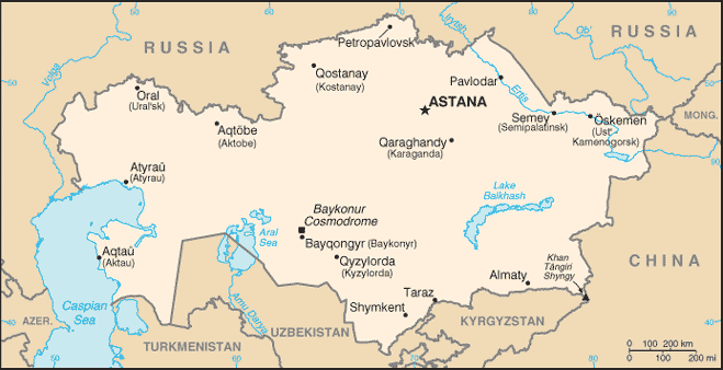
2005/12/04 11:58:32.1 40.61 N 77.69 E 33 Ms3.8 KYRGYZSTAN-XINJIANG BDR REG
2005/12/04 17:14:52.0 39.17 N 70.99 E ML3.0 TAJIKISTAN
2005/12/05 02:56:08.0 42.14 N 72.47 E ML3.5 KYRGYZSTAN

Aleutians (Medium)
----------------------------------------
map 3.4 2005/12/03 03:07:56 53.230 -170.070 10.0 FOX ISLANDS, ALEUTIAN ISLANDS, ALASKA
MAP 4.0 2005/12/05 00:01:49 53.188 -167.013 40.0 FOX ISLANDS, ALEUTIAN ISLANDS, ALASKA
map 2.8 2005/12/05 08:33:27 52.747 -169.916 60.0 FOX ISLANDS, ALEUTIAN ISLANDS, ALASKA

Possibly near Seattle (Medium)
----------------------------------------
map 1.2 2005/12/02 19:59:43 47.422 -122.552 23.3 6 km ( 4 mi) W of Vashon, WA
map 2.1 2005/12/03 19:52:10 47.032 -122.267 26.6 1 km ( 1 mi) SE of Graham, WA

New Madrid Fault (Possibly 2 areas)
----------------------------------------
map 1.6 2005/12/03 23:25:24 36.580N 89.840W 8.2 4 km ( 3 mi) SSW of Parma, MO
map 1.5 2005/12/03 07:50:06 36.500N 89.510W 6.0 10 km ( 6 mi) S of New Madrid, MO
map 1.6 2005/12/04 05:25:24 36.580 -89.840 8.2 4 km ( 2 mi) NNW of Risco, MO

France/Spain (STRONG)
----------------------------------------
2005/12/04 09:07:21.0 38.12 N 8.93 W ML2.2 PORTUGAL
2005/12/05 00:21:46.3 45.76 N 5.64 E 10 ML2.4 FRANCE
2005/12/06 02:56:49.4 42.98 N 0.75 W 10 ML2.9 PYRENEES

Tabasco-Chiapas
----------------------------------------
MAP 4.8 2005/12/02 17:58:18 16.730 -98.151 27.3 GUERRERO, MEXICO
(2 days early)
2005/12/05 17:27:41.5 16.51 N 98.50 W 35 M 4.7 NEAR COAST OF GUERRERO, MEXICO
2005/12/05 21:41:13.9 24.52 N 89.05 W 33 mb5.0 GULF OF MEXICO

Bandan, Oregon area (Strong)
----------------------------------------
map 1.8 2005/12/03 08:02:07 42.025 -120.490 24.5 22 km ( 13 mi) SSW of Lakeview, OR
map 1.7 2005/12/03 22:07:30 42.049 -120.379 13.9 16 km ( 10 mi) S of Lakeview, OR
(I'm not sure of this area for this symptom yet.)

Czechoslovakia/Germany area
----------------------------------------
2005/12/03 06:10:47.2 50.97 N 15.95 E 8 ML2.6 CZECH AND SLOVAK REPUBLICS
2005/12/04 10:56:58.4 49.24 N 6.85 E 2f ML3.1 GERMANY
2005/12/05 11:49:24.0 49.40 N 6.90 E 10G ML2.3 GERMANY

Peace to all.