*For Wednesday, 24 May 2006.
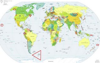
LEGEND for OVERVIEW: Size = My surety of area for quake.
Red Circle = Probable quake to STRONG quake.
Triangle = Very Strong or Stronger quake (And usually takes extra days).
Blue Circle, etc. = Uncertainty of symptom area for probable quake.

Places to watch.
Good luck to all.
For Wednesday, 24 May 2006.
----------------------------------------
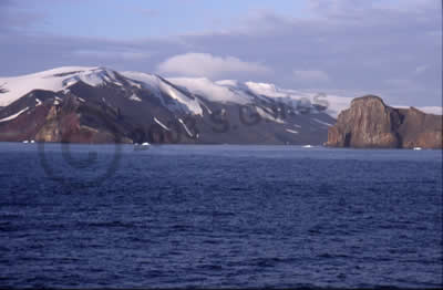
South Atlantic/South Sandwich Islands/South Shetland area (EXTREMELY STRONG)
Cybamuse

----------------------------------------
2006-05-23 07:24:26 5.0 31.02 S 12.76 W Southern Mid Atlantic Ridge
2006-05-23 07:24:27 5.0 30.90 S 13.19 W Southern Mid Atlantic Ridge
(Not as far south as expected.)
2006-05-29 05:20:47.4 59.62 S 26.55 W 131 mb 5.5 SOUTH SANDWICH ISLANDS REGION
(5 extra days)
Southern Alaska (Indication of depth - STRONG).
----------------------------------------
MAP 2.7 2006/05/24 12:04:06 62.539 -151.548 100.0 CENTRAL ALASKA
(Southcentral)
New Britain Region, P.N.G (6.86S 152.61E) (Indication of depth - Strong)
----------------------------------------
2006-05-24 03:48:37 5.0 5.54 S 145.65 E Eastern New Guinea Reg., P.N.G.
2006-05-24 10:11:03.0 2.23 S 139.22 E 10 mb 5.8 NEAR N.CST OF IRIAN JAYA
Mongolia area
----------------------------------------
(Nothing found)
Kermadec Islands
----------------------------------------
2006-05-23 16:15:42 5.2 27.37 S 177.49 W Kermadec Islands Region
24May2006 03:54:31.3 20.4S 177.7W400 mb=4.8 M*GSR FIJI ISLANDS REGION
2006-05-24 06:48:42 5.5 29.07 S 178.67 W Kermadec Islands, New Zealand
Ecuador area (1.579 -85.172) (I used to attribute this symptom to Western Brazil but it seems to be closer to Ecuador now. There is an indication of depth - Strong)
----------------------------------------
2006-05-26 11:30:59.4 5.35 N 82.42 W 40 mb 5.0 SOUTH OF PANAMA
(2 extra days)
Poland/Germany (Medium)
----------------------------------------
(Nothing found)
Honaunau-Napoopoo, HI (19.348 -155.975)
----------------------------------------
MAP 2.3 2006/05/24 00:15:30 19.364 -155.212 2.9 10 km ( 6 mi) SSE of Volcano, HI
MAP 2.4 2006/05/24 16:09:15 19.306 -155.412 0.0 13 km ( 8 mi) NNE of Pahala, HI
Possibly South Dakota area (Unproven symptom)
----------------------------------------
MAP 1.2 2006/05/24 05:03:16 44.288 -110.619 4.1 57 km ( 35 mi) SE of West Yellowstone, MT
MAP 1.2 2006/05/24 05:02:47 44.288 -110.620 4.6 57 km ( 35 mi) SE of West Yellowstone, MT
MAP 1.0 2006/05/24 11:30:47 44.721 -111.106 7.7 7 km ( 4 mi) N of West Yellowstone, MT
MAP 1.5 2006/05/24 12:24:24 44.289 -110.618 3.9 57 km ( 35 mi) SE of West Yellowstone, MT
MAP 1.3 2006/05/24 22:52:06 44.722 -111.107 7.5 7 km ( 4 mi) N of West Yellowstone, MT
Sicily, Italy/Ionian Sea area (Strong)
----------------------------------------
2006-05-24 02:03:55.0 42.12 N 15.77 E 5 ML 2.9 ADRIATIC SEA
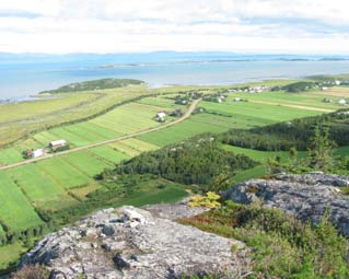
CHARLEVOIX SEISMIC ZONE, QUE. (47.75N 69.73W) (Second day symptoms for this area so will up it to VERY STRONG.)
beauxvillages

----------------------------------------
2006/05/24 19:47:52 47.35N 70.37W 6.5 0.8MN CHARLEVOIX SEISMIC ZONE,QUE.
(I’ve been getting some symptoms for this area each day almost...may not mean anything big is coming.)
Coachella, California (33.787 -116.112)
----------------------------------------
MAP 1.4 2006/05/24 00:15:58 33.251 -116.119 9.0 12 km ( 7 mi) N of Ocotillo Wells, CA
MAP 1.5 2006/05/24 02:44:08 33.468 -116.467 12.9 21 km ( 13 mi) ESE of Anza, CA
MAP 2.0 2006/05/24 07:53:05 33.256 -116.135 6.9 12 km ( 8 mi) N of Ocotillo Wells, CA
MAP 1.0 2006/05/24 09:52:17 33.685 -116.778 17.8 9 km ( 6 mi) SW of Idyllwild, CA
MAP 1.4 2006/05/24 23:28:06 33.872 -116.203 10.6 17 km ( 11 mi) N of Indio, CA
Sumatra (Strong)
----------------------------------------
(Nothing found)
Western Iran to Iraq border area
----------------------------------------
2006-05-24 17:54:54.1 26.97 N 53.99 E 28 M 3.7 SOUTHERN IRAN
Peace to all.

