*For Thursday, 13 April 2006.
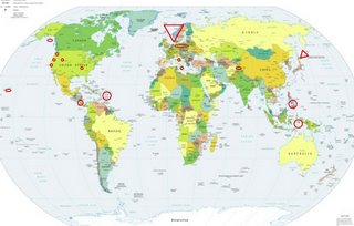
LEGEND for OVERVIEW: Size = My surety of area for quake.
Red Circle = Probable quake to STRONG quake.
Triangle = Very Strong or Stronger quake (And usually takes extra days).
Blue Circle, etc. = Uncertainty of symptom area for probable quake.

Places to watch.
Good luck to all.
For Thursday, 13 April 2006.
----------------------------------------
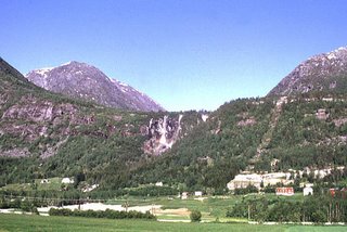
Norway Basin (68.16 -5.08) to Baltic Sea (56.16 N 20.53 E) to Svalbard, Norway (76.21 N 5.61 E) (This was EXTREMELY STRONG - Mostly it seemed to be in the Norway Basin but it was like a dislocation of the left shoulder. But it was 3 inches down from the joint which is Norway. But there was a large area so I am extended the area to be affected.)
http://academic.emporia.edu/aberjame/ice/lec03/lec3.htm>emporia

----------------------------------------
MID-NORWAY NORWAY
Origin time Lat Lon Azres Timres Wres Nphase Ntot Nsta Netmag
2006-103:07.27.15.0 62.75 12.10 0.69 0.09 0.27 2 2 1 2.24
MID-NORWAY NORWAY
Origin time Lat Lon Azres Timres Wres Nphase Ntot Nsta Netmag
2006-104:00.59.22.0 62.62 11.09 1.04 0.07 0.34 2 5 2 2.36
NORWEGIAN SEA
Origin time Lat Lon Azres Timres Wres Nphase Ntot Nsta Netmag
2006-105:03.32.08.0 67.00 -5.53 7.99 0.52 2.52 5 11 4 2.98
(This is nothing - something is still coming that is huge, I think.)
Islamabad, Pakistan (medium)
----------------------------------------
13Apr2006 09:14:19.4 37.3N 70.8E 33 mb=4.0 M GSR AFGHANISTAN-TAJIKISTAN BOR
2006-04-13 22:32:03.0 37.63N 74.07E ML3.4 TAJIKISTAN-XINJIANG BORDER REG
Redding, California area
----------------------------------------
MAP 3.2 2006/04/13 17:40:49 40.904 -123.597 20.1 8 km ( 5 mi) E of Willow Creek, CA
MAP 2.6 2006/04/13 21:03:02 40.533 -124.800 2.8 46 km ( 28 mi) W of Ferndale, CA
The Virgin Islands
----------------------------------------
MAP 3.4 2006/04/13 08:15:09 19.414 -65.406 109.6 119 km ( 74 mi) NNE of Vieques, PR
MAP 2.6 2006/04/13 08:52:12 18.921 -66.935 10.9 48 km ( 30 mi) N of Isabela, PR
MAP 2.6 2006/04/13 08:49:21 18.967 -66.993 20.5 52 km ( 32 mi) N of Isabela, PR
MAP 2.4 2006/04/13 09:18:10 18.907 -66.882 23.3 47 km ( 29 mi) N of Camuy, PR
MAP 2.7 2006/04/13 09:45:22 18.916 -66.952 13.1 47 km ( 29 mi) N of Isabela, PR
MAP 2.4 2006/04/13 09:22:14 18.823 -66.940 9.1 37 km ( 23 mi) NNE of Isabela, PR
MAP 2.2 2006/04/13 09:21:30 18.904 -66.860 12.2 47 km ( 29 mi) N of Camuy, PR
MAP 2.6 2006/04/13 09:19:56 18.916 -66.984 10.9 47 km ( 29 mi) N of Isabela, PR
(I posted the Virgin Islands quakes on the 14th of April.)
Mt. St. Helen’s (A slow pinch...don’t know what that means. Medium.)
----------------------------------------
MAP 1.5 2006/04/13 14:40:13 46.194 -122.194 0.7 1 km ( 1 mi) WSW of Mount St. Helens Volcano, WA
South of Alaska (Indication of depth - Strong.)
----------------------------------------
(Nothing found)
Sicily, Italy then Central Italy (Medium for both)
----------------------------------------
(Nothing found)
Hawaii (medium)
----------------------------------------
MAP 1.8 2006/04/13 13:41:41 19.332 -155.217 5.5 13 km ( 8 mi) S of Volcano, HI
The New Madrid Fault
----------------------------------------
MAP 2.2 2006/04/13 06:26:36 35.600 -84.350 12.2 9 km ( 6 mi) N of Madisonville, TN
Nicaragua/Costa Rica area (10.71N 86.61W) (Volcanic - Strong)
----------------------------------------
06/04/13 23:51:29 11.78N 87.40W 13.4 4.7ML Frente a Poneloya
06/04/13 04:40:15 12.75N 88.71W 3.1 3.6ML Frente a El Salvador
06/04/14 23:59:55 10.58N 86.78W 98.6 2.6ML Oceano Pacífico de Nicaragua
06/04/14 23:49:15 10.77N 86.74W 58.1 2.5ML Frente a El Astillero
06/04/14 23:42:55 10.63N 86.76W 99.7 3.8ML Oceano Pacífico de Nicaragua
06/04/14 10:33:02 12.01N 86.14W 1.0 1.5ML Masaya/Nindirí/Ticuantepe
06/04/14 10:10:35 11.76N 88.30W 1.0 3.6MC Oceano Pacífico de Nicaragua
06/04/14 06:35:42 10.85N 86.45W 20.0 3.4MC Frente a San Juan del Sur
06/04/14 04:54:51 12.18N 87.47W 49.9 3.7MC Frente a Corinto
06/04/14 01:16:44 12.63N 86.77W 5.4 2.5MC Cerca del volcan Telica
06/04/14 00:15:46 11.73N 87.37W 9.3 2.5ML Frente a Poneloya
06/04/14 00:05:08 12.58N 86.71W 2.0 2.4MC Cerca del Volcan Cerro Negro
Mindanao, Philippines (5.66 N 125.50 E) (Medium)
----------------------------------------
2006-04-12 05:36:52.1 19.91 N 121.51 E 60 mb 5.0 PHILIPPINE ISLANDS REGION
2006-04-14 18:08:52 4.9 8.31 N 125.59 E Mindanao, Philippines
Alum Rock, California area (37.337 -121.702) (MEDIUM)
----------------------------------------
MAP 1.2 2006/04/13 15:32:12 36.642 -121.261 5.7 16 km ( 10 mi) NW of Pinnacles, CA
MAP 2.2 2006/04/13 09:09:57 36.583 -121.120 7.8 6 km ( 4 mi) NNE of Pinnacles, CA
MAP 1.4 2006/04/13 05:51:03 36.617 -121.224 5.5 12 km ( 7 mi) NW of Pinnacles, CA
The Moluccas area (Medium)
----------------------------------------
2006-04-11 16:32:52.2 0.23 S 125.16 E 35 f mb 4.9 NORTHERN MOLUCCA SEA
(2 days early)
Utah
----------------------------------------
MAP 1.2 2006/04/13 01:17:44 39.456 -111.198 4.8 24 km ( 15 mi) ESE of Mount Pleasant, UT
MAP 1.7 2006/04/13 01:45:46 39.609 -110.395 0.9 6 km ( 4 mi) N of Sunnyside, UT
MAP 1.9 2006/04/13 04:55:55 39.454 -111.211 8.1 23 km ( 14 mi) ESE of Mount Pleasant, UT
MAP 1.7 2006/04/13 04:26:31 39.460 -111.198 4.4 24 km ( 15 mi) ESE of Mount Pleasant, UT
MAP 1.3 2006/04/13 03:37:37 39.665 -110.516 1.7 16 km ( 10 mi) NNW of East Carbon, UT
MAP 1.3 2006/04/13 05:27:30 39.454 -111.207 4.7 24 km ( 15 mi) ESE of Mount Pleasant, UT
MAP 1.3 2006/04/13 05:07:40 41.354 -111.418 6.0 28 km ( 18 mi) SW of Woodruff, UT
MAP 1.7 2006/04/13 11:52:11 39.455 -111.209 5.2 23 km ( 15 mi) ESE of Mount Pleasant, UT
MAP 1.6 2006/04/13 13:31:01 39.608 -110.394 0.8 6 km ( 4 mi) N of Sunnyside, UT
MAP 1.4 2006/04/13 16:56:50 39.000 -111.319 7.9 10 km ( 7 mi) NW of Emery, UT
MAP 1.2 2006/04/13 18:06:49 39.608 -110.395 0.8 6 km ( 4 mi) N of Sunnyside, UT
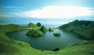
Kuril Islands (Second day symptom, already STRONG for the 12th so I will up it to Very Strong.)
http://artedi.fish.washington.edu/okhotskia/ikip/Gallery/basemap.htm>artedi.fish.washington

----------------------------------------
2006-04-13 04:35:07.5 54.99 N 160.85 E 33 Ms 3.0 NEAR E. CST KAMCHATKA PEN.
2006-04-13 04:27:24.0 41.87 N 142.69 E 60 mb 5.4 HOKKAIDO, JAPAN, REGION
2006-04-13 21:25:25 5.0 46.66 N 148.06 E Northwest of Kuril Islands
2006-04-14 03:43:05.6 47.77 N 153.02 E 128 mb 4.9 KURIL ISLANDS, RUSSIA
2006-04-14 17:07:43.0 48.55 N 152.50 E 33 mb 5.1 KURIL ISLANDS, RUSSIA
Germany/Poland
----------------------------------------
2006-04-13 01:30:00.9 51.12 N 15.90 E ML 2.5 POLAND
2006-04-13 21:42:43 3.4 51.31 N 15.95 E Poland
Peace to all.

