*For Tuesday, 25 July 2006.
LEGEND for OVERVIEW: Size = My surety of area for quake.
Red Circle = Probable quake to STRONG quake.
Triangle = Very Strong/Stronger quake (Usually takes extra days).
Blue Circle, etc. = Uncertainty of symptom area for probable quake.
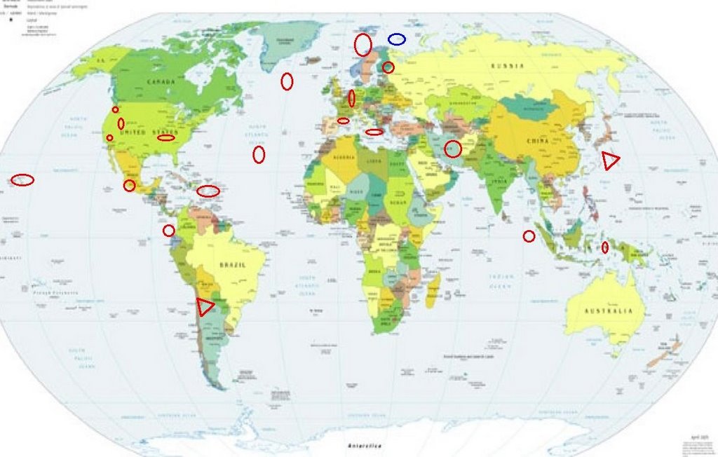
Places to watch.
Good luck to all.
For Tuesday, 25 July 2006.
----------------------------------------
Pyrenees/Spain and France border on the
Mediterranean side (STRONG)
----------------------------------------
2006-07-24 17:20:23.2 42.52N 2.22E 10 ML2.7 PYRENEES
2006-07-25 19:10:39.0 42.66N 2.17E 10 ML2.8 PYRENEES
2006-07-26 04:39:27.4 43.50N 3.15E 2 ML2.5 NEAR SOUTH COAST OF FRANCE
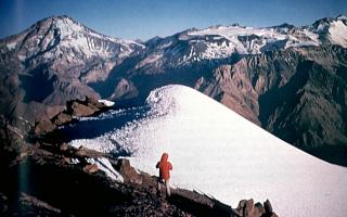
CHILE-ARGENTINA BORDER REGION
(23.55S 67.70W) (Very Strong)
http://www.volcano.si.edu/world/region.cfm?rnum=1507>volcano.si.edu
----------------------------------------
2006-07-24 17:29:29.6 28.45S 72.24W 84 M4.6 OFF COAST OF CENTRAL CHILE
2006-07-26 02:17:28 5.0 20.19S 68.99W Chile-Bolivia Border Region
Puerto Rico/Virgin Islands
----------------------------------------
2.0 2006/07/25 17:36:21 18.105N -67.045W 18.1 3 km ( 2 mi) N of San Germán, PR
3.3 2006/07/25 15:15:06 19.009N -64.759W 2.2 56 km (35 mi) NW of Settlement, Anegada, British Virgin Islands
1.0 2006/07/25 14:58:21 18.087N -67.006W 7.3 4 km ( 2 mi) E of San Germán, PR
2.3 2006/07/25 07:01:38 18.586N -66.510W 11.3 14 km ( 9 mi) N of Tierras Nuevas Poniente, PR
Switzerland to Belgium area
----------------------------------------
25Jul2006 15:06:24.6 46.8N 8.8E 2 ML=1.3 M SED Schaechental / Switzerland0747
Hawaii
----------------------------------------
2.7 2006/07/25 18:15:26 19.360 -155.074 8.5 14 km(9 mi) SSE of Fern Forest, HI
Olancha, California area (36.148 -118.071)
----------------------------------------
1.3 2006/07/24 22:42:42 36.175 -118.249 6.2 24 km ( 15 mi) WSW of Olancha, CA
1.5 2006/07/27 18:21:26 36.164 -118.228 0.0 23 km ( 14 mi) WSW of Olancha, CA
(2 extra days)
Finland area
----------------------------------------
FINLAND-KARELIA BORDER REGION
Origin time Lat Lon Azres Timres Wres Nphase Ntot Nsta Netmag
2006-205:15.06.55.0 60.34 27.09 6.98 1.61 3.36 3 3 2 1.99
GUERRERO, MEXICO area (18.84N 100.43W)
----------------------------------------
2006-07-30 23:45:24.2 10.17N 104.17W 33 mb5.0 OFF COAST OF MEXICO
(5 extra days)
4.3 2006/07/31 12:32:17 17.021 -101.889 35.0 OFFSHORE GUERRERO, MEXICO
4.3 2006/07/31 17:54:45 18.081 -104.423 10.0 OFFSHORE COLIMA, MEXICO
5.4 2006/07/31 18:25:15 18.578 -103.844 10.0 OFFSHORE MICHOACAN, MEXICO
(6 extra days)
BONIN ISLANDS, JAPAN, REGION (27.30N 140.15E)
(Second day symptom and stronger - VERY STRONG.)
(Interesting history of Bonin and other Japanese Islands)
http://www.thebulletin.org/article.php?art_ofn=jf00norris>thebulletin
http://www.focusonnature.com/BirdListRareBirdsJapan.htm>focusonnature
(Ryukyu Robin)
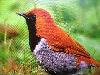
----------------------------------------
(Came in on the 26th and posted there.)
Western Lofoten Basin area (69.69 2.12)
----------------------------------------
WESTERN LOFOTEN BASIN
Origin time Lat Lon Azres Timres Wres Nphase Ntot Nsta Netmag
2006-206:15.23.41.0 70.66 4.80 21.47 0.46 5.83 3 3 3 1.88
WESTERN LOFOTEN BASIN
Origin time Lat Lon Azres Timres Wres Nphase Ntot Nsta Netmag
2006-207:03.23.45.0 69.01 -0.12 16.15 0.17 4.21 2 2 1 2.29
Off the Coast of Ecuador (1.55S 81.05W)
(Medium)
----------------------------------------
4.2 2006/07/28 02:19 2006/07/28 07:19 1.0164 -76.9579 12.00
(3 extra days)
Mt. St. Helen’s
----------------------------------------
1.7 2006/07/25 09:04:38 46.197 -122.193 0.0 1 km(1 mi) WSW of Mount St. Helens Volcano, WA
3.6 2006/07/25 12:31:45 46.196 -122.190 0.4 1 km(1 mi) WSW of Mount St. Helens Volcano, WA
1.6 2006/07/25 14:49:09 46.196 -122.197 0.8 1 km( 1 mi) WSW of Mount St. Helens Volcano, WA
06/07/26 04:43:42 46.19N 122.18W 0.6 3.1 AA
06/07/26 11:52:49 46.19N 122.19W 0.6 1.7 AB
06/07/26 15:56:05 46.19N 122.19W 0.0 1.6 AA
06/07/26 23:01:00 46.19N 122.18W 0.0 2.3 DA
06/07/26 23:36:53 46.19N 122.19W 0.0 1.0 AB
The New Madrid Fault (Strong)
----------------------------------------
2.2 2006/07/25 19:35:39 36.770 -89.490 14.7 9 km ( 5 mi) E of Matthews, MO
Northern Mid Atlantic Ridge (52.86N 31.17W)
then Northern Mid Atlantic (35.64N 36.59W)
----------------------------------------
2006-07-25 19:23:13.7 23.55N 63.59W 33 mb5.0 NORTH ATLANTIC OCEAN ?
2006-07-28 12:56:47.1 59.22N 30.76W 10 f mb 5.2 NORTH ATLANTIC OCEAN
2006-07-28 09:15:05.4 59.17N 30.70W 40 mb 4.8 NORTH ATLANTIC OCEAN
2006-07-28 08:13:23.8 59.35N 30.54W 10 f mb 4.7 NORTH ATLANTIC OCEAN
(3 extra days)
Sicily, Italy/Ionian Sea
----------------------------------------
(Nothing found)
Northern Sumatra (1.31N 97.09E)
(Medium)
----------------------------------------
2006-07-25 17:45:27.4 3.70N 96.11E 100 mb5.1 NORTHERN SUMATERA, INDONESIA
Possibly Barents Sea (New symptom)
----------------------------------------
WESTERN BARENTS SEA
Origin time Lat Lon Azres Timres Wres Nphase Ntot Nsta Netmag
2006-206:00.14.53.0 70.57 21.27 17.55 0.08 4.47 2 4 1 2.20
FRANZ JOSEF LAND, RUSSIA
Origin time Lat Lon Azres Timres Wres Nphase Ntot Nsta Netmag
2006-206:10.55.14.0 80.55 47.62 0.50 0.33 0.46 2 2 1 2.32
Northcentral Iran (STRONG)
----------------------------------------
2006-07-25 15:24:10.3 27.40N 55.63E 16 M3.7 SOUTHERN IRAN
2006-07-25 21:51:45.5 27.71N 56.72E 21 M3.8 SOUTHERN IRAN
(Not northcentral)
Utah/Nevada
----------------------------------------
m
06/07/24 01:06:28 39.61N 110.40W 1.4 1.6 4.5 mi NNW of Sunnyside
06/07/24 04:47:37 39.61N 110.40W 1.5 1.9 4.4 mi NNW of Sunnyside
06/07/24 07:05:43 39.61N 110.39W 1.3 1.4 4.3 mi NNW of Sunnyside
06/07/24 07:11:26 39.61N 110.39W 1.2 1.6 4.2 mi NNW of Sunnyside
06/07/24 19:02:20 39.73N 110.74W 0.4 1.4 7.2 mi NE of Helper
06/07/24 22:11:22 41.91N 112.54W 6.5 2.4 22.8 mi WNW of Garland
06/07/25 03:42:06 39.61N 110.39W 1.5 1.6 4.3 mi NNW of Sunnyside
06/07/25 04:13:45 39.61N 110.39W 1.2 1.5 4.4 mi NNW of Sunnyside
06/07/25 15:23:54 39.61N 110.40W 1.6 1.8 4.4 mi NNW of Sunnyside
06/07/25 16:12:54 42.41N 111.49W 5.4 3.1 6.8 mi SW of Georgetown
06/07/25 16:20:31 42.40N 111.50W 7.0 2.1 7.4 mi SW of Georgetown
06/07/25 16:43:45 42.43N 111.53W 7.1 2.1 7.3 mi SW of Georgetown
06/07/25 19:53:00 39.72N 111.55W 6.6 2.2 7.6 mi NNE of Fountain Green
06/07/25 19:54:19 39.72N 111.54W 3.9 1.3 8.2 mi NNE of Fountain Green
06/07/25 19:56:41 42.43N 111.53W 4.4 1.7 7.4 mi WSW of Georgetown
06/07/25 20:23:30 39.72N 111.55W 4.8 2.4 7.6 mi NNE of Fountain Green
06/07/25 20:27:19 39.73N 111.53W 7.7 2.9 9.0 mi NNE of Fountain Green
06/07/25 20:39:35 39.72N 111.55W 5.1 1.9 7.5 mi NNE of Fountain Green
1.2 2006/07/25 03:30:58 38.359 -118.240 10.2 16 km(10 mi) NW of Tonopah Junction, NV
1.0 2006/07/25 14:07:59 39.411 -119.852 9.9 13 km(8 mi) S of Reno, NV
1.3 2006/07/25 19:39:58 36.137 -115.250 0.0 3 km(2 mi) N of Spring Valley, NV
2.1 2006/07/25 20:15:04 35.923 -115.109 6.0 13 km(8 mi) ENE of Erie, NV
1.4 2006/07/25 20:28:34 37.438 -115.988 0.0 39 km(24 mi) SW of Tempiute, NV
Banda Sea (7.07S 127.52E) (STRONG)
----------------------------------------
2006-07-25 00:11:55.1 5.59S 131.07E 35 G M4.5 BANDA SEA
Peace to all.

posted by Unknown @ 1:41 PM
0 comments
![]()
![]()
