*For Sunday, 21 May 2006.
LEGEND for OVERVIEW: Size = My surety of area for quake.
Red Circle = Probable quake to STRONG quake.
Triangle = Very Strong or Stronger quake (And usually takes extra days).
Blue Circle, etc. = Uncertainty of symptom area for probable quake.

Places to watch.
Good luck to all.
For Sunday, 21 May 2006.
----------------------------------------
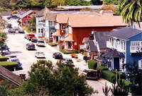
San Simeon/Lake Nacimiento (35.697 -121.520) (Originally this symptom was strong enough to wake me up and then repeated 3 times. Even though I get exaggerated symptoms for California I am putting this at Very Strong.)
http://cacoastinfo.com/communities/SanSimeon.htm>cacoastinfo

----------------------------------------
MAP 2.2 2006/05/20 07:43:29 35.671 -121.091 4.5 9 km ( 6 mi) ENE of San Simeon, CA
Hawaii (STRONG)
----------------------------------------
MAP 1.7 2006/05/21 09:06:23 19.315 -155.232 5.8 15 km ( 9 mi) S of Volcano, HI
MAP 2.2 2006/05/21 15:13:49 19.381 -155.243 3.3 8 km ( 5 mi) S of Volcano, HI
MAP 1.9 2006/05/22 04:27:52 19.063 -155.377 38.0 19 km ( 12 mi) SE of Pahala, HI
MAP 2.0 2006/05/22 07:55:18 19.868 -155.592 19.5 19 km ( 12 mi) SSE of Waimea, HI
Hokkaido (STRONG)
----------------------------------------
(Nothing found)
North of Ascension Island (-1.828 -15.123) (Medium)
----------------------------------------
(Nothing found)
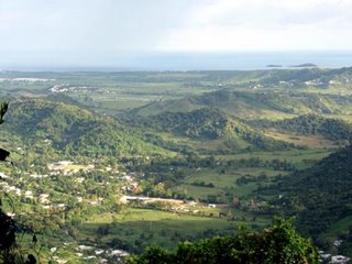
Puerto Rico/Virgin Islands thn Puerto Rico Trench (19.345N 67.329W) (Volcanic and more - 3 different symptoms - Very Strong.)
http://www.greentreks.org/watershedstv/old_cattails/puertorico.asp>greentreks

----------------------------------------
MAP 2.9 2006/05/21 03:59:52 18.557 -67.213 7.6 15 km ( 9 mi) NNW of Cabán, PR
MAP 3.2 2006/05/21 08:14:40 19.291 -65.690 83.5 97 km ( 60 mi) N of Suárez, PR
MAP 3.0 2006/05/21 12:33:29 18.992 -67.900 79.1 95 km ( 59 mi) ENE of Higüey, Dominican Republic
Baja, California area (31.922 -116.180)
----------------------------------------
MAP 1.3 2006/05/21 03:58:14 33.156 -116.127 10.2 1 km ( 1 mi) NNE of Ocotillo Wells, CA
MAP 1.5 2006/05/21 04:02:28 33.820 -116.910 15.2 6 km ( 4 mi) NE of San Jacinto, CA
MAP 1.2 2006/05/21 08:48:28 33.761 -116.037 4.8 16 km ( 10 mi) NE of Coachella, CA
MAP 1.4 2006/05/21 12:33:56 33.743 -116.034 5.8 15 km ( 9 mi) ENE of Coachella, CA
MAP 1.6 2006/05/21 18:30:49 33.771 -116.876 21.6 3 km ( 2 mi) NE of Valle Vista, CA
MAP 1.5 2006/05/21 22:35:23 33.732 -116.725 19.3 2 km ( 1 mi) SW of Idyllwild, CA
Afghanistan
----------------------------------------
(Nothing found)
Western Brazil area (8.96 S 70.98 W) (STRONG)
----------------------------------------
2006-05-19 17:53:57 4.7 4.32 S 79.42 W Peru-Ecuador Border Region
(2 days early)
MAP 6.0 2006/05/21 02:07:36 1.579 -85.172 10.0 OFF THE COAST OF ECUADOR
Northern British Columbia area
----------------------------------------
2006/05/19 17:49:56 53.96N 132.46W 11.6 1.2ML PGC 21 km SW of Masset, BC
(2 days early and not very Northern)
Sicily, Italy/Ionian Sea (STRONG)
----------------------------------------
(5 that were 2.5 or better came in on the 20th and posted there.)
MINAHASSA PENINSULA, SULAWSI area (0.2S 123.8E). (STRONG)
----------------------------------------
22May2006 14:10:52.4 0.0N 123.0E 50 mb=4.6 M GSR MINAHASSA PENINSULA, SULAW
2006-05-22 14:12:09 5.1 3.26 N 122.07 E Celebes Sea
2006-05-22 17:50:23 4.9 2.77 S 130.09 E Seram, Indonesia
22May2006 20:53:59.3 4.7S 126.8E 10 M =6.0 M NEI BANDA SEA
(Some more East and South than expected.)
The Geysers
----------------------------------------
MAP 1.7 2006/05/21 01:38:29 38.797 -122.770 5.1 3 km ( 2 mi) E of The Geysers, CA
Yorba Linda, California area (33.921 -117.775)
----------------------------------------
MAP 1.6 2006/05/21 13:05:02 34.056 -117.544 15.2 6 km ( 4 mi) NW of Glen Avon, CA
MAP 2.0 2006/05/21 18:03:54 34.034 -117.247 18.8 2 km ( 1 mi) SSE of Loma Linda, CA
Peace to all.

