*For Tuesday, 16 May 2006.
LEGEND for OVERVIEW: Size = My surety of area for quake.
Red Circle = Probable quake to STRONG quake.
Triangle = Very Strong or Stronger quake (And usually takes extra days).
Blue Circle, etc. = Uncertainty of symptom area for probable quake.

Places to watch.
Good luck to all.
For Tuesday, 16 May 2006.
----------------------------------------
Possibly Southern Alaska or Alaska Peninsula (Indication of depth - Medium)
----------------------------------------
MAP 1.7 2006/05/15 01:36:54 59.430 -152.917 100.0 57 km ( 36 mi) W of Nanwalek, AK
MAP 2.6 2006/05/15 02:41:20 59.672 -153.036 200.0 SOUTHERN ALASKA
MAP 2.2 2006/05/15 03:58:19 62.024 -152.115 140.0 47 km ( 29 mi) WNW of Skwentna, AK
MAP 2.7 2006/05/16 17:00:53 61.400 -149.791 20.0 SOUTHERN ALASKA
Myanmar (24.02N 94.81E) (Very Strong - may take 5 extra days.)
http://www.myanmardotcom.com/Default.aspx>myanmardocom
----------------------------------------
2006-05-15 23:58:48.0 24.96 N 95.30 E 104 M 4.5 MYANMAR
2006-05-16 21:13:07 4.7 15.11 N 101.29 E Thailand
Sicily, Italy/Ionian Sea
----------------------------------------
2006-05-16 23:44:27.7 37.68 N 20.85 E 3 ML 3.1 IONIAN SEA 2006-05-16 23:55
2006-05-16 22:05:23.0 35.15 N 22.65 E ML 3.2 CENTRAL MEDITERRANEAN SEA
2006-05-16 22:01:31.0 35.10 N 22.75 E ML 3.1 CENTRAL MEDITERRANEAN SEA
2006-05-16 21:29:35.0 38.23 N 14.90 E 150 ML 2.5 SICILY, ITALY
Possibly Kermadec Islands area or New Madrid Fault (Another symptom lap over)
----------------------------------------
2006-05-16 10:39:15.2 31.55 S 179.53 W 80 Mw 7.5 KERMADEC ISLANDS REGION
(I have posted this on the 13th list also because I believe I got the most symptoms for that day for this area. Considered New Zealand area also.)
2006-05-17 10:26:49 5.1 32.00 S 179.02 W South of Kermadec Islands
2006-05-17 09:22:10 5.3 31.77 S 178.74 W Kermadec Islands Region
Volcano Islands area (Medium)
----------------------------------------
MAP 4.6 2006/05/15 22:50:38 32.176 140.749 61.8 IZU ISLANDS, JAPAN REGION
Kurils and East of
----------------------------------------
(Nothing found)
Hawaii (Medium)
----------------------------------------
MAP 1.8 2006/05/16 10:44:33 19.314 -155.053 40.0 19 km ( 12 mi) SSE of Fern Forest, HI
MAP 2.4 2006/05/16 16:25:11 19.393 -155.233 3.1 6 km ( 4 mi) S of Volcano, HI
Mt. St. Helen’s (This was an all day annoyance - STRONG)
----------------------------------------
MAP 1.7 2006/05/16 02:56:02 46.195 -122.194 0.5 1 km ( 1 mi) WSW of Mount St. Helens Volcano, WA
MAP 1.7 2006/05/16 08:56:41 46.195 -122.196 0.0 1 km ( 1 mi) WSW of Mount St. Helens Volcano, WA
MAP 1.2 2006/05/16 12:28:01 46.196 -122.196 0.4 1 km ( 1 mi) WSW of Mount St. Helens Volcano, WA
MAP 1.6 2006/05/16 16:58:15 46.195 -122.195 0.0 1 km ( 1 mi) WSW of Mount St. Helens Volcano, WA
MAP 2.1 2006/05/16 21:14:40 46.194 -122.199 0.0 2 km ( 1 mi) WSW of Mount St. Helens Volcano, WA
MAP 1.6 2006/05/16 23:53:32 46.199 -122.193 0.8 1 km ( 1 mi) W of Mount St. Helens Volcano, WA
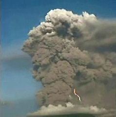
Mariana Islands (Second day of symptoms and stronger - Very Strong.)
http://epsc.wustl.edu/admin/whatsnew/photo_album/anatahan/>epsc
----------------------------------------
(Nothing found - probably still coming)
Puerto Rico/Virgin Islands area then Dominican Republic
----------------------------------------
MAP 2.6 2006/05/17 01:46:04 19.001 -67.764 16.7 90 km ( 56 mi) NW of Aguadilla, PR
MAP 3.2 2006/05/17 07:52:28 18.886 -64.278 62.1 18 km ( 11 mi) NNE of Settlement, British Virgin Islands
MAP 3.2 2006/05/17 08:47:11 19.159 -64.450 37.1 50 km ( 31 mi) NNW of Settlement, British Virgin Islands
MAP 2.2 2006/05/17 09:29:35 18.998 -64.325 59.3 30 km ( 19 mi) N of Settlement, British Virgin Islands
MAP 2.3 2006/05/17 10:22:46 18.936 -64.302 59.7 23 km ( 14 mi) N of Settlement, British Virgin Islands
MAP 2.7 2006/05/17 10:19:43 18.991 -64.412 53.7 31 km ( 19 mi) NNW of Settlement, British Virgin Islands
MAP 3.5 2006/05/17 10:44:18 19.321 -64.910 78.3 90 km ( 56 mi) NW of Settlement, British Virgin Islands
MAP 2.2 2006/05/17 13:56:26 18.795 -64.335 42.4 7 km ( 5 mi) NNW of Settlement, British Virgin Islands
Taylorsville, California area (40.088 -120.871)
----------------------------------------
(Nothing found)
Pyrenees/Portugal aea
----------------------------------------
(Nothing found)
Morocco/Algeria area
----------------------------------------
2006-05-14 22:26:04.1 36.93 N 5.10 E 40 mb 3.8 NORTHERN ALGERIA
(2 days early)
Mongolia area (Second day of symptom - Strong)
----------------------------------------
2006-05-17 07:45:36.0 50.28 N 91.28 E ML 3.4 TUVA-BURYATIA-MONGOLIA BDR REG
Fort-Coulonge, QC area (46.20N 76.88W)
----------------------------------------
2006/05/16 11:18:19 78.92N 94.20W 18.0g 2.4ML GSC 202 km E from Isachsen, NU
2006/05/16 11:04:54 78.80N 94.16W 18.0g 2.6ML GSC 203 km E from Isachsen, NU
2006/05/16 09:48:25 78.67N 94.10W 18.0g 2.1ML GSC 206 km E from Isachsen, NU
2006/05/16 09:34:54 74.92N 95.86W 18.0g 1.9MN GSC 39 km NW from Resolute, NU
(I think these are what I felt and I interpreted the symptom wrong - I will have to watch for a repeat.)
Lake Baikal, Russia area (May go along with Mongolia)
----------------------------------------
(Nothing found)
Peace to all.

posted by Unknown @ 3:28 PM
0 comments
![]()
![]()
