*For Monday, 23 October 2006.
LEGEND for OVERVIEW: Size = My surety of area for quake.
Red Circle = Probable quake to STRONG quake.
Triangle = Very Strong/Stronger quake (Usually takes extra days).
Blue Circle, etc. = Uncertainty of symptom area for probable quake.

Places to watch.
Good luck to all.
For Monday, 23 October 2006.
--------------------------------------
Hawaii
--------------------------------------
2.6 2006/10/23 05:31:48 19.439 -155.882 7.8 1 km(1 mi) SE of Honaunau-Napoopoo, HI
1.9 2006/10/23 06:13:00 20.123 -155.487 1.1 6 km ( 3 mi) NNW of Honokaa, HI
2.3 2006/10/23 08:46:47 19.920 -156.014 11.9 16 km ( 10 mi) W of Puako, HI
2.4 2006/10/23 10:58:24 19.845 -156.040 41.4 14 km ( 9 mi) NNW of Kalaoa, HI
2.3 2006/10/23 13:20:22 19.939 -156.051 16.3 19 km ( 12 mi) W of Puako, HI
4.0 2006/10/23 15:08:53 19.736 -155.956 3.5 5 km ( 3 mi) ENE of Kalaoa, HI
2.6 2006/10/23 18:44:04 19.976 -156.135 15.9 29 km ( 18 mi) W of Puako, HI
Washington State - Various
areas/Mt. Rainier/Mt. St. Helen’s
--------------------------------------
1.4 2006/10/23 00:12:39 48.260 -121.936 13.2 2 km ( 1 mi) SW of Oso, WA
2.2 2006/10/23 00:58:17 46.195 -122.189 0.0 1 km(1 mi) SW of Mount St. Helens Volcano, WA
1.8 2006/10/23 02:12:38 46.861 -121.602 6.0 31 km ( 19 mi) S of Greenwater, WA
1.2 2006/10/23 07:03:07 44.095 -121.794 0.0 29 km ( 18 mi) SW of Sisters, OR
1.7 2006/10/23 07:15:52 48.474 -123.053 26.0 7 km ( 4 mi) SSW of Friday Harbor, WA
2.4 2006/10/23 10:14:14 46.195 -122.187 0.0 1 km ( 0 mi) SW of Mount St. Helens Volcano, WA
1.1 2006/10/23 10:49:32 46.195 -122.192 0.9 1 km ( 1 mi) WSW of Mount St. Helens Volcano, WA
2.5 2006/10/23 10:54:17 47.579 -122.712 21.8 1 km ( 1 mi) S of Erlands Point-Kitsap Lake, WA
2.1 2006/10/23 16:53:33 47.694 -121.856 19.2 4 km ( 3 mi) E of Lake Marcel-Stillwater, WA
Montana/Idaho/Wyoming
(Medium)
--------------------------------------
(Nothing found for the 23d - weird.)
Abbotsford, B.C. area and north (48.53N 122.09W)
--------------------------------------
2006/10/23 00:11:39 53.85N 132.67W 17.6 1.7ML 38 km SW of Masset,BC
2006/10/23 07:15:51 48.46N 123.09W 31.7 1.5ML 20 km NE of Victoria,BC
2006/10/23 10:54:16 47.53N 122.77W 23.7 2.3ML 33 km SW of Seattle,WA
2006/10/23 16:53:32 47.62N 121.88W 25.0 2.1ML 33 km NE of Seattle,WA
2006/10/24 08:40:12 50.22N 120.77W 1.0* 2.0ML 60 km SW from KAMLOOPS,B.C.
2006/10/25 01:39:12 48.88N 122.49W 13.5 1.6ML 24 km SW of Abbotsford,BC
(2 extra days)
Honshu, Japan and south (Keeping it at
VERY STRONG.)
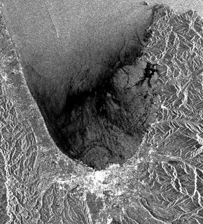
earth.esa.int

--------------------------------------
2006-10-23 00:58:17.3 40.24N 141.95E 72 mb4.5 NEAR EAST COAST OF HONSHU, JAPAN
23Oct2006 21:17:21.2 29.3N 140.4E 33 MS=6.2 M*GSR SOUTH OF HONSHU, JAPAN
Mariana Islands (Medium)
--------------------------------------
(Nothing found)
France (46.37N 0.78E) (STRONG)
--------------------------------------
2006-10-24 21:28:45.4 45.53N 6.62E 2 ML2.4 FRANCE
The Geysers
--------------------------------------
1.7 2006/10/23 05:24:09 38.831 -122.794 2.0 4 km ( 2 mi) NNE of The Geysers, CA
1.7 2006/10/23 07:45:05 38.818 -122.802 1.5 2 km ( 1 mi) N of The Geysers, CA
1.5 2006/10/23 08:02:41 38.868 -122.803 0.2 8 km ( 5 mi) N of The Geysers, CA
2.7 2006/10/23 08:06:05 38.787 -122.745 3.4 5 km (3 mi) WNW of Anderson Springs, CA
1.2 2006/10/23 09:23:21 38.823 -122.796 2.1 3 km ( 2 mi) NNE of The Geysers, CA
1.8 2006/10/23 17:46:21 38.862 -122.804 0.0 7 km ( 4 mi) N of The Geysers, CA
Kazakhstan (49.24N 80.24E)
(This is the fourth day for this area
but back to the first symptom so
keeping it at - STRONG)
--------------------------------------
(Nothing found yet - may still be coming.)
Puerto Rico/Virgin Islands
--------------------------------------
2006/10/23 00:41:05.59 18.250N 66.404W 19.1 2.3 C Central Puerto Rico
2006/10/23 09:59:03.63 18.484N 64.079W 72.4 3.3 D Anegada Passage
2006/10/23 10:07:22.11 19.777N 64.337W 55.6 3.7 D Puerto Rico Trench
2006/10/23 14:47:01.14 19.435N 65.851W 24.9 3.1 D 19° N Fault Zone
2006/10/23 22:46:43.69 19.576N 66.102W 25.2 3.5 D Puerto Rico Trench
Kermadec Islands (STRONG)
--------------------------------------
2006-10-23 05:41:14.5 19.50S 174.38W 33 mb5.2 TONGA
Sumatra (Medium)
--------------------------------------
2006-10-23 00:19:24.0 4.94N 125.29E 40 Mw5.6 KEPULAUAN SANGIHE, INDONESIA
2006-10-23 05:16:00.6 4.99N 125.45E 80 mb5.1 KEPULAUAN SANGIHE, INDONESIA
2006-10-23 07:27:38.2 4.89N 125.39E 60 mb5.1 KEPULAUAN SANGIHE, INDONESIA
2006-10-23 13:19:53.9 7.70S 127.85E 169 mb4.6 KEPULAUAN BARAT DAYA, INDONESIA
The New Madrid Fault (Medium)
--------------------------------------
1.7 2006/10/23 07:53:07 36.540 -89.640 8.4 4 km ( 2 mi) NW of Marston, MO
1.8 2006/10/23 09:14:39 36.530 -89.640 6.2 3 km ( 2 mi) WNW of Marston, MO
1.7 2006/10/23 19:39:23 36.540 -89.640 7.6 4 km ( 2 mi) NW of Marston, MO
SEA OF OKHOTSK (49.91N 146.82E)
(2 different symptoms - STRONG)
--------------------------------------
2006-10-25 08:30:50.9 51.42N 156.67E 33 Ms3.5 KAMCHATKA PENINSULA, RUSSIA
(2 extra days)
Alaska Peninsula
--------------------------------------
3.0 2006/10/23 13:49:19 55.134 -162.030 160.0 ALASKA PENINSULA
CERAM SEA (2.37S 128.59E)
--------------------------------------
2006-10-23 13:19:53.9 7.70S 127.85E 169 mb4.6 KEPULAUAN BARAT DAYA, INDONESIA
2006-10-23 18:41:32.6 5.97S 131.22E 20 mb5.1 BANDA SEA
Turkey then Caspian Sea (37.66N 49.05E)
(Strong for Turkey itself)
--------------------------------------
2006-10-22 12:18:45.4 36.92N 38.59E 19 MD3.5 TURKEY-SYRIA BORDER REGION
2006-10-22 13:53:19.5 39.65N 27.52E 19 MD2.9 WESTERN TURKEY
2006-10-22 17:16:44.6 38.90N 44.51E 2 mb4.2 TURKEY-IRAN BORDER REGION
2006-10-22 17:26:23.2 38.92N 44.57E 7 MD3.5 TURKEY-IRAN BORDER REGION
South Sandwich Islands (55.75S 29.81W)
(This symptom seemed to overlap to
Nova Scotia?)
--------------------------------------
(Posted on the 24th)
San Simeon, CA area (35.721 -121.079)
--------------------------------------
(Nothing found)
AZORES ISLANDS REGION (36.80N 24.02W)
--------------------------------------
(Nothing found)
Owen Fracture Zone Region (12.76N 57.49E)
(2 different symptoms - STRONG)
--------------------------------------
22Oct2006 08:55:17.0 45.8S 96.0E 10 M =6.1 M*NEI SOUTHEAST INDIAN RIDGE 1705
(May not be the right quake for this symptom)
Peace to all.

