*For Tuesday, 24 January 2006.
LEGEND for OVERVIEW:
Size = My surety of area for quake.
Red Circle = Probable quake to STRONG quake.
Triangle = Very Strong or Stronger quake (And usually takes extra days).
Blue Circle, etc. = Uncertainty of symptom area for probable quake.
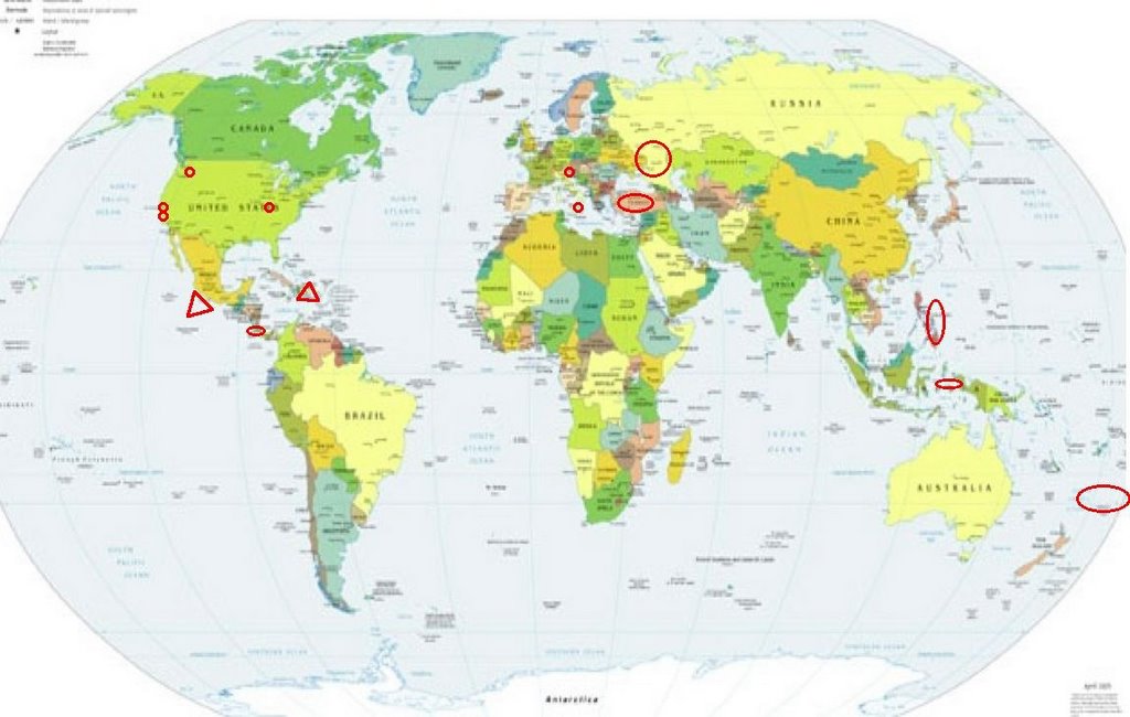
Places to watch.
Good luck to all.
For Tuesday, 24 January 2006.
----------------------------------------
Kermadec Islands area (Medium)
----------------------------------------
MAP 4.7 2006/01/24 13:17:56 -23.605 -178.031 334.0 SOUTH OF THE FIJI ISLANDS
MAP 4.4 2006/01/24 10:30:14 -23.613 -179.498 401.0 SOUTH OF THE FIJI ISLANDS
-2006-01-26 01:16:17 5.6 29.84 S 177.83 W Kermadec Islands, New Zealand
(2 extra days)
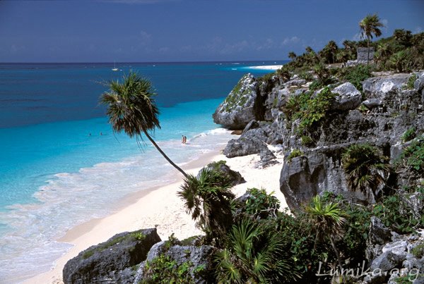
Coast of Guererro, Mexico (17.21 101.35) (VERY STRONG - May be deep because pains seemed distant.)
http://www.lumika.org/mexico_natural_scenes.htm>Mexico
----------------------------------------
MAP 4.0 2006/01/26 02:49:05 16.498 -94.535 67.3 OAXACA, MEXICO
Puerto Rico (Very Strong)
http://honeymoons.about.com/cs/puertorico/l/bl_prpix.htm>Puerto Rico
Arecibo

----------------------------------------
(Nothing found - may still be coming)
Southwestern Siberia
----------------------------------------
NORTHWESTERN SIBERIA, RUSSIA
Origin time Lat Lon Azres Timres Wres Nphase Ntot Nsta Netmag
2006-023:11.10.58.0 71.71 66.18 12.82 0.54 3.75 3 3 3 2.57
(Not South)
The Philippines (Strong)
----------------------------------------
2006-01-23 14:19:59.2 6.62N 126.47E 73 mb5.2 MINDANAO, PHILIPPINE ISLANDS
The Parkfield Fault (Non-specific entire area squeezed.)
----------------------------------------
map 1.8 2006/01/24 13:12:22 36.688 -121.319 4.7 11 km ( 7 mi) S of Tres Pinos, CA
map 1.8 2006/01/24 17:05:38 36.688 -121.321 4.8 11 km ( 7 mi) S of Tres Pinos, CA
map 1.1 2006/01/24 17:39:27 36.508 -121.091 4.0 5 km ( 3 mi) ESE of Pinnacles, CA
map 1.4 2006/01/24 18:01:15 36.907 -121.263 7.0 14 km ( 9 mi) ENE of Hollister, CA
Northern Italy into Austria area (Still getting off and on light symptoms for this area - may indicate a small swarm.)
----------------------------------------
(Nothing found - May still be coming)
Southern Washington State area (Strong)
----------------------------------------
map 2.7 2006/01/24 16:42:14 46.185N 122.189W 0.0 2 km ( 1 mi) S of Mount St. Helens
map 1.8 2006/01/24 09:13:41 41.370N 121.433W 4.9 29 km (18 mi) SSE of Medicine Lakes Volc area
Coso Junction area (36.148 -117.872)
----------------------------------------
map 2.1 2006/01/24 00:27:36 36.018 -117.769 1.8 16 km ( 10 mi) E of Coso Junction, CA
map 2.6 2006/01/24 08:11:11 36.076 -117.908 4.9 5 km ( 3 mi) NE of Coso Junction, CA
Turkey (Medium)
----------------------------------------
2006-01-25 00:04:07.0 36.83N 30.42E 30 f ML3.7 TURKEY
2006-01-25 10:57:27.8 39.30N 33.33E 28 MD3.1 TURKEY
Arenal Volcano, Costa Rica (New symptom)
----------------------------------------
06/01/24 20:48:28 12.50N 87.81W 58.4 2.5ML Frente al Cosigüina
06/01/24 06:57:53 11.97N 86.85W 78.5 2.9MC Frente a Puerto Sandino
06/01/24 05:57:21 12.25N 87.55W 1.0 2.5MC Frente a Corinto
(Nothing for Arenal)
Mt. Etna
----------------------------------------
(Nothing found)
The Moluccas (STRONG)
----------------------------------------
2006-01-25 13:56:19.3 0.76S 124.04E 119 mb4.8 MINAHASSA PENINSULA, SULAWESI
The New Madrid Fault/Missouri
----------------------------------------
(Nothing found)
Peace to all.

posted by Unknown @ 2:56 PM
0 comments
![]()
![]()
