*For Monday, 3 July 2006.
LEGEND for OVERVIEW: Size = My surety of area for quake.
Red Circle = Probable quake to STRONG quake.
Triangle = Very Strong/Stronger quake (Usually takes extra days).
Blue Circle, etc. = Uncertainty of symptom area for probable quake.
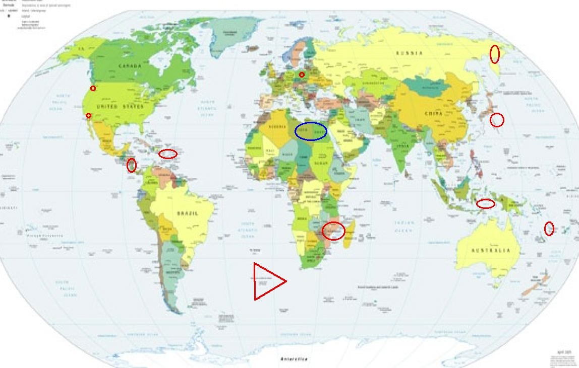
Places to watch.
Good luck to all.
For Monday, 3 July 2006.
----------------------------------------
Mozambique area
----------------------------------------
(Nothing found)
Vanuatu area (15.26S 167.22E)
(STRONG)
----------------------------------------
04Jul2006 04:43:27.0 10.6S 162.0E100 mb=4.8 M GSR SOLOMON ISLANDS
Borrego Springs area (33.441 -116.362)
(Second day symptom - Strong)
----------------------------------------
2.1 2006/07/04 01:53:27 33.248N 116.032W 3.0 9 km ( 5 mi) SW of Salton City, CA
1.4 2006/07/04 04:40:46 33.249N 116.049W 3.3 10 km ( 6 mi) SW of Salton City, CA
1.8 2006/07/04 10:20:30 33.247N 116.021W 4.8 8 km ( 5 mi) SW of Salton City, CA
1.6 2006/07/04 15:20:55 33.271N 116.019W 3.7 6 km ( 4 mi) WSW of Salton City, CA
1.2 2006/07/04 15:32:26 33.984N 116.835W 13.3 8 km ( 5 mi) NE of Banning, CA
1.6 2006/07/04 15:39:40 33.250N 116.032W 4.0 9 km ( 5 mi) SW of Salton City, CA
1.2 2006/07/04 16:09:57 33.479N 116.510W 16.5 17 km (11 mi) ESE of Anza, CA
1.9 2006/07/04 18:07:13 33.242N 116.033W 3.0 9 km ( 6 mi) SW of Salton City, CA
1.3 2006/07/04 18:21:07 33.997N 116.832W 13.5 9 km ( 6 mi) NE of Banning, CA
2.5 2006/07/04 19:57:01 33.244N 116.029W 2.9 9 km ( 6 mi) SW of Salton City, CA
(I posted all the micro quakes that happened on the 3d on the list for the 2nd.)
Eastern Siberia, Russia
----------------------------------------
(Nothing found)
Timor area (8.54S 125.80E)
(Second day symptom - Strong)
----------------------------------------
2006-07-03 16:33:44.2 6.52S 129.73E 148 mb4.7 BANDA SEA
Izu Islands area (32.176 140.749)
(Medium)
----------------------------------------
2006-07-05 02:47:19.3 26.19N 144.09E 10 mb4.9 BONIN ISLANDS, JAPAN, REGION
(2 extra days)
Nicaragua/Costa Rica area
----------------------------------------
06/07/03 22:00:11 10.90N 86.90W 17.8 3.2MC Frente a El Astillero
06/07/03 21:51:06 10.88N 86.90W 17.2 3.4MC Frente a El Astillero
06/07/03 21:39:24 10.95N 86.87W 23.3 3.0MC Frente a La Boquita y Casares
06/07/03 21:27:11 10.93N 86.89W 19.3 2.9MC Frente a La Boquita y Casares
06/07/03 21:20:51 10.95N 86.86W 1.0 3.8MC Frente a El Astillero
06/07/03 21:05:23 10.96N 86.84W 3.3 3.7MC Frente a El Astillero
06/07/03 18:00:32 12.74N 86.50W 5.0 2.2MC Nicaragua
06/07/03 11:36:06 12.21N 87.58W 5.7 2.6MC Frente a Corinto
06/07/03 02:38:56 11.86N 87.11W 14.9 3.0MC Frente a Puerto Sandino
Puerto Rico/Virgin Islands
----------------------------------------
2006/07/03 08:53:50.84 18.697N 67.575W 15.8 3.0 D Mona Canyon
2006/07/03 13:27:07.96 19.042N 67.930W 15.8 3.4 D Septentrional Fault Zone
2006/07/03 13:28:51.83 18.981N 67.897W 17.6 2.6 D Septentrional Fault Zone
2006/07/03 13:36:24.01 19.024N 67.923W 16.1 3.2 D Septentrional Fault Zone
2006/07/03 22:50:08.98 17.930N 66.033W 13.2 2.6 B Southern Puerto Rico
Poland
----------------------------------------
2006-07-03 03:31:58.2 51.00N 15.95E 10 ML 2.5 POLAND
2006-07-03 15:56:43.3 51.35N 16.14E ML 2.3 POLAND
Mt. St. Helen’s
----------------------------------------
map 1.7 2006/07/03 10:26:43 46.195N 122.196W 0.6 1 km(1 mi) WSW of Mount St. Helens Volcano, WA
map 1.2 2006/07/03 03:33:22 46.198N 122.195W 0.0 1 km(1 mi) WSW of Mount St. Helens Volcano, WA
map 2.4 2006/07/03 02:53:20 46.199N 122.207W 0.0 2 km(1 mi) W of Mount St. Helens Volcano, WA
Possibly Libya/Egypt (Fourth day
for this symptom but very light -
STRONG.)
----------------------------------------
(Nothing found)
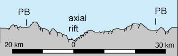
SOUTHERN MID-ATLANTIC RIDGE
(-49.390 -7.971) (VERY STRONG)
http://volcano.und.nodak.edu/vwdocs/Submarine/plates/diverg/slow.html>volcano.und.nodak
----------------------------------------
2006-07-02 07:16:50 5.0 12.45S 21.01W South Atlantic Ocean
(Off on coordinates)
Peace to all.

posted by Unknown @ 4:38 PM
0 comments
![]()
![]()
