*For Friday, 14 July 2006.
LEGEND for OVERVIEW: Size = My surety of area for quake.
Red Circle = Probable quake to STRONG quake.
Triangle = Very Strong/Stronger quake (Usually takes extra days).
Blue Circle, etc. = Uncertainty of symptom area for probable quake.
Places to watch.
Good luck to all.
For Friday, 14 July 2006.
----------------------------------------
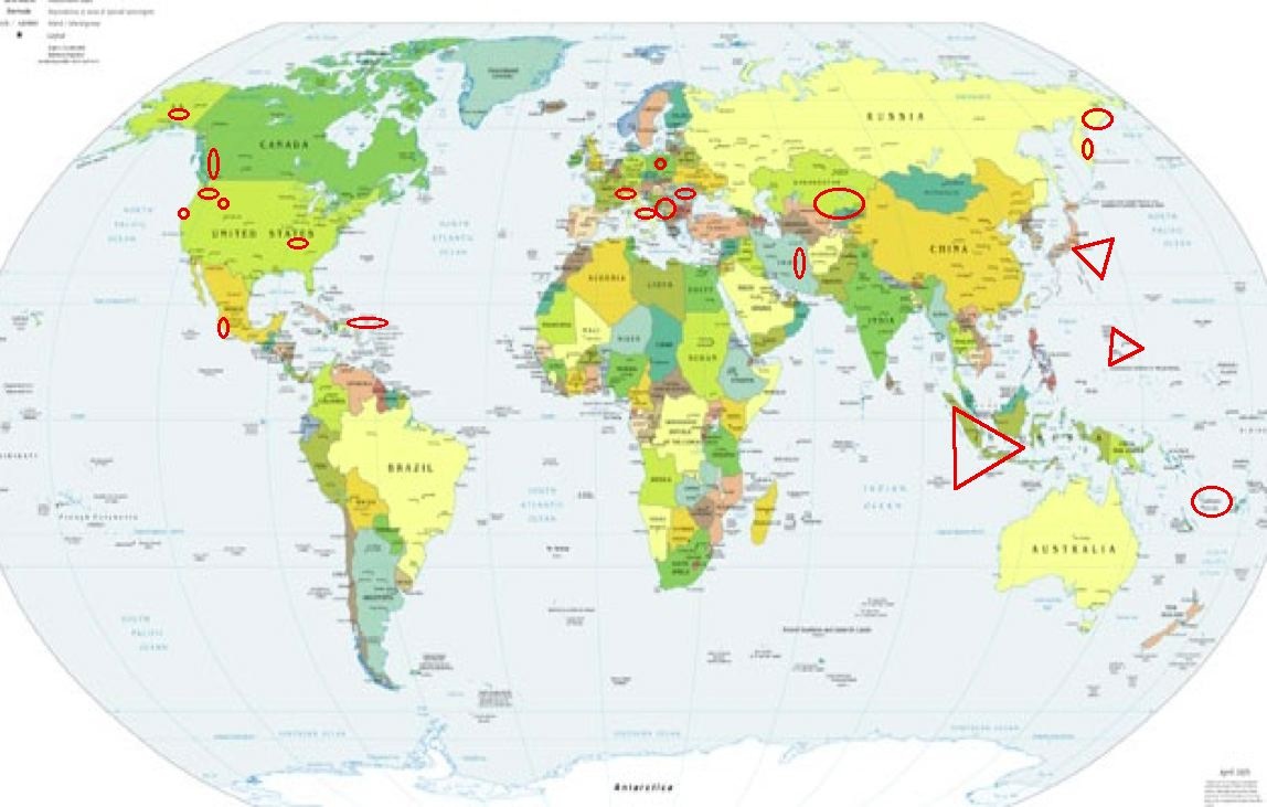
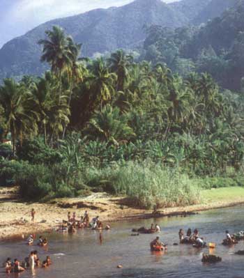
Sumatra, Indonesia (Already at
Very Strong)
http://www.baliforyou-holidays.com/north_sumatra/sumatra_overland.htm>baliforyou-holidays
----------------------------------------
5.1 2006/07/15 11:54:29 3.749 93.556 37.1 OFF THE WEST COAST OF NORTHERN SUMATRA
(Posted Indonesia quakes on the 13th that came in on 17th.)
Southern Alaska
----------------------------------------
2.5 2006/07/14 14:17:31 60.250 -152.869 120.0 SOUTHERN ALASKA
2.6 2006/07/15 18:48:41 61.660 -157.280 1.0 SOUTHERN ALASKA
The New Madrid Fault (More than one area)
----------------------------------------
(Came in on the 15th and posted there.)
The Geysers (Strong)
----------------------------------------
1.6 2006/07/14 02:43:33 38.828 -122.797 1.1 3 km ( 2 mi) NNE of The Geysers, CA
1.5 2006/07/14 15:48:54 38.744 -122.926 0.3 10 km ( 6 mi) SE of Cloverdale, CA
1.7 2006/07/14 17:45:15 38.820 -122.794 3.3 3 km ( 2 mi) NNE of The Geysers, CA
1.5 2006/07/14 22:50:48 38.796 -122.767 0.5 3 km ( 2 mi) E of The Geysers, CA
1.9 2006/07/15 02:13:32 38.830 -122.869 2.0 6 km ( 4 mi) WNW of The Geysers, CA
Kamchatka
----------------------------------------
2006-07-14 00:37:26.7 53.96N 161.72E 40 mb4.8 OFF E. CST KAMCHATKA PEN.
2006-07-14 01:41:14.8 53.90N 161.51E 60 mb3.6 OFF E. CST KAMCHATKA PEN.
2006-07-14 07:22:54.7 47.95N 153.79E 50 mb4.7 KURIL ISLANDS, RUSSIA
2006-07-14 06:52:23.7 48.00N 153.95E 12 mb5.3 KURIL ISLANDS, RUSSIA
2006-07-15 07:39:25.2 56.08N 162.24E 80 mb4.7 NEAR E. CST KAMCHATKA PEN.
2006-07-17 05:26:35.5 56.01N 163.16E 75 mb4.8 NEAR E. CST KAMCHATKA PEN.
(2 extra days)
Poland
----------------------------------------
2006-07-14 15:56:14.9 51.54N 16.08E 2 Ms3.3 POLAND
2006-07-14 16:39:15 2.9 51.33N 16.05E Poland
NORTHWESTERN BALKAN PEN. (41.25N 21.06E)
----------------------------------------
2006-07-14 12:23:00.0 41.30N 22.60E ML3.1 NORTHWESTERN BALKAN PEN.
2006-07-15 12:59:53.0 45.97N 15.69E 8 ML2.1 NORTHWESTERN BALKAN PEN.
British Columbia, Canada (Non-specific
traveling pain?)
----------------------------------------
2006/07/13 00:18:17 52.94N 132.68W 20.0* 1.2ML 67 km SW of Sandspit,BC
2006/07/13 19:23:00 53.80N 133.47W 20.0* 1.2ML 90 km SW of Masset,BC
2006/07/13 18:43:25 53.79N 133.12W 20.0* 1.0ML 68 km SW of Masset,BC
2006/07/13 15:16:19 48.48N 123.46W 19.0 1.0ML 8 km NW of Victoria,BC
2006/07/14 03:02:56 49.50N 127.16W 29.5 1.6ML 79 km SW of Gold R.,BC
Off the Coast of Central Mexico
----------------------------------------
2006/07/13 11:27:07 17.02 99.18 40 4.0 34 km al NORESTE de SA
(More southern - list is usually a week old - there may be more.)
Mariana Islands (Already at VERY STRONG - this
was a tiny sparkle pinch for volcanics)
http://earthobservatory.nasa.gov/NaturalHazards/natural_hazards_v2.php3?img_id=10664>earthobservatory.nasa.gov
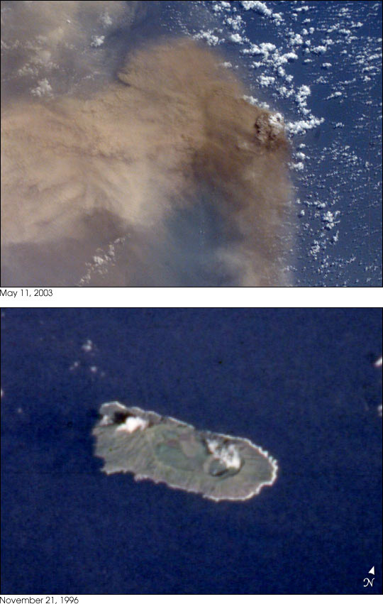
----------------------------------------
2006-07-16 15:18:00.5 13.41N 143.96E 33 mb 5.3 SOUTH OF MARIANA ISLANDS
Honshu, Japan (3d day symptom - Very Strong.)
Amazing black/white photos at link:
http://www.pc-gallery.net/exhibition_photo_c.php?pid=36>pc-gallery.net

----------------------------------------
(Nothing found)
Kazakhstan to Kyrgyzstan
----------------------------------------
(Nothing found)
Puerto Rico Trench area (19.324N 67.293W)
(Strong)
----------------------------------------
2006/07/14 19:14:29.14 19.692N 68.074W 8.8 3.1 D Puerto Rico Trench
2006/07/14 20:45:29.27 19.088N 67.945W 15.0 3.5 D Septentrional Fault Zone
2006/07/14 21:19:25.11 18.867N 67.795W 12.8 2.9 D Septentrional Fault Zone
2006/07/15 00:37:29.87 19.056N 64.362W 48.7 3.5 C Virgin Island Platform
2006/07/15 00:49:25.64 18.872N 64.225W 58.8 3.4 C Virgin Island Platform
2006/07/15 04:02:20.05 18.965N 64.348W 52.0 3.4 C Virgin Island Platform
2006/07/15 04:10:17.52 18.541N 63.735W 8.0 2.2 D Leeward Islands
2006/07/15 04:10:49.57 18.116N 66.579W 19.2 1.9 B Central Puerto Rico
2006/07/15 05:27:36.42 19.084N 64.414W 40.7 3.7 C Sombrero Fault Zone
EASTERN SIBERIA, RUSSIA (60.83N 166.00E)
(STRONG)
----------------------------------------
(Nothing found)
Northern Italy/Switzerland area
then Central to Southern Italy
----------------------------------------
2006-07-14 06:36:53.9 44.37N 10.11E 5 ML3.1 NORTHERN ITALY
Northcentral Iran
----------------------------------------
(Nothing found)
Oregon/Washington border area
----------------------------------------
1.1 2006/07/14 13:04:46 45.362N 121.710W 4.1 19 km (12 mi) SSW of Parkdale, OR
Romania
----------------------------------------
14Jul2006 12:25:53.6 45.9N 22.6E 16 ML=2.3 M ROM ROMANIA
14Jul2006 11:06:07.3 46.9N 22.3E 0 ML=3.0 M ROM ROMANIA
14Jul2006 12:37:17.0 45.5N 26.6E132 ML=1.9 M ROM ROMANIA
Vanuatu/Solomon Islands area
----------------------------------------
2006-07-15 14:53:29 5.4 21.53S 169.17E Southeast of Loyalty Islands
Wyoming/Utah area (STRONG)
----------------------------------------
06/07/14 00:45:25 39.73N 110.74W 1.0 1.5 6.9 mi NE of Helper
06/07/14 02:20:39 39.61N 110.40W 1.2 1.6 4.4 mi NNW of Sunnyside
06/07/14 17:06:01 42.41N 111.51W 7.1 4.0 7.2 mi SW of Georgetown
06/07/14 17:08:34 42.42N 111.50W 3.3 2.8 6.3 mi SW of Georgetown
06/07/14 17:12:50 42.43N 111.51W 1.2 1.4 6.6 mi SW of Georgetown
06/07/14 17:22:31 42.42N 111.55W 7.7 1.2 8.5 mi SW of Georgetown
06/07/14 20:44:05 41.91N 112.55W 5.9 0.8 23.4 mi WNW of Garland
06/07/14 20:45:32 39.61N 110.39W 1.1 1.6 4.3 mi NNW of Sunnyside
2.2 2006/07/14 09:29:04 44.301 -110.478 7.8 64 km ( 40 mi) SE of West Yellowstone, MT
Peace to all.

posted by Unknown @ 6:53 PM
0 comments
![]()
![]()
