*For Thursday, 13 July 2006.
LEGEND for OVERVIEW: Size = My surety of area for quake.
Red Circle = Probable quake to STRONG quake.
Triangle = Very Strong/Stronger quake (Usually takes extra days).
Blue Circle, etc. = Uncertainty of symptom area for probable quake.

Places to watch.
Good luck to all.
For Thursday, 13 July 2006.
----------------------------------------
Svalbard/Norway region (76.21 N 5.61 E)
(Strong)
----------------------------------------
2006-07-15 00:57:00 4.8 81.21N 4.63W North of Svalbard
(2 extra days)
Mariana Islands (Second day - VERY STRONG)
http://epsc.wustl.edu/admin/whatsnew/photo_album/anatahan/>eps.wustl.edu
----------------------------------------
(Came in on the 16th and posted on the 14th.)
Papua New Guinea/Bismarck Archepalego area
(3 different symptoms - STRONG)
----------------------------------------
2006-07-16 13:28:40 5.2 5.56S 150.56E New Britain Region, P.N.G.
(3 extra days)
2006-07-19 01:29:41 5.6 4.76S 149.05E Bismarck Sea
2006-07-19 01:28:58 5.5 4.94S 149.62E Bismarck Sea
(6 extra days)
Bay of Biscay area (STRONG and indication
of depth)
----------------------------------------
19Jul2006 03:53:26.6 48.3N 6.7E 10 ML=2.3 M*LED FRANCE
(6 extra days? not big not deep...could be the following quakes. Unproven)
IRELAND
Origin time Lat Lon Azres Timres Wres Nphase Ntot Nsta Netmag
2006-193:08.42.05.0 54.29 -8.70 11.15 0.39 3.18 3 4 1 2.36
SOUTHERN ENGLAND
Origin time Lat Lon Azres Timres Wres Nphase Ntot Nsta Netmag
2006-196:15.55.16.0 50.68 -0.84 20.95 0.27 5.50 2 3 1 2.30
Hokkaido (MEDIUM)
----------------------------------------
(Nothing found)
Yukon/Northwest Territories (Medium)
----------------------------------------
2006/07/12 04:33:20 66.05N 135.13W 20.0* 3.3ML 157 km SW of Ft. McPherson,NT
2006/07/12 07:41:33 66.04N 135.33W 20.0* 2.9ML 160 km SW of Ft. McPherson,NT
Parkfield Fault/Probably Central
----------------------------------------
1.0 2006/07/13 22:29:55 36.554 -121.147 6.4 2 km ( 2 mi) N of Pinnacles, CA
3.2 2006/07/14 01:05:36 35.928 -120.477 10.3 5 km ( 3 mi) NW of Parkfield, CA
1.4 2006/07/14 02:46:45 36.039 -120.618 0.0 23 km ( 14 mi) NW of Parkfield, CA
2.2 2006/07/14 06:53:57 35.929 -120.472 10.4 5 km ( 3 mi) NW of Parkfield, CA
1.7 2006/07/14 15:09:25 35.995 -120.563 0.0 16 km ( 10 mi) NW of Parkfield, CA
SOUTH OF PANAMA (4.89 N 82.53 W) then
Nicaragua/Costa Rica area
----------------------------------------
2006-07-13 15:03:21.3 1.55S 81.05W 30 mb5.1 OFF COAST OF ECUADOR
Southern Olympic Peninsula area then Northern
Olympic Peninsula/Vancouver Island area
----------------------------------------
1.0 2006/07/13 14:34:16 46.668N 121.586W 5.6 34 km (21 mi) ESE of Ashford, WA
2.0 2006/07/13 13:35:09 44.111N 122.617W 15.9 25 km (15 mi) NNE of Lowell, OR
1.3 2006/07/13 11:22:09 43.636N 123.301W 21.5 3 km ( 2 mi) SSE of Drain, OR
1.0 2006/07/13 00:58:58 47.920N 122.049W 26.9 3 km ( 2 mi) E of Snohomish, WA
Puerto Rico/Virgin Island (Medium)
----------------------------------------
2006/07/13 03:04:01.88 19.072N 66.822W 9.2 3.4 C 19° N Fault Zone
2006/07/13 03:31:33.37 18.011N 67.497W 5.0 2.8 D Mona Passage
2006/07/13 05:12:41.84 19.251N 64.850W 43.3 3.3 D Sombrero Fault Zone
2006/07/13 05:13:55.10 18.102N 67.596W 74.1 3.1 D Mona Passage
2006/07/13 13:39:27.94 19.188N 64.803W 53.5 3.2 C Sombrero Fault Zone
2006/07/13 20:26:56.58 19.052N 67.477W 0.1 2.5 C Mona Canyon
2006/07/13 20:50:36.49 19.626N 68.221W 40.8 3.1 C Puerto Rico Trench
The Geysers
----------------------------------------
1.8 2006/07/12 02:57:57 38.792 -122.751 3.0 5 km ( 3 mi) E of The Geysers, CA
1.8 2006/07/12 06:02:18 38.823 -122.787 0.9 3 km ( 2 mi) NNE of The Geysers, CA
2.1 2006/07/12 09:54:06 38.819 -122.797 4.0 2 km ( 1 mi) NNE of The Geysers, CA
2.0 2006/07/12 13:02:50 38.822 -122.794 4.1 3 km ( 2 mi) NNE of The Geysers, CA
1.8 2006/07/12 16:23:03 38.825 -122.795 0.9 3 km ( 2 mi) NNE of The Geysers, CA
1.6 2006/07/12 22:34:49 38.809 -122.777 2.6 3 km ( 2 mi) ENE of The Geysers, CA
The New Madrid Fault (Non-specific. Medium)
----------------------------------------
2.3 2006/07/12 11:31:53 36.080N 89.810W 9.4 18 km (11 mi) SSW of Hayti, MO
Near the Coast of Central Mexico
----------------------------------------
2006/07/13 03:05:44 16.78 99.66 10 3.8 27 km al SURESTE de AC
2006/07/13 11:19:57 16.68 100.02 6 3.6 25 km al SUROESTE de A
2006/07/13 11:27:07 17.02 99.18 40 4.0 34 km al NORESTE de SA
Sicily, Italy/Ionian Sea
----------------------------------------
2006-07-13 10:08:57.0 37.83N 13.85E 61 ML2.8 SICILY, ITALY
Honshu, Japan (Second day symptom - Strong)
----------------------------------------
(Nothing found)
SANTIAGO DEL ESTERO, ARGENTINA (-28.727 -63.084)
(Strong)
----------------------------------------
4.4 2006/07/14 06:53:44 -24.089 -66.343 164.6 SALTA, ARGENTINA
Turkey (Medium)
----------------------------------------
2006-07-13 19:34:30.7 37.81N 33.88E 24 ML 3.6 TURKEY
2006-07-13 19:17:37.8 37.84N 33.89E 5 ML 3.9 TURKEY
Quebec area (49.18N 67.11W) (Medium)
----------------------------------------
2006/07/13 11:11:20 47.39N 70.13W 15.6 1.3MN CHARLEVOIX SEISMIC ZONE,QUE.
(The symptom for this may go along with the one posted for Saint John and came in as Maine.)
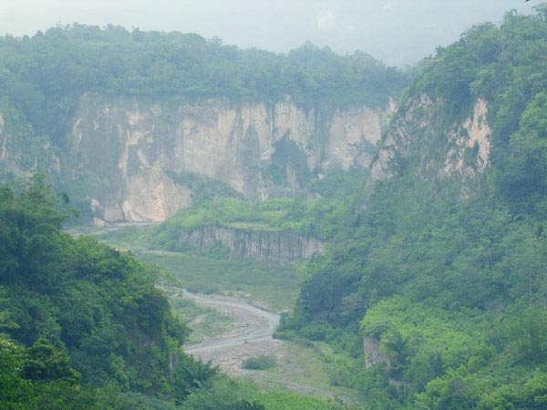
Sumatra, Indonesia (Non-specific but
symptom kept intensifying and lasted
through the night - Very Strong.)
http://www.caingram.info/Sumatra/Pix/page1.html>caingram.info
----------------------------------------
2006-07-17 03:59:44.3 10.09S 120.83E 42 mb 5.0 SUMBA, INDONESIA, REGION
2006-07-17 05:32:28 5.3 5.08S 102.06E Southern Sumatra, Indonesia
2006-07-17 11:24:43 5.3 9.48S 107.83E South of Java, Indonesia
2006-07-17 11:07:32 5.7 9.41S 107.28E South of Java, Indonesia
2006-07-17 11:07:34 5.7 9.55S 107.56E South of Java, Indonesia
2006-07-17 11:03:17 5.3 9.30S 107.20E South of Java, Indonesia
2006-07-17 10:44:33 5.4 9.29S 107.66E South of Java, Indonesia
2006-07-17 10:34:43 5.3 9.56S 107.78E South of Java, Indonesia
6.0 2006/07/17 10:09:07 -8.941 107.700 10.0 JAVA, INDONESIA
2006-07-17 09:55:35 5.0 9.58S 107.83E South of Java, Indonesia
6.2 2006/07/17 09:13:05 -9.111 107.688 10.0 SOUTH OF JAVA, INDONESIA
7.7 2006/07/17 08:19:25 -9.334 107.263 10.0 SOUTH OF JAVA, INDONESIA
2006-07-17 15:09:16 5.2 9.46S 108.27E South of Java, Indonesia
2006-07-17 14:50:57 5.2 9.31S 107.05E South of Java, Indonesia
2006-07-17 14:21:04 4.8 10.85S 107.86E South of Java, Indonesia
2006-07-17 13:53:50 5.0 9.69S 107.75E South of Java, Indonesia
2006-07-17 13:39:21 5.4 10.36S 107.65E South of Java, Indonesia
2006-07-17 12:52:13 5.5 9.18S 107.68E South of Java, Indonesia
2006-07-17 16:09:55 5.6 9.45S 108.76E South of Java, Indonesia
6.3 2006/07/17 15:45:58 -9.453 108.267 10.0 SOUTH OF JAVA, INDONESIA
2006-07-17 15:42:04 5.4 9.58S 107.72E South of Java, Indonesia
2006-07-17 15:28:59 5.1 9.57S 106.55E South of Java, Indonesia
2006-07-17 15:26:25 5.3 9.11S 107.93E South of Java, Indonesia
2006-07-17 15:20:55 5.3 9.56S 108.61E South of Java, Indonesia
2006-07-17 15:15:15 4.9 9.87S 107.90E South of Java, Indonesia
2006-07-17 23:24:30 5.3 9.42S 108.50E South of Java, Indonesia
2006-07-17 21:49:05 4.9 10.09S 107.78E South of Java, Indonesia
2006-07-17 21:49:04 4.9 10.16S 107.79E South of Java, Indonesia
2006-07-17 20:13:23 5.2 9.17S 108.51E South of Java, Indonesia
2006-07-17 19:44:13 5.3 9.56S 108.46E South of Java, Indonesia
2006-07-17 19:49:34 5.6 9.17S 107.74E South of Java, Indonesia
2006-07-17 19:09:30 5.3 9.35S 107.72E South of Java, Indonesia
2006-07-17 16:51:23 4.6 2.50N 97.31E Northern Sumatra, Indonesia
2006-07-17 16:38:44 5.0 9.52S 107.61E South of Java, Indonesia
(4 extra days)
2006-07-18 19:11:14 5.0 10.31S 108.37E South of Java, Indonesia
2006-07-18 17:27:57 5.2 9.41S 107.63E South of Java, Indonesia
2006-07-18 15:48:31 5.0 9.29S 106.82E South of Java, Indonesia
2006-07-18 14:54:58 5.5 9.15S 107.64E South of Java, Indonesia
2006-07-18 13:31:00 5.2 8.66S 107.76E Java, Indonesia
2006-07-18 12:52:15 5.3 9.41S 108.13E South of Java, Indonesia
2006-07-18 06:51:43 5.1 9.88S 107.85E South of Java, Indonesia
2006-07-18 05:06:44 5.3 9.05S 108.54E South of Java, Indonesia
2006-07-18 04:18:25 5.5 9.48S 108.73E South of Java, Indonesia
2006-07-18 03:02:26 5.2 7.38S 108.94E Java, Indonesia
2006-07-18 03:01:44 5.2 10.01S 108.38E South of Java, Indonesia
2006-07-18 02:11:36 5.2 9.23S 107.55E South of Java, Indonesia
2006-07-18 02:04:47 4.9 10.00S 107.81E South of Java, Indonesia
2006-07-18 01:53:54 5.1 2.19S 101.84E Southern Sumatra, Indonesia
2006-07-18 01:38:25 5.0 9.83S 107.65E South of Java, Indonesia
2006-07-18 01:32:45 5.1 9.49S 108.04E South of Java, Indonesia
2006-07-18 00:15:48 5.8 9.37S 108.63E South of Java, Indonesia
(Still continuing aftershocks)
Turkmenistan area (38.63N 53.93E)
(Strong)
----------------------------------------
2006-07-13 08:20:53.1 41.33N 45.65E 8 ML3.1 EASTERN CAUCASUS
Poland
----------------------------------------
2006-07-13 06:49:26 3.2 51.13N 15.25E Poland
2006-07-13 22:20:36.8 51.49N 16.13E 20 ML3.1 POLAND
Saint John, New Brunswick area
(45.19N 65.80W)
----------------------------------------
2006/07/14 09:34:47 46.85N 68.65W 5.0* 4.0MN Felt Maine,felt
ASCENSION ISLAND REGION (11.58S 13.31W)
(Strong)
----------------------------------------
2006-07-10 07:21:36.1 11.58S 13.31W 10 mb5.4 ASCENSION ISLAND REGION
(3 days early?)
Peace to all.

posted by Unknown @ 12:41 PM
0 comments
![]()
![]()
