*For Thursday, 17 August 2006.
LEGEND for OVERVIEW: Size = My surety of area for quake.
Red Circle = Probable quake to STRONG quake.
Triangle = Very Strong/Stronger quake (Usually takes extra days).
Blue Circle, etc. = Uncertainty of symptom area for probable quake.
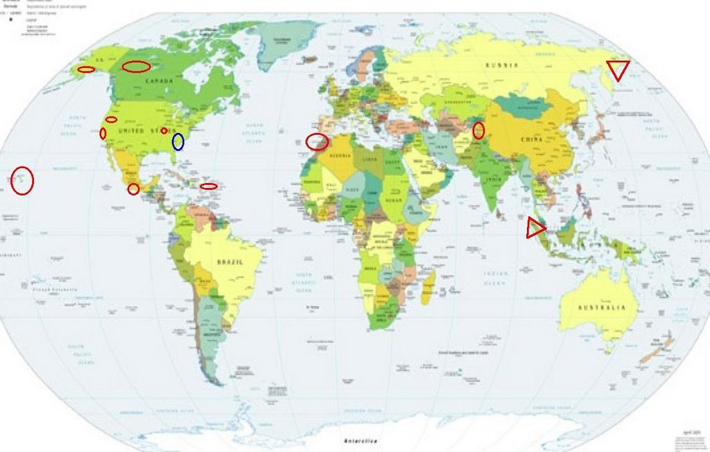
Places to watch.
Good luck to all.
For Thursday, 17 August 2006.
----------------------------------------
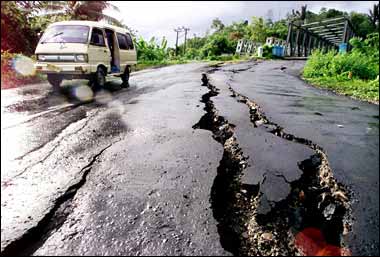
Northern Sumatra (Second day for
symptom area - Very Strong.)
http://www.time.com/time/daily/special/photo/sumatra/index.html>time.com
----------------------------------------
(Came in on the 18th and posted there.)
Strait of Gibraltar/Morocco area (Second
day for symptom area but now it’s pain -
STRONG.)
----------------------------------------
(Nothing found)
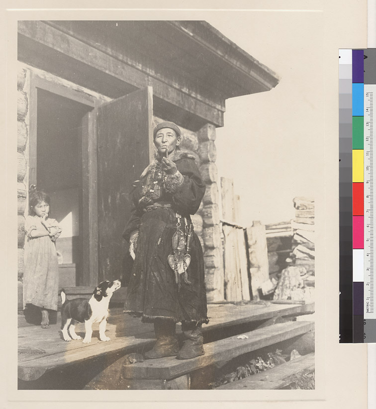
Eastern Siberia (Second day for symptom
area - VERY STRONG.)
http://www.lib.berkeley.edu/doemoff/slavic/siberianphotos.html>llib.erkeley.edu
----------------------------------------
(Nothing found)
Possibly Georgia or The Carolinas
(Unproven symptom)
----------------------------------------
2.6 2006/08/16 08:12:39 34.508N 97.372W 5.0 23 km (14 mi) W of Davis, OK
(I will have to watch for a repeat to see if this might be the right area.)
Zenobia, Nevada area (40.091 -119.614)
----------------------------------------
1.9 2006/08/16 00:05:33 39.744 -120.398 12.4 9 km ( 6 mi) S of Beckwourth, CA
1.3 2006/08/17 17:03:09 38.028 -118.572 5.0 31 km ( 20 mi) S of Qualeys Camp, NV
1.4 2006/08/17 16:35:32 39.331 -120.516 8.6 27 km ( 17 mi) W of Truckee, CA
1.2 2006/08/17 15:52:20 39.333 -120.511 6.3 26 km ( 16 mi) W of Truckee, CA
1.4 2006/08/18 12:23:01 38.095 -116.714 0.0 30 km ( 19 mi) NW of Silverbow, NV
Hawaii
----------------------------------------
2.2 2006/08/17 12:06:49 19.392 -155.260 1.6 7 km ( 4 mi) SSW of Volcano, HI
2.8 2006/08/17 15:09:49 19.431 -155.589 37.1 28 km ( 17 mi) NNW of Pahala, HI
Yukon/Northwest Territories
----------------------------------------
(Nothing found)
HINDU KUSH, AFGHANISTAN, REG
(36.87N 70.63E)
----------------------------------------
2006-08-17 01:16:40.0 37.80N 69.81E ML3.7 AFGHANISTAN-TAJIKISTAN BDR REG
2006-08-17 12:24:08.5 29.17N 68.10E 33 mb4.9 PAKISTAN
Alaska Peninsula
----------------------------------------
3.3 2006/08/17 09:24:13 56.205 -155.618 15.0 ALASKA PENINSULA
Puerto Rico/Virgin Islands
----------------------------------------
3.1 2006/08/17 00:38:54 19.122 -66.454 25.0 74 km ( 46 mi) N of Breñas, PR
2.7 2006/08/17 00:55:58 19.123 -66.435 33.4 73 km ( 46 mi) N of Breñas, PR
2.5 2006/08/17 00:44:22 19.058 -66.448 32.3 66 km ( 41 mi) N of Breñas, PR
2.7 2006/08/17 00:41:33 19.068 -66.445 24.9 67 km ( 42 mi) N of Breñas, PR
3.0 2006/08/17 02:06:57 19.046 -66.436 17.9 65 km ( 40 mi) N of Breñas, PR
2.7 2006/08/17 01:08:50 18.882 -65.191 37.4 65 km ( 40 mi) N of Culebra, PR
2.9 2006/08/17 02:44:48 19.081 -66.447 25.3 69 km ( 43 mi) N of Breñas, PR
3.8 2006/08/17 21:34:16 19.078 -66.460 25.2 69 km ( 43 mi) N of Tierras Nuevas Poniente, PR
The New Madrid Fault/Missouri
(36.490 -89.480)(STRONG)
----------------------------------------
(Nothing found)
The Parkfield Fault/probably central
----------------------------------------
1.9 2006/08/17 02:18:44 36.590 -121.195 8.5 8 km ( 5 mi) NW of Pinnacles, CA
2.9 2006/08/17 05:44:06 36.789 -121.531 10.8 6 km(4mi) S of San Juan Bautista, CA
1.3 2006/08/17 13:43:27 36.568 -121.160 3.6 4 km ( 3 mi) NNW of Pinnacles, CA
1.5 2006/08/17 19:24:02 36.586 -121.411 1.1 9 km ( 6 mi) NNE of Gonzales, CA
Southern Mexico
----------------------------------------
2006/08/17 11:54:53 16.58 100.70 3 3.6 71 km al SUR de TECPAN, GRO
2006/08/17 17:55:21 15.45 98.69 39 4.0 120 km al SUROESTE de PINOTEPA NACIONAL, OAX
2006/08/17 18:34:53 18.71 102.47 63 4.6 44 km al SUROESTE de APATZINGAN, MICH
Peace to all.

posted by Unknown @ 11:11 AM
0 comments
![]()
![]()
