*For Thursday, 6 July 2006.
LEGEND for OVERVIEW: Size = My surety of area for quake.
Red Circle = Probable quake to STRONG quake.
Triangle = Very Strong/Stronger quake (Usually takes extra days).
Blue Circle, etc. = Uncertainty of symptom area for probable quake.
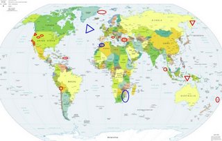
Places to watch.
Good luck to all.
For Thursday, 6 July 2006.
----------------------------------------
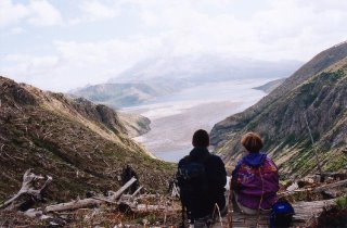
Mt. St. Helen’s (VERY STRONG)
http://www.strengthinperspective.com/mpcompel/mpgal26/mpgal26a.html>strengthinperspective
(Some wonderful pictures by a young Polish
couple when they visited Mt. St. Helen’s, etc.)
http://www.man.poznan.pl/~janczuk/2001_JUN_Mt_St_Helens/index.htm>man.poznan
----------------------------------------
3.1 2006/07/06 02:36:20 46.194 -122.198 0.0 2 km ( 1 mi) WSW of Mount St. Helens Volcano, WA
1.5 2006/07/06 04:01:50 46.196 -122.196 0.6 1 km ( 1 mi) WSW of Mount St. Helens Volcano, WA
1.3 2006/07/06 10:25:34 46.195 -122.197 0.0 1 km ( 1 mi) WSW of Mount St. Helens Volcano, WA
1.2 2006/07/06 16:44:10 46.195 -122.196 0.0 1 km ( 1 mi) WSW of Mount St. Helens Volcano, WA
1.7 2006/07/06 21:52:42 46.194N 122.196W 0.0 1 km ( 1 mi) WSW of Mount St. Helens Volcano, WA
1.6 2006/07/06 14:43:41 46.199N 122.192W 0.0 1 km ( 1 mi) W of Mount St. Helens Volcano, WA
1.1 2006/07/07 23:25:49 46.196N 122.195W 0.8 1 km ( 1 mi) WSW of Mount St. Helens Volcano, WA
1.3 2006/07/07 17:19:44 46.197N 122.197W 0.0 1 km ( 1 mi) WSW of Mount St. Helens Volcano, WA
1.4 2006/07/07 10:23:07 46.196N 122.195W 0.8 1 km ( 1 mi) WSW of Mount St. Helens Volcano, WA
2.5 2006/07/07 09:29:47 46.194N 122.201W 0.0 2 km ( 1 mi) WSW of Mount St. Helens Volcano, WA
1.7 2006/07/07 03:51:04 46.196N 122.195W 0.9 1 km ( 1 mi) WSW of Mount St. Helens Volcano, WA
The Virgin Islands/Puerto Rico
----------------------------------------
3.2 2006/07/06 11:15:19 19.000 -64.814 12.2 60 km ( 37 mi) WNW of Settlement, British Virgin Islands
2006/07/06 09:36:33.78 19.430N 67.474W 24.8 3.1 D Puerto Rico Trench
2006/07/06 17:42:00.10 18.915N 65.163W 18.3 2.9 C Sombrero Fault Zone
2006/07/07 11:10:54.28 18.476N 67.219W 10.9 1.8 C Northwest Puerto Rico
The Parkfield Fault/Parkfield
----------------------------------------
2.2 2006/07/06 04:17:27 35.795 -120.346 9.9 14 km ( 9 mi) SSE of Parkfield, CA
3.3 2006/07/06 06:06:28 35.898 -120.440 6.5 1 km ( 1 mi) WSW of Parkfield, CA
2.8 2006/07/07 19:31:55 36.002 -120.551 13.0 16 km ( 10 mi) NW of Parkfield, CA
Mammoth Lakes/Tom’s Place
----------------------------------------
1.2 2006/07/06 12:08:39 37.550 -118.820 12.1 12 km ( 8 mi) W of Toms Place, CA
2.6 2006/07/06 14:22:24 37.459 -118.840 6.2 18 km ( 11 mi) SW of Toms Place, CA
1.6 2006/07/06 14:21:20 37.467 -118.834 7.5 17 km ( 11 mi) SW of Toms Place, CA
1.5 2006/07/06 14:20:54 37.460 -118.835 6.1 18 km ( 11 mi) SW of Toms Place, CA
1.3 2006/07/06 14:18:48 37.451 -118.836 5.3 19 km ( 11 mi) SW of Toms Place, CA
1.5 2006/07/06 18:55:02 37.452 -118.834 5.7 18 km ( 11 mi) SW of Toms Place, CA
2.3 2006/07/07 08:56:43 37.575N 118.840W 2.4 14 km(9 mi) ESE of Mammoth Lakes, CA
1.9 2006/07/07 09:08:20 37.573N 118.845W 1.9 14 km(9 mi) ESE of Mammoth Lakes, CA
1.0 2006/07/07 15:11:18 37.647N 118.926W 7.8 5 km(3 mi) ENE of Mammoth Lakes, CA
1.3 2006/07/07 15:56:19 37.415N 118.565W 13.0 3 km (2 mi) E of Round Valley, CA
1.1 2006/07/07 15:29:47 37.459N 118.839W 5.9 18 km (11 mi) SW of Toms Place, CA
1.3 2006/07/07 17:59:04 37.411N 118.453W 5.7 6 km (3 mi) N of West Bishop, CA
North of Iceland/Svalbard area
----------------------------------------
2006-07-04 18:53:51 4.6 78.80N 4.35 E Greenland Sea
2006-07-04 18:48:29 4.6 79.46N 6.74 E Svalbard Region
(2 days early)
Central Italy
----------------------------------------
2006-07-06 10:44:35.0 44.28N 10.09E 8 ML 3.1 NORTHERN ITALY
2006-07-06 21:53:02.0 42.66N 11.98E 11 ML 2.1 CENTRAL ITALY
2006-07-06 21:47:31.0 42.66N 12.06E 6 ML 3.1 CENTRAL ITALY
2006-07-08 02:27:24.0 42.62N 12.57E 4 ML 2.8 CENTRAL ITALY
(2 extra days)
Possibly South Africa/Zimbabwe (This is a symptom
I have not got a handle on - seems illogical to be in
this area. Will see. Strong.)
----------------------------------------
(Nothing found - still unproven symptom.)
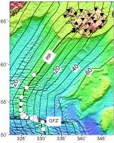
Possibly Reykjanes Ridge (Unproven symptom but
this time should give me a clue because the symptom
was very strong - VERY STRONG. + Other possible area
for this symptom might be Carlsberg Ridge in the Indian Ocean.)
http://www.spacedaily.com/news/tectonics-01f.html>spacedaily
----------------------------------------
05Jul2006 11:56:21.1 25.2S 71.0E 33 MS=4.1 M GSR MID-INDIAN RIDGE
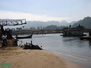
Banda Sea area (7.2S 126.3E) (VERY STRONG)
http://walrus.wr.usgs.gov/tsunami/sumatra05/Lho_Nga.html>walrus.wr.usgs.gov
----------------------------------------
2006-07-07 21:13:24 5.4 7.14 S 129.50E Banda Sea
2006-07-08 12:56:22.9 6.41S 130.47E 131 mb5.1 BANDA SEA
(2 extra days)
West Yellowstone, Montana area (44.565 -110.921)
(medium)
----------------------------------------
06/07/07 02:22:40 44.63N 109.98W 19.0 1.5 20.1 mi ENE of Fishing Bridge
06/07/07 04:18:28 44.63N 110.00W 14.8 2.2 19.2 mi ENE of Fishing Bridge
06/07/07 07:44:23 44.63N 109.99W 13.0 2.5 19.7 mi ENE of Fishing Bridge
06/07/07 18:16:09 44.13N 110.57W 6.1 1.4 19.9 mi SSE of West Thumb
06/07/07 18:33:03 44.12N 110.56W 2.5 2.1 20.7 mi SSE of West Thumb
06/07/08 07:01:12 44.63N 109.99W 18.2 1.3 19.8 mi ENE of Fishing Bridge
1.4 2006/07/08 10:20:58 45.298 -112.597 0.1 10 km ( 6 mi) NNE of Dillon, MT
1.7 2006/07/08 12:15:30 45.603 -111.916 2.2 15 km ( 9 mi) SW of Harrison, MT
2.0 2006/07/08 14:59:07 45.607 -111.910 2.7 14 km ( 9 mi) SW of Harrison, MT
(2 extra days)
EASTERN SIBERIA, RUSSIA (60.83N 166.00E) (Second
day symptom but MUCH stronger - VERY STRONG)
http://forums.ort.org.il/scripts/showsm.asp?which_forum=160&mess=2197560>forums.ort.org
----------------------------------------
(Came in on the 7th and posted there.)
Borrego Springs area (33.441 -116.362)
----------------------------------------
1.4 2006/07/05 17:53:06 33.181 -116.419 8.1 9 km ( 5 mi) SSW of Borrego Springs, CA
2.0 2006/07/06 04:01:19 34.627 -116.675 6.1 32 km ( 20 mi) NE of Lucerne Valley, CA
1.6 2006/07/06 12:12:14 34.689 -116.290 5.3 12 km ( 8 mi) WSW of Ludlow, CA
1.0 2006/07/06 16:02:16 34.356 -116.859 0.0 10 km ( 6 mi) N of Big Bear City, CA
1.7 2006/07/06 20:58:34 33.267 -116.014 2.5 6 km ( 4 mi) SW of Salton City, CA
1.5 2006/07/06 21:07:02 33.985 -116.827 8.2 9 km ( 5 mi) NE of Banning, CA
Turkey (medium)
----------------------------------------
2006-07-06 11:26:25.6 39.89N 40.76E 19 MD2.9 TURKEY
Possibly Morocco area (33.80N 6.43W)
(Unproven symptom)
----------------------------------------
(Nothing found)
Utah/Nevada
----------------------------------------
1.3 2006/07/06 04:51:06 36.760 -116.245 0.0 48 km ( 30 mi) ESE of Beatty, NV
1.3 2006/07/06 00:03:37 39.728 -110.745 5.2 11 km ( 7 mi) ENE of Helper, UT
1.3 2006/07/06 13:35:26 39.611 -110.392 1.3 7 km ( 4 mi) N of Sunnyside, UT
Kermadec Islands area (-30.041 -178.121)
(Medium)
----------------------------------------
2006-07-06 01:15:56 5.8 24.81S 179.97W South of Fiji Islands
2006-07-07 07:26:13.4 15.04S 173.64W 33 mb 5.6 TONGA ISLANDS
2006-07-07 20:04:59 5.3 29.32S 178.08W Kermadec Islands, New Zealand
TARAPACA, CHILE (19.23S 69.13W) (Third day
symptom - STRONG.)
----------------------------------------
(Came in on the 8th and 9th but posted on the 7th.)
Northern Sumatra (2.9N 93.9E) (Medium)
----------------------------------------
2006-07-08 21:38:24.5 3.62N 97.23E 94 mb5.0 NORTHERN SUMATERA, INDONESIA
(2 extra days)
Peace to all.

