Earthquake Prediction by Tiempe

Earth Sensitive quake predictions

Tuesday, August 16, 2005

*For Thursday, 18 August 2005.

For Thursday, 18 August:

I give myself and the Earth a day earlier or a day later than I post for probable quake manifestation. When I post for symptoms that are Very Strong or worse...quakes may take up to 5 days to manifest.

I do not post for magnitudes. I have been logging my symptoms for over 2 years and have much more to learn but I hope with this blog that I can reach more people in more countries so that they can be somewhat prepared. I am not always right and I do not keep a percentage of right predictions.

Please take this FWIW and I hope it helps someone.

Peace to all, Tiempe.

----------------------------------------

New Madrid Fault
----------------------------------------
(Aug 18, 2005 12:45:49 GMT). The event was 2.03 km ( 1.26 mi) southeast
of Shady Grove, AR (Mississippi). The magnitude was 1.4.
A very small earthquake occurred Thu Aug 18, 2005 about 12:33:28 CDT
(Aug 18, 2005 17:33:28 GMT). The event was 0.22 km ( 0.14 mi) north
of Howardville, MO (New Madrid). The magnitude was 1.6.
A very small earthquake occurred Fri Aug 19, 2005 about 01:50:52 CDT
(Aug 19, 2005 06:50:52 GMT). The event was 2.31 km ( 1.44 mi) southwest
of Calvary, TN (Dyer). The magnitude was 1.6.

Olancha (Strong)
----------------------------------------
map 2.0 2005/08/18 00:58:40 36.149 -118.070 2.8 14 km ( 9 mi) SSW of Olancha, CA
map 1.8 2005/08/18 10:16:02 36.206 -118.117 6.5 12 km ( 8 mi) WSW of Olancha, CA

Greece/Turkey
----------------------------------------
2005/08/17 05:35:43.8 40.78 N 27.43 E 15 MD2.9 TURKEY
2005/08/17 07:41:17.7 40.37 N 34.71 E 24 MD2.9 TURKEY
2005/08/17 07:50:05.0 39.41 N 33.10 E 6 MD3.1 TURKEY
2005/08/17 08:15:11.4 39.84 N 38.97 E 24 MD3.0 TURKEY
2005/08/17 08:20:06.9 39.40 N 33.17 E 5 MD2.9 TURKEY
2005/08/17 10:11:37.4 39.47 N 33.17 E 19 MD2.8 TURKEY
2005/08/17 13:03:35.6 38.84 N 27.81 E 7 MD2.9 TURKEY
2005/08/17 14:06:50.9 40.93 N 31.55 E 19 MD3.0 TURKEY
2005/08/19 01:08:50.0 36.82 N 27.58 E ML3.8 DODECANESE ISLANDS, GREECE
2005/08/19 01:20:39.5 38.06 N 21.95 E 76 ML3.2 GREECE
2005/08/19 08:14:22.3 40.42 N 28.12 E 10 ML3.6 TURKEY
2005/08/19 09:08:14.3 39.42 N 33.14 E 18 MD3.0 TURKEY
2005/08/19 10:15:57.6 38.32 N 38.96 E 6 MD3.1 TURKEY
2005/08/19 17:31:41.0 37.82 N 29.19 E 11 MD3.3 TURKEY
2005/08/19 17:42:53.3 39.58 N 29.04 E 16 MD3.1 TURKEY
2005/08/19 19:40:26.1 39.51 N 33.22 E 23 MD2.9 TURKEY
2005/08/19 21:30:57.6 39.45 N 33.17 E 30 MD2.8 TURKEY
2005/08/19 21:49:40.0 36.86 N 27.52 E 5 MD2.9 DODECANESE ISLANDS, GREECE

Honshu, Japan and Kyushu and possibly Osaka
----------------------------------------
2005/08/18 20:51:49 140.6000 35.8000 50.0 3.6 (8,70,91) (184,19,86) * 67.76 R0015

Hawaii
----------------------------------------
map 2.1 2005/08/18 19:03:30 20.355 -155.076 3.3 45 km ( 28 mi) NNE of Laupahoehoe, HI
map 1.9 2005/08/19 15:05:08 19.387 -155.236 2.9 7 km ( 4 mi) S of Volcano, HI
map 1.7 2005/08/19 17:21:51 19.212 -155.529 3.3 5 km ( 3 mi) W of Pahala, HI

Indonesia (STRONG)
----------------------------------------
2005/08/19 18:32:31.3 2.19 N 96.86 E 97 mb5.0 NORTHERN SUMATERA, INDONESIA

Northern Algeria
----------------------------------------
2005/08/17 05:30:56.0 35.60 N 0.22 E 22 mb4.3 NORTHERN ALGERIA

Pyrenees/Portugal side (Strong)
----------------------------------------
2005/08/19 09:07:46.0 38.15 N 8.87 W 9 ML3.1 PORTUGAL

Puerto Rico
----------------------------------------
2005/08/17 07:02:32.31 18.178N 67.090W 18.2 3.2 B West Puerto Rico
MAP 3.9 2005/08/18 23:23:44 19.271 -64.906 35.5 86 km ( 53 mi) NW of Settlement, British Virgin Islands
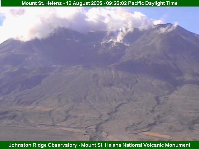
Mt. St. Helen's
----------------------------------------
map 2.5 2005/08/18 04:00:24 46.193 -122.193 0.0 1 km ( 1 mi) SW of Mount St. Helens Volcano, WA
map 1.7 2005/08/18 07:01:56 46.195 -122.187 0.0 1 km ( 0 mi) SW of Mount St. Helens Volcano, WA
map 1.6 2005/08/18 08:29:33 46.196 -122.189 0.1 1 km ( 1 mi) SW of Mount St. Helens Volcano, WA
map 1.9 2005/08/18 11:48:04 46.196 -122.192 0.0 1 km ( 1 mi) WSW of Mount St. Helens Volcano, WA

Tajikistan (Medium)
----------------------------------------
2005/08/18 03:12:58.0 47.84 N 81.62 E ML3.5 EASTERN KAZAKHSTAN
2005/08/18 03:55:24.0 39.56 N 67.82 E ML3.5 SOUTHEASTERN UZBEKISTAN
2005/08/18 07:05:30.0 38.44 N 74.75 E ML3.5 TAJIKISTAN-XINJIANG BORDER REG

Peace to all.

*For Friday, 19 August 2005.

For Friday, 19 August:

I give myself and the Earth a day earlier or a day later than I post for probable quake manifestation. When I post for symptoms that are Very Strong or worse...quakes may take up to 5 days to manifest.

I do not post for magnitudes. I have been logging my symptoms for over 2 years and have much more to learn but I hope with this blog that I can reach more people in more countries so that they can be somewhat prepared. I am not always right and I do not keep a percentage of right predictions.

Please take this FWIW and I hope it helps someone.

Peace to all, Tiempe.

----------------------------------------

Mt. St. Helen's and Mt. Hood area (STRONG for both areas)
----------------------------------------
map 2.6 2005/08/19 15:34:15 46.197 -122.192 1.1 1 km ( 1 mi) WSW of Mount St. Helens Volcano, WA
map 1.7 2005/08/19 12:37:09 46.197 -122.190 0.0 1 km ( 1 mi) WSW of Mount St. Helens Volcano, WA
map 1.7 2005/08/19 10:33:55 46.194 -122.189 0.0 1 km ( 1 mi) SW of Mount St. Helens Volcano, WA
map 2.1 2005/08/19 08:52:37 45.271 -122.216 18.6 9 km ( 6 mi) ESE of Estacada, OR
map 2.6 2005/08/19 08:34:15 46.197N 122.192W 1.1 0 km ( 0 mi) SSW of Mount St. Helens
map 1.6 2005/08/19 08:26:31 46.234 -122.111 10.7 7 km ( 4 mi) NE of Mount St. Helens Volcano, WA
map 2.4 2005/08/19 07:38:58 46.195 -122.187 2.2 1 km ( 0 mi) SW of Mount St. Helens Volcano, WA
map 2.9 2005/08/19 05:49:59 46.199 -122.188 0.9 1 km ( 0 mi) WSW of Mount St. Helens Volcano, WA
map 1.7 2005/08/19 05:37:09 46.197N 122.190W 0.0 0 km ( 0 mi) SE of Mount St. Helens
map 2.6 2005/08/19 04:27:31 46.194 -122.190 0.0 1 km ( 1 mi) SW of Mount St. Helens Volcano, WA
map 1.7 2005/08/19 03:33:55 46.194N 122.189W 0.0 0 km ( 0 mi) SSE of Mount St. Helens
map 1.8 2005/08/19 02:36:46 46.197 -122.187 0.1 1 km ( 0 mi) SW of Mount St. Helens Volcano, WA
map 1.8 2005/08/19 01:58:25 46.196 -122.190 0.0 1 km ( 1 mi) WSW of Mount St. Helens Volcano, WA
map 1.6 2005/08/19 01:26:31 46.234N 122.111W 10.7 7 km ( 5 mi) ENE of Mount St. Helens
map 2.4 2005/08/19 00:38:58 46.195N 122.187W 2.2 1 km ( 0 mi) SE of Mount St. Helens

The Philippines
----------------------------------------
2005/08/19 15:48:23 2.73 N 128.00 E mb=5.6 Northern Molucca Sea X

Western Scotland/to Ireland area
----------------------------------------
SHETLAND-ORKNEY ISLANDS
Origin time Lat Lon Azres Timres Wres Nphase Ntot Nsta Netmag
2005-230:09.41.14.0 59.61 -2.22 15.45 0.07 3.93 2 2 1 1.44

Kamchatka
----------------------------------------
(Nothing found yet)

North Sea area
----------------------------------------
NORTHERN NORTH SEA
Origin time Lat Lon Azres Timres Wres Nphase Ntot Nsta Netmag
2005-230:23.18.04.0 61.87 4.18 9.06 4.25 6.52 5 8 2 3.33

The Geysers (Strong)
----------------------------------------
map 1.5 2005/08/18 10:02:58 38.799 -122.815 3.9 1 km ( 0 mi) W of The Geysers, CA
map 1.5 2005/08/18 10:10:18 38.823 -122.806 4.2 3 km ( 2 mi) N of The Geysers, CA
map 1.8 2005/08/18 10:26:04 38.812 -122.789 2.0 2 km ( 1 mi) NE of The Geysers, CA
map 1.3 2005/08/18 13:41:14 38.790 -122.779 4.0 3 km ( 2 mi) ESE of The Geysers, CA
map 1.5 2005/08/18 19:03:34 38.812 -122.815 4.0 2 km ( 1 mi) NNW of The Geysers, CA
map 1.5 2005/08/18 22:01:25 38.813 -122.811 3.6 2 km ( 1 mi) NNW of The Geysers, CA
map 2.0 2005/08/19 01:02:23 38.829 -122.808 2.5 3 km ( 2 mi) N of The Geysers, CA
map 1.8 2005/08/19 05:44:33 38.820 -122.793 3.7 3 km ( 2 mi) NNE of The Geysers, CA
map 1.6 2005/08/19 11:08:32 38.816 -122.817 1.3 2 km ( 1 mi) NNW of The Geysers, CA
map 1.9 2005/08/19 13:36:36 38.815 -122.816 2.8 2 km ( 1 mi) NNW of The Geysers, CA
map 1.8 2005/08/19 15:10:53 38.823 -122.821 2.8 3 km ( 2 mi) NNW of The Geysers, CA
map 1.8 2005/08/19 15:51:10 38.798 -122.811 4.1 0 km ( 0 mi) W of The Geysers, CA
map 1.4 2005/08/19 18:50:58 38.815 -122.817 3.2 2 km ( 1 mi) NNW of The Geysers, CA

Honshu, Japan (Very Strong)
----------------------------------------
2005/08/19 10:55:38 129.8000 33.5000 17.0 3.6 (272,86,-173) (182,83,-3) * 65.10 R0050

Yucaipa, Calfornia
----------------------------------------
map 1.3 2005/08/20 02:04:27 33.928 -117.046 17.0 7 km ( 4 mi) W of Beaumont, CA
map 1.1 2005/08/20 11:37:43 34.099 -117.316 13.3 4 km ( 2 mi) N of Colton, CA
map 1.6 2005/08/20 12:04:46 34.014 -117.171 12.3 5 km ( 3 mi) S of Redlands, CA

Southern Alaska
----------------------------------------
map 3.1 2005/08/19 02:10:04 59.825 -152.587 100.0 SOUTHERN ALASKA
map 3.2 2005/08/19 20:51:13 60.170 -152.815 100.0 SOUTHERN ALASKA

Hokkaido (VERY STRONG)
----------------------------------------
MAP 4.2 2005/08/18 03:01:00 44.393 142.466 227.7 HOKKAIDO, JAPAN REGION

Afghanistan-Tajikistan Border
----------------------------------------
2005/08/19 22:37:25.0 43.01 N 85.36 E ML3.1 NORTHERN XINJIANG, CHINA
(More North and East than I thought)

Gulf of Alaska (Strong)
----------------------------------------
map 2.6 2005/08/18 04:11:33 59.644 -146.139 5.0 GULF OF ALASKA

Mariana Islands region (Medium)
----------------------------------------
(Nothing found yet)

Peace to all.

*For Wednesday, 17 August 2005.

For Wednesday, 17 August:

I give myself and the Earth a day earlier or a day later than I post for probable quake manifestation. When I post for symptoms that are Very Strong or worse...quakes may take up to 5 days extra to manifest.

I do not post for magnitudes. I have been logging my symptoms for over 2 years and have much more to learn but I hope with this blog that I can reach more people in more countries so that they can be somewhat prepared. I am not always right and I do not keep a percentage of right predictions.

Please take this FWIW and I hope it helps someone.

Peace to all, Tiempe.

----------------------------------------

Yucaipa to Coso Junction (VERY STRONG)
----------------------------------------
map 1.6 2005/08/16 14:53:17 34.019 -116.888 18.5 10 km ( 6 mi) N of Banning, CA
ap 1.6 2005/08/16 23:00:31 35.899 -117.734 6.9 25 km ( 16 mi) SE of Coso Junction, CA
map 1.7 2005/08/16 22:57:13 35.904 -117.728 7.5 25 km ( 16 mi) SE of Coso Junction, CA
map 1.3 2005/08/17 01:58:37 35.429 -118.264 9.0 25 km ( 15 mi) SSE of Weldon, CA
map 1.4 2005/08/17 05:20:51 33.936 -116.820 5.9 6 km ( 4 mi) WNW of Cabazon, CA
map 1.4 2005/08/17 06:39:33 35.748 -118.143 11.6 10 km ( 6 mi) NE of Onyx, CA
map 1.5 2005/08/17 14:39:55 35.900 -117.728 8.6 26 km ( 16 mi) SE of Coso Junction, CA
map 1.9 2005/08/17 19:19:24 36.051 -117.865 5.7 8 km ( 5 mi) E of Coso Junction, CA
map 1.4 2005/08/17 20:10:50 33.928 -116.807 17.3 4 km ( 3 mi) WNW of Cabazon, CA

New Madrid Fault (Strong)
----------------------------------------
A very small earthquake occurred Wed Aug 17, 2005 about 00:31:05 CDT
(Aug 17, 2005 05:31:05 GMT). The event was 2.35 km ( 1.46 mi) north
of Marston, MO (New Madrid). The magnitude was 1.7.
A small earthquake occurred Wed Aug 17, 2005 about 00:33:34 CDT
(Aug 17, 2005 05:33:34 GMT). The event was 3.11 km ( 1.93 mi) west
of McCarty, MO (Pemiscot). The magnitude was 2.0.

Peru (Strong)
----------------------------------------
(Nothing found yet)

Northern Moluccas
----------------------------------------
2005/08/17 01:02:28 8.85 N 122.28 E mb=5.2 Mindanao, Philippines L

Honshu, Japan then Shikoku area (Strong)
----------------------------------------
2005/08/17 13:36:18 40.80 N 142.50 E mb=5.1 Near East Coast of Honshu, Japan L

Afghanistan to North Pakistan to Hindu Kush (Strong)
----------------------------------------
2005/08/16 16:49:40 36.17 N 70.84 E mb=5.1 Hindu Kush Region, Afghanistan B
2005/08/16 17:21:09.0 43.10 N 78.67 E ML3.5 LAKE ISSYK-KUL,KYRGYZSTAN REG
2005/08/17 20:55:24.1 37.89 N 57.97 E 70 mb4.4 IRAN-TURKMENISTAN BORDER REG
2005/08/17 18:26:44.8 39.47 N 44.84 E 2 mb4.3 IRAN-ARMENIA-AZERBAIJAN BDR REG

San Francisco; Olancha to Yucca Valley area
----------------------------------------
(Nothing found yet)

South Sandwich Islands area (Strong)
----------------------------------------
(Nothing found yet)

Northern Olympic Peninsula then Mt. St. Helen's (VERY STRONG for both areas)
----------------------------------------
map 1.8 2005/08/17 00:41:08 46.195 -122.194 0.0 1 km ( 1 mi) WSW of Mount St. Helens Volcano, WA
map 1.1 2005/08/17 01:10:31 48.173 -122.684 25.3 5 km ( 3 mi) S of Coupeville, WA
map 2.3 2005/08/17 03:51:21 46.198 -122.178 0.0 0 km ( 0 mi) SE of Mount St. Helens Volcano, WA
map 1.8 2005/08/17 05:10:30 46.207 -122.193 0.0 1 km ( 1 mi) NW of Mount St. Helens Volcano, WA
map 1.9 2005/08/17 08:00:56 46.195 -122.191 0.1 1 km ( 1 mi) WSW of Mount St. Helens Volcano, WA
map 1.8 2005/08/17 09:45:52 46.196 -122.191 0.0 1 km ( 1 mi) WSW of Mount St. Helens Volcano, WA
map 2.8 2005/08/17 10:00:43 46.191 -122.194 0.0 1 km ( 1 mi) SW of Mount St. Helens Volcano, WA
map 1.5 2005/08/17 11:09:54 46.195 -122.192 0.0 1 km ( 1 mi) WSW of Mount St. Helens Volcano, WA
map 2.7 2005/08/17 15:55:35 46.200 -122.191 0.0 1 km ( 1 mi) W of Mount St. Helens Volcano, WA
(Not much yet for Olympic Peninsula)


Kurils/Pacific Ocean
----------------------------------------
(Nothing found yet)

Just South of Parkfield
----------------------------------------
map 2.4 2005/08/17 15:29:28 35.777 -120.328 8.6 14 km ( 9 mi) NNE of Shandon, CA
map 1.7 2005/08/17 18:20:04 35.858 -120.400 4.6 5 km ( 3 mi) SSE of Parkfield, CA

Western Scotland/into Northern Atlantic (Strong)
----------------------------------------
HUMBER
Origin time Lat Lon Azres Timres Wres Nphase Ntot Nsta Netmag
2005-227:04.01.06.0 54.05 0.62 7.30 0.05 1.87 2 3 1 2.33

Greece
----------------------------------------
2005/08/17 17:23:57.7 34.51 N 26.52 E 80 mb4.2 CRETE, GREECE

Labrador area (Medium)
----------------------------------------
2005/08/15 11:47:48 52.24 N 41.95 W mb=4.7 North Atlantic Ocean L

Kermadec Islands
----------------------------------------
2005/08/17 09:40:23.6 30.14 S 177.88 W 33 mb5.6 KERMADEC ISLANDS, NEW ZEALAND

Cape Verde area (Strong)
----------------------------------------
2005/08/18 01:02:57.5 34.97 N 16.12 W 150 ML4.5 MADEIRA ISLANDS,PORTUGAL REG
(More North than I thought)

Mariana Islands/possibly Anatahan (EXTREMELY STRONG)
----------------------------------------
(Nothing found yet)

Central Russia
----------------------------------------
(Nothing found yet)

English Channel/France/Bay of Biscay area
----------------------------------------

SOUTHWESTERN NORTH SEA
Origin time Lat Lon Azres Timres Wres Nphase Ntot Nsta Netmag
2005-227:04.58.20.0 51.55 1.92 1.58 0.13 0.53 2 3 1 2.25
FRANCE
Origin time Lat Lon Azres Timres Wres Nphase Ntot Nsta Netmag
2005-227:07.22.56.0 49.42 0.87 10.70 0.09 2.77 2 4 1 2.56
NORTHERN LOWER SAXONY AND HOLSTEIN
Origin time Lat Lon Azres Timres Wres Nphase Ntot Nsta Netmag
2005-227:14.40.39.0 53.48 8.08 7.30 0.07 1.89 2 2 1 2.18

Hawaii
----------------------------------------
map 1.7 2005/08/17 04:44:27 19.404 -155.491 2.4 22 km ( 14 mi) N of Pahala, HI
map 2.0 2005/08/17 10:12:15 19.252 -155.452 2.5 6 km ( 4 mi) NNE of Pahala, HI
map 2.0 2005/08/17 21:31:08 19.982 -155.343 13.1 7 km ( 5 mi) SSE of Paauilo, HI

Java, Indonesia (Medium)
----------------------------------------
2005/08/17 07:43:44 1.90 N 97.56 E mb=5.2 Northern Sumatra, Indonesia L
(Not southern)

Poland
----------------------------------------
2005/08/16 20:53:20.5 51.25 N 16.14 E 10 ML2.6 POLAND
2005/08/17 03:43:23.7 51.16 N 15.91 E 1 ML2.8 POLAND
2005/08/18 03:30:34.4 51.40 N 15.96 E 10 ML2.8 POLAND
2005/08/18 06:32:01.4 50.05 N 18.50 E 4 ML2.2 POLAND

Brazil
----------------------------------------
(Nothing found yet)

Peace to all.