*For Thursday, 6 October 2005.
Places to watch.
Good luck to all.
For Thursday, 6 October 2005.
----------------------------------------
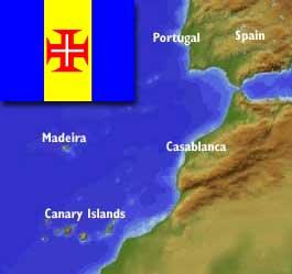
Madeira Islands to Morocco then nearer Azores/Portugal (VERY STRONG for Madeira area and Strong for Azores area. This symptom is the inside of my left upperarm just above the elbow. It manifests as bubbles in the skin and is continuing today so this is a 2 day symptom at least.)
----------------------------------------
2005/10/04 18:54:16.0 38.27 N 26.95 W ML3.1 AZORES ISLANDS, PORTUGAL
(2 days early...This is definitely not all for this area. Please be on the alert until the 13th...at least.)
Wikipedia
Map of area.

Puerto Rico then Central Caribbean (Very Strong for Puerto Rico and Medium for Central Caribbean)
----------------------------------------
MAP 3.8 2005/10/06 18:51:33 19.749 -64.425 15.0 114 km ( 71 mi) N of Settlement, British Virgin Islands
Easter Island (Medium)
----------------------------------------
(Nothing found)
Switzerland (Medium)
----------------------------------------
06Oct2005 01:37:14.6 46.1N 6.9E 5 ML=1.4 M*SED Barberine / Switzerland 1012
06Oct2005 01:21:36.4 46.1N 6.9E 4 ML=1.2 M SED Barberine / Switzerland 0932
06Oct2005 04:55:05.3 46.1N 6.9E 4 ML=1.0 M SED Barberine / Switzerland 1002
06Oct2005 00:23:25.1 46.1N 6.9E 4 ML=1.3 M*SED Barberine / Switzerland 0939
06Oct2005 14:25:04.1 46.2N 7.0E 0 ML=1.2 M SED Val d'Illiez / Switzerlan 2202
2005/10/06 21:39:41.3 46.01 N 6.86 E 2 ML2.4 SWITZERLAND
06Oct2005 22:45:59.2 46.1N 6.9E 4 ML=1.5 M*SED Barberine / Switzerland 1302
Aleutian Islands (Strong)
----------------------------------------
map 3.3 2005/10/05 18:31:24 51.231 -178.062 16.5 ANDREANOF ISLANDS, ALEUTIAN IS., ALASKA
map 2.6 2005/10/06 18:40:13 53.411 -167.052 15.0 FOX ISLANDS, ALEUTIAN ISLANDS, ALASKA
map 2.9 2005/10/07 03:05:25 50.399 -178.529 1.0 ANDREANOF ISLANDS, ALEUTIAN IS., ALASKA
map 3.8 2005/10/07 04:42:07 51.800 -174.145 35.0 ANDREANOF ISLANDS, ALEUTIAN IS., ALASKA
http://www.adn.com/news/alaska/story/7053285p-6957424c.html
Aleutian volcano rumbling
By DOUG O'HARRA
Anchorage Daily News
Published: October 6, 2005
Last Modified: October 6, 2005 at 11:06 AM
A mysterious volcano in the western Aleutian Islands began stirring this month, trembling with lots of tiny earthquakes six to 12 miles underground, according to the Alaska Volcano Observatory.
The swarm beneath 5,925-foot Tanaga marks the first sign of unrest since the observatory wired the rugged cone with its own network of sensors two years ago, said volcanologist Rick Wessels, of the U.S. Geological Survey. The volcano was last known to erupt in 1914.
Most Aleutian Arc volcanoes produce batches of tiny quakes every day, but Tanaga had been remarkably quiet for reasons that remain unclear, Wessels said.
“It had one reasonably measurable event every month or so, and now it’s gone to several per hour,” he said.
The nearest inhabited community is Adak, 63 miles to the east. The volcano is more than 1,200 miles southwest of Anchorage. It's one of 28 volcanoes the observatory monitors around the clock, including the 11,070-foot Mount Spurr that looms on the horizon 80 miles due west of Anchorage.
Aleutian volcanoes like Tanaga can erupt with lava and explosions, sending ash clouds five to six miles into the sky and endangering jetliners over the North Pacific.
The new swarm of quakes doesn’t necessarily mean Tanaga will erupt anytime soon, and the volcano’s alert level was not raised yet, Wessels said.
South China Sea between The Philippines and Vietnam (Strong)
----------------------------------------
(Nothing found)
Possibly Line Islands area in North Pacific (Strong)
----------------------------------------
05Oct2005 20:45:28.2 6.7N 175.9E 30 mb=5.8 A ODC MARSHALL ISLANDS REGION 2115
Greece/Turkey then Central Mediterranean area
----------------------------------------
2005/10/06 00:42:34.3 35.33 N 27.14 E 40f ML3.0 DODECANESE ISLANDS, GREECE
2005/10/06 02:25:20.6 37.18 N 28.77 E 20 MD3.0 TURKEY
2005/10/06 09:52:31.0 37.41 N 26.58 E ML3.2 DODECANESE ISLANDS, GREECE
2005/10/06 10:24:08.2 39.41 N 26.96 E 25 MD2.9 TURKEY
2005/10/06 12:23:06.0 37.79 N 26.86 E ML3.0 DODECANESE ISLANDS, GREECE
2005/10/06 17:57:28.6 42.75 N 42.16 E 40 mb4.5 WESTERN CAUCASUS
2005/10/06 16:17:18.4 42.75 N 41.98 E 34 ML3.9 WESTERN CAUCASUS
Possibly Idaho (Strong)
----------------------------------------
map 2.9 2005/10/04 00:52:23 44.565 -116.016 5.0 SOUTHERN IDAHO
(2 days early)
Kazakhstan (Medium)
----------------------------------------
2005/10/05 08:36:00.0 40.35 N 68.88 E ML3.4 SOUTHEASTERN UZBEKISTAN
2005/10/06 00:40:08.0 42.04 N 73.80 E ML3.6 KYRGYZSTAN
2005/10/06 00:55:43.5 36.79 N 70.31 E 156 mb4.7 HINDU KUSH, AFGHANISTAN, REG
2005/10/06 09:12:15.2 32.36 N 70.43 E 33 mb4.4 PAKISTAN
2005/10/06 15:47:22.6 36.52 N 71.08 E 200 mb4.6 AFGHANISTAN-TAJIKISTAN BDR REG
2005/10/07 04:37:41.0 38.87 N 71.05 E ML3.9 AFGHANISTAN-TAJIKISTAN BDR REG
2005/10/07 04:58:39.0 39.42 N 79.31 E ML3.0 SOUTHERN XINJIANG, CHINA
Czech and Slovak Republics (Medium)
----------------------------------------
2005/10/06 07:23:08.4 48.22 N 13.00 E 10 ML3.7 AUSTRIA
Petrolia and South of
----------------------------------------
map 2.0 2005/10/05 19:31:34 40.145 -123.801 22.2 4 km ( 2 mi) NE of Redway, CA
map 1.6 2005/10/05 23:40:33 40.146 -123.820 22.3 3 km ( 2 mi) N of Redway, CA
map 1.6 2005/10/06 14:25:04 40.129 -123.828 20.2 1 km ( 1 mi) N of Redway, CA
map 2.4 2005/10/06 15:55:28 40.520 -124.997 2.4 62 km ( 39 mi) W of Ferndale, CA
map 2.4 2005/10/07 11:55:45 40.537 -124.641 2.1 32 km ( 20 mi) W of Ferndale, CA
Peace to all.

