*For Monday, 27 March 2006.
LEGEND for OVERVIEW: Size = My surety of area for quake.
Red Circle = Probable quake to STRONG quake.
Triangle = Very Strong or Stronger quake (And usually takes extra days).
Blue Circle, etc. = Uncertainty of symptom area for probable quake.
Places to watch.
Good luck to all.
For Monday, 27 March 2006.
----------------------------------------
Utah
----------------------------------------
MAP 1.9 2006/03/27 02:32:17 39.414 -111.214 7.7 23 km ( 14 mi) WNW of Huntington, UT
MAP 1.4 2006/03/27 06:08:00 39.606 -110.398 0.9 6 km ( 4 mi) N of Sunnyside, UT
MAP 1.7 2006/03/27 06:55:49 39.671 -110.516 4.5 16 km ( 10 mi) NW of Sunnyside, UT
MAP 1.4 2006/03/27 12:03:19 39.668 -110.513 2.2 16 km ( 10 mi) NW of Sunnyside, UT
MAP 1.0 2006/03/27 15:40:43 37.957 -112.942 10.0 16 km ( 10 mi) NW of Parowan, UT
MAP 1.7 2006/03/27 16:17:43 39.441 -111.203 8.4 24 km ( 15 mi) WNW of Huntington, UT
MAP 1.7 2006/03/27 21:49:12 39.733 -110.737 1.1 11 km ( 7 mi) ENE of Helper, UT
MAP 1.3 2006/03/27 22:36:59 39.416 -111.209 6.2 23 km ( 14 mi) WNW of Huntington, UT
Mt. St. Helen’s
----------------------------------------
MAP 1.7 2006/03/27 08:57:39 46.198 -122.186 0.0 0 km ( 0 mi) WSW of Mount St. Helens Volcano, WA
The Virgin Islands area then Puerto Rico ad South of (Medium for The Virgin Islands)
----------------------------------------
MAP 3.4 2006/03/27 18:47:52 19.348 -65.428 101.4 111 km ( 69 mi) NNE of Vieques, PR
MAP 2.0 2006/03/27 13:02:57 17.917 -65.612 30.9 25 km ( 15 mi) SW of Esperanza, PR
MAP 3.5 2006/03/27 09:16:20 18.940 -64.604 5.0 38 km ( 24 mi) NW of Settlement, British Virgin Islands
MAP 2.9 2006/03/27 08:53:50 18.839 -65.215 46.3 60 km ( 37 mi) N of Culebra, PR
MAP 3.7 2006/03/28 00:43:15 19.555 -68.454 50.2 100 km ( 62 mi) ENE of Samaná, Dominican Republic
MAP 2.7 2006/03/28 12:35:09 18.245 -64.451 4.9 23 km ( 14 mi) S of Spanish Town, British Virgin Islands
MAP 3.4 2006/03/28 14:25:02 19.345 -65.289 83.6 115 km ( 72 mi) N of Culebra, PR
MAP 3.4 2006/03/28 14:25:01 19.361 -65.286 83.7 117 km ( 73 mi) N of Culebra, PR
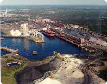
Port-Cartier, Quebec (49.69N 67.09W) (Very Strong)
http://www.greatlakes-seaway.com/en/ports/portofcartier.html>Seaway
----------------------------------------
06/03/28 17:45:06 47.60N 70.22W 17.2 1.4MN GSC CHARLEVOIX SEISMIC ZONE, QUE.
2006/03/27 01:43:14 47.59N 70.01W 11.2 1.0MN GSC CHARLEVOIX SEISMIC ZONE, QUE.
2006/03/26 19:18:13 45.69N 77.27W 18.0g 1.5MN GSC 19 km SW from Pembroke, ON
2006/03/26 04:37:37 47.61N 70.13W 18.4 1.5MN GSC CHARLEVOIX SEISMIC ZONE, QUE.
(This is off a little on location and definitely not big...more may be coming.)
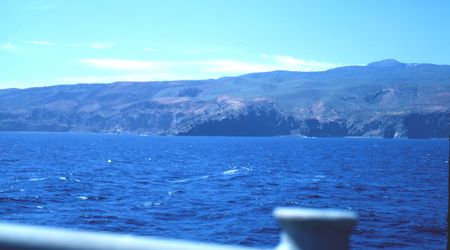
Revilla Gigedo Islands (19.66N 108.98W) (Very Strong)
http://en.wikipedia.org/wiki/Socorro_Island>Socorro
----------------------------------------
MAP 4.8 2006/03/28 22:35:51 15.468 -91.516 219.7 GUATEMALA
MAP 4.3 2006/03/28 20:43:38 13.946 -91.730 64.5 OFFSHORE GUATEMALA
MAP 4.8 2006/03/28 19:36:26 15.728 -95.055 36.6 OFFSHORE OAXACA, MEXICO
(Much further South)
Southern Sumatra (2.7S 104.2E) (3 different strong symptoms - Very Strong)
http://www.s8int.com/dino6.html>Out of Place
Python from Sumatra

----------------------------------------
27Mar2006 16:58:39.9 1.6N 97.0E 33 MS=4.4 M GSR NORTHERN SUMATERA, INDONES
North of Redding, California (40.621 -122.436) (MEDIUM)
----------------------------------------
MAP1.6 2006/03/28 23:53:59 40.202 -122.076 18.7 14 km ( 9 mi) ENE of Red Bluff, CA
Southern/Central Alaska (MEDIUM)
----------------------------------------
MAP 3.9 2006/03/27 03:38:07 66.354 -142.245 1.0 74 km ( 46 mi) ESE of Chalkyitsik, AK
MAP 2.9 2006/03/27 11:45:20 61.046 -148.967 15.0 SOUTHERN ALASKA
MAP 2.9 2006/03/27 18:29:38 60.917 -152.277 120.0 SOUTHERN ALASKA
Uzbekistan area then Kazakhstan (Strong)
----------------------------------------
2006-03-27 07:12:46.0 49.75 N 87.32 E ML 3.0 KAZAKHSTAN-XINJIANG BDR REG
2006-03-27 09:49:17.0 40.95 N 70.71 E ML 3.2 TAJIKISTAN
Yukon/Northwestern Territories
----------------------------------------
2006/03/28 02:39:58 66.30N 142.22W 1.0g 2.8ML PGC 281 km NW of Dawson, YT
United Kingdom to North Sea area
----------------------------------------
NORDLAND REGION NORWAY
Origin time Lat Lon Azres Timres Wres Nphase Ntot Nsta Netmag
2006-085:23.23.47.0 66.63 13.01 17.66 1.23 5.64 5 6 3 2.06
VOERING PLATEAU
Origin time Lat Lon Azres Timres Wres Nphase Ntot Nsta Netmag
2006-086:12.03.14.0 66.18 4.40 9.61 0.82 3.23 3 3 3 2.04
MID-NORWAY NORWAY
Origin time Lat Lon Azres Timres Wres Nphase Ntot Nsta Netmag
2006-086:13.54.58.0 63.66 10.67 17.73 3.84 8.27 3 4 3 2.24
Poland
----------------------------------------
2006-03-27 23:19:48.1 50.20 N 18.36 E 2 ML 2.3 POLAND
2006-03-27 22:37:29.8 51.09 N 15.82 E 2 ML 2.4 POLAND
2006-03-28 11:38:39.6 50.15 N 18.43 E 10 ML 2.1 POLAND
2006-03-28 14:04:32.2 51.40 N 15.96 E 10 ML 2.3 POLAND
Mammoth Lakes/Tom’s Place area (Indication of a deep quake - Medium)
----------------------------------------
MAP 1.0 2006/03/28 01:36:30 37.532 -118.870 3.8 15 km ( 9 mi) SE of Mammoth Lakes, CA
MAP 1.9 2006/03/28 07:19:04 37.489 -118.805 9.4 14 km ( 9 mi) SW of Toms Place, CA
MAP 1.1 2006/03/28 21:43:59 37.529 -118.829 7.7 14 km ( 8 mi) WSW of Toms Place, CA
Mozambique and East of
----------------------------------------
(Nothing found)
Costa Rica area (9.91N 83.72W) (Medium)
----------------------------------------
06/03/27 23:32:42 13.14N 87.58W 2.4 3.0MC Golfo de Fonseca
06/03/27 23:17:20 13.06N 87.58W 1.0 3.1MC Golfo de Fonseca
06/03/27 23:06:16 13.21N 87.65W 5.8 3.1MC Golfo de Fonseca
06/03/27 10:40:33 12.32N 86.14W 2.6 3.0ML Nicaragua
06/03/27 08:39:08 11.65N 86.47W 161.5 3.2ML Frente a Masachapa
Peace to all.

posted by Unknown @ 1:34 PM
0 comments
![]()
![]()
