*For Saturday, 18 February 2006.
LEGEND for OVERVIEW:
Size = My surety of area for quake.
Red Circle = Probable quake to STRONG quake.
Triangle = Very Strong or Stronger quake (And usually takes extra days).
Blue Circle, etc. = Uncertainty of symptom area for probable quake.

Places to watch.
Good luck to all.
For Saturday, 18 February 2006.
----------------------------------------
Nicaragua/Costa Rica on Caribbean side then into Panama area on Caribbean side then South of Panama (Strong for Nicaragua/Costa Rica on Caribbean side)
----------------------------------------
06/02/18 04:44:24 11.31N 87.03W 1.9 3.3MC
06/02/18 06:25:32 12.09N 87.18W 50.8 3.2ML
06/02/18 12:26:14 11.87N 87.18W 14.8 2.8MC
06/02/18 13:51:46 11.06N 88.21W 30.0 3.7MC
06/02/18 13:59:41 12.36N 86.81W 70.9 2.7MC
06/02/18 16:53:40 11.81N 86.51W 74.8 3.0MC
06/02/18 20:20:37 13.03N 87.67W 0.7 3.2MC
06/02/18 20:31:58 12.45N 87.71W 2.4 2.9MC
06/02/18 20:40:14 12.99N 87.55W 3.2 2.7ML
06/02/18 20:46:12 13.03N 87.56W 3.1 3.0MC
06/02/18 20:51:26 13.07N 87.64W 9.0 3.6MC
06/02/18 20:51:26 13.07N 87.63W 9.1 3.6MC
06/02/18 21:02:28 13.04N 87.57W 0.3 2.8ML
06/02/18 21:23:15 13.13N 87.70W 14.3 2.9MC
06/02/18 21:27:57 13.05N 87.66W 10.4 3.0MC
06/02/18 21:37:35 13.01N 87.45W 0.1 2.8MC
06/02/18 21:44:53 13.01N 87.59W 0.0 3.2MC
06/02/18 21:48:11 13.15N 87.81W 12.5 2.9MC
06/02/18 21:54:08 13.30N 87.18W 0.1 2.8MC
06/02/18 22:06:45 13.27N 87.49W 13.1 2.7ML
06/02/18 22:15:54 12.72N 87.07W 15.0 3.1MC
06/02/18 22:47:17 13.42N 87.11W 19.7 2.9MC
06/02/18 23:03:11 13.27N 87.51W 9.0 2.8MC
06/02/18 23:34:50 13.43N 87.11W 0.3 3.1MC
06/02/18 23:58:56 13.41N 87.64W 16.3 3.1MC
06/02/19 00:30:12 13.08N 87.74W 20.2 3.1MC
06/02/19 01:18:39 13.20N 87.72W 5.2 3.3MC
06/02/19 03:02:40 13.22N 87.49W 17.0 3.1MC
06/02/19 04:18:31 12.93N 87.81W 12.4 2.9MC
06/02/19 05:10:16 11.46N 86.97W 23.9 2.8MC
06/02/19 07:14:14 13.23N 87.68W 14.6 3.3MC
06/02/19 09:36:41 11.33N 85.56W 7.0 2.2MC
06/02/19 09:49:25 13.35N 87.26W 4.7 3.2MC
06/02/19 10:12:05 13.44N 87.60W 16.4 3.1MC
06/02/19 12:37:49 13.18N 87.39W 16.0 2.8ML
06/02/19 19:10:42 12.88N 87.75W 30.0 3.1MC
06/02/19 23:07:34 12.79N 87.72W 0.0 2.7ML
Parkfield Fault
----------------------------------------
MAP 1.2 2006/02/18 00:46:56 36.699 -121.336 5.5 10 km ( 6 mi) S of Tres Pinos, CA
Turkey (2 different symptoms and multiples - STRONG)
----------------------------------------
18.02.2006 08:18:11 36.191N 28.831E 15.9 3.1 AKDENIZ
18.02.2006 06:42:53 37.695N 44.082E 31.9 3.2 BAGISLI- (HAKKARI)
Northern Italy area then into Hungary area (Strong for Northern Italy area)
----------------------------------------
2006-02-17 07:35:38.0 42.44N 13.32E 13 ML 2.2 CENTRAL ITALY
2006-02-17 07:16:09.0 42.44N 13.32E 12 ML 2.6 CENTRAL ITALY
2006-02-19 03:43:48.0 42.46N 13.33E 11 ML 2.9 CENTRAL ITALY
2006-02-19 06:18:04.0 42.45N 13.32E 14 ML 2.6 CENTRAL ITALY
2006-02-19 06:57:27.0 42.44N 13.32E 11 ML 2.3 CENTRAL ITALY
2006-02-19 06:57:27.0 42.44N 13.32E 11 ML 2.3 CENTRAL ITALY
(Nothing found for Hungary)
Banda Sea (4.20 S 128.84 E)
----------------------------------------
2006-02-18 01:09:54.1 0.68N 126.07E 114 mb4.8 NORTHERN MOLUCCA SEA
2006-02-19 06:07:40.9 3.05S 138.63E 100 mb4.6 IRIAN JAYA, INDONESIA
19Feb2006 06:27:17.1 7.0S 130.2E230 mb=4.4 M GSR TANIMBAR ISLANDS REG., IND0
Hawaii (Medium)
----------------------------------------
MAP 2.1 2006/02/18 04:16:22 19.384 -155.240 4.0 7 km ( 5 mi) S of Volcano, HI
MAP 2.2 2006/02/18 04:26:48 19.592 -155.173 14.5 7 km ( 4 mi) NNW of Mountain View, HI
MAP 1.8 2006/02/18 05:08:21 19.372 -155.232 3.1 9 km ( 5 mi) S of Volcano, HI
MAP 1.8 2006/02/18 17:02:38 19.430 -155.065 2.3 8 km ( 5 mi) SE of Fern Forest, HI
Caspian Sea/Uzbekistan area (MEDIUM)
----------------------------------------
19Feb2006 08:55:54.6 40.4N 52.8E 60 mb=4.0 M GSR TURKMENISTAN
Honshu, Japan (30.45 N 138.54 E) and South of (I'm putting this at VERY STRONG - there may be 2 areas with the more Southern area moving most.)
http://www.trekearth.com/gallery/Asia/Japan/>Trekearth.com
----------------------------------------
2006-02-17 02:13:34 5.5 24.07 N 141.41 E Volcano Islands, Japan Region
Kermadec Islands (27.4S 178.8W)
----------------------------------------
2006-02-17 15:32:17.8 21.61S 171.05E 33 mb5.2 SE.OF LOYALTY ISLANDS
MAP 5.1 2006/02/18 06:44:23 -37.820 176.320 205.0 NORTH ISLAND OF NEW ZEALAND
2006-02-20 07:55:18.8 33.09S 178.71W 33 mb5.0 SOUTH OF KERMADEC ISLANDS
(2 extra days)
South of Alaska then Alaska Peninsula
----------------------------------------
MAP 3.0 2006/02/18 10:25:54 54.388 -163.988 90.0 UNIMAK ISLAND REGION, ALASKA
Northern England/Ireland area (Medium)
----------------------------------------
FAROES-HEBRIDES REGION
Origin time Lat Lon Azres Timres Wres Nphase Ntot Nsta Netmag
2006-050:13.06.38.0 58.82 -10.03 23.45 0.42 6.28 2 2 1 2.26
FAROES-HEBRIDES REGION
Origin time Lat Lon Azres Timres Wres Nphase Ntot Nsta Netmag
2006-050:09.42.33.0 58.03 -8.11 8.70 0.09 2.27 2 2 1 2.44
BRABANT MASSIF
Origin time Lat Lon Azres Timres Wres Nphase Ntot Nsta Netmag
2006-051:07.21.38.0 51.41 3.67 5.95 0.07 1.56 2 2 1 2.59
Lake Baykal, Russia (Same time as Northern England/Ireland area)
----------------------------------------
(Nothing found)
New Siberian Islands in the Arctic Ocean then North of Svalbard area
----------------------------------------
NORTH OF SVALBARD
Origin time Lat Lon Azres Timres Wres Nphase Ntot Nsta Netmag
2006-049:11.49.42.0 82.74 22.16 12.75 0.10 3.29 2 4 2 1.25
NORTH OF SVALBARD
Origin time Lat Lon Azres Timres Wres Nphase Ntot Nsta Netmag
2006-049:19.22.24.0 83.46 -0.33 15.32 3.48 7.32 3 3 2 1.54
(Very tiny stuff and nothing for Siberian Islands - still haven't got these symptoms right.)
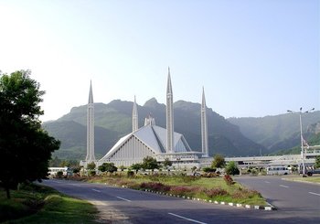
Islamabad, Pakistan (Very Strong - Symptom continued off and on during morning)
http://www.allaboutall.info/article/Islamabad>Allabou all
----------------------------------------
2006-02-21 22:29:10 4.6 35.59 N 71.32 E Pakistan
(3 days extra. Close but seems like there should be more.)
Northern Sumatra (STRONG)
----------------------------------------
18Feb2006 06:09:51.6 4.5N 95.4E 33 mb=4.9 M GSR NORTHERN SUMATERA, INDONES
WSW of New Madrid, Missouri (36.540N 89.660W) and then more East
----------------------------------------
MAP 1.2 2006/02/18 03:01:43 44.801 -74.678 7.9 8 km ( 5 mi) E of Brasher Falls-Winthrop, NY
(Nothing found for Missouri - symptom was different and may not mean quake.)
Puerto Rico
----------------------------------------
MAP 2.8 2006/02/18 00:39:23 18.225 -66.975 26.3 5 km ( 3 mi) N of Maricao, PR
MAP 3.1 2006/02/18 04:39:50 18.921 -64.621 3.8 38 km ( 24 mi) NW of Settlement, British Virgin Islands
Ethiopia (11.49N 43.44E) to Arabian Peninsula (Medium)
----------------------------------------
2006-02-18 08:00:42.0 11.40N 43.16E 11 ML 4.2 ETHIOPIA
2006-02-18 10:13:26.1 11.36N 43.29E 8 ML 3.8 ETHIOPIA
2006-02-18 09:20:24.7 11.45N 43.16E 2 mb 4.4 ETHIOPIA
2006-02-18 08:06:24.9 11.39N 43.24E 7 ML 3.5 ETHIOPIA
2006-02-18 13:57:14.5 11.31N 43.39E 7 ML 3.7 ETHIOPIA
Utah/Nevada
----------------------------------------
map 1.6 2006/02/18 20:56:49 39.605N 110.394W 0.9 6 km ( 4 mi) N of Sunnyside, UT
map 1.9 2006/02/18 18:59:03 37.051N 114.414W 3.1 41 km (26 mi) NW of Mesquite, NV
map 1.6 2006/02/18 17:34:01 39.606N 110.392W 0.7 6 km ( 4 mi) N of Sunnyside, UT
map 1.6 2006/02/18 16:00:37 39.411N 111.219W 3.1 24 km (15 mi) WNW of Huntington, UT
map 1.4 2006/02/18 11:02:53 39.410N 111.216W 2.5 24 km (15 mi) WNW of Huntington, UT
map 1.6 2006/02/18 10:06:47 39.671N 110.517W 1.5 16 km (10 mi) NNW of E. Carbon City, UT
MAP 1.8 2006/02/18 09:41:12 36.888 -115.897 0.0 40 km ( 25 mi) NNW of Indian Springs, NV
map 2.0 2006/02/18 08:23:32 39.608N 110.392W 0.6 6 km ( 4 mi) N of Sunnyside, UT
map 1.4 2006/02/18 00:09:52 39.669N 110.515W 2.1 16 km (10 mi) NNW of E. Carbon City, UT
Algeria/Libya border (STRONG)
----------------------------------------
2006-02-17 07:37:48.7 36.79N 3.48E mb4.5 NORTHERN ALGERIA
Peace to all.

posted by Unknown @ 1:16 PM
0 comments
![]()
![]()
