*For Monday, 16 January 2006.
LEGEND for OVERVIEW:
Size = My surety of area for quake.
Red Circle = Probable quake to STRONG quake.
Triangle = Very Strong or Stronger quake (And usually takes extra days).
Blue Circle, etc. = Uncertainty of symptom area for probable quake.

Places to watch.
Good luck to all.
For Monday, 16 January 2006.
----------------------------------------
New Madrid Fault/Possibly Missouri
----------------------------------------
map 1.1 2006/01/16 07:23:14 35.680 -84.360 17.7 4 km ( 2 mi) E of Philadelphia, TN
map 2.0 2006/01/18 10:00:34 36.490 -89.480 6.6 12 km ( 7 mi) SSE of New Madrid, MO
map 1.6 2006/01/18 10:01:38 36.490 -89.480 4.1 12 km ( 7 mi) SSE of New Madrid, MO
(2 extra days)
Hawaii
----------------------------------------
map 1.8 2006/01/15 00:33:49 19.203 -155.450 6.7 3 km ( 2 mi) E of Pahala, HI
MAP 3.6 2006/01/15 09:04:09 19.643 -155.822 27.7 15 km ( 9 mi) NE of Honalo, HI
map 2.0 2006/01/15 18:27:32 19.386 -155.244 3.8 7 km ( 4 mi) S of Volcano, HI
map 2.1 2006/01/16 08:28:05 19.382 -155.246 1.9 8 km ( 5 mi) S of Volcano, HI
Central Italy to Sardinia (Strong)
----------------------------------------
2006/01/17 19:39:31.7 43.38 N 13.41 E 25 ML3.1 CENTRAL ITALY
Utah
----------------------------------------
map 1.6 2006/01/16 06:59:54 39.731 -110.804 0.0 7 km ( 4 mi) NE of Helper, UT
map 1.4 2006/01/16 23:26:53 39.412 -111.225 1.3 24 km ( 15 mi) WNW of Huntington, UT
Skykomish, Washington area (47.709N 120.842W) (Strong)
----------------------------------------
map 1.2 2006/01/15 21:26:28 47.732 -121.818 18.7 8 km ( 5 mi) ENE of Lake Marcel-Stillwater, WA
Wenatchee, Washington (47.307N 119.809W) (Second or third day of symptoms for this area - Strong.)
----------------------------------------
map 1.5 2006/01/17 10:23:42 47.714 -120.186 3.1 5 km ( 3 mi) NNE of Entiat, WA
Turkey/Greece area (Strong)
----------------------------------------
2006/01/16 06:43:43.7 38.01 N 20.33 E 2 ML3.9 GREECE
2006/01/16 18:06:48.9 40.52 N 35.00 E 6 MD3.1 TURKEY
2006/01/16 21:46:53.0 38.47 N 26.14 E ML3.0 AEGEAN SEA
Xinjiang, China area (43.63 N 83.85 E)
----------------------------------------
2006/01/16 10:53:52.0 50.99 N 89.12 E ML3.1 TUVA-BURYATIA-MONGOLIA BDR REG
MAP 4.8 2006/01/18 00:23:54 34.602 87.851 35.0 WESTERN XIZANG
(2 extra days)
Covelo, California and South of (40.170°N, 123.089°W)
----------------------------------------
map 2.1 2006/01/16 05:39:51 40.267 -124.081 13.3 18 km ( 11 mi) ESE of Petrolia, CA
map 2.7 2006/01/16 15:11:58 40.297 -124.621 1.9 29 km ( 18 mi) W of Petrolia, CA
(Not South)
Parkfield area
----------------------------------------
(Nothing found)
Possibly Black Sea to Turkey/Georgia area (New symptom and a guesstimate - Strong)
----------------------------------------
2006/01/16 09:18:08.7 34.75 N 45.35 E 50 mb4.6 IRAN-IRAQ BORDER REGION
(More South and East then expected.)
North of Svalbard/Greenland area (VERY STRONG)
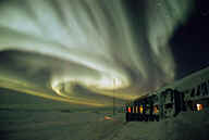
Svalbard Photos

----------------------------------------
GREENLAND SEA
Origin time Lat Lon Azres Timres Wres Nphase Ntot Nsta Netmag
2006-016:03.39.48.0 76.54 0.49 1.49 0.18 0.56 2 2 1 2.40
Puerto Rico area
----------------------------------------
MAP 3.3 2006/01/16 04:23:00 18.680 -65.050 51.5 39 km ( 24 mi) NNW of CHARLOTTE AMALIE, US Virgin Islands
Peace to all.

