*For Monday, 18 December 2006.
LEGEND for OVERVIEW: Size = My surety of area for quake.
Red Circle = Probable quake to STRONG quake.
Triangle = Very Strong/Stronger quake (Usually takes extra days).
Blue Circle, etc. = Uncertainty of symptom area for probable quake.

Places to watch.
Good luck to all.
For Monday, 18 December 2006.
--------------------------------------
Mt. St. Helen’s (Calling this STRONG because
the symptom happened during the night and
woke me up sometimes.)
--------------------------------------
2.3 2006/12/18 06:09:55 46.195 -122.186 0.0 1 km ( 0 mi) SW of Mount St. Helens Volcano, WA
1.4 2006/12/18 15:40:12 46.198 -122.200 0.0 2 km ( 1 mi) W of Mount St. Helens Volcano, WA
1.6 2006/12/18 20:56:59 46.189 -122.195 0.0 2 km ( 1 mi) SW of Mount St. Helens Volcano, WA
1.8 2006/12/18 23:11:55 46.196 -122.186 0.0 1 km ( 0 mi) SW of Mount St. Helens Volcano, WA
Samoa to Tonga area
--------------------------------------
2006-12-17 12:51:11.6 21.11S 174.56W 40 mb5.5 TONGA
2006-12-17 12:40:11.2 21.28S 174.32W 29 mb5.0 TONGA
MOLUCCA SEA (2.72N 126.83E)
--------------------------------------
2006-12-17 09:04:21.1 0.22S 124.96E 40 mb5.0 MOLUCCA SEA
2006-12-19 00:13:20 5.0mb 6.91S 126.83E 450 Banda Sea'
Greece/Aegean Sea/Turkey area
--------------------------------------
2006-12-18 01:08:39.3 36.81N 33.67E 5 MD3.4 CENTRAL TURKEY
2006-12-18 00:18:45.9 39.60N 42.88E 5 MD3.3 EASTERN TURKEY
2006-12-18 03:25:57.3 37.22N 28.11E 9 MD3.0 WESTERN TURKEY
2006-12-18 03:09:14.5 36.93N 30.36E 10 mb4.4 WESTERN TURKEY
2006-12-18 03:52:37.0 37.07N 23.29E ML3.8 SOUTHERN GREECE
2006-12-18 05:25:45.1 38.21N 27.00E 5 MD2.8 WESTERN TURKEY
2006-12-18 08:53:08.9 40.79N 22.99E 15G ML2.0 GREECE
2006-12-18 11:44:23.0 38.80N 23.00E ML3.4 GREECE
2006-12-18 16:49:26.2 40.27N 20.38E 1G ML2.4 ALBANIA
2006-12-18 21:28:23.0 40.24N 20.47E 1G ML2.9 ALBANIA
Puerto Rico/Virgin Islands (Strong)
--------------------------------------
2.6 2006/12/18 12:51:55 17.820N -65.617W 36.7 34 km (21 mi) SSW of Esperanza, PR
2.2 2006/12/18 12:46:50 18.276N -66.362W 33.2 6 km ( 4 mi) NNE of Orocovis, PR
3.2 2006/12/18 07:01:13 19.111N -64.325W 60.4 42 km (26 mi) N of Settlement, Anegada, British Virgin Islands
2.9 2006/12/18 06:00:47 18.869N -65.724W 24.7 51 km (31 mi) NNE of Suárez, PR
2.5 2006/12/18 05:48:19 18.011N -67.089W 17.6 3 km ( 2 mi) SSW of Palmarejo, PR
3.3 2006/12/18 03:32:02 19.183N -66.859W 21.5 78 km (48 mi) N of Camuy, PR
3.2 2006/12/19 21:23:13 18.733N -65.120W 98.2 47 km (29 mi) NNW of Charlotte Amalie, Saint Thomas, US Virgin Islands
1.7 2006/12/19 17:57:33 17.917N -66.908W 16.7 6 km ( 4 mi) SSE of Guánica, PR
Greenwater, Washington area
--------------------------------------
2.8 2006/12/18 19:02:30 45.172N 122.612W 19.1 4 km ( 2 mi) NW of Molalla, OR
1.4 2006/12/18 16:56:41 45.885N 122.255W 6.2 12 km ( 7 mi) E of Yacolt, WA
2.3 2006/12/18 12:45:38 45.884N 122.243W 4.6 13 km ( 8 mi) E of Yacolt, WA
1.9 2006/12/18 12:44:06 45.879N 122.258W 7.2 12 km ( 7 mi) E of Yacolt, WA
Montana/Idaho
--------------------------------------
(Nothing found)
Sweden (STRONG)
--------------------------------------
MALMOEHUS SWEDEN
Origin time Lat Lon Azres Timres Wres Nphase Ntot Nsta Netmag
2006-351:07.35.01.0 55.31 13.32 7.35 5.28 7.11 2 2 1 2.93
VAESTMANLAND REGION SWEDEN
Origin time Lat Lon Azres Timres Wres Nphase Ntot Nsta Netmag
2006-351:12.02.40.0 59.80 14.69 3.95 0.56 1.55 2 3 2 2.17
SOUTH-WESTERN NORRBOTTEN SWEDEN
Origin time Lat Lon Azres Timres Wres Nphase Ntot Nsta Netmag
2006-352:11.50.35.0 67.89 17.47 0.60 0.46 0.61 2 2 1 2.54
CENTRAL NORBOTTEN SWEDEN
Origin time Lat Lon Azres Timres Wres Nphase Ntot Nsta Netmag
2006-352:12.00.15.0 68.17 21.39 4.15 0.93 1.97 2 7 1 2.09
Strait of Gibraltar area/Morocco to Azores
(Second day symptom but much stronger
so I am putting this at - Very Strong)
earth.esa.int
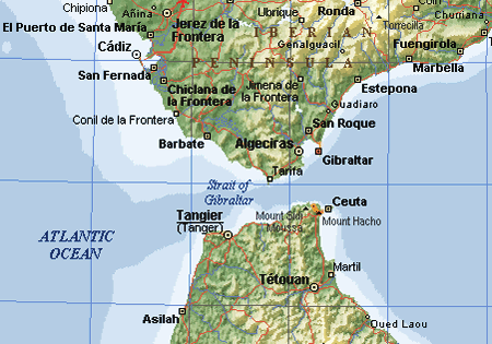
--------------------------------------
2006-12-18 08:42:22.6 36.56N 8.13W 13 mb2.7 WEST OF GIBRALTAR
2006-12-19 03:24:18.4 29.66N 14.71W 73 mb3.0 CANARY ISLANDS, SPAIN REGION
2006-12-21 05:44:36.7 33.05N 11.64W 30f ML3.0 MADEIRA ISLANDS, PORTUGAL REGION
(3 extra days and not so strong.)
Switzerland to Central Italy
--------------------------------------
2006-12-19 20:10:23.4 45.64N 7.05E 10 ML2.6 NORTHERN ITALY
Sumatra
--------------------------------------
2006-12-17 21:39:16.8 1.15N 99.26E 10 mb5.5 NORTHERN SUMATRA, INDONESIA
2006-12-17 21:10:20.0 4.90N 95.04E 30 mb5.8 NORTHERN SUMATRA, INDONESIA
2006-12-19 12:48:15.8 2.57N 98.10E 68 mb5.3 NORTHERN SUMATRA, INDONESIA
Honshu, Japan and North of (2 different
sympoms - Strong.)
--------------------------------------
2006/12/18,18:54 46.8 N 153.2 E 30 km Mj 4.5 KURILE_ISLANDS_REGION 75.08
2006/12/18,18:28 32.0 N 131.6 E 40 km Mj 4.0 HYUGANADA_REGION 92.99
2006/12/18,16:27 38.9 N 141.7 E 70 km Mj 3.6 NORTHERN_MIYAGI_PREF 63.14
2006/12/18,15:39 24.2 N 125.2 E shallow Mj 3.6 NEAR_MIYAKOJIMA_ISLAND 89.02
2006/12/18,07:27 36.8 N 141.3 E 50 km Mj 4.3 E_OFF_IBARAKI_PREF 92.07
Eastern New Guinea Reg., P.N.G.
(5.56S 146.94E)
--------------------------------------
2006-12-18 23:46:14.0 6.46S 154.24E 33 mb5.0 BOUGAINVILLE REGION, P.N.G.
Hawaii (STRONG)
--------------------------------------
1.8 2006/12/18 00:52:51 19.056 -155.153 41.0 38 km ( 24 mi) ESE of Pahala, HI
1.8 2006/12/19 06:16:18 19.012 -155.484 37.9 12 km ( 8 mi) ESE of Naalehu, HI
3.0 2006/12/19 06:37:59 19.414 -155.639 3.6 26 km ( 16 mi) E of Honaunau-Napoopoo, HI
2.5 2006/12/19 11:24:41 19.312 -155.218 8.9 15 km ( 10 mi) S of Volcano, HI
2.2 2006/12/19 17:14:55 20.092 -155.748 6.9 11 km ( 7 mi) NW of Waimea, HI
South Sandwich Islands area
(With volcanics - Strong)
--------------------------------------
4.6 2006/12/17 19:05:41 -58.995 -25.693 25.1 SOUTH SANDWICH ISLANDS REGION
Ethiopia area (11.49N 43.44E) (Strong)
--------------------------------------
2006-12-18 13:55:44.1 12.06N 43.82E 4 ML3.5 NEAR THE COAST OF YEMEN
2006-12-18 13:48:04.9 12.10N 43.79E 17 ML3.1 NEAR THE COAST OF YEMEN
Central Parkfield Fault to Coalinga
(36.169°N 120.348°W)
--------------------------------------
2.0 2006/12/16 02:26:05 36.167 -120.288 11.2 7 km ( 4 mi) ENE of Coalinga, CA
2.5 2006/12/16 03:59:56 36.169 -120.297 9.6 6 km ( 4 mi) ENE of Coalinga, CA
1.9 2006/12/16 06:25:07 36.159 -120.296 11.0 6 km ( 4 mi) ENE of Coalinga, CA
2.4 2006/12/16 06:20:36 36.175 -120.291 10.2 7 km ( 4 mi) ENE of Coalinga, CA
4.3 2006/12/16 06:14:05 36.174 -120.292 9.8 7 km ( 4 mi) ENE of Coalinga, CA
1.4 2006/12/16 08:03:18 36.173 -120.291 11.3 7 km ( 4 mi) ENE of Coalinga, CA
1.3 2006/12/16 07:50:12 36.173 -120.289 11.4 7 km ( 4 mi) ENE of Coalinga, CA
1.5 2006/12/16 08:46:04 36.159 -120.285 11.2 7 km ( 4 mi) ENE of Coalinga, CA
1.7 2006/12/16 12:32:14 36.191 -120.312 10.6 7 km ( 4 mi) NE of Coalinga, CA
1.3 2006/12/16 13:39:16 36.176 -120.296 11.1 7 km ( 4 mi) NE of Coalinga, CA
1.6 2006/12/16 15:10:57 36.163 -120.280 11.0 7 km ( 5 mi) ENE of Coalinga, CA
1.3 2006/12/17 03:43:21 36.022 -120.599 0.0 20 km ( 13 mi) NW of Parkfield, CA
1.8 2006/12/17 08:51:02 35.624 -120.745 4.3 6 km ( 4 mi) W of Paso Robles, CA
1.4 2006/12/17 14:32:57 35.934 -120.490 10.5 7 km ( 4 mi) NW of Parkfield, CA
Portugal to Azores Islands area (Second
day symptom and seems to be associated
with Strait of Gibraltar symptoms - STRONG)
--------------------------------------
(Posted above under Strait of Gibraltar, etc. - should have combined these 2 symptom areas)
Big Sur area
--------------------------------------
(Nothing found)
Peace to all.

posted by Unknown @ 1:48 PM
0 comments
![]()
![]()
