*For Sunday, 22 January 2006.
LEGEND for OVERVIEW:
Size = My surety of area for quake.
Red Circle = Probable quake to STRONG quake.
Triangle = Very Strong or Stronger quake (And usually takes extra days).
Blue Circle, etc. = Uncertainty of symptom area for probable quake.

Places to watch.
Good luck to all.
For Sunday, 22 January 2006.
----------------------------------------
Off the Coast of Peru (Second day for this area but different symptom - VERY STRONG.)
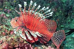
Peru Photos

----------------------------------------
2006-01-27 06:43:00.8 10.58S 78.71W 60mb 5.0 NEAR COAST OF PERU
(5 extra days.)
Possibly Latvia/Northwestern Russia area then Poland (Medium for Poland)
----------------------------------------
BALTIC STATES-BELARUS-NW RUSSIA REGION
Origin time Lat Lon Azres Timres Wres Nphase Ntot Nsta Netmag
2006-022:00.02.56.0 56.11 40.94 17.22 0.82 5.13 3 3 3 2.81
BALTIC STATES-BELARUS-NW RUSSIA REGION
Origin time Lat Lon Azres Timres Wres Nphase Ntot Nsta Netmag
2006-022:00.54.33.0 65.85 45.50 13.26 3.97 7.28 5 6 3 2.06
BALTIC STATES-BELARUS-NW RUSSIA REGION
Origin time Lat Lon Azres Timres Wres Nphase Ntot Nsta Netmag
2006-022:01.29.15.0 60.02 40.93 16.01 0.42 4.43 3 3 3 2.43
BALTIC STATES-BELARUS-NW RUSSIA REGION
Origin time Lat Lon Azres Timres Wres Nphase Ntot Nsta Netmag
2006-022:03.08.54.0 53.94 26.87 19.12 1.01 5.79 3 4 2 2.22
2006/01/22 01:32:12.6 51.20 N 15.98 E ML2.1 POLAND
2006/01/22 06:43:20.5 50.88 N 16.12 E 12 ML2.1 POLAND
2006-01-23 15:25:45.0 52.53 N 18.63 E33ML 3.7 POLAND
South of Fiji/Kermadec Islands area then Vanuatu area (VERY STRONG for both areas)
Kermadec Marine Reserve
----------------------------------------
2006/01/22 11:15:40.0 22.48 S 173.62 E 33 mb5.3 SE.OF LOYALTY ISLANDS
2006-01-22 11:37:05 5.6 23.56 S 178.49 W South of Fiji Islands
2006-01-23 13:15:38 6.2 24.71 S 179.41 E South of Fiji Islands
South Pacific Gallery

----------------------------------------
21Jan2006 22:36:25.7 5.7S 154.4E450 mb=4.8 M*GSR SOLOMON ISLANDS 0508
2006-01-23 06:02:54 5.8 17.26 S 167.71 E Vanuatu Islands
Southern Pacific Ocean ( 36.13 S 100.36 W) (Medium)
----------------------------------------
2006-01-24 04:27:09.9 55.22S 135.58W10GM 5.5 PACIFIC-ANTARCTIC RIDGE
(2 extra days - off some on area)
Turkey/Black Sea area (Medium)
----------------------------------------
2006/01/22 09:08:04.8 39.13 N 36.07 E 14 MD3.2 TURKEY
2006/01/22 14:26:21.7 36.67 N 34.76 E 4 ML4.0 TURKEY
Northern Italy to Austria area (Strong - probably deep) then Adriatic Sea (Medium) then France/Switzerland/North Italy area
----------------------------------------
2006/01/22 06:44:47.1 44.56N 7.13E 10 ML2.1 NORTHERN ITALY
2006-01-22 14:01:00.0 42.73N 12.75E 8 ML2.1 CENTRAL ITALY
2006-01-22 13:56:16.8 39.74N 15.78E 276 ML3.3 SOUTHERN ITALY
(Nothing very big and a deep one was in Southern Italy)
Tuva-Buratia-Mongolia (50.99 N 89.12 E) and North of then China (VERY STRONG for Tuva area and MEDIUM for China - non specific)
Buratia
----------------------------------------
2006-01-23 03:11:54.2 41.58N 82.08E 33 mb4.3 SOUTHERN XINJIANG, CHINA
(Nothing found for Tuva-Buratia-Mongolia but may still be coming.)
Off the Coast of Nicaragua area (Medium)
----------------------------------------
2006/01/22 16:10:00.6 13.82 N 90.62 W 144 mb4.8 NEAR COAST OF GUATEMALA
Avenal, California
----------------------------------------
(Nothing found)
South Sandwich Islands
----------------------------------------
2006-01-23 13:52:22.9 55.90S 26.42W 33 mb5.6 SOUTH SANDWICH ISLANDS REGION 2
North of Svalbard (84.91 N 14.69 E)
----------------------------------------
NORTH OF SVALBARD
Origin time Lat Lon Azres Timres Wres Nphase Ntot Nsta Netmag
2006-021:19.00.07.0 82.41 1.38 10.70 0.28 2.95 2 2 1 2.45
NORTH OF SVALBARD
Origin time Lat Lon Azres Timres Wres Nphase Ntot Nsta Netmag
2006-021:20.28.55.0 81.71 -4.87 4.70 0.14 1.31 2 3 1 2.51
NORTH OF SVALBARD
Origin time Lat Lon Azres Timres Wres Nphase Ntot Nsta Netmag
2006-022:18.30.00.0 83.54 -1.85 13.40 0.06 3.41 2 2 1 2.53
San Francisco and South of
----------------------------------------
map 1.1 2006/01/23 14:15:25 37.931 -122.023 12.1 3 km ( 2 mi) NE of Walnut Creek, CA
map 1.3 2006/01/23 20:36:44 37.214 -121.458 7.0 19 km ( 12 mi) NE of San Martin, CA
Aleutian Islands and North of
----------------------------------------
map 2.8 2006/01/22 03:33:34 53.495 -167.142 1.0 FOX ISLANDS, ALEUTIAN ISLANDS, ALASKA
map 3.1 2006/01/22 10:30:50 51.495 -177.875 70.0 ANDREANOF ISLANDS, ALEUTIAN IS., ALASKA
map 2.5 2006/01/22 16:19:08 53.897 -165.079 60.0 FOX ISLANDS, ALEUTIAN ISLANDS, ALASKA
map 3.0 2006/01/22 18:52:35 51.287 -177.241 35.0 ANDREANOF ISLANDS, ALEUTIAN IS., ALASKA
Guatamala/Nicaragua area (Medium)
----------------------------------------
06/01/22 13:01:47 12.13N 86.83W 72.2 2.4ML Frente a Puerto Sandino
06/01/22 12:37:01 12.88N 88.37W 70.6 3.2ML Frente a El Salvador
06/01/22 11:32:24 12.19N 86.49W 107.1 2.3ML Oeste-Suroeste de Managua
06/01/22 10:09:57 13.88N 90.85W 100.0 5.2ML Frente a Guatemala
Honshu, Japan
----------------------------------------
(Nothing found)
Peace to all.

posted by Unknown @ 7:31 PM
0 comments
![]()
![]()
