*For Sunday, 18 December 2005.
Places to watch.
Good luck to all.
For Sunday, 18 December 2005.
----------------------------------------
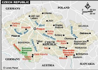
Czech And Slovak Republics then West into Northern Italy/France
(VERY STRONG for all areas)

----------------------------------------
2005/12/17 21:10:55.4 44.45 N 2.97 E 10 ML2.5 FRANCE
2005/12/19 19:35:11.0 41.03 N 22.37 E ML3.0 NORTHWESTERN BALKAN PEN.
2005-12-20 06:08:09 3.2 50.43 N 15.15 E Czech And Slovak Republics
(Took 2 days extra and not so strong.)
Southern Peru (Medium)
----------------------------------------
(Nothing found)
New Madrid Fault/possibly Tennessee (Medium)
----------------------------------------
map 1.8 2005/12/18 03:50:41 36.220 -89.610 8.4 6 km ( 4 mi) NE of Caruthersville, MO
map 1.8 2005/12/18 10:31:00 36.040 -89.830 8.4 2 km ( 1 mi) WSW of Cooter, MO
map 2.0 2005/12/18 20:29:56 36.550 -89.700 5.1 7 km ( 4 mi) S of Catron, MO
Strange Shaking
Andrew Findley
News 5
Dec 16, 2005
http://www.wkrg.com/servlet/Satellite?pagename=WKRG%2FMGArticle%2FKRG_BasicArticle&c=MGArticle&cid=1128768768378&path=%21news%21local
A mysterious force shook buildings from Pascagoula, Mississippi to Chumuckla, Florida Friday morning, but no one News 5 talked to knows exactly what caused it. Sometime between 9:00 and 9:30 am, a thunderous sound rumbled through the Gulf Coast. Not everyone felt it, but those who did all described it in much the same way. Ruthstein Woods in Eight Mile said, "I was laying in the bed watching TV and all of a sudden, it was like big boom, like the ceiling or something was like falling. I jumped up and ran and looked, and I looked outside, but I didn't see anything. It was like real, real shaking and stuff."
Donny George in Midtown felt it, too. "It was more like a sonic boom. I questioned whether or not the space shuttle had come back into the atmosphere, because I'm from Florida. And when the space shuttle comes in there, it makes a sonic boom, rattles the windows," said George. He added, "It rattled the building, rattled the windows. I thought somebody had hit our building."
It shook Harvey Smith as well. "I just heard a loud boom, I thought maybe some kind of sonic boom or something like an airplane breaking the sound barrier, or...but it shook my house. I still don't know what it was."
People from as far away as Pascagoula, Mississippi to Flomaton, Alabama to Chumuckla, Florida called News 5 to tell us they heard and felt something. But because not everyone felt it, speculation rose from the ground to the air. Some suspected military aircraft causing sonic booms by breaking the sound barrier. But News 5 was unable to confirm whether it was a jet. So, the mystery and the speculation continue.
Possibly Georgia or South Carolina (Still working on this symptom) (Medium)
----------------------------------------
MAP 3.0 2005/12/20 00:52:20 30.275 -90.703 5.0 10 km ( 6 mi) ESE of French Settlement, LA
(This is close to my guesstimate but will need a repeat to be sure. Took 2 extra days.)
Puerto Rico (STRONG)
----------------------------------------
MAP 3.0 2005/12/18 08:23:51 18.898 -67.345 22.3 55 km ( 34 mi) NNW of Cabán, PR
MAP 3.3 2005/12/18 15:17:56 19.086 -64.897 12.0 72 km ( 45 mi) WNW of Settlement, British Virgin Islands
map 2.4 2005/12/18 16:17:32 18.112 -67.123 14.6 3 km ( 2 mi) NNW of Monte Grande, PR
MAP 3.1 2005/12/18 22:00:58 19.070 -67.838 29.6 101 km ( 63 mi) NW of Aguadilla, PR
Central Italy (Medium)
----------------------------------------
2005/12/18 08:06:48.8 42.49 N 13.20 E 40 ML3.1 CENTRAL ITALY
Turkey/Greece area
----------------------------------------
2005/12/18 05:12:52.0 36.31 N 24.32 E ML3.0 SOUTHERN GREECE
2005/12/18 18:31:48.0 37.91 N 23.87 E ML3.8 SOUTHERN GREECE
Coquimbo, Chile area
----------------------------------------
(Nothing found)
Northern Sumatra (EXTREMELY STRONG - multiple STRONG symptoms)
----------------------------------------
2005/12/18 04:23:17.1 2.92 N 96.19 E 89 mb5.1 NORTHERN SUMATERA, INDONESIA
Southern Alaska
----------------------------------------
map 2.4 2005/12/18 16:08:00 63.062 -150.911 120.0 77 km ( 48 mi) N of Petersville, AK
map 2.0 2005/12/18 19:53:34 63.272 -145.220 5.0 32 km ( 20 mi) NE of Paxson, AK
Ethiopia (STRONG)
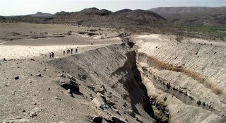
Split in Africa

----------------------------------------
(Nothing found)
Kazakhstan to Kyrgyzstan (Strong)
----------------------------------------
(Nothing found)
Hawaii
----------------------------------------
map 2.6 2005/12/18 00:00:21 19.174 -155.332 50.5 16 km ( 10 mi) ESE of Pahala, HI
map 2.2 2005/12/18 09:06:42 19.925 -155.321 12.2 11 km ( 7 mi) SW of Laupahoehoe, HI
MAP 3.0 2005/12/18 11:53:31 19.006 -155.483 36.1 13 km ( 8 mi) ESE of Naalehu, HI
map 2.0 2005/12/18 23:12:58 19.413 -155.626 2.5 28 km ( 17 mi) E of Honaunau-Napoopoo, HI
map 1.8 2005/12/19 15:49:46 19.333 -155.201 2.8 13 km ( 8 mi) SSE of Volcano, HI
Mt. Hood area (Medium)
----------------------------------------
(Nothing found)
Hokkaido
----------------------------------------
(Nothing found)
ANDREANOF ISLANDS, ALEUTIAN IS., ALASKA (Volcanic, I think. I had a burning sensation in the face the same time as the symptom for Aleutians.)
----------------------------------------
map 3.3 2005/12/19 01:32:32 51.986 179.214 180.0 RAT ISLANDS, ALEUTIAN ISLANDS, ALASKA
map 2.8 2005/12/19 04:29:23 51.100 -179.159 30.0 ANDREANOF ISLANDS, ALEUTIAN IS., ALASKA
Romania (May take extra days - Strong)
----------------------------------------
2005/12/18 15:09:47.3 45.41 N 26.04 E 73 ML3.6 ROMANIA
Lake Baykal, Russia area (Strong)
----------------------------------------
18Dec2005 01:31:22.6 57.4N 120.9E 33 MS=3.8 M GSR SOUTHEASTERN SIBERIA, RUSS0555
2005/12/18 12:06:51.8 57.45 N 120.69 E 2 mb4.6 SOUTHEASTERN SIBERIA, RUSSIA
18Dec2005 12:06:56.1 57.6N 120.7E 33 MS=3.8 M*GSR SOUTHEASTERN SIBERIA, RUSS1347
Possibly Jamaica/Central Caribbean
----------------------------------------
(Nothing found)
Coso Junction
----------------------------------------
map 1.4 2005/12/18 16:00:05 36.025 -117.771 3.1 16 km ( 10 mi) E of Coso Junction, CA
map 1.3 2005/12/18 19:49:29 36.020 -117.775 3.7 16 km ( 10 mi) E of Coso Junction, CA
Kuril Islands (STRONG)
----------------------------------------
2005-12-17 12:20:00 5.0 52.41 N 158.08 E Near East Coast of Kamchatka
Northern Mid-Atlantic Ridge (May take extra days)
----------------------------------------
2005/12/19 19:17:00.2 52.93 N 34.78 W 33 mb4.7 NORTH ATLANTIC OCEAN
Peace to all.

