*For Sunday, 20 November 2005.
Places to watch.
Good luck to all.
For Sunday, 20 November 2005.
----------------------------------------
Possibly Nigeria area (New symptom)
----------------------------------------
2005/11/22 01:21:22.5 36.70 N 4.22 E mb3.7 NORTHERN ALGERIA
2005/11/22 10:38:52.6 36.81 N 4.28 E mb4.2 NORTHERN ALGERIA
2005/11/23 08:36:42.1 36.93 N 3.85 E 2 mb4.6 NORTHERN ALGERIA
(2 and 3 extra days, if right. I am not sure about this symptom and area - will wait for a repeat.)
Turkey/Azerbaijan area
----------------------------------------
2005/11/20 01:16:41.0 39.83 N 39.56 E 21 MD3.0 TURKEY
Hawaii/Maui (Strong)
----------------------------------------
(Nothing found for this day but some came in on the 19th and the 21st.)
Southern Alaska
----------------------------------------
(Nothing found)
Afghanistan/Iran border area (Medium)
----------------------------------------
2005/11/20 16:11:09.2 30.86 N 56.74 E 10 M 4.1 NORTHERN AND CENTRAL IRAN
2005/11/20 16:36:22.0 32.17 N 55.53 E 8 M 3.7 NORTHERN AND CENTRAL IRAN
(More West than expected.)
Utah/Nevada
----------------------------------------
map 1.5 2005/11/20 01:07:28 39.444 -119.624 0.0 16 km ( 10 mi) SE of Sparks, NV
map 2.6 2005/11/20 10:24:29 41.367 -111.691 2.8 14 km ( 9 mi) NNE of Huntsville, UT
map 1.0 2005/11/20 10:27:33 41.373 -111.689 10.8 14 km ( 9 mi) NNE of Huntsville, UT
map 2.7 2005/11/20 10:24:29 41.364 -111.700 0.8 13 km ( 8 mi) NNE of Huntsville, UT
map 1.8 2005/11/20 18:11:03 39.673 -110.522 1.1 17 km ( 11 mi) NNW of East Carbon, UT
map 2.1 2005/11/20 21:10:39 38.605 -119.481 2.2 26 km ( 16 mi) SSW of Smith, NV
map 1.7 2005/11/20 21:29:36 39.711 -110.737 0.9 11 km ( 7 mi) ENE of Helper, UT
map 1.8 2005/11/20 22:55:57 39.453 -111.214 6.4 23 km ( 14 mi) ESE of Mount Pleasant, UT
Guatamala/Nicaragua (Strong)
----------------------------------------
05/11/20 22:01:23 12.67N 86.78W 9.7 1.6MC Nicaragua
05/11/20 21:56:46 12.58N 86.76W 2.1 1.0MC Cerca del Volcan Cerro Negro
05/11/20 17:58:06 13.88N 84.35W 30.7 3.8MC Nicaragua
05/11/20 17:17:18 12.20N 87.53W 18.3 2.5MC Frente a Corinto
05/11/20 16:54:37 12.00N 88.58W 18.0 3.5MC Oceano Pacífico de Nicaragua
05/11/20 16:08:44 12.66N 86.62W 16.4 1.7MC Nicaragua
05/11/20 15:37:50 13.43N 90.57W 5.0 4.6MC Frente a Guatemala
05/11/20 15:31:21 12.56N 86.78W 4.5 2.2MC Cerca del Volcan Cerro Negro
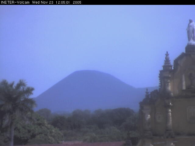
(Half of what happened on the 20th. Posting a picture of the Cerro Negro Volcano.)
http://www.ineter.gob.ni/geofisica/webcam/v_cerronegro/index.htmlvolcano
Finland area (Medium)
----------------------------------------
SOUTHWESTERN FINLAND FINLAND
Origin time Lat Lon Azres Timres Wres Nphase Ntot Nsta Netmag
2005-321:12.33.07.0 60.54 26.49 5.85 0.48 1.94 2 3 2 2.21
FINLAND-KARELIA BORDER REGION
Origin time Lat Lon Azres Timres Wres Nphase Ntot Nsta Netmag
2005-322:12.31.13.0 68.88 29.90 15.05 0.70 4.46 6 11 3 2.07
Campell River, Canada in Pacific Ocean
----------------------------------------
MAP 5.2 2005/11/19 12:40:06 48.691 -128.543 10.0 280 km (174 mi) WSW of Campbell River, Canada
Honshu to Hokkaido (VERY STRONG)
----------------------------------------
2005/11/21 15:36:17.6 31.13 N 130.07 E 33 mb6.2 KYUSHU, JAPAN
(Much further south than I thought)
Santa Monica, California area
----------------------------------------
map 1.7 2005/11/19 13:49:52 34.030 -118.529 12.1 5 km ( 3 mi) WNW of Santa Monica, CA
map 1.6 2005/11/21 16:21:18 33.633 -117.607 12.2 2 km ( 1 mi) SW of Rancho Santa Margarita, CA
map 1.5 2005/11/21 07:46:04 38.053 -122.255 7.7 2 km ( 2 mi) NNE of Rodeo, CA
Parkfield area
----------------------------------------
map 1.6 2005/11/22 03:39:37 36.012 -120.571 3.9 18 km ( 11 mi) NW of Parkfield, CA
map 2.7 2005/11/22 03:38:02 36.009 -120.572 5.0 17 km ( 11 mi) NW of Parkfield, CA
(Took 2 extra days.)
Vanuatu Islands (VERY STRONG)
----------------------------------------
(Came in on the 21st and posted it there - two different symptoms on two different days.)
Caroline Islands to Papua New Guinea and then Volcano Islands (VERY STRONG)
----------------------------------------
005/11/20 01:06:46.5 2.37 N 128.40 E 165 M 4.7 HALMAHERA, INDONESIA
20Nov2005 19:34:45.8 7.3S 123.8E 33 mb=5.3 M GSR BANDA SEA 2042
21Nov2005 07:12:41.9 1.2S 137.3E 33 mb=5.2 M GSR NEAR NORTH COAST OF IRIAN 0809
21Nov2005 05:20:17.6 2.4N 126.9E 33 mb=5.1 M GSR NORTHERN MOLUCCA SEA 0610
23Nov2005 22:35:47.9 3.0N 132.4E100 mb=5.2 M*GSR WESTERN CAROLINE ISLANDS 0000
(3 extra days for Caroline Islands)
New Madrid Fault/Missouri (Medium)
----------------------------------------
(Nothing found)
San Francisco area (non-specific but STRONG)
----------------------------------------
map 1.5 2005/11/21 07:46:04 38.053 -122.255 7.7 2 km ( 2 mi) NNE of Rodeo, CA
map 1.2 2005/11/22 08:51:10 37.900 -121.979 8.1 6 km ( 4 mi) SW of Clayton, CA
map 1.0 2005/11/22 14:25:45 37.761 -122.568 11.4 7 km ( 4 mi) WNW of San Francisco Zoo
map 2.5 2005/11/24 00:49:19 37.384 -121.741 6.6 SAN FRANCISCO BAY AREA, CALIFORNIA
(4 extra days)
Central Italy/Adriatic Sea then Greece/Athens area (STRONG for Greece/Athens area)
----------------------------------------
2005/11/20 05:03:08.1 38.25 N 26.69 E 20 MD3.4 AEGEAN SEA
2005/11/20 14:15:53.7 38.20 N 26.76 E 23 MD3.2 AEGEAN SEA
2005/11/20 17:56:41.6 38.44 N 21.86 E 2 ML3.8 GREECE
2005/11/20 21:20:58.6 35.32 N 27.31 E 50f ML4.0 DODECANESE ISLANDS, GREECE
2005/11/21 02:10:20.0 36.86 N 21.40 E ML3.2 SOUTHERN GREECE
Strait of Gibraltar (Strong)
----------------------------------------
2005/11/20 22:41:13.8 42.74 N 10.95 W 33f ML2.7 NORTH ATLANTIC OCEAN
(More North than expected.)
2005/11/21 19:50:26.7 34.14 N 5.14 W mb3.5 MOROCCO
Taiwan area (STRONG)
----------------------------------------
(Nothing found)
Sumatra (STRONG)
----------------------------------------
20Nov2005 15:31:00.9 11.4S 111.6E 33 mb=5.0 M GSR SOUTH OF JAWA, INDONESIA 1624
The Geysers (Strong)
----------------------------------------
map 1.3 2005/11/20 17:56:21 38.809 -122.791 1.9 2 km ( 1 mi) NE of The Geysers, CA
map 1.5 2005/11/20 19:52:49 38.808 -122.791 2.3 2 km ( 1 mi) NE of The Geysers, CA
map 1.5 2005/11/20 23:27:20 38.824 -122.870 2.2 6 km ( 4 mi) WNW of The Geysers, CA
map 2.2 2005/11/21 01:36:42 38.815 -122.818 3.4 2 km ( 1 mi) NNW of The Geysers, CA
map 2.0 2005/11/21 19:46:18 38.826 -122.868 2.5 6 km ( 4 mi) WNW of The Geysers, CA
map 1.4 2005/11/21 20:57:42 38.826 -122.871 2.0 6 km ( 4 mi) WNW of The Geysers, CA
map 2.4 2005/11/21 21:10:15 38.830 -122.868 2.7 6 km ( 4 mi) WNW of The Geysers, CA
map 1.4 2005/11/21 22:39:53 38.821 -122.803 4.3 3 km ( 2 mi) N of The Geysers, CA
Peace to all.

posted by Unknown @ 11:08 AM
0 comments
![]()
![]()
