*For Tuesday, 13 December 2005.
Places to watch.
Good luck to all.
For Tuesday, 13 December 2005.
----------------------------------------
Poland (EXTREMELY STRONG)
Poland

----------------------------------------
(Nothing found - may still be coming or might never happen like the Jordan/Syria EXTREMELY STRONG that never occurred.)
Utah
----------------------------------------
map 1.5 2005/12/13 02:46:09 39.455 -111.215 4.6 23 km ( 14 mi) ESE of Mount Pleasant, UT
map 1.6 2005/12/13 07:59:15 37.127 -112.880 7.6 12 km ( 8 mi) ESE of Springdale, UT
map 1.6 2005/12/13 19:29:23 39.726 -110.802 0.4 6 km ( 4 mi) NE of Helper, UT
Azores area
----------------------------------------
2005/12/14 08:59:48.5 36.96 N 10.35 W mb3.8 NORTH ATLANTIC OCEAN
Viking Graben area (61.03 2.61) (MEDIUM)
----------------------------------------
WESTERN LOFOTEN BASIN
Origin time Lat Lon Azres Timres Wres Nphase Ntot Nsta Netmag
2005-345:03.52.53.0 69.65 -1.49 0.65 0.41 0.57 2 3 1 1.98
Possibly Burma/China area (New symptom)
----------------------------------------
2005/12/14 07:10:09.9 30.77 N 79.23 E 200 mb4.9 WESTERN XIZANG-INDIA BDR REG
2005/12/14 17:21:45.0 38.21 N 81.33 E ML3.1 SOUTHERN XINJIANG, CHINA
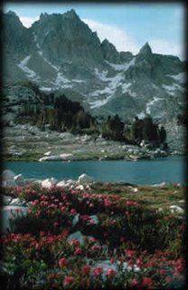
Mammoth Lakes/Tom's Place area (Extremely Strong)
John Muir Wilderness

----------------------------------------
map 1.2 2005/12/16 07:19:12 37.578 -118.846 10.3 13 km ( 8 mi) ESE of Mammoth Lakes, CA
map 2.5 2005/12/16 09:26:44 37.446 -118.841 9.3 19 km ( 12 mi) SW of Toms Place, CA
map 1.5 2005/12/16 09:49:51 37.447 -118.843 7.9 19 km ( 12 mi) SW of Toms Place, CA
map 1.0 2005/12/16 10:10:21 37.446 -118.844 8.8 19 km ( 12 mi) SW of Toms Place, CA
map 1.5 2005/12/16 11:58:31 37.447 -118.844 8.0 19 km ( 12 mi) SW of Toms Place, CA
(This took 3 extra days to start (Normal for STRONG or more) and may not be finished yet.)
Southern Alaska
----------------------------------------
map 2.5 2005/12/13 06:19:47 63.112 -148.883 160.0 CENTRAL ALASKA
(Southcentral)
New Madrid Fault
----------------------------------------
map 1.5 2005/12/13 17:42:44 35.630 -84.310 9.2 9 km ( 5 mi) WNW of Vonore, TN
Possibly Emperor Seamounts in North Pacific
----------------------------------------
(Nothing found)
Seattle area
----------------------------------------
map 2.3 2005/12/14 14:02:14 47.534 -122.052 17.8 1 km ( 0 mi) WSW of Issaquah, WA
Kermadec Islands (Strong)
----------------------------------------
2005/12/11 20:26:41.6 29.77 S 177.50 W 33 mb5.4 KERMADEC ISLANDS, NEW ZEALAND
(2 days early)
2005/12/13 03:16:09.0 15.30 S 178.53 W 33 Mw6.6 FIJI ISLANDS REGION
2005/12/13 07:32:34.8 15.17 S 178.85 W 33 mb5.2 FIJI ISLANDS REGION
2005-12-13 20:02:59 5.5 18.12 S 178.76 W Fiji Islands Region
West Yellowstone, Montana
----------------------------------------
(Nothing found)
Finland/Norway/Sweden area (Stronger stuff - Strong)
----------------------------------------
NORWAY BASIN
Origin time Lat Lon Azres Timres Wres Nphase Ntot Nsta Netmag
2005-344:04.47.50.0 67.61 -0.94 3.95 3.69 4.67 2 3 1 2.13
VAESTMANLAND REGION SWEDEN
Origin time Lat Lon Azres Timres Wres Nphase Ntot Nsta Netmag
2005-345:03.06.30.0 60.02 16.53 18.58 1.26 5.91 3 5 2 2.54
Hokkaido area then South into Sea of Japan area (STRONG for Sea of Japan)
----------------------------------------
2005/12/13 19:01:38.6 55.69 N 161.75 E 100 mb4.5 NEAR E. CST KAMCHATKA PEN.
(Nothing for the Sea of Japan)
North California to Tahoe area (More than one area and non-specific - Strong)
----------------------------------------
(Nothing found)
Yucca Valley/Ludlow, California area
----------------------------------------
map 1.4 2005/12/13 02:06:59 34.676 -116.346 4.7 18 km ( 11 mi) WSW of Ludlow, CA
map 1.5 2005/12/13 16:04:58 34.359 -116.452 7.7 26 km ( 16 mi) N of Yucca Valley, CA
map 1.4 2005/12/13 16:18:59 34.365 -116.452 9.6 27 km ( 17 mi) N of Yucca Valley, CA
map 1.0 2005/12/13 21:42:37 34.582 -116.288 7.9 19 km ( 12 mi) SW of Ludlow, CA
Turkey area
----------------------------------------
2005/12/13 00:23:47.5 34.78 N 25.33 E 45 ML4.0 CRETE, GREECE
2005/12/13 01:02:20.9 39.49 N 41.14 E 5 MD3.4 TURKEY
2005/12/13 01:21:27.0 37.06 N 25.55 E ML3.6 DODECANESE ISLANDS, GREECE
2005/12/13 01:29:01.5 38.22 N 26.58 E 5 MD2.8 AEGEAN SEA
2005/12/13 02:50:32.0 38.14 N 26.65 E 5 MD3.0 AEGEAN SEA
2005/12/13 10:27:54.3 37.01 N 27.90 E 29 MD2.9 TURKEY
2005/12/13 12:20:32.7 38.14 N 26.82 E 28 MD3.2 AEGEAN SEA
2005/12/13 14:22:25.8 38.12 N 26.70 E 12 MD3.0 AEGEAN SEA
2005/12/13 14:32:27.4 40.38 N 26.20 E 11 ML3.2 TURKEY
2005/12/13 14:37:40.6 40.34 N 29.13 E 20 MD2.8 TURKEY
2005/12/13 17:06:50.6 38.17 N 26.67 E 7 MD3.1 AEGEAN SEA
2005/12/13 18:02:56.6 39.92 N 39.65 E 8 MD3.3 TURKEY
2005/12/13 18:56:42.6 39.96 N 39.54 E 18 MD3.2 TURKEY
2005/12/13 19:23:57.8 37.62 N 27.09 E 8 ML3.2 TURKEY
Guatamala (Strong)
----------------------------------------
05/12/13 23:50:08 11.76N 86.33W 84.2 2.2ML Carazo
05/12/13 12:03:42 11.21N 86.79W 15.1 3.9ML Frente a La Boquita y Casares
05/12/13 08:14:33 13.27N 90.33W 15.0 4.6MC Frente a El Salvador
05/12/13 03:30:26 12.75N 89.20W 19.9 3.9MC Frente a El Salvador
Peace to all.

