*For Saturday, 19 November 2005.
Places to watch.
Good luck to all.
For Saturday, 19 November 2005.
----------------------------------------
In the Eastern States/possibly New York at Erie
----------------------------------------
map 2.4 2005/11/19 20:02:20 33.000 -80.200 5.0 2 km ( 1 mi) WSW of Summerville, SC
Costa Rica/Nicaragua into Caribbean Sea (Medium)
----------------------------------------
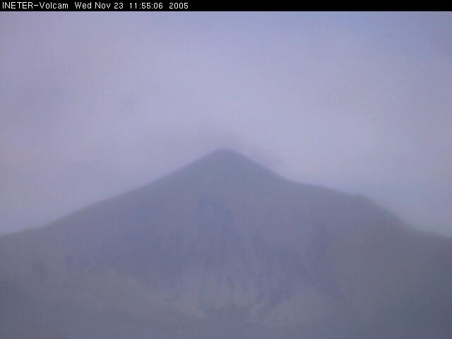
05/11/20 11:11:31 12.61N 86.88W 8.9 2.1MC Cerca del volcan Telica
05/11/20 10:32:05 12.56N 86.90W 9.3 1.4MC Cerca del volcan Telica
05/11/20 09:24:17 12.55N 86.90W 9.4 1.4MC Cerca del volcan Telica
05/11/20 08:52:38 12.54N 86.92W 21.5 2.5MC Cerca del volcan Telica
05/11/20 08:49:49 12.57N 86.89W 8.5 2.0MC Cerca del volcan Telica
05/11/20 06:04:46 12.85N 88.74W 57.1 4.4ML Frente a El Salvador
05/11/20 03:35:36 11.18N 86.74W 40.0 3.0ML Frente a La Boquita y Casares
(Nothing for the 19th but a lot for the 20th. I am including half on this posting plus a picture of the Telica Volcano - where most of the movement was.)
http://www.ineter.gob.ni/geofisica/webcam/v_telica/index.htmlTelica
Southern Italy/Adriatic Sea/to Albania (Medium)
----------------------------------------
2005/11/18 18:35:00.0 39.15 N 17.23 E 16 ML3.5 SOUTHERN ITALY
Kazakhstan to Kyrgyzstan (Strong)
----------------------------------------
MAP 4.2 2005/11/19 11:38:04 34.412 73.896 10.0 PAKISTAN
(More south than expected.)
Between San Francisco and The Geysers on the coast (Medium)
----------------------------------------
(Nothing found)
Possibly North Pacific/Hawaii area (non-specific)
----------------------------------------
map 2.2 2005/11/19 09:03:26 19.431 -155.620 2.4 28 km ( 17 mi) E of Honaunau-Napoopoo, HI
map 2.4 2005/11/19 10:11:40 20.375 -155.094 3.5 46 km ( 29 mi) NNE of Laupahoehoe, HI
map 2.0 2005/11/19 17:27:33 19.268 -155.439 9.1 8 km ( 5 mi) NNE of Pahala, HI
Central Chile/Argentina area (Medium)
----------------------------------------
2005 1119 0647 35.7DL -31.924 -71.616 55.8 GUC 8 0.2 2.4CGUC 2.6LGUC
2005 1119 0552 32.8SL -35.141 -70.442 20.4 GUC 14 0.2 3.3CGUC 2.8LGUC
Switzerland/France/Northern Italy
----------------------------------------
2005/11/19 06:42:48.0 46.01 N 6.88 E 10 ML2.2 SWITZERLAND
2005/11/19 20:42:37.7 42.76 N 7.25 W 10 ML3.2 SPAIN
2005/11/19 20:49:25.0 42.72 N 7.22 W ML2.1 SPAIN
20Nov2005 02:49:07.5 45.7N 7.9E 2 ML=1.5 M*SED NORTHERN ITALY
2005/11/20 02:59:37.7 45.67 N 7.84 E 2 ML3.1 NORTHERN ITALY
20Nov2005 03:21:07.3 45.8N 7.8E 2 ML=1.4 M*SED Brusson / Italy
2005/11/20 10:48:57.4 45.42 N 9.10 E 10 ML4.0 NORTHERN ITALY
Alaska Peninsula at Southern Alaska area and then Southern Alaska (Both of these symptoms are on the right side of my skull. But this time the pain seemed to move into the teeth. Don't know if that means anything yet. - Medium)
----------------------------------------
MAP 4.3 2005/11/19 01:18:39 61.494 -149.739 42.6 SOUTHERN ALASKA
map 2.5 2005/11/19 01:52:00 57.325 -156.742 102.0 ALASKA PENINSULA
map 3.7 2005/11/19 04:51:19 60.468 -152.942 1.0 SOUTHERN ALASKA
map 3.9 2005/11/19 11:15:48 61.489 -149.743 43.1 SOUTHERN ALASKA
map 3.1 2005/11/20 03:00:20 60.818 -150.150 60.0 KENAI PENINSULA, ALASKA
map 3.8 2005/11/20 15:06:08 53.867 -164.163 50.0 UNIMAK ISLAND REGION, ALASKA
map 3.2 2005/11/20 14:50:21 53.960 -164.059 35.0 UNIMAK ISLAND REGION, ALASKA
map 3.2 2005/11/20 14:02:14 53.651 -163.952 1.0 UNIMAK ISLAND REGION, ALASKA
map 3.3 2005/11/20 13:48:51 53.675 -163.879 1.0 UNIMAK ISLAND REGION, ALASKA
map 3.0 2005/11/20 13:14:29 53.632 -163.837 1.0 UNIMAK ISLAND REGION, ALASKA
MAP 6.0 2005/11/20 12:53:06 54.122 -164.168 52.8 UNIMAK ISLAND REGION, ALASKA
(This might be the 'into the teeth' sensation - not sure.)
The Philippines (Strong)
----------------------------------------
18Nov2005 04:34:00.0 14.6N 123.4E 33 mb=5.4 M*GSR LUZON, PHILIPPINE ISLANDS 0705
2005/11/19 17:55:10.0 6.22 N 125.91 E 91 M 5.4 MINDANAO, PHILIPPINE ISLANDS
21Nov2005 16:19:00.1 10.9N 125.3E100 mb=5.1 M GSR LEYTE, PHILIPPINE ISLANDS 1732
Pinnacles/Parkfield Fault (Medium)
----------------------------------------
map 1.9 2005/11/19 04:33:11 36.471 -121.045 4.8 11 km ( 7 mi) SE of Pinnacles, CA
Turkey (STRONG)
----------------------------------------
2005/11/19 04:52:26.9 38.16 N 26.68 E 15 ML3.2 AEGEAN SEA
2005/11/19 11:05:52.0 38.13 N 26.80 E ML3.0 AEGEAN SEA
2005/11/19 18:58:38.1 38.19 N 26.70 E 20 MD3.3 AEGEAN SEA
2005/11/20 14:00:24.8 40.44 N 26.36 E 20 MD3.0 TURKEY
Northern Sumatra
----------------------------------------
2005/11/19 06:38:53.8 2.86 N 95.45 E 40f mb5.1 OFF W. CST OF NORTHERN SUMATERA
2005/11/19 14:10:09.6 2.24 N 96.83 E 2 Mw6.5 NORTHERN SUMATERA, INDONESIA
2005/11/19 17:11:38.9 4.23 S 103.34 E 10 mb5.3 SOUTHERN SUMATERA, INDONESIA
Hokkaido area (Strong)
----------------------------------------
2005/11/18 09:30:36.8 44.27 N 144.89 E 150 mb4.6 HOKKAIDO, JAPAN, REGION
Shetland-Orkney Islands (60.22 -0.33)
----------------------------------------
(Nothing found)
Puerto Rico (Medium)
----------------------------------------
map 2.1 2005/11/18 06:21:10 18.209 -67.008 31.5 4 km ( 3 mi) NW of Maricao, PR
map 2.2 2005/11/18 08:09:22 17.791 -66.880 8.2 21 km ( 13 mi) SSE of Guánica, PR
map 2.5 2005/11/18 15:30:56 17.877 -66.558 15.2 15 km ( 9 mi) SSW of Potala Pastillo, PR
MAP 3.3 2005/11/18 17:15:42 19.278 -68.011 35.0 104 km ( 64 mi) NE of Higüey, Dominican Republic
MAP 3.7 2005/11/19 15:15:16 18.301 -68.370 102.1 50 km ( 31 mi) SE of Higüey, Dominican Republic
Germany/Poland/Denmark area (New symptom - Strong)
----------------------------------------
2005/11/19 01:13:32.2 51.20 N 15.96 E 10 ML2.2 POLAND
Mt. St. Helen's and then near Seattle
----------------------------------------
map 1.4 2005/11/19 01:37:22 46.195 -122.186 0.0 1 km ( 0 mi) SW of Mount St. Helens Volcano, WA
map 1.4 2005/11/19 02:40:38 46.195 -122.187 0.0 1 km ( 0 mi) SW of Mount St. Helens Volcano, WA
map 1.3 2005/11/19 23:12:40 46.196 -122.187 0.0 1 km ( 0 mi) SW of Mount St. Helens Volcano, WA
map 1.3 2005/11/19 22:34:56 48.865 -122.107 2.4 6 km ( 4 mi) SSE of Kendall, WA
(Kendall quake is much further north than I thought.)
Possibly Burma/Laos (New symptom - STRONG. I'll know for sure after this happens whether I am off on my guesstimate.)
----------------------------------------
2005/11/18 18:56:47.2 26.40 N 96.43 E 33 mb5.2 MYANMAR
Tonga area
----------------------------------------
MAP 4.5 2005/11/19 12:17:21 -22.060 -178.491 390.7 SOUTH OF THE FIJI ISLANDS
Strait of Gibraltar (Medium)
----------------------------------------
2005/11/19 20:40:28.1 36.59 N 5.41 E 31 mb4.1 NORTHERN ALGERIA
Peace to all.

posted by Unknown @ 1:08 PM
0 comments
![]()
![]()
