*For Tuesday, 5 September 2006.
LEGEND for OVERVIEW: Size = My surety of area for quake.
Red Circle = Probable quake to STRONG quake.
Triangle = Very Strong/Stronger quake (Usually takes extra days).
Blue Circle, etc. = Uncertainty of symptom area for probable quake.

Places to watch.
Good luck to all.
For Tuesday, 5 September 2006.
---------------------------------------
KYRGYZSTAN-XINJIANG BDR REG
(40.39N 75.74E) (STRONG)
---------------------------------------
05Sep2006 04:54:39.7 36.9N 70.7E180 mb=4.9 M GSR HINDU KUSH REGION, AFGHANI
2006-09-06 07:51:47.0 40.37N 76.86E 60 mb4.9 KYRGYZSTAN-XINJIANG BDR REG
2006-09-06 15:42:47.0 37.70N 77.10E ML3.0 SOUTHERN XINJIANG, CHINA
TALAUD ISLANDS, INDONESIA
(3.1N 125.2E) (STRONG)
---------------------------------------
2006-09-05 04:52:59.6 7.71N 126.51E 124 mb5.6 MINDANAO, PHILIPPINE ISLANDS
Strait of Gibraltar/Madeira Islands area
(STRONG)
---------------------------------------
2006-09-06 19:49:02.0 36.88N 8.30W 5 ML2.1 WEST OF GIBRALTAR
NORTHERN SUMATERA (1.17N 96.80E)
---------------------------------------
06Sep2006 03:18:35.8 0.8N 97.3E 33 mb=5.0 M GSR NORTHERN SUMATERA, INDONES
Central Virgin Islands (STRONG-2 areas)
---------------------------------------
2.6 2006/09/05 00:02:51 18.887N -64.642W 13.9 38 km (24 mi) WNW of Settlement, Anegada, British Virgin Islands
2.7 2006/09/06 21:19:54 17.602N -64.094W 5.3 67 km (42 mi) ESE of Christiansted, Saint Croix, US Virgin Islands
2.2 2006/09/06 21:17:02 18.610N -64.483W 10.0 18 km (11 mi) NNW of Spanish Town, Virgin Gorda, British Virgin Islands
3.0 2006/09/06 19:22:54 18.942N -64.704W 4.3 47 km (29 mi) WNW of Settlement, Anegada, British Virgin Islands
2.6 2006/09/06 19:05:30 18.729N -64.298W 35.0 2 km ( 1 mi) E of Settlement, Anegada, British Virgin Islands
3.5 2006/09/07 18:09:59 18.717N -64.192W 33.2 14 km ( 8 mi) E of Settlement, Anegada, British Virgin Islands
2.7 2006/09/07 03:58:18 18.669N -64.912W 23.2 34 km (21 mi) NW of Little Harbour, Jost van Dyke, British Virgin Islands
2.9 2006/09/07 03:12:37 18.387N -64.258W 71.7 8 km ( 5 mi) W of West End, Tortola, British Virgin Islands
Honshu, Japan (Medium)
---------------------------------------
(Posted 2 on the 6th)
The New Madrid Fault/Barbourville, KY area
(36.940 -83.810) (Strong but may be for
more than Kentucky area, only one symptom
specific to Kentucky area.)
---------------------------------------
1.8 2006/09/05 22:42:48 36.270N 89.500W 7.1 1 km ( 1 mi) NW of Ridgely, TN
Huntingdon, QC area (45.00N 74.42W)
(This is very close to the New York posted
for 4 September - already at STRONG but
I will not up the alert again.)
---------------------------------------
2006/09/05 08:13:54 45.19N 66.84W 5.0* 2.2MN 21 km NE from Saint Andrews,NB
2006/09/05 22:38:29 49.23N 67.99W 18.0* 1.2MN 12 km E from Baie-Comeau,QC
Moreno Valley, CA (33.929 -117.211)
---------------------------------------
1.3 2006/09/05 04:29:19 34.032 -117.560 13.1 7 km ( 4 mi) WNW of Glen Avon, CA
EASTERN GULF OF ADEN area (14.38N 51.17E)
(Very Strong)
Port of Aden
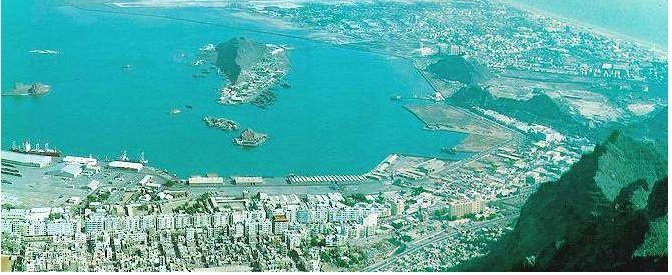
---------------------------------------
2006-09-09 12:22:05 5.2 24.79N 62.27E 10 Off Coast of Pakistan
(4 extra days and more East and North than expected.)
Central Italy (Medium)
---------------------------------------
2006-09-05 06:43:48.0 42.36N 13.38E 11 ML2.1 CENTRAL ITALY
Germany and Poland
---------------------------------------
2006-09-05 01:17:13.9 51.35N 16.18E ML2.1 POLAND
2006-09-05 11:00:26.8 50.22N 12.67E ML2.0 GERMANY
2006-09-05 16:31:01.6 51.31N 16.30E 10 ML2.7 POLAND
LAKE TANGANYIKA REGION (6.96S 29.80E)
---------------------------------------
(Nothing found)
San Francisco Zoo (37.734 -122.604)
---------------------------------------
1.3 2006/09/03 02:18:59 37.751 -122.570 10.3 6 km ( 4 mi) WNW of San Francisco Zoo
(2 days early)
1.1 2006/09/05 00:48:33 37.829 -121.791 11.4 11 km ( 7 mi) E of Blackhawk, CA
1.5 2006/09/05 19:50:49 37.981 -122.465 0.5 5 km ( 3 mi) E of San Rafael, CA
1.8 2006/09/05 21:35:49 38.021 -122.261 7.8 1 km ( 1 mi) S of Rodeo, CA
1.6Q 2006/09/05 21:39:44 37.326 -122.103 0.1 0 km ( 0 mi) SSE of Quarry near Cupertino, CA(Probable quarry explosion)
FRANCE area/Humber (47.74N 4.98W)
(Second day symptom - STRONG)
---------------------------------------
FAROES-HEBRIDES REGION
Origin time Lat Lon Azres Timres Wres Nphase Ntot Nsta Netmag
2006-248:08.49.04.0 61.66 -1.35 12.25 3.27 6.33 3 4 2 3.21
SHETLAND-ORKNEY ISLANDS
Origin time Lat Lon Azres Timres Wres Nphase Ntot Nsta Netmag
2006-248:10.16.08.0 61.01 -1.99 13.29 4.18 7.50 3 3 1 3.07
West Yellowstone, MT (44.579 -110.899)
(Strong)
---------------------------------------
1.0 2006/09/04 07:48:33 44.801 -110.835 4.4 26 km(16 mi) NE of West Yellowstone, MT
1.3 2006/09/04 09:48:05 45.300 -112.596 0.0 10 km(6 mi) NNE of Dillon, MT
2.2 2006/09/05 21:51:17 44.771 -110.801 7.4 27 km(17 mi)ENE of West Yellowstone, MT
1.4 2006/09/06 03:44:29 44.770 -110.801 7.7 27 km(17 mi)ENE of West Yellowstone, MT
1.4 2006/09/06 04:09:59 44.678 -110.409 5.5 47 km(29 mi)SSE of Gardiner, MT
1.5 2006/09/06 08:29:18 44.750 -111.051 7.0 11 km(7 mi) NNE of West Yellowstone, MT
1.0 2006/09/07 17:33:32 45.320 -112.518 0.4 15 km(9 mi) NE of Dillon, MT
1.1 2006/09/07 21:03:16 44.803 -110.848 1.1 26 km(16 mi)NE of West Yellowstone, MT
(2 extra days)
2.8 2006/09/08 01:09:45 44.779 -110.394 3.2 38 km ( 24 mi) SE of Gardiner, MT
1.4 2006/09/08 01:13:01 44.755 -110.406 2.0 40 km ( 25 mi) SE of Gardiner, MT
1.1 2006/09/08 01:17:41 44.812 -110.403 7.0 35 km ( 22 mi) SE of Gardiner, MT
(3 extra days)
Dominican Republic/Puerto Rico (Could
consider second day symptom but not
necessarily same area.)
---------------------------------------
2.8 2006/09/05 11:24:55 19.113N -66.459W 21.3 73 km (45 mi) N of Tierras Nuevas Poniente, PR
2.2 2006/09/05 07:02:19 17.819N -67.008W 15.7 18 km (11 mi) SSE of La Parguera, PR
3.4 2006/09/05 06:11:05 19.183N -68.418W 26.2 70 km (43 mi) NNE of Higüey, La Altagracia, Dominican Republic
3.3 2006/09/05 05:11:01 18.956N -65.512W 5.0 68 km (42 mi) NNE of Vieques, PR
3.0 2006/09/05 02:56:07 19.093N -65.510W 77.6 82 km (51 mi) NNE of Vieques, PR
Hawaii
---------------------------------------
2.4 2006/09/05 01:11:47 19.905 -155.797 21.3 4 km ( 3 mi) S of Waikoloa Village, HI
3.3 2006/09/05 03:27:39 19.903 -155.988 11.3 13 km ( 8 mi) WSW of Puako, HI
2.9 2006/09/05 09:53:03 19.300 -155.383 4.6 15 km ( 9 mi) NE of Pahala, HI
1.8 2006/09/05 13:28:57 19.370 -155.184 2.5 10 km ( 6 mi) SSE of Volcano, HI
1.8 2006/09/05 22:06:09 19.376 -155.288 2.9 10 km ( 6 mi) SW of Volcano, HI
Peace to all.

posted by Unknown @ 3:08 PM
0 comments
![]()
![]()
