*For Monday, 26 December 2005.
Places to watch.
Good luck to all.
For Monday, 26 December 2005.
----------------------------------------
Pinnacles and North of
----------------------------------------
map 2.8 2005/12/26 01:38:05 36.650 -121.270 6.7 16 km ( 10 mi) SSE of Tres Pinos, CA
map 2.4 2005/12/26 03:23:51 36.652 -121.274 6.8 16 km ( 10 mi) SSE of Tres Pinos, CA
map 2.7 2005/12/26 04:41:46 36.651 -121.272 6.7 16 km ( 10 mi) SSE of Tres Pinos, CA
map 1.4 2005/12/26 04:51:12 36.648 -121.275 5.6 16 km ( 10 mi) SSE of Tres Pinos, CA
map 1.1 2005/12/28 01:07:03 36.641 -121.236 6.8 15 km ( 9 mi) NW of Pinnacles, CA
map 2.1 2005/12/28 01:04:10 36.641 -121.234 7.4 15 km ( 9 mi) NW of Pinnacles, CA
(2 extra days)
Finland/Norway/Sweden
----------------------------------------
TROMS NORWAY
Origin time Lat Lon Azres Timres Wres Nphase Ntot Nsta Netmag
2005-358:10.39.07.0 69.97 20.56 7.81 5.20 7.15 3 4 1 2.37
Eastern Sea of Japan (STRONG)
----------------------------------------
2005-12-27 10:31:44 5.4 36.90 N 135.09 E Sea of Japan
Kurlis
----------------------------------------
(Nothing found)
Alaska Peninsula (Medium)
----------------------------------------
map 2.6 2005/12/26 02:17:17 55.869 -159.322 100.0 ALASKA PENINSULA
Mariana Islands (Medium)
----------------------------------------
2005/12/26 04:29:32.3 12.29 N 141.27 E 33 mb5.3 SOUTH OF MARIANA ISLANDS
2005/12/26 05:24:08.7 17.29 N 145.21 E 33 mb5.6 MARIANA ISLANDS
2005-12-27 09:34:04 5.1 19.21 N 146.07 E Mariana Islands Region
Virgin Islands area
----------------------------------------
South Sandwich Islands area
----------------------------------------
2005-12-25 18:47:51 5.3 57.22 S 25.73 W South Sandwich Islands Region
North of Oceanside, California (Medium)
----------------------------------------
(Nothing found)
Offshore Northern California/Petrolia level
----------------------------------------
(Nothing found)
Moluccas/Banda Sea area (EXTREMELY STRONG)
The Moluccas

----------------------------------------
2005-12-24 21:40:54 5.0 2.49 N 127.24 E Northern Molucca Sea
(2 days early - I think more is coming)
South of the Aleutians (Unusual dislocation spike of pain in the right neck backside lower part.)
----------------------------------------
MAP 4.2 2005/12/26 06:51:18 51.269 178.576 50.0 RAT ISLANDS, ALEUTIAN ISLANDS, ALASKA
Northcentral Iran (MEDIUM)
----------------------------------------
2005/12/26 00:14:02.4 31.61 N 50.14 E 50 M 4.0 NORTHERN AND CENTRAL IRAN
2005/12/26 00:52:37.7 31.61 N 50.03 E 10 M 3.6 NORTHERN AND CENTRAL IRAN
2005/12/26 04:15:23.0 31.57 N 49.92 E 4 M 3.9 WESTERN IRAN
2005/12/26 04:40:06.0 31.67 N 50.01 E 3 M 3.7 NORTHERN AND CENTRAL IRAN
2005/12/26 04:43:08.0 31.61 N 50.02 E 26 M 3.6 NORTHERN AND CENTRAL IRAN
2005/12/26 23:15:48.0 32.23 N 49.24 E 10 mb5.1 WESTERN IRAN
2005/12/27 03:36:27.1 32.04 N 49.09 E 8 M 3.0 WESTERN IRAN
2005/12/27 06:02:09.7 32.00 N 49.18 E 21 M 3.1 WESTERN IRAN
2005/12/27 08:37:15.9 33.40 N 60.11 E 20 M 4.0 NORTHERN AND CENTRAL IRAN
2005/12/27 11:01:12.2 30.93 N 56.72 E 10 M 4.1 NORTHERN AND CENTRAL IRAN
2005/12/27 11:06:22.9 33.53 N 59.88 E 7 M 3.7 NORTHERN AND CENTRAL IRAN
Tonga area
----------------------------------------
2005-12-25 23:39:12 5.3 16.40 S 172.76 W Samoa Islands Region
East of Pine Valley, California ( 32.941 -116.503) area (MEDIUM)
----------------------------------------
map 1.8 2005/12/25 22:49:31 33.186 -116.038 5.2 10 km ( 6 mi) ENE of Ocotillo Wells, CA
map 1.7 2005/12/26 00:11:35 33.042 -116.429 9.4 15 km ( 9 mi) ESE of Julian, CA
map 1.9 2005/12/26 00:58:35 32.979 -115.543 20.0 1 km ( 0 mi) WNW of Brawley, CA
Myanmar
----------------------------------------
(Came in on the 27th and posted it there.)
Irian Jaya, Indonesia (MEDIUM)
----------------------------------------
(Nothing found)
Svalbard/North Greenland area (Strong)
----------------------------------------
2005/12/27 00:39:08.6 76.85 N 6.32 E 25 mb4.0 SVALBARD, NORWAY, REGION
Gulf of Alaska to Vancouver Island area (EXTREMELY STRONG - These symptoms were right ear tones and sometimes these are a day early for me. The first quake will be the EXTREMELY STRONG one, I think with 3 following quakes in lessor degree of magnitude. This may be one of the Seamounts.)
Seamounts
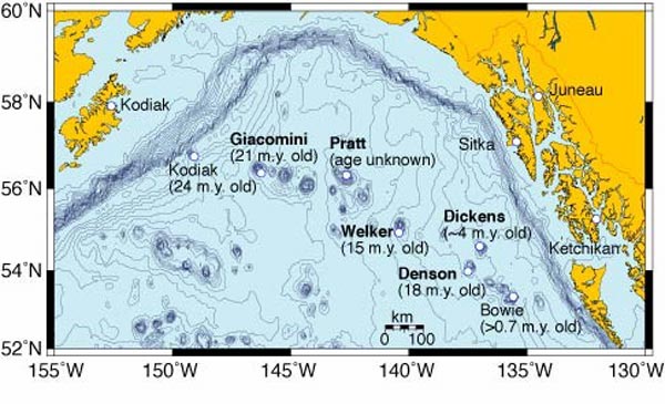
----------------------------------------
map 1.9 2005/12/27 19:49:16 47.306 -124.373 43.2 8 km ( 5 mi) SW of Taholah, WA
(Started coming in on the 28th and posted there.)
Southern Mexico area (Medium)
----------------------------------------
(Nothing found)
Seattle area then Mt. St. Helen's (MEDIUM for Mt. St. Helen's.)
----------------------------------------
map 1.4 2005/12/25 06:06:10 46.193 -122.189 0.0 1 km ( 1 mi) SW of Mount St. Helens Volcano, WA
map 2.4 2005/12/27 05:46:07 47.770 -121.832 12.4 10 km ( 6 mi) NE of Lake Marcel-Stillwater, WA
Utah (Medium)
----------------------------------------
map 1.5 2005/12/26 07:27:37 39.715 -110.737 0.2 11 km ( 7 mi) ENE of Helper, UT
MAP 3.0 2005/12/26 09:29:24 38.289 -112.224 0.4 6 km ( 4 mi) N of Junction, UT
map 1.9 2005/12/26 12:34:23 38.311 -112.236 2.7 8 km ( 5 mi) N of Junction, UT
map 1.3 2005/12/26 21:59:08 39.706 -110.592 1.6 22 km ( 14 mi) ENE of Price, UT
map 1.5 2005/12/27 15:15:02 38.303 -112.234 2.7 8 km ( 5 mi) N of Junction, UT
South Atlantic Ocean (26.75 S 7.83 W)
----------------------------------------
(Nothing found)
Peace to all.

posted by Unknown @ 1:16 PM
0 comments
![]()
![]()
