*For Saturday, 17 December 2005.
Places to watch.
Good luck to all.
For Saturday, 17 December 2005.
----------------------------------------
Greece/Turkey/Aegean area (VERY STRONG)
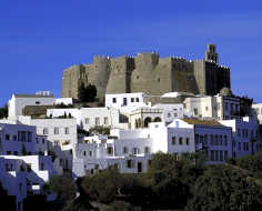
http://www.travelinfo.gr/patmos/index.htmPatmos

----------------------------------------
2005/12/17 00:15:44.1 39.40 N 33.14 E 5 ML4.2 TURKEY
2005/12/17 01:31:46.0 39.35 N 19.85 E ML3.0 GREECE-ALBANIA BORDER REGION
2005/12/17 03:08:27.5 39.40 N 33.19 E 5 MD3.3 TURKEY
2005/12/17 11:12:23.5 38.26 N 26.85 E 26 MD3.1 AEGEAN SEA
2005/12/17 16:01:47.1 37.44 N 30.30 E 8 MD3.1 TURKEY
Hawaii and North of (May be deep - Medium)
----------------------------------------
MAP 3.4 2005/12/17 16:06:04 18.564 -66.453 89.6 12 km ( 7 mi) NNE of Tierras Nuevas Poniente, PR
MAP 3.1 2005/12/17 03:30:31 18.901 -155.200 10.5 45 km ( 28 mi) ESE of Naalehu, HI
map 2.0 2005/12/17 04:14:13 18.893 -155.221 6.6 43 km ( 27 mi) ESE of Naalehu, HI
map 1.8 2005/12/17 12:15:30 19.445 -155.451 16.6 23 km ( 14 mi) W of Volcano, HI
Finland/Norway/Sweden area (Usual little symptoms)
----------------------------------------
SVALBARD, NORWAY, REGION
Origin time Lat Lon Azres Timres Wres Nphase Ntot Nsta Netmag
2005-348:13.56.58.0 77.62 25.97 5.53 0.08 1.46 2 2 1 2.01
Palm Springs and surrounding area then near Yucca Valley/Ludlow, California area (Medium or less for all.)
----------------------------------------
map 1.4 2005/12/17 00:00:55 34.008 -116.320 10.6 13 km ( 8 mi) S of Joshua Tree, CA
map 1.7 2005/12/17 02:54:10 33.458 -116.601 14.8 13 km ( 8 mi) SSE of Anza, CA
map 1.1 2005/12/17 05:49:55 33.673 -116.727 17.8 8 km ( 5 mi) S of Idyllwild, CA
map 1.5 2005/12/17 10:08:26 33.487 -116.460 21.1 21 km ( 13 mi) ESE of Anza, CA
Tonga/Fiji/Kermaec Islands area
----------------------------------------
2005/12/16 19:35:57.7 33.18 S 179.33 W 118 mb5.4 SOUTH OF KERMADEC ISLANDS
2005-12-18 01:07:58 5.0 15.78 S 173.98 W Tonga Islands
2005-12-18 05:10:24 5.1 20.64 S 175.20 W Tonga Islands
2005-12-18 09:09:55 5.3 22.63 S 175.51 W Tonga Islands Region
2005/12/18 17:22:39.7 24.23 S 176.94 W 33 mb5.5 SOUTH OF FIJI ISLANDS
Puerto Rico to Virgin Islands (Medium - various areas)
----------------------------------------
MAP 3.3 2005/12/17 07:18:23 19.242 -65.341 25.2 104 km ( 65 mi) N of Culebra, PR
MAP 3.4 2005/12/17 16:06:04 18.564 -66.453 89.6 12 km ( 7 mi) NNE of Tierras Nuevas Poniente, PR
MAP 3.2 2005/12/17 18:49:15 19.543 -65.779 35.3 124 km ( 77 mi) N of Suárez, PR
Kazakhstan to Kyrgyzstan
----------------------------------------
2005/12/17 04:54:25.0 39.33 N 72.45 E ML3.6 KYRGYZSTAN
Southern Sumatra/Java, Indonesia then Nicobar/Andaman area (Very Strong for Southern Sumatra/Java, Indonesia area.)
----------------------------------------
(Nothing found)
Peru/Ecuador/Colombia border area
----------------------------------------
(Nothing found)
Possibly South Pacific near Marquesas Island (New symptom area and not sure if this is part of Hawaii or much further South. Very Strong)
----------------------------------------
(Nothing found yet)
Almanor (40.218 -121.180) to Susanville area
----------------------------------------
(Nothing found)
Mt. St. Helen's
----------------------------------------
(Nothing found)
Novato, California (38.097 -122.568)/San Francisco area then Milpitas (37.488 -121.842) area (Strong for the Novato area)
----------------------------------------
map 1.3 2005/12/17 03:04:10 38.438 -122.466 7.2 7 km ( 4 mi) S of St. Helena, CA
map 1.8 2005/12/16 17:01:11 37.334 -122.145 5.8 4 km ( 3 mi) S of Los Altos Hills, CA
map 1.6 2005/12/16 20:41:28 37.417 -121.769 5.4 7 km ( 5 mi) NE of Alum Rock, CA
East China to Kyushu, Japan area (Very Strong for Kyushu area)
----------------------------------------
2005-12-16 05:15:38 5.2 21.99 N 121.47 E Taiwan Region
Possibly Sardinia (Strong)
http://en.wikipedia.org/wiki/History_of_SardiniaSardinia
Already in the Stone Age Monte Arci played an important role. The old volcano was one of the central places where obsidian was found and worked for cutting tools and arrowheads. Even now the vulcanic glass can be found on the sides of the mountain.

----------------------------------------
2005/12/17 19:55:47.3 37.08 N 3.32 E mb3.6 WESTERN MEDITERRANEAN SEA
2005/12/18 00:30:48.6 36.67 N 3.11 E mb3.7 NORTHERN ALGERIA
2005/12/18 22:16:05.0 36.56 N 5.86 E mb4.1 NORTHERN ALGERIA
South Sandwich Islands area (Strong)
----------------------------------------
(Nothing found)
New Madrid Fault
----------------------------------------
map 2.1 2005/12/17 07:06:38 36.590 -89.590 9.4 2 km ( 1 mi) E of Lilbourn, MO
Coso Junction
----------------------------------------
map 2.1 2005/12/16 07:15:38 35.931 -117.922 4.9 13 km ( 8 mi) S of Coso Junction, CA
map 2.4 2005/12/16 17:14:02 36.013 -117.789 2.7 15 km ( 9 mi) ESE of Coso Junction, CA
Peace to all.

