*For Monday, 17 April 2006.
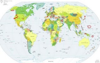
LEGEND for OVERVIEW: Size = My surety of area for quake.
Red Circle = Probable quake to STRONG quake.
Triangle = Very Strong or Stronger quake (And usually takes extra days).
Blue Circle, etc. = Uncertainty of symptom area for probable quake.

Places to watch.
Good luck to all.
For Monday, 17 April 2006.
----------------------------------------
Utah then Wyoming area (STRONG for Utah)
----------------------------------------
MAP 1.5 2006/04/17 03:39:46 39.411 -111.260 5.2 21 km ( 13 mi) ESE of Spring City, UT
MAP 1.3 2006/04/17 04:01:02 44.329 -110.870 6.0 42 km ( 26 mi) SSE of West Yellowstone, MT
MAP 1.6 2006/04/17 03:51:29 44.350 -110.843 7.8 41 km ( 25 mi) SSE of West Yellowstone, MT
MAP 2.2 2006/04/17 17:15:08 45.352 -112.520 0.0 18 km ( 11 mi) NNE of Dillon, MT
MAP 1.9 2006/04/17 18:54:59 39.604 -110.392 0.9 6 km ( 4 mi) N of Sunnyside, UT
MAP 1.2 2006/04/17 20:38:49 44.740 -111.136 10.9 9 km ( 6 mi) NNW of West Yellowstone, MT
MAP 1.4 2006/04/17 20:38:30 39.462 -111.175 6.9 23 km ( 14 mi) NW of Huntington, UT
MAP 1.0 2006/04/17 23:50:55 39.725 -110.746 1.3 10 km ( 6 mi) ENE of Helper, UT
Hokkaido
----------------------------------------
2006-04-17 03:04:56.4 41.84 N 141.34 E 89 mb 4.8 HOKKAIDO, JAPAN, REGION
2006-04-18 10:38:25.6 42.45 N 144.28 E 40 mb 4.9 HOKKAIDO, JAPAN, REGION
Mt. St. Helen’s (Strong)
----------------------------------------
MAP 2.7 2006/04/17 05:51:22 46.199 -122.192 0.0 1 km ( 1 mi) W of Mount St. Helens Volcano, WA
MAP 1.3 2006/04/17 07:26:52 46.199 -122.192 1.0 1 km ( 1 mi) W of Mount St. Helens Volcano, WA
MAP 1.4 2006/04/17 15:11:04 46.198 -122.195 1.0 1 km ( 1 mi) WSW of Mount St. Helens Volcano, WA
MAP 1.5 2006/04/18 02:58:56 46.196 -122.195 0.8 1 km ( 1 mi) WSW of Mount St. Helens Volcano, WA
Coalinga, California area (36.114 -120.626)
----------------------------------------
(Nothing found)
France/Spain border
----------------------------------------
2006-04-17 13:48:04.1 39.66N 3.40W 2 ML3.8 SPAIN
The New Madrid Fault/Missouri probably (Strong)
----------------------------------------
MAP 1.5 2006/04/17 01:55:12 36.290 -89.420 5.1 6 km ( 4 mi) ENE of Ridgely, TN
MAP 1.5 2006/04/17 08:46:27 36.570 -89.620 10.2 2 km ( 1 mi) W of Howardville, MO
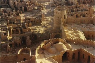
Northcentral Iran (VERY STRONG - may be 2 different places.)
http://www.dejkam.com/iran/>dejkam

----------------------------------------
(Nothing found)
Mongolia area (Strong)
----------------------------------------
2006-04-18 13:10:35.0 44.94 N 82.72 E ML 3.0 NORTHERN XINJIANG, CHINA
(More west than expected - not strong)
Entiat, Washington area (47.714 -120.186)
----------------------------------------
MAP 2.0 2006/04/17 19:05:59 46.484 -119.362 0.3 20 km ( 13 mi) SW of Basin City, WA
Mariana Islands
----------------------------------------
(Nothing found)
Romania (Second day of symptom - STRONG)
----------------------------------------
2006-04-17 03:54:55.0 42.63 N 18.98 E 21 ML 2.8 NORTHWESTERN BALKAN PEN.
(Not very strong and more west.)
Southern to Central Italy
----------------------------------------
2006-04-17 02:37:15.4 37.17 N 20.82 E 26 G IONIAN SEA
2006-04-17 02:44:04.5 39.64 N 17.20 E 10 mb 4.7 SOUTHERN ITALY
2006-04-17 03:10:00.0 39.57 N 17.12 E 10 ML 3.0 SOUTHERN ITALY
2006-04-17 08:54:40.1 37.68 N 20.97 E 10 mb 4.2 IONIAN SEA
2006-04-17 08:43:56.0 37.04 N 16.31 E 6 ML 2.8 IONIAN SEA
2006-04-17 12:01:24.0 37.53 N 20.92 E 5 ML 3.9 IONIAN SEA
2006-04-17 12:59:37.4 44.59 N 10.24 E 10 ML 2.8 NORTHERN ITALY
2006-04-17 12:49:00.3 44.60 N 10.35 E 10 ML 3.0 NORTHERN ITALY
2006-04-17 12:31:03.0 38.40 N 13.60 E 12 ML 3.0 SICILY, ITALY
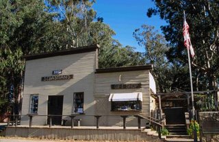
San Simeon (35.709 -121.118) (Second day of symptoms - Very Strong)
http://travel.yahoo.com/p-travelguide-474513-action-pictures-san_simeon_vacations-i;_ylc=X3oDMTE3N2phcW1vBF9TAzI3NjY2NzkEX3MDOTY5NTUzMjUEc2VjA3NyBHNsawN0aXRsZQ-->yahootravel

----------------------------------------
MAP 2.0 2006/04/17 00:20:14 35.737 -121.036 1.3 14 km ( 9 mi) W of Lake Nacimiento, CA
Poland
----------------------------------------
(Nothing found)
Aru Islands, Indonesia area (5.02S 134.01E)
----------------------------------------
2006-04-16 17:46:16.4 4.57 N 125.42 E 185 M 5.7 TALAUD ISLANDS, INDONESIA
2006-04-18 01:47:27 4.7 5.84 S 132.38 E Aru Islands Region, Indonesia
Solomon Islands area (5.7S 154.4E)
----------------------------------------
2006-04-15 17:13:26 5.3 5.04 S 154.26 E Solomon Islands
(2 days early)
Alaska Peninsula
----------------------------------------
(Nothing found)
Nevada
----------------------------------------
MAP 3.3 2006/04/17 20:14:51 36.714 -116.055 5.6 37 km ( 23 mi) WNW of Indian Springs, NV
MAP 1.1 2006/04/17 20:25:04 36.724 -116.064 3.6 38 km ( 24 mi) WNW of Indian Springs, NV
MAP 1.9 2006/04/17 22:20:10 35.953 -115.203 0.0 9 km ( 5 mi) S of Enterprise, NV
Peace to all.

