*For Wednesday, 4 January 2006.
Places to watch.
Good luck to all.
For Wednesday, 4 January 2006.
----------------------------------------
Salta Province, Argentina (24.05 S 66.79 W) area
----------------------------------------
2006-01-04 13:01:14 5.6 23.18 S 65.56 W Jujuy Province, Argentina
Kuril Islands
----------------------------------------
05Jan2006 01:35:52.7 45.6N 148.5E150 mb=4.6 M*GSR KURIL ISLANDS 0540
Alaska Peninsula
----------------------------------------
map 3.0 2006/01/04 04:37:17 57.907 -156.976 1.0 ALASKA PENINSULA
map 3.1 2006/01/04 11:59:00 56.215 -158.030 60.0 ALASKA PENINSULA
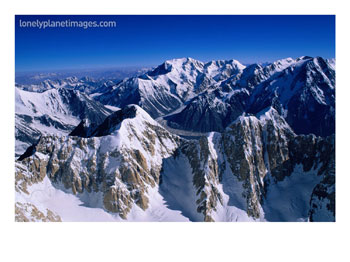
Pakistan/Hindu Kush then more Tajikistan area (VERY STRONG for Pakistan area)
Posters of all kinds including Hindu Kush Mountain Range below.
----------------------------------------
04Jan2006 12:31:29.9 35.6N 73.4E100 mb=4.6 M GSR NORTHWESTERN KASHMIR 1348
04Jan2006 10:45:23.9 39.1N 73.2E140 mb=4.8 M*GSR TAJIKISTAN-XINJIANG BORDER1118
2006/01/05 14:47:22.7 32.07 N 70.38 E 30 mb4.9 PAKISTAN
2006/01/06 22:41:49.3 34.84 N 73.67 E 80 mb4.7 PAKISTAN
(2 days extra)
Mt. St. Helen's
----------------------------------------
map 2.7 2006/01/04 17:12:05 46.207 -122.197 0.0 1 km ( 1 mi) WNW of Mount St. Helens Volcano, WA
Kazakhstan to Kyrgyzstan
----------------------------------------
2006/01/03 19:11:45.0 42.45 N 75.95 E ML3.2 KYRGYZSTAN
2006/01/05 09:05:00.0 53.47 N 71.81 E ML3.1 CENTRAL KAZAKHSTAN
Severnaya Zemlya/Arctic Ocean
----------------------------------------
NOVAYA ZEMLYA, RUSSIA
Origin time Lat Lon Azres Timres Wres Nphase Ntot Nsta Netmag
2006-003:21.16.08.0 75.33 57.09 9.03 0.47 2.72 3 3 2 2.09
Southwestern Siberia (Second day of symptoms - STRONG)
----------------------------------------
(Nothing found)
Yucaipa to Lakeview, California area
----------------------------------------
map 1.5 2006/01/04 13:35:06 34.038 -117.190 10.5 3 km ( 2 mi) SW of Redlands, CA
Cayucos, California (35.531°N, 120.840°W) area
----------------------------------------
MAP 3.1 2006/01/04 23:56:59 35.318 -120.941 3.7 10 km ( 6 mi) W of Baywood-Los Osos, CA
San Simeon area (Medium)
----------------------------------------
(Nothing found)
Nevada (Second day for this symptom - Strong)
----------------------------------------
MAP 3.1 2006/01/03 18:21:09 37.440 -117.084 5.5 22 km ( 14 mi) NE of Tokop, NV
map 1.9 2006/01/05 20:08:11 38.517 -117.284 0.0 50 km ( 31 mi) N of Tonopah, NV
map 1.0 2006/01/05 21:12:43 36.089 -115.196 0.0 6 km ( 3 mi) ESE of Spring Valley, NV
Mongolia/China (Strong)
----------------------------------------
2006/01/04 22:33:41.2 44.34 N 102.05 E 12 mb5.1 MONGOLIA
San Francisco (Second day symptoms - Medium).
----------------------------------------
map 2.5 2006/01/05 19:58:03 37.427 -121.835 1.7 5 km ( 3 mi) E of Milpitas, CA
Shikoku to Kyushu, Japan area (Second day symptoms - Strong)
----------------------------------------
(Nothing found)
Possibly East of The Virgin Islands (New symptom area.)
----------------------------------------
(Lists may not be up to date - Nothing found)
Puerto Rico (Medium)
----------------------------------------
(Lists may not be up to date - Nothing found)
South Atlantic/Ascension (Medium)
----------------------------------------
(Nothing found)
Petrolia (Second day symptoms - Strong)
----------------------------------------
map 2.6 2006/01/05 14:32:13 40.221 -124.147 3.5 17 km ( 10 mi) SE of Petrolia, CA
map 2.9 2006/01/06 19:52:42 40.314 -124.099 32.8 16 km ( 10 mi) E of Petrolia, CA
(2 extra days)
Utah (Strong)
----------------------------------------
map 1.3 2006/01/04 00:06:54 39.731 -110.732 1.0 12 km ( 7 mi) ENE of Helper, UT
map 1.6 2006/01/04 02:59:27 39.734 -110.725 0.6 12 km ( 8 mi) ENE of Helper, UT
map 1.6 2006/01/04 07:38:09 39.731 -110.798 0.1 7 km ( 4 mi) NE of Helper, UT
map 1.5 2006/01/04 12:08:36 39.670 -110.520 2.1 17 km ( 10 mi) NNW of East Carbon, UT
map 1.6 2006/01/04 18:11:15 39.670 -110.508 7.4 16 km ( 10 mi) NW of Sunnyside, UT
map 1.4 2006/01/04 19:47:04 39.725 -110.937 5.2 8 km ( 5 mi) WNW of Helper, UT
map 1.7 2006/01/05 01:00:40 39.674 -110.523 1.2 17 km ( 11 mi) NNW of East Carbon, UT
map 1.7 2006/01/05 01:57:54 39.670 -110.521 1.6 17 km ( 10 mi) NNW of East Carbon, UT
map 1.5 2006/01/05 02:30:45 39.669 -110.526 1.8 17 km ( 10 mi) NNW of East Carbon, UT
map 1.6 2006/01/05 04:46:57 39.669 -110.519 2.2 16 km ( 10 mi) NNW of East Carbon, UT
map 1.9 2006/01/05 11:51:11 38.328 -112.232 2.3 10 km ( 6 mi) N of Junction, UT
map 1.8 2006/01/05 13:33:07 38.011 -112.909 4.6 18 km ( 11 mi) NW of Paragonah, UT
Northcentral Iran
----------------------------------------
(Nothing found)
Coquimbo, Chile (-29.307 -71.068) area
----------------------------------------
2006/01/05 22:51:24.8 35.88 S 72.27 W 100 mb5.2 NEAR COAST OF CENTRAL CHILE
Parkfield, California
----------------------------------------
(Nothing found)
France/Bay of Biscay area (MEDIUM)
----------------------------------------
(Nothing found)
Quebec
----------------------------------------
2006/01/04 19:27:36 50.02N 65.66W 11.3 3.0MN GSC 35 km SE from Moisie, QC
WESTERN LOFOTEN BASIN (69.65 -1.49) area
----------------------------------------
WESTERN LOFOTEN BASIN
Origin time Lat Lon Azres Timres Wres Nphase Ntot Nsta Netmag
2006-004:15.31.48.0 69.69 2.12 15.85 0.09 4.05 2 2 1 2.31
WESTERN LOFOTEN BASIN
Origin time Lat Lon Azres Timres Wres Nphase Ntot Nsta Netmag
2006-004:15.43.12.0 69.64 1.61 14.40 0.27 3.88 3 3 2 2.07
Peace to all.

posted by Unknown @ 2:25 PM
0 comments
![]()
![]()
