*For Wednesday, 21 December 2005.
Places to watch.
Good luck to all.
For Wednesday, 21 December 2005.
----------------------------------------
Guererro, Mexico area (Medium)
----------------------------------------
(Nothing found)
Kyushu, Japan and South of (May be deep) then Honshu area (Strong for Honshu)
----------------------------------------
2005/12/20 05:34:05.9 34.63 N 136.53 E 33 mb5.4 WESTERN HONSHU, JAPAN
2005/12/20 22:58:02.2 37.88 N 143.09 E 33 Ms4.6 OFF EAST COAST OF HONSHU, JAPAN
2005/12/22 09:06:12.4 22.58 N 129.22 E 33 mb4.2 PHILIPPINE SEA
Pine Valley, California ( 32.941 -116.503)
----------------------------------------
map 1.5 2005/12/20 23:28:50 32.938 -116.502 12.6 12 km ( 8 mi) N of Pine Valley, CA
British Virgin Islands then Puerto Rico (STRONG for both)
----------------------------------------
MAP 3.5 2005/12/21 04:05:04 17.688 -68.174 25.3 109 km ( 68 mi) WSW of Pole Ojea, PR
MAP 3.4 2005/12/21 08:07:05 18.198 -68.061 98.4 83 km ( 52 mi) SE of Higüey, Dominican Republic
MAP 3.2 2005/12/21 09:07:09 18.921 -64.998 47.5 62 km ( 39 mi) NNW of Little Harbour, British Virgin Islands
Mariana Islands/Bonnin Islands (May go with the Kyushu symptom - STRONG)
----------------------------------------
2005-12-21 20:45:46 5.2 31.37 N 148.60 E North Pacific Ocean
Turkey area (Very Strong - probably multiples not just one big one.)
http://www.blogger.com/img/gl.link.gifIzmir

----------------------------------------
2005/12/21 09:32:02.4 37.43 N 21.06 E 15 ML3.3 SOUTHERN GREECE
2005/12/21 10:09:36.7 38.73 N 31.25 E 29 MD3.1 TURKEY
2005/12/21 12:25:17.1 38.82 N 31.05 E 30 MD3.0 TURKEY
2005/12/21 12:41:15.5 41.93 N 34.22 E 20 MD3.0 TURKEY
2005/12/21 17:05:01.0 37.38 N 22.58 E ML3.5 SOUTHERN GREECE
2005/12/22 04:28:19.0 34.60 N 26.76 E ML3.0 CRETE, GREECE
2005/12/22 09:13:07.2 35.86 N 26.95 E 87 ML3.8 CRETE, GREECE
2005/12/22 11:27:25.6 38.41 N 21.81 E 2 ML3.0 GREECE
The New Madrid Fault/Tennessee (STRONG for Tennessee - then other places)
----------------------------------------
map 1.6 2005/12/20 10:29:31 36.360 -89.530 9.2 5 km ( 3 mi) WSW of Tiptonville, TN
Sumatra (Medium)
----------------------------------------
2005/12/21 22:35:21.8 1.77 S 88.30 E 33 mb5.0 SOUTH INDIAN OCEAN
Valparaiso, Chile (-32.733 -70.308) (STRONG)
----------------------------------------
MAP 4.9 2005/12/21 22:19:46 -42.811 -74.175 25.8 OFFSHORE LOS LAGOS, CHILE
Hawaii (Very Strong)
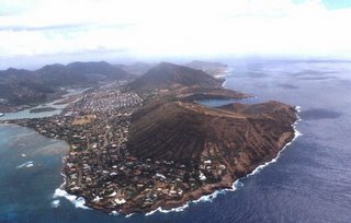
Oahu by Helicopter

----------------------------------------
map 2.6 2005/12/22 09:05:02 19.427 -155.641 35.6 26 km ( 16 mi) E of Honaunau-Napoopoo, HI
map 2.6 2005/12/22 09:05:03 19.453 -155.641 29.4 26 km ( 16 mi) E of Honaunau-Napoopoo, HI
Hokkaido/Kurils area (Something deep)
----------------------------------------
2005/12/21 20:46:49.6 43.43 N 143.84 E 60 mb5.0 HOKKAIDO, JAPAN, REGION
Mammoth Lakes/Tom's Place (Medium)
----------------------------------------
map 1.9 2005/12/21 16:20:24 37.532 -118.890 3.1 14 km ( 9 mi) SE of Mammoth Lakes, CA
map 1.4 2005/12/22 10:28:46 37.481 -118.833 3.8 16 km ( 10 mi) WSW of Toms Place, CA
map 1.1 2005/12/22 17:35:27 37.441 -118.844 8.8 20 km ( 12 mi) SW of Toms Place, CA
map 1.6 2005/12/22 18:38:27 37.443 -118.845 8.9 20 km ( 12 mi) SW of Toms Place, CA
Mt. St. Helen's
----------------------------------------
(Nothing found)
The Geysers (Something deep)
----------------------------------------
map 2.6 2005/12/21 15:28:25 38.796 -122.753 2.8 5 km ( 3 mi) E of The Geysers, CA
map 1.6 2005/12/21 19:38:34 38.800 -122.804 1.1 0 km ( 0 mi) NE of The Geysers, CA
Peace to all.

