Earthquake Prediction by Tiempe

Earth Sensitive quake predictions

Friday, March 31, 2006

*For Monday, 3 April 2006.

LEGEND for OVERVIEW: Size = My surety of area for quake.
Red Circle = Probable quake to STRONG quake.
Triangle = Very Strong or Stronger quake (And usually takes extra days).
Blue Circle, etc. = Uncertainty of symptom area for probable quake.


Places to watch.

Good luck to all.

For Monday, 3 April 2006.
----------------------------------------

Kermadec Islands
----------------------------------------
2006-04-01 03:40:53.9 29.53 S 177.48 W 65 f mb 4.7 KERMADEC ISLANDS, NEW ZEALAND
2006-04-01 05:15:34.5 29.65 S 177.28 W 51 mb 5.4 KERMADEC ISLANDS, NEW ZEALAND
2006-04-01 06:25:43.0 29.27 S 177.26 W 43 mb 5.3 KERMADEC ISLANDS, NEW ZEALAND
2006-04-01 08:19:16.8 29.34 S 177.20 W 72 M 5.1 KERMADEC ISLANDS, NEW ZEALAND
2006-04-01 10:32:25 5.1 29.22 S 177.80 W Kermadec Islands, New Zealand
2006-04-01 11:30:22 5.3 30.26 S 178.25 W Kermadec Islands, New Zealand
2006-04-01 17:51:07 5.3 29.67 S 176.87 W Kermadec Islands Region
01Apr2006 17:55:59.6 29.7S 176.9W 33 MS=5.2 M*GSR KERMADEC ISLANDS REGION
01Apr2006 20:02:40.2 29.5S 177.6W230 mb=5.2 M GSR KERMADEC ISLANDS, NEW ZEAL
(2 days early)

2006-04-03 01:41:26.1 28.77 S 177.76 W 100 f mb 5.1 KERMADEC ISLANDS REGION

2006-04-04 10:47:15.0 29.01 S 177.09 W 10 f mb 5.1 KERMADEC ISLANDS, NEW ZEALAND
04Apr2006 16:10:12.2 29.0S 177.3W 33 mb=5.2 M GSR KERMADEC ISLANDS, NEW ZEAL
04Apr2006 20:15:52.8 29.8S 177.1W 33 MS=5.1 M*GSR KERMADEC ISLANDS, NEW ZEAL
04Apr2006 23:57:26.4 29.6S 177.2W 33 mb=5.5 M*GSR KERMADEC ISLANDS, NEW ZEAL

05Apr2006 00:27:34.0 29.8S 177.1W 33 mb=5.7 M GSR KERMADEC ISLANDS, NEW ZEAL
(2 extra days)

North Atlantic/Strait of Gibraltar area (35.47N 13.07W) (STRONG)
----------------------------------------
02Apr2006 06:44:46.6 35.6N 4.3E110 mb=4.7 M*GSR NORTHERN ALGERIA
2006-04-02 19:41:57.0 35.95 N 3.98 W 12 mb 3.0 STRAIT OF GIBRALTAR

Utah/Nevada
----------------------------------------
MAP 1.4 2006/04/02 01:36:10 39.723 -110.747 1.3 10 km ( 6 mi) ENE of Helper, UT
MAP 1.7 2006/04/02 03:48:09 39.608 -110.395 1.0 6 km ( 4 mi) N of Sunnyside, UT
MAP 1.6 2006/04/02 04:54:34 39.607 -110.391 0.7 6 km ( 4 mi) N of Sunnyside, UT
MAP 1.0 2006/04/02 05:32:46 37.412 -117.078 4.6 20 km ( 13 mi) NE of Tokop, NV
MAP 1.5 2006/04/02 05:51:09 39.670 -110.513 1.8 16 km ( 10 mi) NW of Sunnyside, UT
MAP 1.6 2006/04/02 07:00:39 41.147 -112.804 4.4 57 km ( 36 mi) W of Hooper, UT
MAP 1.9 2006/04/02 07:09:36 39.967 -111.582 9.3 8 km ( 5 mi) SE of Woodland Hills, UT
MAP 1.5 2006/04/02 08:23:32 39.701 -110.724 0.9 12 km ( 7 mi) E of Helper, UT
MAP 1.2 2006/04/02 13:13:23 37.419 -117.083 5.7 20 km ( 13 mi) NE of Tokop, NV
MAP 1.2 2006/04/02 14:15:51 37.415 -117.080 0.0 20 km ( 13 mi) NE of Tokop, NV
MAP 1.6 2006/04/02 19:03:37 39.740 -110.726 0.2 13 km ( 8 mi) ENE of Helper, UT
MAP 1.5 2006/04/02 20:45:21 38.986 -111.327 7.0 10 km ( 6 mi) NW of Emery, UT
MAP 1.1 2006/04/02 21:31:53 39.726 -110.747 1.4 10 km ( 6 mi) ENE of Helper, UT

MAP 1.4 2006/04/03 04:37:56 39.608 -110.392 0.8 6 km ( 4 mi) N of Sunnyside, UT
MAP 1.4 2006/04/03 14:40:55 39.413 -111.216 5.0 23 km ( 15 mi) WNW of Huntington, UT
MAP 1.5 2006/04/03 16:55:57 41.344 -112.003 1.8 3 km ( 2 mi) N of Pleasant View, UT
MAP 1.5 2006/04/03 17:20:00 39.411 -111.207 5.8 23 km ( 14 mi) WNW of Huntington, UT
MAP 1.9 2006/04/03 22:16:42 41.153 -112.668 14.5 46 km ( 29 mi) W of Hooper, UT
MAP 1.9 2006/04/03 22:49:52 39.490 -119.624 0.0 12 km ( 7 mi) SE of Sparks, NV
MAP 1.5 2006/04/03 23:06:56 39.672 -110.514 1.6 16 km ( 10 mi) NW of Sunnyside, UT

MAP 1.0 2006/04/04 21:48:13 39.726 -119.497 12.3 16 km ( 10 mi) SW of Nixon, NV
MAP 1.6 2006/04/04 21:38:25 39.611 -110.394 0.9 7 km ( 4 mi) N of Sunnyside, UT
MAP 1.5 2006/04/04 18:34:14 39.608 -110.396 0.9 6 km ( 4 mi) N of Sunnyside, UT
MAP 2.0 2006/04/04 18:19:01 39.732 -110.805 0.3 7 km ( 4 mi) NE of Helper, UT
MAP 1.9 2006/04/04 17:22:47 38.989 -111.338 9.7 11 km ( 7 mi) NW of Emery, UT
MAP 1.4 2006/04/04 17:21:56 39.669 -110.512 2.1 16 km ( 10 mi) NW of Sunnyside, UT
MAP 1.6 2006/04/04 14:07:41 39.672 -110.513 1.7 16 km ( 10 mi) NW of Sunnyside, UT
MAP 1.5 2006/04/04 05:48:37 39.673 -110.522 0.8 17 km ( 11 mi) NNW of East Carbon, UT
MAP 1.3 2006/04/04 02:11:02 36.716 -116.303 5.0 46 km ( 28 mi) ESE of Beatty, NV
MAP 1.4 2006/04/04 01:13:31 39.704 -110.591 1.2 22 km ( 14 mi) ENE of Price, UT
MAP 1.3 2006/04/04 00:41:38 39.609 -110.394 1.1 6 km ( 4 mi) N of Sunnyside, UT

Madison Junction, Wyoming area (44.600N 110.738W)
----------------------------------------
MAP 2.1 2006/04/03 16:46:41 45.373 -112.601 6.2 18 km ( 11 mi) N of Dillon, MT
MAP 1.3 2006/04/03 19:14:15 45.350 -112.574 0.6 16 km ( 10 mi) NNE of Dillon, MT
MAP 1.1 2006/04/04 11:03:49 45.171 -112.627 0.6 5 km ( 3 mi) S of Dillon, MT
(Wyoming came in on the 4th - this part of the symptom is for Montana, I think.)

Costa Rica area (9.85 N 84.30 W).
----------------------------------------
06/04/04 07:48:35 10.82N 85.94W 54.2 2.3MC Frente a San Juan del Sur
06/04/04 22:11:20 11.70N 86.74W 52.3 2.6MC Frente a Masachapa

Petrolia and North of (Medium)
----------------------------------------
(Nothing found)

The Virgin Islands (STRONG)
----------------------------------------
MAP 2.9 2006/04/03 02:40:41 19.112 -67.836 5.2 104 km ( 65 mi) NW of Aguadilla, PR
MAP 1.8 2006/04/03 06:10:49 17.960 -66.566 17.7 7 km ( 4 mi) SSW of Capitanejo, PR
MAP 3.4 2006/04/03 06:49:41 19.486 -64.857 24.9 101 km ( 63 mi) NW of Settlement, British Virgin Islands
MAP 3.4 2006/04/03 07:45:29 17.046 -68.596 25.3 159 km ( 99 mi) SSE of La Romana, Dominican Republic
MAP 3.2 2006/04/03 08:18:01 19.082 -65.701 131.8 74 km ( 46 mi) NNE of Suárez, PR
MAP 2.3 2006/04/03 10:46:52 18.082 -64.522 2.9 41 km ( 25 mi) SE of Cruz Bay, US Virgin Islands
MAP 2.6 2006/04/03 16:20:20 18.894 -63.700 6.2 68 km ( 42 mi) ENE of Settlement, British Virgin Islands
MAP 2.9 2006/04/03 16:59:51 18.405 -64.222 14.6 4 km ( 3 mi) W of West End, British Virgin Islands
MAP 2.8 2006/04/03 17:36:45 19.076 -65.381 19.0 86 km ( 53 mi) NNE of Luquillo, PR
MAP 2.9 2006/04/03 17:32:51 19.289 -65.365 50.3 108 km ( 67 mi) NNE of Vieques, PR
MAP 2.9 2006/04/03 17:31:48 19.037 -65.381 16.5 82 km ( 51 mi) N of Culebra, PR
MAP 2.9 2006/04/03 17:29:28 18.968 -65.391 32.7 74 km ( 46 mi) N of Culebra, PR
MAP 3.1 2006/04/03 17:27:52 19.038 -65.371 13.4 82 km ( 51 mi) N of Culebra, PR
MAP 2.6 2006/04/03 17:25:38 19.046 -65.326 6.7 82 km ( 51 mi) N of Culebra, PR
MAP 2.9 2006/04/03 18:31:35 19.057 -65.341 11.1 84 km ( 52 mi) N of Culebra, PR
MAP 3.1 2006/04/03 18:29:02 19.094 -65.296 3.2 88 km ( 54 mi) N of Culebra, PR
MAP 3.7 2006/04/03 18:25:36 19.047 -65.360 18.3 83 km ( 51 mi) N of Culebra, PR

NNE of Kukuihaele, HI area (20.329 -155.465) (VERY STRONG)
http://starbulletin.com/2006/03/25/news/story04.html>starbulletin


----------------------------------------
MAP 2.2 2006/04/02 04:21:28 19.399 -155.281 2.7 7 km ( 5 mi) SW of Volcano, HI
MAP 2.1 2006/04/02 07:03:37 19.438 -155.637 3.0 26 km ( 16 mi) E of Honaunau-Napoopoo, HI

MAP 2.1 2006/04/03 05:43:18 19.344 -155.318 2.0 15 km ( 9 mi) SW of Volcano, HI

Point Arena, California
----------------------------------------
(Nothing found)

Turkey/Iraq border area
----------------------------------------
2006-04-03 11:25:03.7 37.17 N 34.36 E 29 MD 2.9 TURKEY
2006-04-03 12:36:43.6 37.00 N 27.77 E 30 MD 2.9 TURKEY

2006-04-04 15:49:29.9 38.75 N 31.20 E 10 MD 2.9 TURKEY
2006-04-04 19:08:12.8 37.72 N 43.80 E 8 MD 3.2 TURKEY
2006-04-04 21:29:22.4 39.00 N 31.77 E 22 MD 2.8 TURKEY
2006-04-04 21:21:52.3 39.58 N 38.02 E 24 MD 3.3 TURKEY
2006-04-04 20:21:09.2 38.65 N 39.33 E 32 MD 3.0 TURKEY

Andaman Islands (11.54 N 95.10 E) (Very Strong)
http://volcano.und.nodak.edu/vwdocs/current_volcs/barren_isle/Barren_Isle.html>volcano.und.nodak


----------------------------------------
(Nothing found)

Guadalupe Victoria, Mexico area (32.355N 115.252W)
----------------------------------------
MAP 3.5 2006/04/02 03:25:05 31.773 -114.896 3.8 61 km ( 38 mi) SSE of Guadalupe Victoria, Mexico

MAP 2.0 2006/04/03 05:29:04 32.334 -115.021 6.0 10 km ( 6 mi) ENE of Guadalupe Victoria, Mexico

MAP 2.5 2006/04/04 06:31:35 32.333 -115.212 34.8 11 km ( 7 mi) WNW of Guadalupe Victoria, Mexico
MAP 2.5 2006/04/04 06:23:23 31.810 -115.916 0.4 47 km ( 29 mi) NNW of Lázaro Cárdenas, Mexico
MAP 1.9 2006/04/04 07:55:10 32.699 -115.385 5.0 9 km ( 6 mi) NE of Mexicali, Mexico

Chile/Argentina border area (24.26S 67.00W) (Strong)
----------------------------------------
2006-04-04 05:47:30.4 22.95 S 66.42 W 165 mb 4.7 JUJUY PROVINCE, ARGENTINA
(Posted on 2 April also - 2 different symptoms for same area - more may be coming.)

2006-04-05 01:34:12 5.0 31.94 S 70.39 W Chile-Argentina Border Region
(2 extra days)

Peace to all.

Thursday, March 30, 2006

*For Sunday, 2 April 2006.

LEGEND for OVERVIEW: Size = My surety of area for quake.
Red Circle = Probable quake to STRONG quake.
Triangle = Very Strong or Stronger quake (And usually takes extra days).
Blue Circle, etc. = Uncertainty of symptom area for probable quake.


Places to watch.

Good luck to all.

For Sunday, 2 April 2006.
----------------------------------------

San Diego area
----------------------------------------
MAP 2.1 2006/04/02 23:30:26 32.980 -117.539 16.8 26 km ( 16 mi) W of Del Mar, CA

Hindu Kush
----------------------------------------
2006-04-01 00:08:08.0 36.36 N 70.57 E 180 mb 4.4 HINDU KUSH, AFGHANISTAN, REG

Taiwan area
----------------------------------------
MAP 6.2 2006/04/01 10:02:20 22.887 121.281 9.0 TAIWAN REGION
MAP 4.8 2006/04/01 10:40:23 23.144 121.187 10.0 TAIWAN
MAP 4.2 2006/04/01 12:56:50 22.669 121.871 10.0 TAIWAN REGION
(I also posted the above for the 29th of March.)
2006-04-04 12:49:29.9 22.84 N 121.11 E 33 mb 5.0 TAIWAN REGION
MAP 4.4 2006/04/04 06:59:03 22.906 121.469 20.7 TAIWAN REGION
MAP 4.6 2006/04/04 06:48:34 22.983 121.429 29.3 TAIWAN REGION
(2 days extra)

Nicaragua area (11.06N 88.21W) then Guatamala area (Strong for Nicaragua area.)
----------------------------------------
06/04/03 08:09:45 13.07N 86.92W 100.0 2.7ML Nicaragua
06/04/02 20:14:54 11.46N 86.26W 101.8 2.6ML Frente a El Astillero
06/04/02 08:51:17 11.19N 86.95W 64.2 3.2ML Frente a Masachapa
(Nothing for Guatamala found)

Virgin Islands (Strong)
----------------------------------------
MAP 2.9 2006/04/01 00:28:06 18.901 -64.973 25.9 59 km ( 37 mi) NNW of Little Harbour, British Virgin Islands
MAP 2.4 2006/04/01 00:27:48 18.887 -66.307 45.0 46 km ( 29 mi) N of Breñas, PR
MAP 2.8 2006/04/01 07:34:53 18.428 -66.861 23.0 3 km ( 2 mi) ESE of Piedra Gorda, PR
MAP 3.7 2006/04/01 09:17:46 18.314 -67.954 117.1 74 km ( 46 mi) W of Rincón, PR
MAP 3.9 2006/04/01 09:04:47 18.893 -68.955 156.6 16 km ( 10 mi) NNE of El Seybo, Dominican Republic
MAP 3.2 2006/04/01 12:17:56 18.930 -64.964 8.1 62 km ( 38 mi) NNW of Little Harbour, British Virgin Islands
MAP 1.6 2006/04/01 20:26:25 17.959 -67.070 6.6 3 km ( 2 mi) SW of La Parguera, PR

Romania (Strong)
----------------------------------------
31Mar2006 05:35:49.0 45.9N 26.9E 75 ML=3.8 M*ROM ROMANIA
(2 days early)

Petrolia, California area (40.267 -124.081) (Medium)
----------------------------------------
MAP 1.5 2006/04/02 23:08:02 40.278 -123.745 17.6 19 km ( 12 mi) NNE of Redway, CA

Angola or Zambia (New symptom) and Mozambique area
----------------------------------------
2006-04-04 02:13:34 4.9 21.21 S 32.63 E Mozambique
(2 extra days)

The Geysers (MEDIUM)
----------------------------------------
MAP 1.9 2006/04/01 02:00:23 38.828 -122.790 3.2 4 km ( 2 mi) NNE of The Geysers, CA

MAP 1.5 2006/04/02 12:18:40 38.812 -122.817 2.3 2 km ( 1 mi) NNW of The Geysers, CA
MAP 1.7 2006/04/02 13:15:35 38.798 -122.764 2.2 4 km ( 2 mi) E of The Geysers, CA
MAP 1.7 2006/04/02 17:35:01 38.817 -122.784 2.5 3 km ( 2 mi) NE of The Geysers, CA
MAP 1.7 2006/04/02 22:14:08 38.811 -122.812 4.6 1 km ( 1 mi) NNW of The Geysers, CA
MAP 2.2 2006/04/02 23:01:46 38.828 -122.796 2.1 3 km ( 2 mi) NNE of The Geysers, CA

MAP 1.3 2006/04/03 00:13:29 38.835 -122.803 2.7 4 km ( 3 mi) N of The Geysers, CA
MAP 1.9 2006/04/03 00:29:46 38.826 -122.799 4.3 3 km ( 2 mi) NNE of The Geysers, CA
MAP 1.9 2006/04/03 11:21:32 38.794 -122.808 4.0 0 km ( 0 mi) SSW of The Geysers, CA
MAP 1.7 2006/04/03 13:40:18 38.815 -122.827 3.0 3 km ( 2 mi) NW of The Geysers, CA

Italy
----------------------------------------
2006-04-01 16:42:26.5 44.50 N 10.02 E 2 ML 3.5 NORTHERN ITALY
2006-04-01 09:41:00.0 37.88 N 14.37 E 58 ML 2.5 SICILY, ITALY

Scotia Sea (60.40 S 42.64 W)
----------------------------------------
2006-04-04 01:43:23 5.9 56.12 S 26.49 W South Sandwich Islands Region
(2 extra days)

Gulf of Oman area/Southern Iran (VERY STRONG and indication of deep quake.) (Second day of symptom but already at VERY STRONG.)
http://visibleearth.nasa.gov/view_rec.php?id=2363>visibleearth


----------------------------------------
(This is a symptom that is now in question. I posted the swarm and large quakes on 2 different lists because there were 2 different symptoms. Something I have to figure out yet.)

Jujuy Province, Argentina area (23.53S 66.46W) (Strong)
----------------------------------------
2006-04-04 05:47:30.4 22.95 S 66.42 W 165 mb 4.7 JUJUY PROVINCE, ARGENTINA
(2 extra days)

Java Sea (-5.559 110.074) (MEDIUM)
----------------------------------------
(Nothing found)

Peace to all.

Wednesday, March 29, 2006

*For Saturday, 1 April 2006.

LEGEND for OVERVIEW: Size = My surety of area for quake.
Red Circle = Probable quake to STRONG quake.
Triangle = Very Strong or Stronger quake (And usually takes extra days).
Blue Circle, etc. = Uncertainty of symptom area for probable quake.


Places to watch.

Good luck to all.

For Saturday, 1 April 2006.
----------------------------------------

Ridgecrest, California area ( 35.630 -117.602) (Medium)
----------------------------------------
MAP 1.4 2006/04/01 04:27:45 34.234 -117.611 11.3 7 km ( 4 mi) SSE of Mt. Baldy, CA
MAP 1.3 2006/04/01 04:08:42 34.148 -117.596 12.7 3 km ( 2 mi) NNW of Rancho Cucamonga, CA
MAP 1.4 2006/04/01 10:36:09 34.240 -117.542 8.0 11 km ( 7 mi) ESE of Mt. Baldy, CA

Eastern Tenneessee Seismic Zone/Ridgely, Tennesse area (36.250N 89.450W)
----------------------------------------
map 1.7 2006/04/02 03:35:45 36.130N 89.440W 11.1 12 km ( 7 mi) NNW of Dyersburg, TN

map 1.0 2006/04/01 06:42:37 35.720N 84.300W 20.3 3 km ( 2 mi) ESE of Loudon, TN

Mt. St. Helen’s
----------------------------------------
MAP 1.0 2006/04/01 05:40:21 46.196 -122.195 0.0 1 km ( 1 mi) WSW of Mount St. Helens Volcano, WA
MAP 1.2 2006/04/01 16:38:08 46.197 -122.193 0.9 1 km ( 1 mi) WSW of Mount St. Helens Volcano, WA

Rio de Janeiro, Brazil area (MEDIUM)
----------------------------------------
2006-04-03 03:33:47 5.3 8.96 S 70.98 W Western Brazil
(Brazil...but not near the coast at all! I will watch for a repeat to prove the symptom.)

Czech and Slovak Republics (50.48N 13.52) (MEDIUM)
----------------------------------------
2006-04-03 10:16:59 3.5 49.57 N 18.59 E Czech And Slovak Republics
(2 extra days)

Nicaragua/Costa Rica area (Strong)
----------------------------------------
MAP 4.3 2006/03/31 02:47:22 10.717 -86.563 50.0 OFF THE COAST OF COSTA RICA
06/04/01 19:34:58 12.90N 86.60W 1.0 2.2ML Nicaragua
06/04/01 19:19:52 12.69N 86.82W 5.3 1.4ML Nicaragua
06/04/01 15:58:42 12.31N 87.70W 12.8 2.7MC Frente al Cosigüina
06/04/01 13:14:41 10.41N 86.68W 1.9 3.8MC Oceano Pacífico de Nicaragua
06/04/01 11:53:28 10.71N 86.61W 6.4 4.0ML Frente a San Juan del Sur
06/04/01 10:32:47 12.19N 86.16W 9.8 2.1MC Sur del Lago de Managua
06/04/01 06:41:12 10.40N 86.67W 2.0 4.4MC Oceano Pacífico de Nicaragua
06/04/01 03:24:19 12.44N 88.18W 15.7 3.0MC Frente al Golfo de Fonseca

Off the East Coast of Honshu, Japan (34.99 N 141.31)
----------------------------------------
2006-04-01 05:23:22 5.3 34.12 N 145.19 E Off East Coast of Honshu, Japan
2006-04-01 05:57:56 4.9 27.01 N 141.33 E Bonin Islands, Japan Region
2006-04-01 06:34:43.8 38.62 N 144.18 E 500 mb 4.6 OFF EAST COAST OF HONSHU, JAPAN

02Apr2006 00:37:59.8 34.1N 136.1E320 mb=4.9 M*GSR WESTERN HONSHU, JAPAN
02Apr2006 07:22:52.9 38.6N 141.7E 50 mb=4.9 M*GSR NEAR EAST COAST OF HONSHU,
02Apr2006 11:23:26.7 29.9N 142.0E 60 mb=4.9 M*GSR SOUTH OF HONSHU, JAPAN

Xizang to Myanmar area (32.3N 95.1E) (STRONG)
----------------------------------------
MAP 4.1 2006/04/01 12:35:10 32.739 93.536 35.0 XIZANG-QINGHAI BORDER REGION

Sumatra (Strong)
----------------------------------------
2006-04-01 10:34:48.6 2.29N 94.94E 29 M 5.0 OFF W. CST OF NORTHERN SUMATERA

2006-04-02 08:30:27 5.2 2.71 N 96.48 E Northern Sumatra, Indonesia

Red Sea area (27.88N 34.41E) (Second day symptoms and harder - STRONG.)
----------------------------------------
(Nothing found)

Mariana Islands (Strong)
----------------------------------------
MAP 4.3 2006/04/01 03:24:29 17.778 145.928 142.5 ALAMAGAN REG., NORTHERN MARIANA ISLANDS
MAP 5.1 2006/04/01 05:44:18 18.562 145.280 522.9 PAGAN REGION, NORTHERN MARIANA ISLANDS

Utah
----------------------------------------
MAP 2.1 2006/04/01 01:10:58 38.992 -111.331 5.0 10 km ( 6 mi) NW of Emery, UT
MAP 1.4 2006/04/01 05:17:48 39.671 -110.515 1.3 16 km ( 10 mi) NW of Sunnyside, UT
MAP 2.1 2006/04/01 05:02:31 39.457 -111.214 5.4 23 km ( 14 mi) ESE of Mount Pleasant, UT
MAP 1.4 2006/04/01 06:06:09 39.619 -110.417 1.4 8 km ( 5 mi) N of Sunnyside, UT
MAP 1.4 2006/04/01 06:54:44 39.672 -110.513 1.5 16 km ( 10 mi) NW of Sunnyside, UT
MAP 1.6 2006/04/01 07:45:58 39.458 -111.200 3.7 24 km ( 15 mi) ESE of Mount Pleasant, UT
MAP 1.5 2006/04/01 09:37:42 39.669 -110.519 2.6 16 km ( 10 mi) NNW of East Carbon, UT
MAP 1.6 2006/04/01 15:20:21 39.608 -110.393 0.8 6 km ( 4 mi) N of Sunnyside, UT
MAP 1.6 2006/04/01 18:24:06 39.672 -110.523 4.4 17 km ( 11 mi) NNW of East Carbon, UT
MAP 1.7 2006/04/01 19:35:24 39.608 -110.392 0.9 6 km ( 4 mi) N of Sunnyside, UT

Gulf of Oman area/Southern Iran (VERY STRONG and indication of deep quake.)
(Some sites - off site, do not work.)
http://www.geocities.com/Heartland/Acres/2692/>Heartland


----------------------------------------
2006-03-31 02:48:32.5 33.78 N 48.69 E 18 M 3.5 WESTERN IRAN
2006-03-31 02:42:36.0 33.81 N 48.66 E M 3.1 WESTERN IRAN
2006-03-31 02:12:29.6 33.73 N 48.60 E 8 M 3.1 WESTERN IRAN
2006-03-31 02:08:59.4 33.90 N 48.67 E 9 M 3.1 WESTERN IRAN
2006-03-31 01:31:23.4 33.72 N 48.71 E 20 mb 5.1 WESTERN IRAN
2006-03-31 01:17:00.2 33.63 N 48.76 E 10 mb 5.7 WESTERN IRAN
2006-03-31 02:58:30.6 33.79 N 48.54 E 4 M 3.4 WESTERN IRAN
2006-03-31 05:08:33.0 33.42 N 48.81 E 23 M 3.1 WESTERN IRAN
2006-03-31 05:03:10.8 33.43 N 48.84 E 18 M 3.0 WESTERN IRAN
2006-03-31 05:43:07.7 33.83 N 48.47 E 18 M 3.1 WESTERN IRAN
2006-03-31 07:23:36.7 33.71 N 48.73 E 18 M 3.0 WESTERN IRAN
2006-03-31 09:56:29.4 33.34 N 48.86 E 29 M 3.0 WESTERN IRAN
2006-03-31 09:40:30.5 33.75 N 48.88 E 32 M 3.2 WESTERN IRAN
2006-03-31 09:23:39.6 33.79 N 48.76 E 27 M 3.4 WESTERN IRAN
2006-03-31 07:58:23.6 33.79 N 48.65 E 19 M 3.2 WESTERN IRAN
2006-03-31 11:54:00.3 33.61 N 48.77 E 10 mb 4.8 WESTERN IRAN
2006-03-31 11:43:46.6 33.43 N 47.27 E 18 M 3.6 WESTERN IRAN
2006-03-31 13:50:02.4 33.68 N 48.65 E 6 M 3.1 WESTERN IRAN
2006-03-31 16:02:51.6 33.63 N 48.67 E 18 M 3.1 WESTERN IRAN
2006-03-31 15:30:12.1 33.63 N 48.85 E 18 M 3.5 WESTERN IRAN
2006-03-31 20:04:17.4 33.67 N 48.83 E 18 M 3.0 WESTERN IRAN
(I also posted this as possible for the Very Strong for Nepal for the 29th of March - this is at least closer to the Very Strong for Southern Iran. I will need to hone in on the symptoms better to see which one was the right area.)

Northern Chile (21.9S 69.0W) then further South (.-30.691 -71.451) (VERY STRONG for the Southern Chile quakes and indication of deep quake.)
http://www.geographia.com/chile/>geographia


----------------------------------------
31/03/2006 22:42:49 -33.571 -70.964 78.5 3.8Mc GUC 4.1Ml GUC33 km al O de Santiago
(Nothing found for Northern Chile)

Peace to all.

Tuesday, March 28, 2006

*For Friday, 31 March 2006.

LEGEND for OVERVIEW: Size = My surety of area for quake.
Red Circle = Probable quake to STRONG quake.
Triangle = Very Strong or Stronger quake (And usually takes extra days).
Blue Circle, etc. = Uncertainty of symptom area for probable quake.


Places to watch.

Good luck to all.

For Friday, 31 March 2006.
----------------------------------------

Pyrenees at Portugal side (Strong)
----------------------------------------
2006-03-30 20:22:01.4 43.02 N 0.06 E 2 ML 2.5 FRANCE

Sumatra (STRONG)
----------------------------------------
31Mar2006 09:06:17.0 2.4N 97.2E 33 mb=5.3 M GSR NORTHERN SUMATERA, INDONES

Newport, Nebraska area (42.547 -99.283)
----------------------------------------
map 2.1 2006/04/01 02:30:47 38.264N 90.270W 16.8 5 km ( 3 mi) SE of Valmeyer, IL
(I will have to watch for a repeat of this one...much further East than expected.)

Canada and British Columbia (Getting different forehead sensations - Strong for Central British Columbia)
----------------------------------------
2006/04/01 23:32:35 52.45N 80.34W 18.0g 2.1MN GSC James Bay, Aftershock
2006/04/01 23:20:47 52.59N 80.33W 18.0g 2.8MN GSC James Bay
2006/04/01 18:37:54 49.13N 67.47W 18.0g 1.7MN GSC 32 km N from Matane, QC
2006/04/01 07:59:46 56.18N 83.90W 18.0g 1.4MN GSC 131 km NE from Winisk, ON
2006/04/01 01:06:04 54.95N 120.57W 1.0g 2.2MN PGC 93 km SW of Dawson Creek, BC
2006/03/31 20:37:04 49.26N 127.60W 10.0g 2.7ML PGC 117 km SW of Gold R., BC
2006/03/31 12:57:46 48.36N 123.53W 10.9 0.5ML PGC 14 km SW of Victoria, BC
2006/03/31 12:15:24 49.11N 122.70W 2.5 0.4ML PGC 3 km NW of Langley, BC
2006/03/31 09:58:47 72.93N 88.75W 18.0g 1.5MN GSC 118 km W from Arctic Bay, NU
2006/03/31 08:19:45 51.31N 125.15W 1.0g 1.0ML PGC 145 km NE of Campbell R., BC
2006/03/31 06:53:05 49.12N 122.70W 2.9 0.7ML PGC 4 km NW of Langley, BC
2006/03/31 01:45:29 49.12N 122.69W 3.3 0.5ML PGC 3 km NW of Langley, BC
2006/03/31 01:00:21 54.30N 131.86W 14.5 0.8ML PGC 36 km NE of Masset, BC
2006/03/30 23:36:03 75.44N 102.25W 18.0g 2.3MN GSC 151 km W from Polaris, NU
2006/03/30 21:31:41 59.71N 139.32W 1.0g 2.4ML PGC 47 km NE of Yakutat, AK
2006/03/30 15:59:38 48.86N 129.08W 10.0g 2.8Mw PGC 233 km SW of Tofino, BC
2006/03/30 14:03:49 47.75N 70.14W 9.3 1.8MN GSC CHARLEVOIX SEISMIC ZONE, QUE.
2006/03/30 12:45:27 66.41N 135.76W 35.0g 2.1ML PGC 128 km SW of Ft. McPherson, NT
2006/03/30 11:48:03 54.02N 132.52W 19.7 0.8ML PGC 24 km NW of Masset, BC
2006/03/30 05:17:42 47.44N 70.37W 11.4 1.4MN GSC CHARLEVOIX SEISMIC ZONE, QUE.

North of Svalbard area
----------------------------------------
SVALBARD, NORWAY, REGION
Origin time Lat Lon Azres Timres Wres Nphase Ntot Nsta Netmag
2006-089:17.58.14.0 81.43 24.00 7.80 0.05 2.00 2 2 1 2.35
NORTH OF SVALBARD
Origin time Lat Lon Azres Timres Wres Nphase Ntot Nsta Netmag
2006-090:00.09.55.0 81.25 3.28 6.32 3.15 4.73 3 5 2 1.30
SVALBARD, NORWAY, REGION
Origin time Lat Lon Azres Timres Wres Nphase Ntot Nsta Netmag
2006-090:02.57.00.0 77.81 30.49 9.60 0.16 2.56 2 3 1 1.04
SVALBARD, NORWAY, REGION
Origin time Lat Lon Azres Timres Wres Nphase Ntot Nsta Netmag
2006-090:06.08.34.0 80.55 17.32 18.70 0.13 4.81 2 3 1 2.17

The Philippines (14.99 N 120.35 E) (Strong)
----------------------------------------
30Mar2006 21:18:36.8 14.0N 120.3E 33 mb=5.2 M GSR LUZON, PHILIPPINE ISLANDS
30Mar2006 22:41:56.2 13.7N 121.0E 33 mb=4.6 M GSR MINDORO, PHILIPPINE ISLAND

2006-03-31 17:51:24 5.0 19.43 N 122.24 E Philippine Islands Region
2006-03-31 18:40:07.2 19.68 N 121.79 E 114 mb 5.8 PHILIPPINE ISLANDS REGION

Olympic Peninsula North tip
----------------------------------------
map 1.2 2006/04/01 16:38:23 47.524N 122.562W 23.8 3 km ( 2 mi) E of Parkwood, WA
map 1.0 2006/04/02 01:26:16 48.232N 122.685W 25.0 2 km ( 1 mi) N of Coupeville, WA
map 2.0 2006/04/02 18:51:32 47.706N 122.628W 22.1 4 km ( 2 mi) SSE of Poulsbo, WA

Mozambique area (Medium)
----------------------------------------
(Nothing found)

Hawaii
----------------------------------------
MAP 2.9 2006/03/30 02:03:08 19.419 -155.584 25.4 26 km ( 16 mi) NNW of Pahala, HI

Pinnacles area
----------------------------------------
MAP 1.7 2006/03/31 14:09:00 36.620 -121.227 4.5 12 km ( 8 mi) NW of Pinnacles, CA
MAP 1.3 2006/03/31 15:44:23 36.680 -121.309 2.2 12 km ( 8 mi) S of Tres Pinos, CA

MAP 1.7 2006/04/01 09:57:35 36.529 -121.034 8.8 10 km ( 6 mi) E of Pinnacles, CA
MAP 1.9 2006/04/01 11:38:52 36.518 -121.094 1.8 5 km ( 3 mi) ESE of Pinnacles, CA
MAP 2.1 2006/04/01 12:31:44 36.516 -121.090 1.9 5 km ( 3 mi) ESE of Pinnacles, CA
MAP 4.3 2006/04/01 12:26:00 36.518 -121.097 4.5 4 km ( 3 mi) ESE of Pinnacles, CA
MAP 1.5 2006/04/01 12:18:52 34.507 -118.093 13.5 8 km ( 5 mi) S of Palmdale, CA
MAP 2.5 2006/04/01 12:52:26 36.516 -121.091 1.5 5 km ( 3 mi) ESE of Pinnacles, CA
MAP 1.4 2006/04/01 13:40:51 36.523 -121.089 1.9 5 km ( 3 mi) E of Pinnacles, CA
MAP 2.1 2006/04/01 12:54:21 36.518 -121.094 2.0 5 km ( 3 mi) ESE of Pinnacles, CA
MAP 2.1 2006/04/01 13:48:18 36.515 -121.086 0.0 5 km ( 3 mi) ESE of Pinnacles, CA
MAP 1.4 2006/04/01 13:58:49 36.526 -121.093 1.7 5 km ( 3 mi) E of Pinnacles, CA
MAP 1.6 2006/04/01 15:38:29 36.517 -121.091 2.3 5 km ( 3 mi) ESE of Pinnacles, CA
MAP 1.7 2006/04/01 17:12:02 36.524 -121.092 1.7 5 km ( 3 mi) E of Pinnacles, CA
MAP 1.3 2006/04/01 17:11:33 36.523 -121.091 1.9 5 km ( 3 mi) ESE of Pinnacles, CA
MAP 2.2 2006/04/01 18:14:00 36.811 -121.530 5.4 4 km ( 2 mi) S of San Juan Bautista, CA
MAP 1.9 2006/04/01 21:54:48 36.517 -121.094 2.1 5 km ( 3 mi) ESE of Pinnacles, CA
MAP 2.6 2006/04/01 23:35:13 36.993 -120.793 0.0 9 km ( 6 mi) SSE of Los Banos, CA
MAP 1.9 2006/04/01 23:27:45 36.684 -121.312 4.5 12 km ( 7 mi) S of Tres Pinos, CA

South Atlantic Ocean (26.10 S 12.43 E) then Central Mid-Atlantic. (STRONG for the South)
----------------------------------------
MAP 4.7 2006/03/31 13:38:50 3.515 -31.300 10.0 CENTRAL MID-ATLANTIC RIDGE

Puerto Rico area (18.709N -66.430W) then Virgin Island (Medium for both)
----------------------------------------
MAP 3.4 2006/03/31 04:19:34 19.149 -64.838 5.1 72 km ( 45 mi) NW of Settlement, British Virgin Islands
MAP 3.3 2006/03/31 06:20:05 19.480 -65.356 52.6 128 km ( 79 mi) NNE of Vieques, PR
MAP 3.3 2006/03/31 05:57:13 19.108 -64.797 10.0 65 km ( 41 mi) NW of Settlement, British Virgin Islands
MAP 2.4 2006/03/31 08:20:15 17.805 -65.961 8.3 20 km ( 12 mi) S of Lamboglia, PR

MAP 2.4 2006/04/01 00:27:48 18.887 -66.307 45.0 46 km ( 29 mi) N of Breñas, PR
MAP 2.9 2006/04/01 00:28:06 18.901 -64.973 25.9 59 km ( 37 mi) NNW of Little Harbour, British Virgin Islands
MAP 2.8 2006/04/01 07:34:53 18.428 -66.861 23.0 3 km ( 2 mi) ESE of Piedra Gorda, PR
MAP 3.7 2006/04/01 09:17:46 18.314 -67.954 117.1 74 km ( 46 mi) W of Rincón, PR
MAP 3.9 2006/04/01 09:04:47 18.893 -68.955 156.6 16 km ( 10 mi) NNE of El Seybo, Dominican Republic
MAP 3.2 2006/04/01 12:17:56 18.930 -64.964 8.1 62 km ( 38 mi) NNW of Little Harbour, British Virgin Islands
MAP 1.6 2006/04/01 20:26:25 17.959 -67.070 6.6 3 km ( 2 mi) SW of La Parguera, PR

Sweden (Medium)
----------------------------------------
VAESTMANLAND REGION SWEDEN
Origin time Lat Lon Azres Timres Wres Nphase Ntot Nsta Netmag
2006-089:14.17.39.0 60.60 17.16 7.78 0.79 2.73 3 4 2 2.23
EASTERN GOETALAND SWEDEN
Origin time Lat Lon Azres Timres Wres Nphase Ntot Nsta Netmag
2006-090:11.48.48.0 59.02 16.22 20.47 1.10 6.22 3 3 2 2.19

Mt. St. Helen’s (Medium)
----------------------------------------
MAP 1.0 2006/03/31 16:17:02 46.196 -122.186 0.0 1 km ( 0 mi) SW of Mount St. Helens Volcano, WA
MAP 1.0 2006/03/31 23:11:50 46.197 -122.189 0.5 1 km ( 1 mi) WSW of Mount St. Helens Volcano, WA

Red Sea area (27.88N 34.41E)
----------------------------------------
Of all the extinct volcanoes in the world, however, none is so
remarkable as the Dead Sea. That singular collection of salt and
bitter water has the level of its surface depressed 1312 feet below
that of the Mediterranean--thus indicating an enormous subsidence.
The Dead Sea occupies the site of what was formerly the plain of
Jordan, described as having been "well-watered everywhere, as the
garden of the Lord, like the land of Egypt." One part of it, called
the Vale of Siddim, was full of slime-pits--the only indications of
volcanic action. When the cities of Sodom and Gomorrah, which stood
in the plain, were destroyed, the Lord, it is said, rained upon
them fire and brimstone from heaven; but while these fell upon the
cities from the atmosphere, it appears that they must have
primarily been discharged from the earth; for "the smoke of the
country went up as the smoke of a furnace." The phenomena,
therefore, most likely resembled, in the first instance, those of
Jorullo; but the catastrophe seems to have ended like the last
great eruption of the volcano in Timor--the whole of the plain
having been ingulfed and replaced by the salt lake, whose depressed
level so clearly indicates the nature of its origin.

Taiwan
----------------------------------------
2006-04-01 10:02:17.9 22.87 N 121.22 E 2 f mb 6.2 TAIWAN REGION

Peace to all.

Monday, March 27, 2006

*For Thursday, 30 March 2006.

LEGEND for OVERVIEW: Size = My surety of area for quake.
Red Circle = Probable quake to STRONG quake.
Triangle = Very Strong or Stronger quake (And usually takes extra days).
Blue Circle, etc. = Uncertainty of symptom area for probable quake.


Places to watch.

Good luck to all.

For Thursday, 30 March 2006.
----------------------------------------

East Alaska
----------------------------------------
MAP 3.7 2006/03/30 03:48:07 59.633 -145.786 15.0 GULF OF ALASKA

The Parkfield Fault(Center part - STRONG)
----------------------------------------
(Nothing for the 30th...quite a few for the 31st...and continuing to the 5th of April as I update.)

Greece/Turkey area (Strong)
----------------------------------------
2006-03-29 01:38:45.4 39.64 N 40.33 E 30 MD 3.2 TURKEY
2006-03-29 06:07:55.2 40.29 N 32.97 E 14 MD 3.1 TURKEY
2006-03-29 10:09:01.0 40.69 N 33.10 E 24 MD 3.2 TURKEY
2006-03-29 15:53:37.7 41.11 N 32.60 E 61 MD 3.1 TURKEY

2006-03-30 07:03:09.9 39.43 N 33.12 E 5 MD 3.5 TURKEY
2006-03-30 15:30:18.0 38.26 N 26.72 E 21 MD 2.9 AEGEAN SEA

Kamchatka (Indication of deep quake - STRONG)
----------------------------------------
30Mar2006 20:47:44.3 51.0N 156.8E 150 mb=4.5 M GSR KAMCHATKA
(Tip of Kamchatka and deep)

Myanmar/China border area (Medium)
----------------------------------------
2006-03-30 18:31:47.8 33.23 N 93.62 E 89 mb 4.7 QINGHAI, CHINA

2006-03-31 00:14:31 4.8 34.04 N 91.80 E Qinghai, China

Papua New Guinea area (VERY STRONG)
http://www.kalmbachnet.de/papua/>kalmbachnet


----------------------------------------
2006-03-29 22:40:38 5.1 5.74 S 151.36 E New Britain Region, P.N.G.

Aleutians (51.295 179.881)
----------------------------------------
MAP 2.6 2006/03/29 00:20:57 52.160 -173.949 68.0 ANDREANOF ISLANDS, ALEUTIAN IS., ALASKA
MAP 5.2 2006/03/29 10:20:40 51.218 -179.344 57.3 ANDREANOF ISLANDS, ALEUTIAN IS., ALASKA
MAP 2.9 2006/03/29 11:01:03 50.400 -179.314 100.0 ANDREANOF ISLANDS, ALEUTIAN IS., ALASKA
MAP 3.4 2006/03/29 22:41:06 52.391 -173.916 20.0 ANDREANOF ISLANDS, ALEUTIAN IS., ALASKA

MAP 4.1 2006/03/30 05:15:41 51.247 176.987 50.0 RAT ISLANDS, ALEUTIAN ISLANDS, ALASKA

Central Mid-Atlantic (2 different areas)
----------------------------------------
2006-03-30 03:14:53 5.0 0.87 S 15.36 W North of Ascension Island

Northern Chile (21.9S 69.0W)
----------------------------------------
2006-03-28 23:44:09.9 23.53 S 66.46 W 200 mb 4.7 JUJUY PROVINCE, ARGENTINA
(2 extra days)

Northwestern Balkan Peninsula (43.19 N16.57)
----------------------------------------
2006-03-31 13:18:12.3 43.98 N 20.59 E 60 ML 3.7 NORTHWESTERN BALKAN PEN.
2006-03-31 13:07:03.0 43.23 N 19.81 E 16 ML 2.6 NORTHWESTERN BALKAN PEN.
2006-03-31 00:02:44 2.7 49.64 N 18.20 E Czech And Slovak Republics

Poland
----------------------------------------
2006-03-30 19:35:32.3 51.40 N 15.96 E 10 ML 2.8 POLAND

2006-03-31 03:56:23.7 51.42 N 15.94 E ML 2.3 POLAND
2006-03-31 10:50:31.2 50.08 N 18.46 E 2 ML 2.5 POLAND

Possibly Harrisburg, Pennsylvania (New symptom)
----------------------------------------
(Nothing found)

Tonga/Fiji area
----------------------------------------
2006-03-30 12:19:39.3 20.28 S 174.08 W 2 mb 4.9 TONGA ISLANDS

2006-03-31 07:25:04.1 22.24 S 177.81 W 265 f mb 5.0 SOUTH OF FIJI ISLANDS
31Mar2006 13:21:03.1 29.5S 176.8W 27 M =6.4 M*NEI KERMADEC ISLANDS REGION
2006-03-31 14:05:42.2 29.60 S 176.71 W 20 f mb 5.3 KERMADEC ISLANDS REGION
2006-03-31 16:11:59.4 29.56 S 177.25 W 33 mb 5.4 KERMADEC ISLANDS, NEW ZEALAND
2006-03-31 20:18:48.6 29.71 S 177.05 W 33 mb 5.2 KERMADEC ISLANDS, NEW ZEALAND

Mt. St. Helen’s
----------------------------------------
MAP 2.3 2006/03/30 07:28:59 46.192 -122.195 1.0 1 km ( 1 mi) SW of Mount St. Helens Volcano, WA

Possibly Central or Southern Ohio (New symptom and I am quite interested in this one since it will be local enough that I might feel it.)
----------------------------------------
map 1.5 2006/03/30 08:22:35 36.450N 89.510W 11.4 9 km ( 5 mi) NNW of Tiptonville, TN
(I will have to watch for a repeat of this. Much further South than I thought.)

Ethiopia (6.99 N 42.96 E) (Second day of symptom and slightly different area but considering this - EXTREMELY STRONG.)
http://www.galenfrysinger.com/ethiopia.htm>galenfrysinger


----------------------------------------
2006-04-03 09:46:50.2 12.19 N 44.07 E 13 ML 3.2 WESTERN ARABIAN PENINSULA
2006-04-03 09:02:02.2 12.20 N 43.91 E 12 ML 3.2 WESTERN ARABIAN PENINSULA
(4 days extra and not strong)

Puerto Rico area
----------------------------------------
MAP 3.4 2006/03/30 05:14:25 19.249 -64.153 6.5 60 km ( 37 mi) NNE of Settlement, British Virgin Islands
MAP 3.0 2006/03/30 06:06:44 19.351 -67.420 16.2 103 km ( 64 mi) NNW of Isabela, PR
MAP 3.4 2006/03/30 08:17:39 19.171 -68.719 5.4 56 km ( 35 mi) NE of El Seybo, Dominican Republic
MAP 3.4 2006/03/30 09:11:53 19.284 -64.562 10.0 67 km ( 41 mi) NNW of Settlement, British Virgin Islands
MAP 2.8 2006/03/30 09:42:47 19.150 -67.319 5.0 79 km ( 49 mi) NNW of Isabela, PR
MAP 3.2 2006/03/30 13:09:41 19.188 -67.503 117.4 91 km ( 57 mi) NNW of Cabán, PR

Barents Sea (75.37 44.81)
----------------------------------------
(Nothing found)

Peace to all.

Sunday, March 26, 2006

*For Wednesday, 29 March 2006.

LEGEND for OVERVIEW: Size = My surety of area for quake.
Red Circle = Probable quake to STRONG quake.
Triangle = Very Strong or Stronger quake (And usually takes extra days).
Blue Circle, etc. = Uncertainty of symptom area for probable quake.


Places to watch.

Good luck to all.

For Wednesday, 29 March 2006.
----------------------------------------

Xizang to Myanmar area (32.3N 95.1E) (Second day of symptom - Strong)
----------------------------------------
2006-03-29 23:39:08.4 37.05N 95.25E 60 mb5.1 QINGHAI, CHINA

Sumatra (MEDIUM)
----------------------------------------
(Nothing found)

San Francisco
----------------------------------------
MAP 1.0Q 2006/03/29 19:55:33 37.038 -122.135 2.3 1 km ( 1 mi) NE of Quarry near Davenport, CA(Probable quarry explosion)
MAP 2.0Q 2006/03/29 22:06:02 37.324 -122.106 0.0 0 km ( 0 mi) SW of Quarry near Cupertino, CA(Probable quarry explosion)
MAP 1.8 2006/03/30 07:12:58 37.729 -122.546 8.4 4 km ( 2 mi) W of San Francisco Zoo

Possibly Southern Georgia (New symptom)
----------------------------------------
(Nothing found)

Yukon/Northwest Territories (Medium)
----------------------------------------
MAP 4.6 2006/03/29 03:36:52 67.125 -140.970 14.5 NORTHERN YUKON TERRITORY, CANADA

Banda Sea area (7.14S 25.91E) (MEDIUM)
----------------------------------------
2006-03-28 22:26:59 4.8 1.38 N 126.49 E Northern Molucca Sea

31Mar2006 21:14:47.0 3.9N 126.3E 48 M =5.9 M*NEI TALAUD ISLANDS, INDONESIA
(2 extra days)

OFF THE COAST OF COQUIMBO, CHILE (-30.912 -72.015) (Medium)
----------------------------------------
30/03/2006 11:07:36 -30.504 -71.155 55.6 3.8 Mc GUC 3.9 Ml GUC 16 km al NE de Ovalle

29/03/2006 21:57:12 -32.469 -71.363 53 4.4 Mc GUC 4.3 Ml GUC 74 km al NE de Valparaíso

28/03/2006 20:07:51 -32.671 -71.756 36.3 4.3 Mc GUC 4.3 Ml GUC 46 km al N de Valparaíso
28/03/2006 19:52:46 -32.67 -71.826 36.7 4.5 Ml GUC 48 km al N de Valparaíso

Costa Rica area (MEDIUM)
----------------------------------------
06/03/29 23:42:00 11.56N 87.17W 25.1 2.9MC Frente a Puerto Sandino
06/03/29 05:11:13 10.42N 86.26W 3.4 3.6MC Oceano Pacífico de Nicaragua
06/03/29 02:56:02 10.92N 86.38W 6.6 2.9MC Frente a San Juan del Sur
06/03/28 18:39:19 10.80N 86.55W 9.2 3.3MC Frente a San Juan del Sur
06/03/28 17:56:32 9.53N 86.71W 5.0 3.5MC Oceano Pacífico de Costa Rica

COLOMBIA-VENEZUELA BORDER REGION (7.021 -72.749) (2 different areas both - MEDIUM)
----------------------------------------
Galeras, Colombia

Due to an increase in tremor at Galeras beginning on the morning of 28 March, INGEOMINAS raised the Alert Level from 3 ("changes in the behavior of volcanic activity have been noted") to 2 ("likely eruption in days or weeks"). On the 28th, energetic signals and tremor began that had been absent during previous weeks. In addition, seismic instruments detected very shallow low-energy hybrid signals, similar to ones recorded during 1991-1993 when dome emplacement occurred on the main crater's floor.

Source: Instituto Colombiano de Geologia y Mineria - "Report provided courtesy of the Smithsonian's Global Volcanism Program and the US Geological Survey's Volcano Hazards Program."


Central/Southern Italy
----------------------------------------
2006-03-29 16:24:53.0 38.55 N 15.50 E 167 ML 3.1 SICILY, ITALY
2006-03-29 20:20:00.0 37.70 N 13.86 E 10 ML 3.7 SICILY, ITALY

2006-03-30 01:15:00.0 43.68 N 12.29 E 7 ML 2.1 CENTRAL ITALY

Pinnacles area
----------------------------------------
MAP 2.4 2006/03/29 15:36:25 36.520 -121.091 1.9 5 km ( 3 mi) ESE of Pinnacles, CA
MAP 1.5 2006/03/29 15:11:05 36.518 -121.092 2.4 5 km ( 3 mi) ESE of Pinnacles, CA
MAP 1.9 2006/03/29 13:25:38 36.520 -121.091 2.4 5 km ( 3 mi) ESE of Pinnacles, CA
MAP 2.0 2006/03/29 13:21:22 36.520 -121.091 1.9 5 km ( 3 mi) ESE of Pinnacles, CA
MAP 2.9 2006/03/29 13:13:10 36.527 -121.096 1.3 4 km ( 3 mi) E of Pinnacles, CA

From Kazakhstan to Pakistan (Non-specific)
----------------------------------------
2006-03-29 12:34:09.0 43.89 N 65.14 E ML 3.2 CENTRAL KAZAKHSTAN

Honshu, Japan
----------------------------------------
2006-03-29 10:28:39.9 37.09 N 141.49 E 77 M 4.7 NEAR E.CST EASTERN HONSHU

Ethiopia (6.99 N 42.96 E) (VERY STRONG)
http://www.swisseduc.ch/stromboli/perm/erta/airspace-en.html>swisseduc


----------------------------------------
(Nothing found)

Northcentral Iran
----------------------------------------
2006-03-29 02:08:10.5 27.76N 55.60E 18 M3.0 SOUTHERN IRAN
2006-03-29 03:07:46.8 27.70N 55.79E 18 M3.5 SOUTHERN IRAN

2006-03-30 07:28:53 4.7 27.50N 55.10E Southern Iran
MAP 4.7 2006/03/30 16:17:06 33.523 48.731 10.0 WESTERN IRAN
2006-03-30 19:36:17.4 33.71N 48.75E 20f mb5.2 WESTERN IRAN

W of Pokhara (Pokhara), Nepal (28.240 83.890) (VERY STRONG)
http://www.culturefocus.com/nepal.htm>culturefocus


----------------------------------------
2006-03-31 02:48:32.5 33.78 N 48.69 E 18 M 3.5 WESTERN IRAN
2006-03-31 02:42:36.0 33.81 N 48.66 E M 3.1 WESTERN IRAN
2006-03-31 02:12:29.6 33.73 N 48.60 E 8 M 3.1 WESTERN IRAN
2006-03-31 02:08:59.4 33.90 N 48.67 E 9 M 3.1 WESTERN IRAN
2006-03-31 01:31:23.4 33.72 N 48.71 E 20 mb 5.1 WESTERN IRAN
2006-03-31 01:17:00.2 33.63 N 48.76 E 10 mb 5.7 WESTERN IRAN
2006-03-31 02:58:30.6 33.79 N 48.54 E 4 M 3.4 WESTERN IRAN
2006-03-31 05:08:33.0 33.42 N 48.81 E 23 M 3.1 WESTERN IRAN
2006-03-31 05:03:10.8 33.43 N 48.84 E 18 M 3.0 WESTERN IRAN
2006-03-31 05:43:07.7 33.83 N 48.47 E 18 M 3.1 WESTERN IRAN
2006-03-31 07:23:36.7 33.71 N 48.73 E 18 M 3.0 WESTERN IRAN
2006-03-31 09:56:29.4 33.34 N 48.86 E 29 M 3.0 WESTERN IRAN
2006-03-31 09:40:30.5 33.75 N 48.88 E 32 M 3.2 WESTERN IRAN
2006-03-31 09:23:39.6 33.79 N 48.76 E 27 M 3.4 WESTERN IRAN
2006-03-31 07:58:23.6 33.79 N 48.65 E 19 M 3.2 WESTERN IRAN
2006-03-31 11:54:00.3 33.61 N 48.77 E 10 mb 4.8 WESTERN IRAN
2006-03-31 11:43:46.6 33.43 N 47.27 E 18 M 3.6 WESTERN IRAN
2006-03-31 13:50:02.4 33.68 N 48.65 E 6 M 3.1 WESTERN IRAN
2006-03-31 16:02:51.6 33.63 N 48.67 E 18 M 3.1 WESTERN IRAN
2006-03-31 15:30:12.1 33.63 N 48.85 E 18 M 3.5 WESTERN IRAN
2006-03-31 20:04:17.4 33.67 N 48.83 E 18 M 3.0 WESTERN IRAN
(I expected this for Nepal. If these are right for the symptoms I had - I was off by 3 countries!)

Xinjiang, China (40.04 N 82.92 E).
----------------------------------------
2006-03-30 18:31:43.6 33.02 N 93.61 E 60 f mb 4.8 QINGHAI, CHINA

Off the Coast of Northern Peru (8.59 S 81.03 W) (Strong)
----------------------------------------
(Nothing found)

Peace to all.

Saturday, March 25, 2006

*For Tuesday, 28 March 2006.

LEGEND for OVERVIEW: Size = My surety of area for quake.
Red Circle = Probable quake to STRONG quake.
Triangle = Very Strong or Stronger quake (And usually takes extra days).
Blue Circle, etc. = Uncertainty of symptom area for probable quake.


Places to watch.

Good luck to all.

For Tuesday, 28 March 2006.
----------------------------------------

Honshu, Japan (Medium)
----------------------------------------
2006-03-28 13:32:46.5 31.73 N 137.68 E 400 f Mw 6.0 SOUTHEAST OF HONSHU, JAPAN

2006-03-29 02:20:34.3 30.62 N 142.64 E 33 mb 5.4 SOUTHEAST OF HONSHU, JAPAN

Pinnacles
----------------------------------------
MAP 1.8 2006/03/28 00:07:59 36.078 -120.653 0.7 23 km ( 15 mi) ENE of San Ardo, CA
MAP 1.4 2006/03/28 01:27:03 37.138 -121.541 9.8 8 km ( 5 mi) NE of San Martin, CA
MAP 1.9 2006/03/28 22:05:50 36.466 -121.024 8.4 13 km ( 8 mi) SE of Pinnacles, CA

Nicaragua area
----------------------------------------
06/03/28 15:35:47 11.54N 86.13W 38.2 2.0ML Rivas
06/03/28 15:22:37 12.11N 86.93W 75.6 2.9ML Frente a Puerto Sandino
06/03/28 09:10:23 11.69N 87.06W 15.0 3.2ML Frente a Puerto Sandino
06/03/28 04:58:50 11.99N 86.61W 65.7 2.6MC Oeste-Suroeste de Managua

Eastern Gulf of Aden area (14.38 N 51.17 E) (Medium)
----------------------------------------
2006-03-28 13:02:03.8 34.29N 35.28E 2 ML3.5 JORDAN - SYRIA REGION
(Way too east.)
2006-03-28 18:39:37.7 35.79N 31.16E 26 MD3.6 CYPRUS REGION

29Mar2006 22:05:13.8 35.2N 35.4E 33 MS=4.6 M*GSR JORDAN - SYRIA REGION

Kamchatka/Kurils area
----------------------------------------
30Mar2006 21:13:53.5 44.7N 147.3E 90 mb=4.7 M*GSR KURIL ISLANDS
(2 extra days)

Pyrenees/France-Spain border on Mediterranean side (Medium)
----------------------------------------
2006-03-26 20:45:14.0 37.00 N 4.88 W 15 ML 2.5 SPAIN
(2 days early)

2006-03-29 12:44:57.3 43.16 N 0.65 W 8 ML 3.2 PYRENEES
2006-03-29 22:53:12.3 43.68 N 6.64 E 10 ML 2.0 NEAR SOUTH COAST OF FRANCE

Lake Tahoe and North of
----------------------------------------
MAP 1.0 2006/03/28 12:03:54 39.227 -120.105 8.5 5 km ( 3 mi) WSW of Tahoe Vista, CA

British Columbia and East of
----------------------------------------
2006/03/27 20:21:34 48.78N 125.79W 26.7 1.0ML PGC 25 km SW of Ucluelet, BC
2006/03/27 15:46:21 49.13N 122.69W 4.2 1.4ML PGC 4 km NW of Langley, BC

2006/03/28 04:18:31 48.17N 124.48W 43.1 1.4ML PGC 87 km SW of Victoria, BC

Austria/Germany area
----------------------------------------
2006-03-29 03:48:03 3.6 49.30 N 6.58 E Germany

Possibly Gulf of California (Unproven symptom)
----------------------------------------
2006-03-28 22:35:50.4 15.46 N 91.51 W 219 M 4.8 MEXICO-GUATEMALA BORDER REGION 2006-03-29 00:13
(Still not sure of this symptom)

South Atlantic Ocean (26.10 S 12.43 E) (Medium)
----------------------------------------
(Nothing found)

Sumatra
----------------------------------------
2006-03-27 16:58:36.6 1.07 N 97.25 E 40 mb 4.7 NORTHERN SUMATERA, INDONESIA

28Mar2006 13:11:26.4 1.8N 95.9E 33 mb=4.9 M GSR OFF W COAST OF NORTHERN SU

Xizang area (32.3N 95.1E). (MEDIUM)
----------------------------------------
(Nothing found)

Utah (MEDIUM)
----------------------------------------
MAP 1.7 2006/03/28 00:13:55 39.453 -111.203 2.1 24 km ( 15 mi) ESE of Mount Pleasant, UT
MAP 1.6 2006/03/28 03:22:36 39.666 -110.517 2.4 16 km ( 10 mi) NNW of East Carbon, UT
MAP 1.5 2006/03/28 04:28:30 39.607 -110.393 0.9 6 km ( 4 mi) N of Sunnyside, UT
MAP 1.6 2006/03/28 04:17:18 39.417 -111.205 5.0 23 km ( 14 mi) WNW of Huntington, UT
MAP 1.5 2006/03/28 05:44:15 38.986 -111.320 4.9 9 km ( 6 mi) NW of Emery, UT
MAP 1.4 2006/03/28 05:28:24 39.667 -110.514 2.6 16 km ( 10 mi) NW of Sunnyside, UT
MAP 1.6 2006/03/28 17:26:32 41.511 -112.319 6.1 18 km ( 11 mi) WSW of Corinne, UT
MAP 1.5 2006/03/28 18:23:56 39.413 -111.209 1.4 23 km ( 14 mi) WNW of Huntington, UT
MAP 1.6 2006/03/28 19:58:19 39.669 -110.514 2.2 16 km ( 10 mi) NW of Sunnyside, UT
MAP 1.3 2006/03/28 23:21:00 41.542 -112.445 2.4 26 km ( 16 mi) S of Howell, UT

Petrolia
----------------------------------------
MAP 1.9 2006/03/29 18:36:27 40.272 -124.263 18.4 6 km ( 4 mi) SSE of Petrolia, CA

Crete and South of
----------------------------------------
2006-03-27 02:31:40.0 35.84 N 29.00 E ML 3.0 EASTERN MEDITERRANEAN SEA

2006-03-28 14:19:28.0 37.56 N 21.41 E ML 3.1 SOUTHERN GREECE

Tonga/Fiji area (Medium)
----------------------------------------
2006-03-27 20:08:23.5 17.75 S 178.84 W 500 mb 5.2 FIJI ISLANDS REGION

2006-03-29 02:08:00 5.4 23.44 S 179.42 W South of Fiji Islands
2006-03-29 05:42:20.0 22.08 S 176.63 W 33 mb 5.5 SOUTH OF FIJI ISLANDS
2006-03-29 06:38:22.2 22.84 S 175.16 W 40 mb 5.3 TONGA ISLANDS REGION
2006-03-29 10:24:08.4 22.75 S 175.34 W 25 G M 5.2 TONGA ISLANDS REGION
2006-03-29 17:48:15 5.5 23.27 S 179.84 W South of Fiji Islands
2006-03-29 17:20:40 5.5 30.13 S 176.45 E North of New Zealand
2006-03-29 17:20:10 5.5 27.72 S 179.28 W Kermadec Islands Region
2006-03-29 15:58:26 5.5 23.04 S 175.54 W Tonga Islands Region

Peace to all.

Friday, March 24, 2006

*For Monday, 27 March 2006.

LEGEND for OVERVIEW: Size = My surety of area for quake.
Red Circle = Probable quake to STRONG quake.
Triangle = Very Strong or Stronger quake (And usually takes extra days).
Blue Circle, etc. = Uncertainty of symptom area for probable quake.


Places to watch.

Good luck to all.

For Monday, 27 March 2006.
----------------------------------------

Utah
----------------------------------------
MAP 1.9 2006/03/27 02:32:17 39.414 -111.214 7.7 23 km ( 14 mi) WNW of Huntington, UT
MAP 1.4 2006/03/27 06:08:00 39.606 -110.398 0.9 6 km ( 4 mi) N of Sunnyside, UT
MAP 1.7 2006/03/27 06:55:49 39.671 -110.516 4.5 16 km ( 10 mi) NW of Sunnyside, UT
MAP 1.4 2006/03/27 12:03:19 39.668 -110.513 2.2 16 km ( 10 mi) NW of Sunnyside, UT
MAP 1.0 2006/03/27 15:40:43 37.957 -112.942 10.0 16 km ( 10 mi) NW of Parowan, UT
MAP 1.7 2006/03/27 16:17:43 39.441 -111.203 8.4 24 km ( 15 mi) WNW of Huntington, UT
MAP 1.7 2006/03/27 21:49:12 39.733 -110.737 1.1 11 km ( 7 mi) ENE of Helper, UT
MAP 1.3 2006/03/27 22:36:59 39.416 -111.209 6.2 23 km ( 14 mi) WNW of Huntington, UT

Mt. St. Helen’s
----------------------------------------
MAP 1.7 2006/03/27 08:57:39 46.198 -122.186 0.0 0 km ( 0 mi) WSW of Mount St. Helens Volcano, WA

The Virgin Islands area then Puerto Rico ad South of (Medium for The Virgin Islands)
----------------------------------------
MAP 3.4 2006/03/27 18:47:52 19.348 -65.428 101.4 111 km ( 69 mi) NNE of Vieques, PR
MAP 2.0 2006/03/27 13:02:57 17.917 -65.612 30.9 25 km ( 15 mi) SW of Esperanza, PR
MAP 3.5 2006/03/27 09:16:20 18.940 -64.604 5.0 38 km ( 24 mi) NW of Settlement, British Virgin Islands
MAP 2.9 2006/03/27 08:53:50 18.839 -65.215 46.3 60 km ( 37 mi) N of Culebra, PR

MAP 3.7 2006/03/28 00:43:15 19.555 -68.454 50.2 100 km ( 62 mi) ENE of Samaná, Dominican Republic
MAP 2.7 2006/03/28 12:35:09 18.245 -64.451 4.9 23 km ( 14 mi) S of Spanish Town, British Virgin Islands
MAP 3.4 2006/03/28 14:25:02 19.345 -65.289 83.6 115 km ( 72 mi) N of Culebra, PR
MAP 3.4 2006/03/28 14:25:01 19.361 -65.286 83.7 117 km ( 73 mi) N of Culebra, PR

Port-Cartier, Quebec (49.69N 67.09W) (Very Strong)
http://www.greatlakes-seaway.com/en/ports/portofcartier.html>Seaway


----------------------------------------
06/03/28 17:45:06 47.60N 70.22W 17.2 1.4MN GSC CHARLEVOIX SEISMIC ZONE, QUE.

2006/03/27 01:43:14 47.59N 70.01W 11.2 1.0MN GSC CHARLEVOIX SEISMIC ZONE, QUE.

2006/03/26 19:18:13 45.69N 77.27W 18.0g 1.5MN GSC 19 km SW from Pembroke, ON
2006/03/26 04:37:37 47.61N 70.13W 18.4 1.5MN GSC CHARLEVOIX SEISMIC ZONE, QUE.
(This is off a little on location and definitely not big...more may be coming.)

Revilla Gigedo Islands (19.66N 108.98W) (Very Strong)
http://en.wikipedia.org/wiki/Socorro_Island>Socorro


----------------------------------------
MAP 4.8 2006/03/28 22:35:51 15.468 -91.516 219.7 GUATEMALA
MAP 4.3 2006/03/28 20:43:38 13.946 -91.730 64.5 OFFSHORE GUATEMALA
MAP 4.8 2006/03/28 19:36:26 15.728 -95.055 36.6 OFFSHORE OAXACA, MEXICO
(Much further South)

Southern Sumatra (2.7S 104.2E) (3 different strong symptoms - Very Strong)
http://www.s8int.com/dino6.html>Out of Place
Python from Sumatra


----------------------------------------
27Mar2006 16:58:39.9 1.6N 97.0E 33 MS=4.4 M GSR NORTHERN SUMATERA, INDONES

North of Redding, California (40.621 -122.436) (MEDIUM)
----------------------------------------
MAP1.6 2006/03/28 23:53:59 40.202 -122.076 18.7 14 km ( 9 mi) ENE of Red Bluff, CA

Southern/Central Alaska (MEDIUM)
----------------------------------------
MAP 3.9 2006/03/27 03:38:07 66.354 -142.245 1.0 74 km ( 46 mi) ESE of Chalkyitsik, AK
MAP 2.9 2006/03/27 11:45:20 61.046 -148.967 15.0 SOUTHERN ALASKA
MAP 2.9 2006/03/27 18:29:38 60.917 -152.277 120.0 SOUTHERN ALASKA

Uzbekistan area then Kazakhstan (Strong)
----------------------------------------
2006-03-27 07:12:46.0 49.75 N 87.32 E ML 3.0 KAZAKHSTAN-XINJIANG BDR REG
2006-03-27 09:49:17.0 40.95 N 70.71 E ML 3.2 TAJIKISTAN

Yukon/Northwestern Territories
----------------------------------------
2006/03/28 02:39:58 66.30N 142.22W 1.0g 2.8ML PGC 281 km NW of Dawson, YT

United Kingdom to North Sea area
----------------------------------------
NORDLAND REGION NORWAY
Origin time Lat Lon Azres Timres Wres Nphase Ntot Nsta Netmag
2006-085:23.23.47.0 66.63 13.01 17.66 1.23 5.64 5 6 3 2.06
VOERING PLATEAU
Origin time Lat Lon Azres Timres Wres Nphase Ntot Nsta Netmag
2006-086:12.03.14.0 66.18 4.40 9.61 0.82 3.23 3 3 3 2.04
MID-NORWAY NORWAY
Origin time Lat Lon Azres Timres Wres Nphase Ntot Nsta Netmag
2006-086:13.54.58.0 63.66 10.67 17.73 3.84 8.27 3 4 3 2.24

Poland
----------------------------------------
2006-03-27 23:19:48.1 50.20 N 18.36 E 2 ML 2.3 POLAND
2006-03-27 22:37:29.8 51.09 N 15.82 E 2 ML 2.4 POLAND

2006-03-28 11:38:39.6 50.15 N 18.43 E 10 ML 2.1 POLAND
2006-03-28 14:04:32.2 51.40 N 15.96 E 10 ML 2.3 POLAND

Mammoth Lakes/Tom’s Place area (Indication of a deep quake - Medium)
----------------------------------------
MAP 1.0 2006/03/28 01:36:30 37.532 -118.870 3.8 15 km ( 9 mi) SE of Mammoth Lakes, CA
MAP 1.9 2006/03/28 07:19:04 37.489 -118.805 9.4 14 km ( 9 mi) SW of Toms Place, CA
MAP 1.1 2006/03/28 21:43:59 37.529 -118.829 7.7 14 km ( 8 mi) WSW of Toms Place, CA

Mozambique and East of
----------------------------------------
(Nothing found)

Costa Rica area (9.91N 83.72W) (Medium)
----------------------------------------
06/03/27 23:32:42 13.14N 87.58W 2.4 3.0MC Golfo de Fonseca
06/03/27 23:17:20 13.06N 87.58W 1.0 3.1MC Golfo de Fonseca
06/03/27 23:06:16 13.21N 87.65W 5.8 3.1MC Golfo de Fonseca
06/03/27 10:40:33 12.32N 86.14W 2.6 3.0ML Nicaragua
06/03/27 08:39:08 11.65N 86.47W 161.5 3.2ML Frente a Masachapa

Peace to all.

Thursday, March 23, 2006

*For Sunday, 26 March 2006.

LEGEND for OVERVIEW: Size = My surety of area for quake.
Red Circle = Probable quake to STRONG quake.
Triangle = Very Strong or Stronger quake (And usually takes extra days).
Blue Circle, etc. = Uncertainty of symptom area for probable quake.


Places to watch.

Good luck to all.

For Sunday, 26 March 2006.
----------------------------------------

Italy/Adriatic Sea area
----------------------------------------
2006-03-27 08:04:46 4.3 44.37 N 11.22 E Northern Italy

Vanuatu Islands (14.86 S 167.90 E) (Medium)
----------------------------------------
2006-03-24 23:30:49 5.4 13.72 S 167.84 E Vanuatu Islands
(2 days early)
MAP 4.4 2006/03/26 22:57:17 -20.214 169.339 96.1 VANUATU

Andaman Islands (11.72 N 94.21 E) (MEDIUM)
----------------------------------------
(Nothing found)

Lake Baykal, Russia into Mongolia/China area
----------------------------------------
2006-03-26 19:20:44 5.0 34.17 N 104.39 E Gansu, China
(Even more south than I thought.)

South Atlantic Ocean (25.84S 2.48W) (Strong)
----------------------------------------
2006-03-27 01:10:35 5.1 7.19 N 34.40 W Central Mid Atlantic Ridge
(This may be the quake for this symptom - I will have to watch for a repeat.)

The Geysers
----------------------------------------
MAP 2.4 2006/03/25 17:17:47 38.794 -122.778 2.3 3 km ( 2 mi) E of The Geysers, CA
MAP 1.7 2006/03/25 18:56:55 38.817 -122.812 1.2 2 km ( 1 mi) NNW of The Geysers, CA

MAP 2.2 2006/03/26 17:48:51 38.809 -122.798 3.6 1 km ( 1 mi) NNE of The Geysers, CA
MAP 1.5 2006/03/26 19:24:48 38.806 -122.796 4.0 1 km ( 1 mi) NE of The Geysers, CA

Hydesville, California area (40.553 -123.829)
----------------------------------------
MAP 2.4 2006/03/26 14:47:06 40.097 -123.684 19.7 12 km ( 8 mi) ESE of Redway, CA

Mt. St. Helen’s
----------------------------------------
MAP 1.2 2006/03/25 15:32:03 46.196 -122.187 0.0 1 km ( 0 mi) SW of Mount St. Helens Volcano, WA
MAP 2.7 2006/03/25 15:42:18 46.197 -122.190 0.2 1 km ( 1 mi) WSW of Mount St. Helens Volcano, WA

Bering Sea area (58.34 N 177.54 E)
----------------------------------------
2006-03-28 18:36:53.1 76.63N 129.77E 10 f mb4.5 LAPTEV SEA?
(2 days extra and off on location some - I will watch for a repeat.)

Northern Molucca Sea area (2.4N 126.9E) (Medium)
----------------------------------------
2006-03-26 09:21:56.2 7.10S 128.44E 100 mb4.9 BANDA SEA

Joseco, Nevada area (37.652 -114.180) (Strong)
----------------------------------------
MAP 1.2 2006/03/27 01:09:11 37.389 -117.078 0.0 19 km ( 12 mi) ENE of Tokop, NV
MAP 1.2 2006/03/27 10:23:22 37.434 -117.078 5.4 22 km ( 14 mi) NE of Tokop, NV
MAP 1.8 2006/03/27 23:48:52 35.914 -114.782 0.0 10 km ( 6 mi) ESE of Boulder City, NV

Peace to all.

Wednesday, March 22, 2006

*For Saturday, 25 March 2006.

LEGEND for OVERVIEW: Size = My surety of area for quake.
Red Circle = Probable quake to STRONG quake.
Triangle = Very Strong or Stronger quake (And usually takes extra days).
Blue Circle, etc. = Uncertainty of symptom area for probable quake.


Places to watch.

Good luck to all.

For Saturday, 25 March 2006.
----------------------------------------

Lake Tahoe (medium)
----------------------------------------
MAP 1.9 2006/03/25 13:59:15 40.289 -122.014 14.2 19 km ( 12 mi) SW of Manton, CA

Lake Baykal and East of (Second day symptom - Strong)
----------------------------------------
(Nothing found)

Near Volcano Momotombo (12.39N 86.53W) (Second day symptom - Strong)
----------------------------------------
MAP4.7 2006/03/26 05:14:53 -13.521 -76.992 26.9 NEAR THE COAST OF CENTRAL PERU

Alaska Peninsula
----------------------------------------
MAP 3.0 2006/03/25 02:46:05 59.765 -151.983 50.0 KENAI PENINSULA, ALASKA
MAP 3.8 2006/03/25 09:38:10 58.771 -156.314 200.0 ALASKA PENINSULA
MAP 3.7 2006/03/25 09:00:25 58.449 -151.480 15.0 KODIAK ISLAND REGION, ALASKA

Coalinga, California (East of Parkfield)
----------------------------------------
MAP1.0 2006/03/25 07:01:46 35.980 -120.611 2.6 18 km ( 11 mi) WNW of Parkfield, CA
MAP1.9 2006/03/25 12:44:36 36.251 -120.418 15.2 13 km ( 8 mi) NNW of Coalinga, CA

Southeast of Easter Island (-41.093 -91.334) (Second day symptom - Strong)
----------------------------------------
(Nothing found)

Southwestern Atlantic Ocean (61.05 S 21.82 W) (MEDIUM)
----------------------------------------
MAP 4.8 2006/03/27 13:10:27 -59.665 -26.053 44.8 SOUTH SANDWICH ISLANDS REGION

Honshu, Japan (33.67 N 143.24 E)
----------------------------------------
25Mar2006 23:59:08.3 29.6N 140.1E 80 mb=4.6 M*GSR SOUTH OF HONSHU, JAPAN

26Mar2006 18:21:58.0 32.3N 141.7E 33 mb=4.7 M GSR SOUTH OF HONSHU, JAPAN

Peace to all.

Tuesday, March 21, 2006

*For Friday, 24 March 2006.

LEGEND for OVERVIEW: Size = My surety of area for quake.
Red Circle = Probable quake to STRONG quake.
Triangle = Very Strong or Stronger quake (And usually takes extra days).
Blue Circle, etc. = Uncertainty of symptom area for probable quake.


Places to watch.

Good luck to all.

For Friday, 24 March 2006.
----------------------------------------

Molucca Sea area (2.82 N 126.40 E) (MEDIUM)
----------------------------------------
24Mar2006 11:57:32.6 1.6S 125.1E580 mb=4.3 M GSR SOUTHERN MOLUCCA SEA

North Atlantic (36.62N 12.20W)
----------------------------------------
2006-03-24 17:02:04.2 35.47N 13.07W mb 2.5 NORTH ATLANTIC OCEAN

Northwestern Balkan Peninsula area (41.03 N 22.37 E)
----------------------------------------
2006-03-23 12:00:56.8 49.57N 15.68E 2 ML 2.3 CZECH AND SLOVAK REPUBLICS

2006-03-25 10:21:07.0 50.48 N 13.52 E ML 2.1 CZECH AND SLOVAK REPUBLICS
2006-03-25 15:38:43.0 43.19 N 16.57 E 10 ML 3.1 NORTHWESTERN BALKAN PEN.
2006-03-25 16:15:17.0 43.24 N 16.76 E 2 ML 3.0 NORTHWESTERN BALKAN PEN.

Puerto Rico area
----------------------------------------
MAP 3.1 2006/03/24 16:14:54 18.398 -66.436 122.5 4 km ( 2 mi) S of Coto Norte, PR
MAP 3.0 2006/03/24 23:30:39 18.468 -66.385 108.9 3 km ( 2 mi) NNE of Vega Baja, PR

Turkey (MEDIUM)
----------------------------------------
2006-03-24 09:07:17.1 40.97 N 33.43 E 57 MD 2.8 TURKEY

2006-03-25 07:00:45.7 38.34 N 38.77 E 19 MD 3.3 TURKEY

Yucca Valley area (34.011 -116.323) (MEDIUM)
----------------------------------------
MAP 1.5 2006/03/24 01:00:14 34.438 -116.207 6.1 24 km ( 15 mi) NNW of Twentynine Palms Base, CA
MAP 2.2 2006/03/24 00:56:21 34.806 -116.695 0.0 32 km ( 20 mi) ESE of Barstow, CA
MAP 1.6 2006/03/24 02:25:26 33.924 -116.923 19.2 2 km ( 2 mi) WSW of Banning, CA
MAP 1.4 2006/03/24 03:24:49 33.956 -116.790 16.3 6 km ( 4 mi) NNW of Cabazon, CA
MAP 1.5 2006/03/24 03:45:03 33.371 -116.412 12.2 14 km ( 9 mi) NNW of Borrego Springs, CA
MAP 3.6 2006/03/24 05:54:12 33.792 -116.182 4.3 9 km ( 6 mi) NNE of Indio, CA
MAP 1.8 2006/03/24 06:33:53 33.797 -116.178 5.3 10 km ( 6 mi) NNE of Indio, CA
MAP 1.4 2006/03/24 05:58:42 33.161 -116.046 6.6 8 km ( 5 mi) ENE of Ocotillo Wells, CA
MAP 1.4 2006/03/24 08:36:37 33.694 -116.727 20.6 6 km ( 4 mi) SSW of Idyllwild, CA
MAP 2.0 2006/03/24 09:50:25 33.695 -116.735 18.6 6 km ( 4 mi) SSW of Idyllwild, CA
MAP 1.5 2006/03/24 11:17:58 33.801 -116.183 10.7 10 km ( 6 mi) NNE of Indio, CA
MAP 1.2 2006/03/24 11:50:38 33.349 -116.381 15.9 11 km ( 7 mi) N of Borrego Springs, CA
MAP 1.5 2006/03/24 12:06:54 33.224 -116.632 17.3 12 km ( 8 mi) E of Lake Henshaw, CA
MAP 1.4 2006/03/24 12:28:10 33.783 -116.165 7.6 9 km ( 6 mi) NE of Indio, CA
MAP 1.3 2006/03/24 12:48:35 33.783 -116.164 3.3 9 km ( 6 mi) NE of Indio, CA
MAP 1.2 2006/03/24 15:00:25 33.791 -116.175 6.7 10 km ( 6 mi) NE of Indio, CA
MAP 1.2 2006/03/24 20:49:49 33.257 -116.200 13.3 14 km ( 9 mi) NNW of Ocotillo Wells, CA

Italy and Adriatic Sea
----------------------------------------
2006-03-24 20:07:21.0 37.82 N 14.87 E 29 ML 2.7 SICILY, ITALY

Near Volcano Momotombo (12.39N 86.53W)
----------------------------------------
MAP 4.4 2006/03/23 05:01:24 13.300 -90.617 87.4 OFFSHORE GUATEMALA

Novaya Zemlya (74.33 56.79)
----------------------------------------
NOVAYA ZEMLYA, RUSSIA
Origin time Lat Lon Azres Timres Wres Nphase Ntot Nsta Netmag
2006-078:21.23.58.0 70.07 56.01 13.05 0.09 3.35 2 2 1 2.22

Southeast of Easter Island (-41.093 -91.334)
----------------------------------------
(Nothing found)

Lake Baykal, Russia (55.23N 110.31E) and possibly Hokkaido
----------------------------------------
2006-03-24 10:55:29.1 51.76 N 116.53 E 20 Ms 4.2 EAST OF LAKE BAYKAL, RUSSIA
2006-03-24 22:15:59.0 42.20 N 143.08 E 60 mb 5.0 HOKKAIDO, JAPAN, REGION

The New Madrid Fault/Tennessee
----------------------------------------
Bessie, TN (Lake). The magnitude was 1.8.

Origin Time: 2006/03/24 09:53:28.99
Magnitude: 1.8
Hypocenter: 36.48 deg latitude -89.51 deg longitude
Depth: 6.50 km
Number Picks: 48
Closest Station: 7 km
RMS: 0.06 sec
Gap: 48 deg
Quality: A

Parkfield
----------------------------------------
MAP 1.6 2006/03/24 12:10:39 36.649 -121.104 9.9 13 km ( 8 mi) NNE of Pinnacles, CA

Peace to all.

Monday, March 20, 2006

*For Thursday, 23 March 2006.

LEGEND for OVERVIEW: Size = My surety of area for quake.
Red Circle = Probable quake to STRONG quake.
Triangle = Very Strong or Stronger quake (And usually takes extra days).
Blue Circle, etc. = Uncertainty of symptom area for probable quake.


Places to watch.

Good luck to all.

For Thursday, 23 March 2006.
----------------------------------------

Kamchatka area
----------------------------------------
(Nothing found)

Mozambique area (-21.058 32.984) (Very Strong)
http://www.questconnect.org/africa_Mozambique.htm>Mozambique
Train station


----------------------------------------
2006-03-22 11:35:13.1 21.34 S 33.25 E 20 mb 5.0 MOZAMBIQUE

2006-03-23 06:14:39.0 21.31 S 33.28 E 2 mb 5.0 MOZAMBIQUE

Northcentral Iran (34.59 N 53.10 E)
----------------------------------------
2006-03-22 02:52:11.5 34.92 N 45.06 E 8 M 3.1 IRAN-IRAQ BORDER REGION

2006-03-24 01:42:53.6 28.18 N 56.61 E 18 M 3.2 SOUTHERN IRAN
2006-03-24 05:02:35.2 37.58 N 57.62 E 10 M 3.1 IRAN-TURKMENISTAN BORDER REG
2006-03-24 06:33:06.8 32.08 N 58.72 E 19 M 3.4 NORTHERN AND CENTRAL IRAN
2006-03-24 18:08:24.2 36.87 N 53.91 E 10 M 3.0 NORTHERN AND CENTRAL IRAN

Off the Coast of Northern California/Southern Oregon (Medium)
----------------------------------------
MAP 4.9 2006/03/22 05:42:01 40.734 -126.305 10.0 173 km (108 mi) W of Ferndale, CA
MAP 1.0 2006/03/23 19:30:31 44.011 -122.671 0.0 13 km ( 8 mi) NE of Lowell, OR
(Not off the coast)
MAP 5.0 2006/03/25 20:14:06 41.939 -125.995 10.0 140 km ( 87 mi) WSW of Gold Beach, OR
20MAP 4.1 2006/03/25 03:42:33 41.812 -125.966 10.0 142 km ( 88 mi) W of Brookings, OR
06-03-25 03:16:06.3 42.03 N 125.92 W 15 f mb 5.0 OFF COAST OREGON
MAP 4.5 2006/03/25 23:23:56 43.936 -128.162 10.0 OFF THE COAST OF OREGON
(2 extra days)
MAP 4.6 2006/03/26 01:56:38 40.273 -124.387 21.9 10 km ( 6 mi) SW of Petrolia, CA
MAP 2.9 2006/03/26 03:44:55 40.279 -124.382 22.2 10 km ( 6 mi) WSW of Petrolia, CA
MAP 1.8 2006/03/26 04:30:52 40.192 -124.257 8.2 15 km ( 9 mi) S of Petrolia, CA
MAP 2.6 2006/03/26 08:35:30 40.272 -124.363 21.6 9 km ( 6 mi) SW of Petrolia, CA
(3 extra days.)

Northeastern China area (MEDIUM)
----------------------------------------
(Nothing found)

Aegean Sea/Turkey area (Medium)
----------------------------------------
2006-03-22 01:49:37.2 36.96 N 27.80 E 9 MD 3.1 DODECANESE ISLANDS, GREECE
2006-03-22 00:17:51.6 38.20 N 26.56 E 7 MD 3.2 AEGEAN SEA
2006-03-22 00:09:14.0 39.41 N 33.14 E 5 MD 3.4 TURKEY
2006-03-22 03:04:11.0 39.74 N 41.68 E 13 MD 3.2 TURKEY
2006-03-22 03:37:53.3 39.28 N 41.81 E 15 MD 3.2 TURKEY
2006-03-22 06:14:42.8 38.09 N 26.67 E 8 MD 2.8 AEGEAN SEA
2006-03-22 11:56:32.9 40.30 N 32.94 E 10 MD 3.1 TURKEY
2006-03-22 12:40:32.0 39.41 N 41.96 E 32 MD 3.4 TURKEY
2006-03-22 14:22:29.6 40.37 N 36.22 E 29 MD 3.0 TURKEY

2006-03-23 05:51:49.0 38.81 N 42.48 E 32 MD 3.6 TURKEY

Poland
----------------------------------------
2006-03-23 02:26:46.0 50.15 N 18.43 E 10 ML 2.1 POLAND

2006-03-24 04:57:31.5 50.07 N 18.33 E 1 ML 2.5 POLAND
2006-03-24 04:14:33.7 51.38 N 16.10 E ML 2.3 POLAND
2006-03-24 10:14:29.2 51.14 N 15.78 E 2 ML 3.1 POLAND
2006-03-24 15:04:36.7 51.39 N 16.60 E 10 ML 2.4 POLAND

The Parkfield Fault
----------------------------------------
MAP 1.4 2006/03/23 00:26:49 36.280 -120.886 5.9 21 km ( 13 mi) NE of San Lucas, CA
MAP 1.6 2006/03/23 00:19:49 35.995 -120.665 2.1 19 km ( 12 mi) NE of Bradley, CA
MAP 1.3 2006/03/23 10:18:59 36.648 -121.269 4.6 16 km ( 10 mi) SSE of Tres Pinos, CA
MAP 1.9 2006/03/23 16:44:51 36.614 -121.219 5.2 11 km ( 7 mi) NW of Pinnacles, CA
MAP 2.8 2006/03/23 17:29:22 35.772 -120.323 9.0 14 km ( 9 mi) NNE of Shandon, CA
MAP 1.7 2006/03/23 22:42:51 36.561 -121.093 10.6 6 km ( 3 mi) NE of Pinnacles, CA

Northern New York State (43.23N 77.28W) (Possibly 2 magnitude because I got 2 pinches?)
----------------------------------------
MAP 1.3 2006/03/21 11:36:09 41.058 -73.983 0.4 2 km ( 1 mi) WSW of Blauvelt, NY
(2 days early and not northern)

Taiwan area (Medium)
----------------------------------------
26Mar2006 13:53:08.6 24.9N 122.3E 33 mb=4.9 M GSR TAIWAN REGION
(3 extra days)

Southern Sumatra (2.7S 104.2E) (MEDIUM)
----------------------------------------
MAP 4.0 2006/03/24 23:12:39 -5.559 110.074 551.3 JAVA SEA

Reykjanes Ridge area (Strong)
----------------------------------------
(Nothing found)

West of Gibraltar/Atlantic Ocean (36.96 N 10.35 W) (STRONG)
----------------------------------------
2006-03-23 22:35:56.8 36.60N 9.37W 40 f ML 2.5 WEST OF GIBRALTAR

Northern Chile (18.12 S 69.05 W)
----------------------------------------
22Mar2006 11:50:59.1 21.9S 69.0W100 mb=5.1 M*GSR NORTHERN CHILE

Olancha, California area (36.156 -118.078)
----------------------------------------
MAP 1.5 2006/03/22 14:17:20 35.873 -118.094 11.4 23 km ( 14 mi) SW of Coso Junction, CA

Peace to all.

Sunday, March 19, 2006

*For Wednesday, 22 March 2006.

LEGEND for OVERVIEW: Size = My surety of area for quake.
Red Circle = Probable quake to STRONG quake.
Triangle = Very Strong or Stronger quake (And usually takes extra days).
Blue Circle, etc. = Uncertainty of symptom area for probable quake.


Places to watch.

Good luck to all.

For Wednesday, 22 March 2006.
----------------------------------------

Mt. St. Helen’s
----------------------------------------
MAP 2.7 2006/03/21 06:47:18 46.198 -122.189 0.0 1 km ( 0 mi) WSW of Mount St. Helens Volcano, WA
MAP 1.0 2006/03/21 08:23:39 46.196 -122.194 0.6 1 km ( 1 mi) WSW of Mount St. Helens Volcano, WA
MAP 1.3 2006/03/21 16:38:32 46.198 -122.185 0.0 0 km ( 0 mi) WSW of Mount St. Helens Volcano, WA

Sicily, Italy and Southern Italy
----------------------------------------
2006-03-22 03:24:03.0 38.84 N 15.82 E 17 ML 3.0 SICILY, ITALY
2006-03-22 22:45:26.1 39.05 N 8.24 E 10 mb 3.2 SARDINIA, ITALY

Revilla Gigedo, Mexico (medium)
----------------------------------------
2006-03-20 23:37:12 5.1 18.85 N 101.82 W Guerrero, Mexico

Mid-Atlantic Ridge (31.81 N 40.93 W)
----------------------------------------
MAP 4.6 2006/03/20 03:16:49 0.828 -27.998 10.0 CENTRAL MID-ATLANTIC RIDGE
2006-03-22 15:07:58 5.0 13.67 S 14.68 W Southern Mid Atlantic Ridge

The Virgin Islands
----------------------------------------
MAP 2.2 2006/03/21 20:00:49 17.836 -67.022 39.8 16 km ( 10 mi) S of La Parguera, PR
MAP 2.5 2006/03/21 17:48:27 19.053 -66.416 11.1 65 km ( 41 mi) N of Breñas, PR
MAP 2.3 2006/03/21 15:05:32 18.038 -65.422 17.0 9 km ( 6 mi) SE of Esperanza, PR
MAP 3.6 2006/03/21 13:53:20 19.604 -66.139 24.8 127 km ( 79 mi) N of Dorado, PR
MAP 3.3 2006/03/21 11:32:00 19.087 -64.982 9.0 78 km ( 49 mi) NNW of Little Harbour, British Virgin Islands
MAP 3.6 2006/03/21 11:29:16 19.476 -68.585 17.2 84 km ( 52 mi) ENE of Samaná, Dominican Republic
MAP 2.7 2006/03/21 10:37:49 19.278 -64.830 25.2 81 km ( 50 mi) NW of Settlement, British Virgin Islands
MAP 3.0 2006/03/21 10:36:51 19.297 -64.897 49.9 87 km ( 54 mi) NW of Settlement, British Virgin Islands
MAP 3.4 2006/03/21 04:00:11 19.226 -64.960 11.5 87 km ( 54 mi) NW of Settlement, British Virgin Islands
MAP 3.3 2006/03/21 03:16:42 19.100 -64.982 5.6 80 km ( 50 mi) NNW of Little Harbour, British Virgin Islands
MAP 3.3 2006/03/21 03:16:41 19.179 -64.978 5.7 85 km ( 53 mi) NW of Settlement, British Virgin Islands
MAP 3.1 2006/03/21 02:53:14 19.219 -64.956 5.5 86 km ( 54 mi) NW of Settlement, British Virgin Islands
MAP 2.9 2006/03/21 02:51:18 19.224 -64.974 9.2 88 km ( 55 mi) NW of Settlement, British Virgin Islands
MAP 3.2 2006/03/21 02:05:29 18.327 -67.576 112.3 34 km ( 21 mi) W of Rincón, PR
MAP 3.1 2006/03/21 00:25:08 19.283 -64.911 25.3 87 km ( 54 mi) NW of Settlement, British Virgin Islands
MAP 3.2 2006/03/21 00:20:01 19.264 -64.957 5.3 89 km ( 56 mi) NW of Settlement, British Virgin Islands
MAP 2.8 2006/03/21 00:12:55 19.140 -64.988 7.9 84 km ( 52 mi) WNW of Settlement, British Virgin Islands
MAP 2.8 2006/03/21 00:12:07 19.226 -65.001 10.7 90 km ( 56 mi) NW of Settlement, British Virgin Islands
MAP 2.6 2006/03/21 00:11:28 19.191 -64.996 37.4 88 km ( 54 mi) NW of Settlement, British Virgin Islands

MAP 3.4 2006/03/22 19:15:24 19.793 -64.503 14.4 120 km ( 74 mi) N of Settlement, British Virgin Islands
MAP 2.0 2006/03/22 14:10:40 18.005 -66.518 16.1 2 km ( 1 mi) ESE of Capitanejo, PR
MAP 2.1 2006/03/22 12:00:33 17.895 -67.354 29.4 20 km ( 12 mi) WSW of Pole Ojea, PR
MAP 1.2 2006/03/22 10:42:44 18.005 -67.031 10.8 4 km ( 2 mi) NNE of La Parguera, PR
MAP 3.1 2006/03/22 10:21:49 19.660 -67.644 12.2 145 km ( 90 mi) NNW of Isabela, PR
MAP 3.5 2006/03/22 07:51:42 19.123 -65.352 20.6 91 km ( 57 mi) N of Culebra, PR
MAP 2.9 2006/03/22 07:08:51 18.941 -65.872 44.2 57 km ( 35 mi) N of Suárez, PR
MAP 3.1 2006/03/22 03:47:12 19.208 -64.870 41.1 79 km ( 49 mi) NW of Settlement, British Virgin Islands
(I did not have very many symptoms for this amount of movement.)

Islamabad, Pakistan (STRONG)
----------------------------------------
2006-03-22 07:51:40.7 40.74 N 77.61 E 40 f mb 4.9 KYRGYZSTAN-XINJIANG BDR REG
2006-03-22 19:06:02.0 37.51 N 69.11 E ML 3.1 AFGHANISTAN-TAJIKISTAN BDR REG

23Mar2006 13:43:42.5 36.9N 71.3E150 mb=4.9 M*GSR AFGHANISTAN-TAJIKISTAN BOR
23Mar2006 16:07:13.6 39.5N 71.7E 20 mb=4.6 M*GSR TAJIKISTAN
(Near but not Islamabad - I will watch for a closer quake.)

Poland (STRONG)
----------------------------------------
2006-03-22 04:01:29.5 50.03 N 18.46 E 4 ML 2.0 POLAND
2006-03-22 04:36:56.0 54.14 N 19.36 E 33 ML 4.1 POLAND
2006-03-22 04:37:39.2 51.20 N 15.96 E 10 ML 2.4 POLAND

Myanmar, India area
----------------------------------------
(Posted on the 21st.)

Honshu, Japan (STRONG - a dislocation type of symptom.)
----------------------------------------
25Mar2006 23:59:08.3 29.6N 140.1E 80 mb=4.6 M*GSR SOUTH OF HONSHU, JAPAN

26Mar2006 18:21:58.0 32.3N 141.7E 33 mb=4.7 M GSR SOUTH OF HONSHU, JAPAN
(Posted these on the 25th of March but the symptoms for this day suggest they belong here. 3 and 4 extra days.)

Peace to all.

Saturday, March 18, 2006

*For Tuesday, 21 March 2006.

LEGEND for OVERVIEW: Size = My surety of area for quake.
Red Circle = Probable quake to STRONG quake.
Triangle = Very Strong or Stronger quake (And usually takes extra days).
Blue Circle, etc. = Uncertainty of symptom area for probable quake.


Places to watch.

Good luck to all.

For Tuesday, 21 March 2006.
----------------------------------------

The Geysers (Second day for symptoms - Medium)
----------------------------------------
MAP 2.9 2006/03/21 22:06:52 38.765 -122.719 0.8 3 km ( 2 mi) WSW of Anderson Springs, CA
MAP 2.5 2006/03/21 22:06:02 38.766 -122.743 0.0 5 km ( 3 mi) WSW of Anderson Springs, CA
MAP 2.1 2006/03/21 22:05:33 38.761 -122.728 1.4 3 km ( 2 mi) WSW of Anderson Springs, CA
MAP 2.3 2006/03/21 22:18:28 38.754 -122.720 3.2 3 km ( 2 mi) SW of Anderson Springs, CA

MAP 1.7 2006/03/22 18:29:52 38.794 -122.765 3.2 4 km ( 2 mi) E of The Geysers, CA
MAP 2.0 2006/03/22 22:41:43 38.819 -122.806 4.5 2 km ( 1 mi) N of The Geysers, CA

Strait of Gibraltar area then closer to Algeria/Western Mediterranean (STRONG for Strait of Gibraltar area and north of)
----------------------------------------
2006-03-20 21:10:14.4 36.89 N 5.25 E mb 3.7 NORTHERN ALGERIA
2006-03-20 19:54:19.6 36.78 N 5.35 E mb 4.4 NORTHERN ALGERIA
2006-03-20 19:44:22.2 36.68 N 5.33 E 2 Mw 5.2 NORTHERN ALGERIA

2006-03-22 07:47:06.5 36.93 N 5.39 E mb 3.8 NORTHERN ALGERIA
(Nothing for Strait of Gibraltar.)

South of Fiji/Kermadec Islands
----------------------------------------
2006-03-20 17:38:05.0 23.61 S 179.74 E 500 mb 5.2 SOUTH OF FIJI ISLANDS

22Mar2006 04:36:05.0 19.5S 177.6W560 mb=5.0 M*GSR FIJI ISLANDS REGION

2006-03-23 03:25:24 5.6 29.98 S 178.06 W Kermadec Islands, New Zealand
(2 extra days)

Poland
----------------------------------------
(Nothing found)

Northeastern India/Myanmar area (26.73N 91.56E) (Strong)
----------------------------------------
2006-03-25 05:51:58.7 26.89 N 92.18 E 80 mb 4.8 NORTHEASTERN INDIA
2006-03-25 20:12:26 5.3 22.93 N 109.14 E Southeastern China
2006-03-25 20:13:36 5.3 23.45 N 94.04 E Myanmar-India Border Region
(4 extra days - posted here even though this was a 2 day symptom, most symptoms were for this day.)

The Parkfield Fault
----------------------------------------
MAP 1.4 2006/03/21 00:43:59 36.035 -120.555 7.8 19 km ( 12 mi) NW of Parkfield, CA
MAP 1.4 2006/03/21 05:14:35 36.766 -121.359 5.3 4 km ( 3 mi) SW of Tres Pinos, CA

San Francisco (I continue to get PAINFUL symptoms for this area - STRONG.)
----------------------------------------
MAP 1.2 2006/03/21 04:07:53 37.646 -122.035 2.5 4 km ( 2 mi) E of Hayward, CA
MAP 1.9 2006/03/21 05:52:45 37.939 -122.069 9.5 1 km ( 1 mi) SSE of Pleasant Hill, CA
MAP 1.1 2006/03/21 05:42:18 37.163 -121.659 5.3 4 km ( 3 mi) NNW of Morgan Hill, CA
MAP 1.9 2006/03/21 05:52:45 37.939 -122.069 9.5 1 km ( 1 mi) SSE of Pleasant Hill, CA
MAP 1.3 2006/03/21 21:56:44 37.802 -122.085 10.3 6 km ( 4 mi) SE of Moraga, CA
MAP 2.0 2006/03/21 21:56:13 37.812 -122.068 11.8 6 km ( 4 mi) SE of Moraga, CA
MAP 1.3 2006/03/21 21:53:28 37.812 -122.062 10.9 6 km ( 4 mi) SSW of Alamo, CA
MAP 1.0 2006/03/21 21:51:57 37.804 -122.069 10.6 7 km ( 4 mi) SE of Moraga, CA
MAP 1.4 2006/03/21 21:47:00 37.810 -122.069 11.9 6 km ( 4 mi) SE of Moraga, CA
MAP 2.7 2006/03/21 21:45:26 37.812 -122.073 12.2 6 km ( 4 mi) SE of Moraga, CA
MAP 3.7 2006/03/21 21:41:42 37.812 -122.074 13.2 6 km ( 4 mi) SE of Moraga, CA
MAP 1.5 2006/03/21 22:15:35 37.807 -122.074 12.4 6 km ( 4 mi) SE of Moraga, CA
MAP 2.2 2006/03/21 22:28:07 37.807 -122.071 11.6 6 km ( 4 mi) SE of Moraga, CA
MAP 1.0 2006/03/21 23:12:29 37.798 -122.079 11.0 6 km ( 4 mi) SE of Moraga, CA
MAP 2.5 2006/03/21 23:46:56 37.812 -122.067 12.4 6 km ( 4 mi) SSW of Alamo, CA

MAP 1.5 2006/03/22 00:44:30 37.804 -122.073 10.8 6 km ( 4 mi) SE of Moraga, CA
MAP 1.7 2006/03/22 00:42:57 37.809 -122.069 12.4 6 km ( 4 mi) SE of Moraga, CA
MAP 1.0 2006/03/22 00:25:07 37.796 -122.086 10.2 6 km ( 4 mi) SSE of Moraga, CA
MAP 2.3 2006/03/22 02:21:29 37.810 -122.074 11.9 6 km ( 4 mi) SE of Moraga, CA
MAP 1.9 2006/03/22 03:50:07 37.813 -122.070 11.4 6 km ( 4 mi) SE of Moraga, CA
MAP 1.9 2006/03/22 05:32:42 37.811 -122.070 12.0 6 km ( 4 mi) SE of Moraga, CA
MAP 1.3 2006/03/22 07:32:36 37.811 -122.069 12.7 6 km ( 4 mi) SE of Moraga, CA
MAP 2.1 2006/03/22 08:29:39 37.812 -122.072 11.6 6 km ( 4 mi) SE of Moraga, CA
MAP 1.7 2006/03/22 11:56:51 37.334 -122.138 6.3 4 km ( 3 mi) S of Los Altos Hills, CA

Possibly Los Banos area
----------------------------------------
(Nothing found.)

The Virgin Islands and Puerto Rico
----------------------------------------
MAP 2.8 2006/03/21 00:12:55 19.140 -64.988 7.9 84 km ( 52 mi) WNW of Settlement, British Virgin Islands
MAP 2.8 2006/03/21 00:12:07 19.226 -65.001 10.7 90 km ( 56 mi) NW of Settlement, British Virgin Islands
MAP 2.6 2006/03/21 00:11:28 19.191 -64.996 37.4 88 km ( 54 mi) NW of Settlement, British Virgin Islands
MAP 3.3 2006/03/21 03:16:42 19.100 -64.982 5.6 80 km ( 50 mi) NNW of Little Harbour, British Virgin Islands
MAP 3.4 2006/03/21 04:00:11 19.226 -64.960 11.5 87 km ( 54 mi) NW of Settlement, British Virgin Islands
MAP 3.3 2006/03/21 11:32:00 19.087 -64.982 9.0 78 km ( 49 mi) NNW of Little Harbour, British Virgin Islands
MAP 3.6 2006/03/21 13:53:20 19.604 -66.139 24.8 127 km ( 79 mi) N of Dorado, PR

Mammoth Lakes/Tom’s Place
----------------------------------------
MAP 2.6 2006/03/18 20:15:59 38.057 -81.846 0.0 2 km ( 2 mi) WSW of Madison, WV

Redding, California (40.621 -122.436)
----------------------------------------
MAP 1.7 2006/03/21 14:58:22 40.113 -123.578 6.4 21 km ( 13 mi) E of Redway, CA

Central/Southern Italy
----------------------------------------
2006-03-21 06:59:23.0 42.82 N 15.59 E 447 ML 3.3 ADRIATIC SEA

Naalehu, Hawaii (18.893 -155.221) (Indication of deep quake - Strong)
----------------------------------------
MAP 2.3 2006/03/21 09:40:55 19.333 -155.506 6.9 15 km ( 9 mi) N of Pahala, HI
MAP 1.9 2006/03/21 09:31:50 19.389 -155.282 3.1 8 km ( 5 mi) SW of Volcano, HI

MAP 2.0 2006/03/22 07:25:20 19.328 -155.226 8.4 14 km ( 8 mi) S of Volcano, HI
MAP 3.4 2006/03/22 14:38:30 20.040 -155.757 5.2 9 km ( 6 mi) WNW of Waimea, HI
MAP 2.6 2006/03/22 17:39:18 19.295 -155.214 7.6 17 km ( 11 mi) S of Volcano, HI

Sumatra (Second day symptom - Strong)
----------------------------------------
2006-03-21 09:30:03.3 10.75 N 94.60 E 40 mb 4.4 ANDAMAN ISLANDS,INDIA, REG

The New Madrid Fault (MEDIUM - possible NEW AREA with a new symptom)
----------------------------------------
map 2.0 2006/03/22 15:32:57 35.380N 85.800W 20.1 9 km ( 6 mi) SW of Altamont, TN

Yucca Valley area (34.416 -116.491).
----------------------------------------
MAP 1.9 2006/03/21 03:43:17 33.232 -116.049 3.5 11 km ( 7 mi) SW of Salton City, CA
MAP 1.0 2006/03/21 09:47:11 33.441 -116.362 10.0 22 km ( 13 mi) N of Borrego Springs, CA
MAP 1.1 2006/03/21 13:37:25 33.645 -116.743 14.7 11 km ( 7 mi) SSW of Idyllwild, CA
MAP 1.2 2006/03/21 20:09:12 34.296 -116.823 7.0 4 km ( 3 mi) NNE of Big Bear City, CA

Southern Nevada
----------------------------------------
MAP 1.9 2006/03/21 08:50:33 38.714 -118.741 0.0 23 km ( 15 mi) NNW of Hawthorne, NV

Peace to all.

Friday, March 17, 2006

*For Monday, 20 March 2006.

LEGEND for OVERVIEW: Size = My surety of area for quake.
Red Circle = Probable quake to STRONG quake.
Triangle = Very Strong or Stronger quake (And usually takes extra days).
Blue Circle, etc. = Uncertainty of symptom area for probable quake.


Places to watch.

Good luck to all.

For Monday, 20 March 2006.
----------------------------------------

Parkfield Fault
----------------------------------------
MAP 1.0 2006/03/20 00:45:16 36.536 -121.112 4.1 3 km ( 2 mi) E of Pinnacles, CA
MAP 1.1 2006/03/20 16:42:10 36.524 -120.963 1.1 16 km ( 10 mi) E of Pinnacles, CA

The Geysers
----------------------------------------
MAP 1.8 2006/03/20 01:30:57 38.808 -122.790 2.7 2 km ( 1 mi) NE of The Geysers, CA
MAP 2.0 2006/03/20 09:27:01 38.818 -122.810 3.7 2 km ( 1 mi) N of The Geysers, CA
MAP 2.1 2006/03/20 09:00:47 38.833 -122.804 2.7 4 km ( 2 mi) N of The Geysers, CA
MAP 2.3 2006/03/20 11:59:31 38.819 -122.792 4.1 3 km ( 2 mi) NNE of The Geysers, CA
MAP 1.6 2006/03/20 12:42:19 38.787 -122.770 2.4 3 km ( 2 mi) ESE of The Geysers, CA
MAP 1.8 2006/03/20 13:09:39 38.795 -122.762 1.6 4 km ( 2 mi) E of The Geysers, CA
MAP 1.5 2006/03/20 20:08:58 38.793 -122.800 4.2 1 km ( 1 mi) SE of The Geysers, CA

Mariana Islands area (Strong)
----------------------------------------
22Mar2006 12:56:08.7 21.7N 143.2E 33 mb=5.0 M GSR MARIANA ISLANDS REGION
(2 extra days)

Hawaii (Weirdness - coldness - STRONG)
----------------------------------------
MAP 1.9 2006/03/20 07:49:36 19.199 -155.424 32.6 6 km ( 4 mi) E of Pahala, HI
MAP 2.1 2006/03/20 09:45:42 19.369 -155.812 10.3 12 km ( 7 mi) SE of Honaunau-Napoopoo, HI
MAP 1.7 2006/03/20 21:12:20 19.389 -155.283 2.9 8 km ( 5 mi) SW of Volcano, HI
MAP 1.7 2006/03/20 21:40:06 19.376 -155.506 13.5 19 km ( 12 mi) N of Pahala, HI
MAP 1.9 2006/03/20 23:16:40 19.278 -155.468 10.2 8 km ( 5 mi) N of Pahala, HI

Puerto Rico/Virgin Islands area
----------------------------------------
MAP 3.1 2006/03/20 03:05:28 18.609 -64.775 49.7 21 km ( 13 mi) NNW of Little Harbour, British Virgin Islands
MAP 2.7 2006/03/20 12:44:17 19.075 -63.805 26.0 66 km ( 41 mi) NE of Settlement, British Virgin Islands
MAP 3.1 2006/03/20 19:00:28 18.837 -64.826 97.9 47 km ( 29 mi) NNW of Little Harbour, British Virgin Islands
MAP 3.2 2006/03/20 19:17:22 19.218 -64.905 47.2 82 km ( 51 mi) NW of Settlement, British Virgin Islands
MAP 3.4 2006/03/20 20:08:52 19.055 -64.853 81.8 67 km ( 41 mi) WNW of Settlement, British Virgin Islands

Mt. St. Helen's (Indication of a deep quake and second day of strong symptoms - Very Strong)
----------------------------------------
MAP 1.1 2006/03/20 03:25:46 46.198 -122.193 0.4 1 km ( 1 mi) WSW of Mount St. Helens Volcano, WA
MAP 2.4 2006/03/20 14:54:05 46.188 -122.179 0.0 1 km ( 1 mi) S of Mount St. Helens Volcano, WA
MAP 2.3 2006/03/20 22:23:46 46.196 -122.196 0.4 1 km ( 1 mi) WSW of Mount St. Helens Volcano, WA
MAP 1.1 2006/03/20 23:36:16 46.195 -122.194 0.7 1 km ( 1 mi) WSW of Mount St. Helens Volcano, WA

MAP 2.7 2006/03/21 06:47:18 46.198 -122.189 0.0 1 km ( 0 mi) WSW of Mount St. Helens Volcano, WA
MAP 1.0 2006/03/21 08:23:39 46.196 -122.194 0.6 1 km ( 1 mi) WSW of Mount St. Helens Volcano, WA
(Nothing deep)

San Francisco (Although nothing much has happened in the San Francisco area so far...17 March...I am getting more and stronger symptoms for San Francisco. I am posting for 20th to 25th as - VERY STRONG.)
http://www.onelang.com/encyclopedia/index.php/San_Francisco_Bay_Area>The Bay


----------------------------------------
(A swarm came in on the 21st and 22nd and I am posting them on the 21st correlations list.)

Timor, Indonesia area (9.51S 126.27E) (Medium)
----------------------------------------
(Nothing found)

Xinjiang, China area (41.42N 83.04E) (MEDIUM)
----------------------------------------
2006-03-20 02:09:04.6 48.78 N 85.20 E 40 ML 4.4 KAZAKHSTAN-XINJIANG BDR REG

Possibly Kurils or Hokkaido area (Right ear tone - unproven)
----------------------------------------
2006-03-19 22:18:36 5.0 46.60 N 134.20 E E Russia-NE China Border Region
2006/3/21
TOKYO (AP)
A volcano in northern Japan erupted early Tuesday, spewing a small amount of ash into the air, the Meteorological Agency said.

Mount Meakandake on Japan's northern main island of Hokkaido, about 890 kilometers (555 miles) northwest of Tokyo, erupted about 6:28 a.m., the weather agency said in a news release.

A column of white smoke up to 400 meters (1,320 feet) high was observed moving toward the southeast.

About 8,500 residents of the nearby town of Ashoro have been advised not to go near the 1,499-meter (4,947-foot) volcano, but no evacuation order has been issued, according to Keiichi Kamada, official of Hokkaido Prefectural Office.

The volcano had another minor eruption in 1998, according to the weather agency.

Japan, which has 108 active volcanos, is among the world's most seismically active countries.

The New Madrid Fault (Very Strong)
http://www.sciencedaily.com/releases/2001/03/010309080443.htm>Glacier thoughts

"``Why earthquakes occur in the middle of plates and where they are likely to occur in the future is a fundamental outstanding problem,`` Zoback says. The New Madrid area sits squarely on top of what geologists call a ``failed rift,`` where hot, molten rock underneath the Earth`s crust once threatened to rise and push apart the North American continent. For some reason, the upwelling stopped and never successfully split the plate. But the process left its signature, Zoback says, creating a unique tension in the New Madrid portion of the North American plate."

http://www.trekearth.com/gallery/North_America/United_States/Midwest/Missouri>Missouri


----------------------------------------
(Nothing found - this is probably still coming.)

Off the Coast of Peru (STRONG) (Second day symptom for this area so upping it to - Very Strong.)
http://gosouthamerica.about.com/library/blPerspacepix7.htm>Peru


----------------------------------------
(Nothing found - may still be coming.)

Central Italy (42.54N 13.23E).
----------------------------------------
(Nothing found)

Sumatra (MEDIUM)
----------------------------------------
(Nothing found)

Poland
----------------------------------------
2006-03-20 16:46:09.5 50.14 N 18.75 E 10 ML 2.5 POLAND
2006-03-20 20:35:44.7 51.61 N 16.07 E 2 ML 4.2 POLAND
2006-03-20 23:03:14.7 51.40 N 15.96 E 10 ML 2.4 POLAND

Hindu Kush/Pakistan
----------------------------------------
19Mar2006 02:48:55.9 34.5N 73.7E 15 MS=4.2 M*GSR PAKISTAN

2006-03-20 04:33:02.4 36.64N 71.43E 92 mb4.6 AFGHANISTAN-TAJIKISTAN BDR REG
2006-03-20 17:40:48.0 34.98N 73.74E 40 mb5.5 PAKISTAN
2006-03-20 22:41:45 4.7 34.90N 74.06E Southwestern Kashmir
2006-03-20 22:41:42.5 34.90N 73.82E 33 mb5.2 PAKISTAN

2006-03-21 01:15:01.0 34.85N 73.94E 10 mb4.4 PAKISTAN
2006-03-21 06:52:05.8 29.44N 68.28E 33 mb5.0 PAKISTAN
MAP 5.0 2006/03/21 07:08:14 29.384 68.277 10.0 PAKISTAN

Spring City, Utah area
----------------------------------------
MAP 1.7 2006/03/20 00:44:20 39.411 -111.213 2.5 23 km ( 14 mi) WNW of Huntington, UT
MAP 1.6 2006/03/20 02:23:12 39.667 -110.518 2.3 16 km ( 10 mi) NNW of East Carbon, UT
MAP 2.1 2006/03/20 02:56:19 39.607 -110.397 0.7 6 km ( 4 mi) N of Sunnyside, UT
MAP 1.6 2006/03/20 04:40:01 39.715 -110.758 1.4 9 km ( 6 mi) ENE of Helper, UT
MAP 1.6 2006/03/20 03:53:57 39.735 -110.730 3.9 12 km ( 8 mi) ENE of Helper, UT
MAP 1.5 2006/03/20 10:40:45 39.674 -110.508 1.7 16 km ( 10 mi) NW of Sunnyside, UT
MAP 1.4 2006/03/20 11:21:19 38.989 -111.333 3.9 10 km ( 6 mi) NW of Emery, UT
MAP 1.3 2006/03/20 11:43:33 39.666 -110.513 2.6 16 km ( 10 mi) NW of Sunnyside, UT
MAP 1.5 2006/03/20 15:04:52 39.667 -110.517 1.8 16 km ( 10 mi) NNW of East Carbon, UT
MAP 1.2 2006/03/20 16:26:32 39.671 -110.515 1.9 16 km ( 10 mi) NW of Sunnyside, UT
MAP 1.3 2006/03/20 17:49:53 39.606 -110.395 0.8 6 km ( 4 mi) N of Sunnyside, UT
MAP 1.8 2006/03/20 17:43:18 39.608 -110.396 1.1 6 km ( 4 mi) N of Sunnyside, UT
MAP 1.2 2006/03/20 18:44:04 39.663 -110.519 2.3 16 km ( 10 mi) NNW of East Carbon, UT
MAP 1.6 2006/03/20 21:24:12 40.632 -111.361 1.5 7 km ( 4 mi) W of Kamas, UT
MAP 1.8 2006/03/20 21:25:07 39.614 -110.402 1.1 7 km ( 4 mi) N of Sunnyside, UT
MAP 1.7 2006/03/20 22:42:47 39.418 -111.203 11.3 23 km ( 14 mi) WNW of Huntington, UT
MAP 1.8 2006/03/20 23:48:21 39.418 -111.205 4.7 23 km ( 14 mi) WNW of Huntington, UT
(No Spring City)

Chile/Argentina area (Second day but different symptom for this area - Strong.)
----------------------------------------
22Mar2006 11:50:59.1 21.9S 69.0W100 mb=5.1 M*GSR NORTHERN CHILE
(2 extra days)

Northern Algeria area (36.96N 3.38E) (Odd rhythmic symptom.)
----------------------------------------
2006-03-19 21:58:55.3 34.96N 3.17W mb 3.1 MOROCCO
2006-03-19 22:13:26.7 35.07N 3.12W mb 3.2 STRAIT OF GIBRALTAR

2006-03-20 19:44:24.8 36.62N 5.48E 10 mb 5.0 NORTHERN ALGERIA
2006-03-20 21:10:14.4 36.89N 5.25E mb 3.7 NORTHERN ALGERIA

Peace to all.

Thursday, March 16, 2006

*For Sunday, 19 March 2006.

LEGEND for OVERVIEW: Size = My surety of area for quake. Red Circle = Probable quake to STRONG quake. Triangle = Very Strong or Stronger quake (And usually takes extra days). Blue Circle, etc. = Uncertainty of symptom area for probable quake.


Places to watch.

Good luck to all.

For Sunday, 19 March 2006.
----------------------------------------

Bonin Islands area (MEDIUM)
----------------------------------------
2006-03-19 08:09:05.9 26.16 N 140.71 E 370 mb 4.1 BONIN ISLANDS, JAPAN, REGION

Mt. St. Helen's (STRONG)
----------------------------------------
MAP 1.1 2006/03/19 00:30:50 46.195 -122.197 0.9 1 km ( 1 mi) WSW of Mount St. Helens Volcano, WA
MAP 2.8 2006/03/19 07:21:48 46.195 -122.194 0.1 1 km ( 1 mi) WSW of Mount St. Helens Volcano, WA
MAP 1.2 2006/03/19 12:36:05 46.197 -122.193 0.9 1 km ( 1 mi) WSW of Mount St. Helens Volcano, WA

Southern to Central Alaska (Medium)
----------------------------------------
MAP 3.1 2006/03/19 03:12:17 63.392 -151.561 1.0 CENTRAL ALASKA
MAP 3.4 2006/03/19 04:50:54 63.468 -154.924 50.0 CENTRAL ALASKA
MAP 2.6 2006/03/19 21:27:49 61.669 -150.289 100.0 SOUTHERN ALASKA

Puerto Rico
----------------------------------------
MAP 2.7 2006/03/19 13:16:57 18.957 -65.058 24.8 69 km ( 43 mi) N of CHARLOTTE AMALIE, US Virgin Islands
MAP 3.1 2006/03/19 18:41:51 19.075 -63.824 36.5 65 km ( 40 mi) NE of Settlement, British Virgin Islands

The Geysers (Same right bicep area new hard squeeze symptom - STRONG.)
----------------------------------------
MAP 1.7 2006/03/18 14:37:15 38.812 -122.791 4.2 2 km ( 1 mi) NE of The Geysers, CA
MAP 1.5 2006/03/18 20:42:26 38.794 -122.749 2.7 5 km ( 3 mi) E of The Geysers, CA
MAP 1.2 2006/03/18 22:00:13 38.806 -122.790 1.9 2 km ( 1 mi) ENE of The Geysers, CA
MAP 1.2 2006/03/18 22:07:00 38.807 -122.790 1.8 2 km ( 1 mi) NE of The Geysers, CA

MAP 2.3 2006/03/19 15:13:02 38.815 -122.815 3.3 2 km ( 1 mi) NNW of The Geysers, CA

Sicily, Italy
----------------------------------------
(Nothing found)

Poland
----------------------------------------
2006-03-19 19:20:48.5 50.15 N 18.43 E 10 ML 3.0 POLAND
2006-03-19 20:39:37.6 50.17 N 18.74 E 2 ML 2.7 POLAND

Northern Chile/Argentina (Medium)
----------------------------------------
(Nothing found)

Sumatra
----------------------------------------
2006-03-19 04:36:27.9 3.09N 93.91E 28 M5.2 OFF W. CST OF NORTHERN SUMATERA
2006-03-19 04:36:26.0 3.65N 94.06E 10 mb5.4 OFF W. CST OF NORTHERN SUMATERA
2006-03-19 04:24:29.2 4.21N 96.17E 33 mb5.4 NORTHERN SUMATERA, INDONESIA

Turkey (Medium)
----------------------------------------
2006-03-19 06:08:14.7 38.19 N 29.72 E 7 MD 2.7 TURKEY
2006-03-19 13:51:39.0 39.04 N 26.98 E ML 3.2 TURKEY

Iceland region (63.58N 23.29W)
----------------------------------------
(Nothing found)

Western Kazakhstan (47.20N 64.35E)
----------------------------------------
2006-03-19 13:34:40.0 40.12N 53.28E ML 3.5 TURKMENISTAN

Yukon/Northwest Territories (Medium)
----------------------------------------
2006/03/20 18:40:58 65.43N 141.99W 1F 4.4 196 km NW Dawson YT

Mongolia into China area
----------------------------------------
2006-03-19 22:18:36 5.0 46.60 N 134.20 E E Russia-NE China Border Region

Kermadec Islands area
----------------------------------------
(Nothing found)

Off the Coast of Peru (STRONG)
----------------------------------------
(Nothing found)

The Parkfield Fault
----------------------------------------
MAP 1.7 2006/03/19 04:56:36 36.542 -121.130 4.7 2 km ( 1 mi) NE of Pinnacles, CA

Utah
----------------------------------------
MAP 1.5 2006/03/19 02:55:21 39.667 -110.517 2.2 16 km ( 10 mi) NNW of East Carbon, UT
MAP 1.2 2006/03/19 03:53:55 39.668 -110.515 2.2 16 km ( 10 mi) NW of Sunnyside, UT
MAP 1.5 2006/03/19 12:46:01 39.669 -110.507 1.9 16 km ( 10 mi) NW of Sunnyside, UT
MAP 1.6 2006/03/19 16:35:04 39.609 -110.396 1.0 6 km ( 4 mi) N of Sunnyside, UT
MAP 1.0 2006/03/19 19:44:53 39.743 -110.727 5.0 13 km ( 8 mi) ENE of Helper, UT
MAP 1.6 2006/03/19 19:48:46 39.607 -110.393 0.9 6 km ( 4 mi) N of Sunnyside, UT
MAP 1.7 2006/03/19 22:03:55 39.608 -110.391 0.8 6 km ( 4 mi) N of Sunnyside, UT

Peace to all.

>

Wednesday, March 15, 2006

*For Saturday, 18 March 2006.

LEGEND for OVERVIEW:
Size = My surety of area for quake.
Red Circle = Probable quake to STRONG quake.
Triangle = Very Strong or Stronger quake (And usually takes extra days).
Blue Circle, etc. = Uncertainty of symptom area for probable quake.


Places to watch.

Good luck to all.

For Saturday, 18 March 2006.
----------------------------------------

Mariana Islands (Medium)
----------------------------------------
(Nothing found)

Possibly Trinidade Island in the South Atlantic (A symptom that has never been proven. Second day symptoms - VERY STRONG..)
(The Island of Trinidade in the South Atlantic seems to be well known for a UFO event in 1958 - the website is below.)
http://ufologie.net/htm/brazil58.htm>Trinidade


----------------------------------------
MAP 4.6 2006/03/18 15:49:40 -58.944 -25.368 74.9 SOUTH SANDWICH ISLANDS REGION
MAP 5.2 2006/03/18 14:13:38 -55.846 -27.611 91.8 SOUTH SANDWICH ISLANDS REGION
MAP 5.3 2006/03/18 23:12:01 -56.410 -26.793 83.1 SOUTH SANDWICH ISLANDS REGION

MAP 5.4 2006/03/19 04:31:55 -58.055 -25.213 56.8 SOUTH SANDWICH ISLANDS REGION
(Not where I thought but strong - I will watch for a repeat of symptom.)

Nicaragua (Medium)
----------------------------------------
06/03/18 19:44:43 12.72N 88.49W 99.7 3.8MC Frente a El Salvador
06/03/18 17:47:40 12.01N 87.04W 11.3 2.8MC Frente a Puerto Sandino
06/03/18 06:04:41 11.41N 87.13W 19.1 2.8ML Frente a Masachapa
06/03/18 00:27:30 11.53N 87.53W 1.0 3.3ML Frente a Puerto Sandino
06/03/17 17:28:58 11.58N 86.12W 5.8 2.3ML Rivas
06/03/17 09:30:23 12.48N 86.11W 7.4 2.8ML Nicaragua

Lake Tahoe area (Medium)
----------------------------------------
MAP 2.5 2006/03/16 08:43:32 39.713 -120.278 7.5 5 km ( 3 mi) NW of Loyalton, CA
(2 days early)
MAP 1.1 2006/03/18 00:10:06 40.274 -121.181 6.3 6 km ( 3 mi) SE of Chester, CA
MAP 1.8 2006/03/18 06:52:38 40.609 -121.816 17.9 13 km ( 8 mi) NNE of Shingletown, CA
MAP 1.1 2006/03/18 09:04:25 39.227 -120.106 7.7 5 km ( 3 mi) WSW of Tahoe Vista, CA
MAP 2.2 2006/03/18 09:20:25 35.766 -120.329 7.3 13 km ( 8 mi) NNE of Shandon, CA
MAP 1.4 2006/03/18 09:41:08 39.226 -120.095 0.0 5 km ( 3 mi) WSW of Tahoe Vista, CA

Western Oregon
----------------------------------------
MAP 1.7 2006/03/19 13:31:04 45.920 -123.016 25.4 15 km ( 9 mi) ENE of Vernonia, OR

Sumatra
----------------------------------------
2006-03-17 21:57:23 5.0 2.33 N 96.80 E Northern Sumatra, Indonesia

Nevada/Utah
----------------------------------------
MAP 1.3 2006/03/18 05:54:37 38.989 -111.336 10.2 11 km ( 7 mi) NW of Emery, UT
MAP 1.4 2006/03/18 08:02:00 38.456 -118.365 10.3 17 km ( 11 mi) WSW of Luning, NV
MAP 1.2 2006/03/18 08:48:35 38.504 -118.365 7.6 16 km ( 10 mi) W of Luning, NV
MAP 1.2 2006/03/18 13:21:23 38.449 -118.366 7.0 17 km ( 11 mi) WSW of Luning, NV
MAP 1.2 2006/03/18 12:52:50 37.435 -117.079 0.0 22 km ( 14 mi) NE of Tokop, NV
MAP 1.2 2006/03/18 17:40:18 38.458 -118.371 5.7 17 km ( 11 mi) WSW of Luning, NV
MAP 1.8 2006/03/18 18:47:52 39.673 -110.506 2.0 16 km ( 10 mi) NW of Sunnyside, UT
MAP 1.7 2006/03/18 20:18:51 39.410 -111.216 4.9 23 km ( 14 mi) WNW of Huntington, UT
MAP 1.1 2006/03/18 21:30:56 39.413 -111.214 1.4 23 km ( 14 mi) WNW of Huntington, UT
MAP 1.3 2006/03/18 22:19:38 39.417 -111.208 7.2 23 km ( 14 mi) WNW of Huntington, UT
MAP 1.6 2006/03/18 22:37:48 39.666 -110.513 1.6 16 km ( 10 mi) NW of Sunnyside, UT
MAP 1.6 2006/03/18 23:58:33 39.608 -110.394 0.8 6 km ( 4 mi) N of Sunnyside, UT

Northern Chile (18.12 S 69.05 W)
----------------------------------------
18/03/2006 11:16:29 -35.127 -72.271 38.9 4.2 Mc GUC 4.2 Ml GUC 61 km al NO de Talca
(More south and west than expected.)

Sicily, Italy (medium)
----------------------------------------
2006-03-18 16:21:10.0 41.89 N 12.77 E 27 ML 2.6 SOUTHERN ITALY

Central China
----------------------------------------
(Nothing found)

The Parkfield Fault (medium)
----------------------------------------
MAP 2.3 2006/03/18 21:05:24 36.590 -120.967 2.2 17 km ( 11 mi) ENE of Pinnacles, CA
MAP 1.1 2006/03/18 22:30:11 36.786 -121.336 6.7 1 km ( 1 mi) WSW of Tres Pinos, CA

Peace to all.

Tuesday, March 14, 2006

*For Friday, 17 March 2006.

LEGEND for OVERVIEW:
Size = My surety of area for quake.
Red Circle = Probable quake to STRONG quake.
Triangle = Very Strong or Stronger quake (And usually takes extra days).
Blue Circle, etc. = Uncertainty of symptom area for probable quake.


Places to watch.

Good luck to all.

For Friday, 17 March 2006.
----------------------------------------

Taiwan Region (24.1N 122.3E)
----------------------------------------
2006-03-18 19:19:43.9 25.09 N 122.66 E 154 mb 4.8 TAIWAN REGION

Possibly Red Sea area
----------------------------------------
(Nothing found)

The Parkfield Fault (MEDIUM)
----------------------------------------
MAP 1.7 2006/03/17 00:43:53 36.538 -121.117 2.1 2 km ( 2 mi) ENE of Pinnacles, CA
MAP 1.0 2006/03/17 07:29:16 36.587 -121.187 5.0 7 km ( 5 mi) NNW of Pinnacles, CA
MAP 1.5 2006/03/17 06:56:19 36.538 -121.118 2.8 2 km ( 1 mi) ENE of Pinnacles, CA
MAP 2.2 2006/03/17 20:42:53 36.237 -120.804 9.7 23 km ( 14 mi) ENE of San Lucas, CA

Southwest Indian Ridge (33.08 S 56.83 E) (Indication of a deep quake - STRONG)
----------------------------------------
(Nothing found)

Germany/Poland area
----------------------------------------
2006-03-16 05:20:52 3.6 49.30 N 6.75 E Germany
2006-03-16 17:08:55 3.4 51.50 N 16.16 E Poland

2006-03-17 12:00:11.9 50.25 N 12.67 E ML 2.0 GERMANY
2006-03-17 16:34:11.1 51.27 N 16.26 E 10 ML 2.4 POLAND

Mt. St. Helen's (Possible small eruption) (MEDIUM)
----------------------------------------
MAP 2.2 2006/03/17 04:51:37 46.191 -122.181 0.0 1 km ( 1 mi) S of Mount St. Helens Volcano, WA
MAP 2.9 2006/03/17 15:12:17 46.197 -122.190 0.0 1 km ( 1 mi) WSW of Mount St. Helens Volcano, WA

Luzon, Philippines and East of (14.99 N 120.35 E) (STRONG for East of)
----------------------------------------
2006-03-16 21:50:15 5.5 6.88 S 126.04 E Banda Sea

006-03-17 13:07:20 5.8 7.51 S 125.14 E Banda Sea
2006-03-17 14:21:42 5.5 5.34 S 123.14 E Banda Sea

2006-03-18 02:40:14 5.3 6.72 S 129.30 E Banda Sea
(Nothing for the Philippines and I was way off on the East of)

Ryukyu Islands area (Strong)
----------------------------------------
(Nothing found)

Italy (Medium)
----------------------------------------
(Nothing found)

Possibly Trinidade Island in the South Atlantic (A symptom that has never been proven - STRONG)
----------------------------------------
(Nothing found)

Panama/Colombia area
----------------------------------------
(Nothing found)

Puerto Rico area (Strong)
----------------------------------------
MAP 3.2 2006/03/17 07:46:27 18.237 -67.448 85.7 23 km ( 15 mi) WSW of Stella, PR

Hawaii (2 different symptoms - Strong)
----------------------------------------
MAP 1.9 2006/03/17 09:26:43 19.508 -155.451 5.2 23 km ( 15 mi) WNW of Volcano, HI
MAP 2.2 2006/03/17 14:28:33 19.427 -156.304 11.6 40 km ( 25 mi) WSW of Kahaluu-Keauhou, HI
MAP 2.7 2006/03/17 17:34:03 19.419 -155.660 2.5 24 km ( 15 mi) E of Honaunau-Napoopoo, HI
MAP 1.7 2006/03/17 20:47:57 19.195 -155.420 33.3 6 km ( 4 mi) E of Pahala, HI

San Francisco
----------------------------------------
MAP 1.7 2006/03/18 09:12:06 37.810 -122.071 12.0 6 km ( 4 mi) SE of Moraga, CA
MAP 1.6 2006/03/18 10:49:12 37.809 -122.075 11.7 6 km ( 4 mi) SE of Moraga, CA
MAP 2.2 2006/03/18 11:35:45 37.806 -122.077 11.8 6 km ( 4 mi) SE of Moraga, CA
MAP 1.7 2006/03/18 15:58:21 37.436 -121.790 5.7 8 km ( 5 mi) NNE of Alum Rock, CA
MAP 1.0 2006/03/18 20:56:49 37.799 -122.090 10.6 6 km ( 4 mi) SSE of Moraga, CA
MAP 1.2 2006/03/18 23:50:19 37.203 -121.525 4.2 13 km ( 8 mi) NE of Morgan Hill, CA

Kamchatka (STRONG)
----------------------------------------
(Nothing found)

Peace to all.

Monday, March 13, 2006

*For Thursday, 16 March 2006.

LEGEND for OVERVIEW:
Size = My surety of area for quake.
Red Circle = Probable quake to STRONG quake.
Triangle = Very Strong or Stronger quake (And usually takes extra days).
Blue Circle, etc. = Uncertainty of symptom area for probable quake.


Places to watch.

Good luck to all.

For Thursday, 16 March 2006.
----------------------------------------

San Francisco (This symptom continues but not as strongly - Medium)
----------------------------------------
(Still nothing found - Symptoms stopped on the 19th.)

Thurso, Quebec (45.66N 75.23W) (Second day symptoms for this area and already have them at Very Strong.)
----------------------------------------
(Nothing found)

The Parkfield Fault
----------------------------------------
MAP 1.4 2006/03/16 05:11:18 36.016 -120.581 4.8 19 km ( 12 mi) NW of Parkfield, CA
MAP 1.4 2006/03/16 13:31:37 36.828 -121.561 6.9 3 km ( 2 mi) SW of San Juan Bautista, CA
MAP 2.8 2006/03/16 14:21:55 36.536 -121.111 2.4 3 km ( 2 mi) E of Pinnacles, CA
MAP 1.8 2006/03/16 14:38:30 36.538 -121.111 2.6 3 km ( 2 mi) ENE of Pinnacles, CA
MAP 1.5 2006/03/16 21:53:01 36.537 -121.114 2.5 3 km ( 2 mi) ENE of Pinnacles, CA

Northern Peru (MEDIUM)
----------------------------------------
MAP 4.8 2006/03/15 08:06:06 -19.603 -68.913 113.5 TARAPACA, CHILE
(More South than expected - having trouble pinpointing this area.)

Bismarck Sea (3.21 S 147.98 E) (STRONG)
----------------------------------------
2006-03-16 03:24:35.2 7.14 S 129.37 E 122 mb 4.7 BANDA SEA
2006-03-16 05:43:06.6 7.22 S 106.81 E 10 mb 5.4 JAWA, INDONESIA
2006-03-16 21:50:17.9 7.14 S 125.91 E 480 mb 5.0 BANDA SEA 2006-03-16 23:20
2006-03-16 21:37:48.2 0.91 S 123.23 E 119 mb 5.2 MINAHASSA PENINSULA, SULAWESI

2006-03-17 15:13:52 5.1 5.92 S 147.96 E Eastern New Guinea Reg., P.N.G.
2006-03-17 14:21:42 5.5 5.34 S 123.14 E Banda Sea
2006-03-17 13:48:25 5.5 4.84 S 149.23 E Bismarck Sea
2006-03-17 13:07:20 5.8 7.51 S 125.14 E Banda Sea

Northwest Territories/Yukon Territories (2 areas - Yukon Territory - Strong)
----------------------------------------
2006/03/14 12:08:57 66.26N 141.94W 1F 3.3 273 km NNW Dawson YT
2006/03/14 07:56:40 66.23N 141.63W 1F 4.4 264 km NNW Dawson YT
2006/03/14 07:54:12 66.29N 141.68W 5F 4.1 271 km NNW Dawson YT

Utah
----------------------------------------
MAP 1.4 2006/03/16 21:06:06 39.606 -110.391 0.7 6 km ( 4 mi) N of Sunnyside, UT
MAP 2.3 2006/03/16 19:55:13 39.106 -110.392 14.1 24 km ( 15 mi) WNW of Green River, UT
MAP 1.5 2006/03/16 19:16:30 39.669 -110.511 1.8 16 km ( 10 mi) NW of Sunnyside, UT
MAP 1.5 2006/03/16 18:58:44 39.396 -111.183 14.9 20 km ( 12 mi) WNW of Huntington, UT
MAP 1.6 2006/03/16 18:05:59 38.959 -112.959 1.3 48 km ( 30 mi) SSW of Hinckley, UT
MAP 1.2 2006/03/16 17:36:24 39.724 -110.746 1.4 10 km ( 6 mi) ENE of Helper, UT
MAP 1.6 2006/03/16 16:38:32 39.673 -110.511 1.5 16 km ( 10 mi) NW of Sunnyside, UT
MAP 1.3 2006/03/16 15:07:22 37.841 -113.074 8.1 10 km ( 6 mi) NNW of Enoch, UT
MAP 1.6 2006/03/16 12:11:52 39.409 -111.213 2.3 23 km ( 14 mi) WNW of Huntington, UT
MAP 2.0 2006/03/16 07:13:41 39.414 -111.208 2.1 23 km ( 14 mi) WNW of Huntington, UT
MAP 1.8 2006/03/16 07:04:57 39.673 -110.520 1.6 17 km ( 10 mi) NW of Sunnyside, UT
MAP 1.6 2006/03/16 05:30:19 39.407 -111.217 2.6 23 km ( 14 mi) WNW of Huntington, UT
MAP 1.2 2006/03/16 05:13:34 39.485 -110.920 7.0 14 km ( 9 mi) NW of Elmo, UT
MAP 1.8 2006/03/16 04:50:23 39.673 -110.512 4.5 16 km ( 10 mi) NW of Sunnyside, UT
MAP 2.3 2006/03/16 04:11:15 39.609 -110.401 1.0 6 km ( 4 mi) N of Sunnyside, UT
MAP 1.6 2006/03/16 03:17:55 39.411 -111.219 4.2 24 km ( 15 mi) WNW of Huntington, UT
MAP 1.3 2006/03/16 02:30:05 39.680 -110.508 1.2 17 km ( 10 mi) NNW of Sunnyside, UT
MAP 1.4 2006/03/16 02:01:36 39.706 -110.747 0.0 10 km ( 6 mi) E of Helper, UT
MAP 1.4 2006/03/16 01:44:52 39.653 -110.535 5.3 16 km ( 10 mi) NW of East Carbon, UT

Coso Junction (36.022 -117.776) (Second day symptom - Strong)
----------------------------------------
MAP 1.2 2006/03/17 01:00:16 36.081 -117.909 6.6 5 km ( 3 mi) NE of Coso Junction, CA

Turkey/Greece area
----------------------------------------
2006-03-16 05:53:13.6 38.12 N 20.59 E 11 ML 3.0 GREECE
2006-03-16 08:57:45.0 38.18 N 22.63 E ML 3.0 GREECE
2006-03-16 10:01:09.2 40.70 N 30.33 E 19 MD 3.1 TURKEY
2006-03-16 10:03:30.8 40.69 N 30.32 E 13 MD 3.3 TURKEY
2006-03-16 10:18:51.2 39.79 N 32.97 E 18 MD 2.6 TURKEY
2006-03-16 12:05:24.4 40.99 N 40.00 E 29 MD 3.1 TURKEY
2006-03-16 18:56:16.0 38.64 N 43.27 E 3 MD 3.6 TURKEY

Mariana/Bonin Islands area Possibly volcanic/Mt. Fukutokuoka-no-ba 700 miles southeast of Tokyo (21.18N 143.99E) (Second day for this area but different symptoms - STRONG)
----------------------------------------
(Nothing found)

South Atlantic Ocean (8.17 S 8.95 W)
----------------------------------------
11:52:37 5.2 26.10 S 12.43 E South Atlantic Ocean

Fern Forest, Hawaii (19.322 -155.053) (MEDIUM)
----------------------------------------
MAP 2.0 2006/03/16 23:29:24 19.280 -155.203 7.2 19 km ( 12 mi) S of Volcano, HI
MAP 2.0 2006/03/16 22:42:45 20.039 -155.559 4.3 9 km ( 6 mi) S of Kukuihaele, HI
MAP 2.2 2006/03/16 20:17:26 19.127 -155.088 28.4 39 km ( 24 mi) S of Fern Forest, HI
MAP 2.1 2006/03/16 20:08:49 19.259 -155.190 9.5 22 km ( 14 mi) SSE of Volcano, HI
MAP 1.7 2006/03/16 19:36:29 19.272 -155.188 8.9 20 km ( 13 mi) SSE of Volcano, HI
MAP 2.5 2006/03/16 19:33:27 19.309 -155.217 9.2 16 km ( 10 mi) S of Volcano, HI

South Shetland Islands area
----------------------------------------
2006-03-18 14:13:44 5.8 55.96 S 27.55 W South Sandwich Islands Region
2006-03-18 23:11:53.8 56.34 S 26.84 W 33 mb 5.6 SOUTH SANDWICH ISLANDS REGION

Ryukyu Islands area
----------------------------------------
MAP 4.6 2006/03/16 13:57:44 31.225 141.844 39.9 IZU ISLANDS, JAPAN REGION

Mt. St. Helen's
----------------------------------------
MAP 1.1 2006/03/16 06:48:39 46.195 -122.188 0.0 1 km ( 1 mi) SW of Mount St. Helens Volcano, WA
MAP 1.1 2006/03/16 11:51:33 46.195 -122.187 0.0 1 km ( 0 mi) SW of Mount St. Helens Volcano, WA

The New Madrid Fault/possibly Tennessee (MEDIUM)
----------------------------------------
MAP 1.5 2006/03/16 02:10:28 36.310 -89.510 8.0 6 km ( 3 mi) NNW of Ridgely, TN
MAP 1.6 2006/03/16 03:56:27 36.460 -89.530 8.2 10 km ( 6 mi) SE of Marston, MO
MAP 1.5 2006/03/16 09:06:53 36.420 -89.530 8.0 7 km ( 4 mi) NW of Tiptonville, TN
MAP 2.2 2006/03/16 16:54:22 38.714 -89.138 10.7 6 km ( 4 mi) SW of Patoka, IL

Southwest Indian Ridge (33.08 S 56.83 E)
----------------------------------------
(Nothing found)

Peace to all.

Sunday, March 12, 2006

*For Wednesday,15 March 2006.

LEGEND for OVERVIEW:
Size = My surety of area for quake.
Red Circle = Probable quake to STRONG quake.
Triangle = Very Strong or Stronger quake (And usually takes extra days).
Blue Circle, etc. = Uncertainty of symptom area for probable quake.


Places to watch.

Good luck to all.

For Wednesday,15 March 2006.
----------------------------------------

Southeast Indian Ocean (Second day symptom - STRONG)
----------------------------------------
15Mar2006 09:40:59.0 0.9S 67.4E 33 mb=4.6 M GSR CARLSBERG RIDGE (More Northern
than expected)
MAP 4.4 2006/03/15 18:09:00 -20.899 32.895 10.0 ZIMBABWE

Uzbekistan area (Medium)
----------------------------------------
2006-03-15 07:15:45.0 51.80 N 79.85 E ML 3.2 EASTERN KAZAKHSTAN
(More East than expected)

East of San Francisco then San Francisco (The symptoms for San Francisco persist - Extremely Strong.)
http://www.du.edu/~ajenniso/SFPhotIndex.html>Monteray


----------------------------------------
(Still nothing found - symptoms have stopped on 19 March.)

Southern Alaska then Alaska Peninsula (Medium for both)
----------------------------------------
MAP 3.1 2006/03/15 11:48:03 60.118 -153.320 100.0 SOUTHERN ALASKA

MAP 2.9 2006/03/16 19:02:06 61.427 -147.491 20.0 SOUTHERN ALASKA
MAP 2.6 2006/03/16 16:01:38 61.500 -150.209 20.0 SOUTHERN ALASKA
MAP 3.1 2006/03/16 10:35:35 61.871 -147.137 35.0 SOUTHERN ALASKA

MAP 4.8 2006/03/17 20:54:36 60.722 -151.951 80.2 KENAI PENINSULA, ALASKA
(2 extra days)

The Parkfield Fault (Medium)
----------------------------------------
MAP 1.0 2006/03/15 17:05:42 36.612 -121.219 5.1 11 km ( 7 mi) NW of Pinnacles, CA
MAP 1.0Q 2006/03/15 19:39:09 36.749 -121.593 0.0 0 km ( 0 mi) NNE of Quarry near Natividad, CA(Probable quarry explosion)

Willow Creek, CA (40.699 -123.783) area
----------------------------------------
(Nothing found)

Banning, California area (33.921 -116.835) (Strong)
----------------------------------------
MAP 1.7 2006/03/15 21:52:10 33.929 -117.211 14.0 2 km ( 1 mi) ENE of Moreno Valley, CA
MAP 1.6 2006/03/15 21:12:35 33.933 -117.218 14.0 1 km ( 1 mi) NE of Moreno Valley, CA
MAP 1.6 2006/03/15 19:40:08 33.940 -117.141 16.2 8 km ( 5 mi) E of Moreno Valley, CA
MAP 1.4 2006/03/15 11:24:40 33.979 -116.943 17.0 7 km ( 4 mi) NW of Banning, CA

Mid-Indian Ridge (-40.131 78.473) (Medium)
----------------------------------------
(Nothing found)

France/Switzerland border area
----------------------------------------
2006-03-16 03:06:08.4 42.32N 1.42E 2 ML 2.6 PYRENEES
2006-03-15 01:45:51.0 45.81N 0.73W 10 ML2.4 FRANCE
2006-03-15 10:30:17.5 46.11N 3.52E 10 ML2.2 FRANCE

Hawaii
----------------------------------------
MAP 1.7 2006/03/15 23:54:55 19.430 -155.677 2.3 22 km ( 14 mi) E of Honaunau-Napoopoo, HI

Eastern North Sea/Norway area (58.14 5.76) (Strong)
----------------------------------------
2006-03-17 10:22:09 5.0 61.63 N 11.60 E Southern Norway
(2 extra days)

Thurso, Quebec (45.66N 75.23W) (Very Strong)
----------------------------------------
2006/03/14 23:05:26 45.84N 73.73W 18.0g 2.1MN GSC 11 km NE from Sainte-Anne-des-Plaines, Q
2006/03/14 10:13:43 47.74N 69.72W 13.8 1.7MN GSC CHARLEVOIX SEISMIC ZONE, QUE. Felt
2006/03/14 00:52:14 49.69N 67.09W 14.7 1.6MN GSC 40 km SW from Port-Cartier, QC

Possibly Fukutokuoka-no-ba 700 miles southeast of Tokyo (This symptom has not been proven and might be Mariana Islands.)
----------------------------------------
MAP4.8 2006/03/13 19:44:05 19.012 145.663 127.9 Maug Islands region, Northern Mariana
Islands? (2 days early)

The Philippines and East of
----------------------------------------
2006-03-13 22:34:05 5.2 14.99 N 120.35 E Luzon, Philippines (2 days early)

15Mar2006 18:23:17.7 17.2N 120.0E 33 mb=4.8 M GSR LUZON, PHILIPPINE ISLANDS

The Kurils area (49.38N 158.33E)
----------------------------------------
2006-03-15 00:45:50.3 49.97 N 158.61 E 140 mb 4.3 EAST OF KURIL ISLANDS, RUSSIA

Italy (Medium)
----------------------------------------
(Nothing found)

The New Madrid Fault
----------------------------------------
(Nothing found)

South Sandwich Islands area
----------------------------------------
(Nothing found)

Coso Junction (36.022 -117.776) (Medium)
----------------------------------------
MAP 2.0 2006/03/15 20:29:00 36.026 -117.764 3.5 17 km ( 10 mi) E of Coso Junction, CA
MAP 1.3 2006/03/15 20:10:39 36.026 -117.765 3.4 17 km ( 10 mi) E of Coso Junction, CA
MAP 1.5 2006/03/15 19:36:40 36.027 -117.773 3.7 16 km ( 10 mi) E of Coso Junction, CA

Peace to all.

Saturday, March 11, 2006

*For Tuesday, 14 March 2006.

LEGEND for OVERVIEW:
Size = My surety of area for quake.
Red Circle = Probable quake to STRONG quake.
Triangle = Very Strong or Stronger quake (And usually takes extra days).
Blue Circle, etc. = Uncertainty of symptom area for probable quake.


Places to watch.

Good luck to all.

For Tuesday, 14 March 2006.
(This seems to be the longest list of places I have ever felt symptoms for in one day!)
----------------------------------------

Sweden
----------------------------------------
2006-03-14 17:05:34 4.6 56.16 N 20.53 E Baltic Sea

Turkey/Greece area (Strong)
----------------------------------------
2006-03-14 14:03:42.4 39.01N 31.74E 11 MD3.3 TURKEY
2006-03-14 13:06:44.8 38.98N 31.70E 12 MD2.9 TURKEY
2006-03-14 12:23:52.9 39.00N 31.67E 11 MD2.9 TURKEY
2006-03-14 12:17:43.3 38.97N 31.65E 11 MD3.0 TURKEY
2006-03-14 09:17:00.7 37.97N 19.86E 30f mb4.6 IONIAN SEA
2006-03-14 08:39:04.4 41.73N 25.51E 10 ML3.1 GREECE-BULGARIA BORDER REGION
2006-03-14 08:06:49.9 41.69N 25.55E 30f ML3.5 GREECE-BULGARIA BORDER REGION

2006-03-15 00:57:34.0 36.30N 26.71E 80 ML3.1 DODECANESE ISLANDS, GREECE
2006-03-15 03:17:13.3 36.67N 28.23E 30 mb4.0 DODECANESE ISLANDS, GREECE
2006-03-15 05:28:35.0 34.29N 23.13E ML3.6 CRETE, GREECE
2006-03-15 10:02:00.4 38.51N 39.24E 14 MD3.1 TURKEY
2006-03-15 10:14:46.3 36.56N 28.82E 22 MD3.0 DODECANESE ISLANDS, GREECE
2006-03-15 12:00:04.3 38.19N 26.61E 19 MD3.2 AEGEAN SEA
2006-03-15 12:31:58.2 40.87N 28.42E 20 MD3.1 TURKEY

Nicaragua/Costa Rica area then Guatamala area and north of (Medium for Nicaragua/Costa Rica area)
----------------------------------------
06/03/15 18:36:40 12.90N 87.56W 162.2 3.7ML Cerca del volcan Cosigüina
06/03/15 15:40:04 9.91N 83.72W 30.0 4.3MC Costa Rica
06/03/15 01:53:46 11.87N 87.41W 55.7 2.7ML Frente a Poneloya

Northcentral Iran
----------------------------------------
2006-03-14 19:37:41.5 36.43N 53.88E 5 M3.1 NORTHERN AND CENTRAL IRAN

Virgin Islands area/Puerto Rico (Medium for Virgin Islands area)
----------------------------------------
MAP 2.1 2006/03/14 01:11:19 17.910 -65.794 8.6 14 km ( 9 mi) SE of Emajagua, PR
MAP 2.8 2006/03/14 01:38:57 18.571 -66.664 83.3 14 km ( 9 mi) NNE of Arecibo, PR
MAP 3.2 2006/03/14 03:23:19 19.267 -64.165 14.5 62 km (38 mi) NNE of Settlement, British Virgin Islands
MAP 2.7 2006/03/14 04:48:12 18.906 -65.267 31.9 67 km ( 41 mi) N of Culebra, PR
MAP 3.4 2006/03/14 07:47:55 19.114 -63.962 1.9 57 km ( 35 mi) NE of Settlement, British Virgin Islands

Kurils/Kamchatka area
----------------------------------------
2006-03-14 14:04:10 5.6 47.97N 147.45E Northwest of Kuril Islands

2006-03-15 00:45:50.3 49.97N 158.61E 140 mb 4.3 EAST OF KURIL ISLANDS, RUSSIA

Possibly North Pacific Ocean (42.11 N 159.44 W) (Still not sure of this symptom.)
----------------------------------------
2006-03-14 23:31:49.8 19.66N 108.98W 80 mb5.2 REVILLA GIGEDO IS.MEXICO
(Way off if this is the right quake - still unsure.)

South Sandwich Islands area
----------------------------------------
2006-03-15 06:11:15 5.0 60.40 S 42.64 W Scotia Sea

The Parkfield Fault
----------------------------------------
MAP 2.5 2006/03/14 05:04:35 35.852 -120.396 5.5 6 km ( 4mi) SSE of Parkfield, CA
MAP 1.3 2006/03/14 08:53:17 36.964 -121.585 6.6 5km ( 3 mi) S of Gilroy, CA
MAP 1.2 2006/03/14 17:15:55 36.637 -121.255 6.2 15km ( 10 mi) NW of Pinnacles, CA

Southeast Alaska
----------------------------------------
MAP 2.6 2006/03/13 13:28:45 63.317 -153.116 1.0 CENTRAL ALASKA
(My description of southeast is close to USGS's description of Central)

Coast of Central Peru
----------------------------------------
MAP4.5 2006/03/14 09:08:34 -30.912 -72.015 34.3 OFF THE COAST OF COQUIMBO, CHILE
(More south than expected.)

Possibly New Madrid Fault and East of
----------------------------------------
(Nothing found)

Off the Coast of Oregon/Petrolia
----------------------------------------
MAP1.4 2006/03/14 20:42:15 44.086 -122.527 3.3 27 km ( 17 mi) NE of Lowell, OR
(Not off the coast.)

Utah/Nevada
----------------------------------------
MAP 1.7 2006/03/14 22:56:40 39.669 -110.504 1.7 16 km ( 10 mi) NW of Sunnyside, UT
MAP 1.6 2006/03/14 21:24:06 39.406 -111.213 2.5 23 km ( 14 mi) WNW of Huntington, UT
MAP 1.4 2006/03/14 19:15:11 39.672 -110.509 1.6 16 km ( 10 mi) NW of Sunnyside, UT
MAP 1.5 2006/03/14 18:14:15 39.410 -111.217 3.5 23 km ( 15 mi) WNW of Huntington, UT
MAP 3.7 2006/03/14 16:32:03 39.731 -115.913 0.0 25 km ( 15 mi) N of Eureka, NV
MAP 1.5 2006/03/14 13:50:35 39.673 -110.510 1.5 16 km ( 10 mi) NW of Sunnyside, UT
MAP 1.6 2006/03/14 10:30:39 38.448 -118.370 7.7 18 km ( 11 mi) WSW of Luning, NV
MAP 1.3 2006/03/14 08:47:24 40.091 -119.614 11.6 13 km ( 8 mi) SE of Zenobia, NV
MAP 1.7 2006/03/14 04:44:29 39.410 -111.217 7.6 23 km ( 15 mi) WNW of Huntington, UT
MAP 1.7 2006/03/14 02:56:56 39.412 -111.215 5.7 23 km ( 14 mi) WNW of Huntington, UT
MAP 1.4 2006/03/14 02:19:12 39.675 -110.520 0.9 17 km ( 11 mi) NW of Sunnyside, UT
MAP 1.7 2006/03/14 00:33:27 39.408 -111.218 3.3 23 km ( 15 mi) WNW of Huntington, UT
MAP 1.4 2006/03/14 00:05:50 39.665 -110.521 2.3 16 km ( 10 mi) NNW of East Carbon, UT

Southern Xinjiang, China (41.00 N 81.34 E) (Medium)
----------------------------------------
MAP 4.1 2006/03/15 04:30:26 41.769 87.902 60.1 SOUTHERN XINJIANG, CHINA

Caspian Sea area (Medium)
----------------------------------------
(Nothing found)

San Francisco area (I know I get California symptoms magnified but I am still going to catagorize this as - VERY STRONG.)
Webcam


----------------------------------------
(Still nothing found for this area - I have stopped getting symptoms for the area as of the 19th of March.)

Northern Chile (18.12 S 69.05 W)
----------------------------------------
2006-03-13 15:12:58.5 24.26S 67.00W 153 M4.8 CHILE-ARGENTINA BORDER REGION
2006-03-15 08:05:57 5.2 19.87S 69.63W Northern Chile

Southeast Indian Ocean then possibly Crozet Island area (STRONG for Southeast Indian Ocean)
----------------------------------------
(One occurred on the 15th but I expect more quakes for this area.)

Westcentral Italy area
----------------------------------------
2006-03-14 03:15:03.0 40.81N 15.33E 10 ML2.8 SOUTHERN ITALY
2006-03-14 13:33:43.0 40.80N 15.34E 10 ML2.5 SOUTHERN ITALY

Ryukyu Islands area
----------------------------------------
(Nothing found)

Poland
----------------------------------------
2006-03-14 04:30:42 4.5 51.48 N 16.04 E Poland
2006-03-14 10:38:11.2 51.12N 15.94E ML2.2 POLAND
2006-03-14 17:06:43.5 51.20N 15.96E 10 ML2.2 POLAND
2006-03-14 22:09:19.4 51.39N 16.28E 10 ML2.2 POLAND

2006-03-15 00:27:23 3.0 51.30 N 15.95 E Poland
2006-03-15 02:47:37.0 50.87N 16.15E 18 ML2.2 POLAND

South Africa (Second day of symptom but that is already posted for the 13th of March - Continued extremely strong.)
----------------------------------------
2006-03-14 07:25:31 5.0 21.50 S 33.40 E Mozambique
2006-03-14 07:25:31 4.9 21.48 S 33.42 E Mozambique

2006-03-15 11:52:53.1 21.12S 33.64E 10 mb5.3 MOZAMBIQUE
2006-03-15 14:19:50.7 21.09S 33.56E 30 f mb5.6 MOZAMBIQUE
2006-03-15 18:09:03 4.5 20.85S 32.83E Zimbabwe


Original site for article

AFRICA'S NEW OCEAN

A Continent Splits Apart

By Axel Bojanowski

Normally new rivers, seas and mountains are born in slow motion. The Afar Triangle near the Horn of
Africa is another story. A new ocean is forming there with staggering speed -- at least by geological
standards. Africa will eventually lose its horn.

Geologist Dereje Ayalew and his colleagues from Addis Ababa University were amazed -- and frightened.
They had only just stepped out of their helicopter onto the desert plains of central Ethiopia when the
ground began to shake under their feet. The pilot shouted for the scientists to get back to the
helicopter. And then it happened: the Earth split open. Crevices began racing toward the researchers
like a zipper opening up. After a few seconds, the ground stopped moving, and after they had
recovered from their shock, Ayalew and his colleagues realized they had just witnessed history. For the
first time ever, human beings were able to witness the first stages in the birth of an ocean. Normally
changes to our geological environment take place almost imperceptibly. A life time is too short to see
rivers changing course, mountains rising skywards or valleys opening up. In north-eastern Africa's Afar
Triangle, though, recent months have seen hundreds of crevices splitting the desert floor and the
ground has slumped by as much as 100 meters (328 feet). At the same time, scientists have observed
magma rising from deep below as it begins to form what will eventually become a basalt ocean floor.
Geologically speaking, it won't be long until the Red Sea floods the region. The ocean that will then be
born will split Africa apart.

The Afar Triangle, which cuts across Ethiopia, Eritrea and Djibouti, is the largest construction site on the
planet. Three tectonic plates meet there with the African and Arabian plates drifting apart along two
separate fault lines by one centimeter a year. A team of scientists working with Christophe Vigny of the
Paris Laboratory of Geology reported on the phenomenon in a 2006 issue of the Journal of Geophysical
Research. While the two plates move apart, the ground sinks to make room for the Red Sea and the
Gulf of Aden.

Bubbling magma and the smell of sulphur

A third crevice cuts south, splitting not far from Lake Victoria. One branch of the rift runs to the east,
the other to the west of the lake. The two branches of this third crevice are moving apart by about
one millimeter a year. Karte Afrika Afar-Senke english version Zoom SPIEGEL ONLINE Karte Afrika
Afar-Senke english version

The dramatic event that Ayalew and his colleagues witnessed in the Afar Desert on Sept. 26, 2005 was
the first visual proof of this process -- and it was followed by a week-long series of earthquakes. During
the months that followed, hundreds of further crevices opened up in the ground, spreading across an
area of 345 square miles. "The earth has not stopped moving since," geophysicist Tim Wright of the
University of Oxford says. The ground is still splitting open and sinking, he says; small earthquakes are
constantly shaking the region.

Scientists have made repeated trips to the area since the drama of last September. Locals have
reported a number of new cracks opening in the ground, says geologist Cynthia Ebinger from the
University of London, and during each visit, new crevices are discovered. Fumes as hot as 400 degrees
Celsius (752 degrees Fahrenheit) shoot up from some of them; the sound of bubbling magma and the
smell of sulphur rise from others. The larger crevices are dozens of meters deep and several hundred
meters long. Traces of recent volcanic eruptions are also visible.

In a number of places, cracks have opened up beneath the thin layer of volcanic ash that covers the
region. As there is no ash in the fissures, it's clear that they opened up after the volcanic eruptions,
most of which took place at the end of September or in October, 2005. A number of locals who fled
the eruptions have reported that a black cloud of ash -- spewed out of the Dabbahu volcano --
darkened the sky for three days.

A new ocean floor on the Earth's surface

Basalt magma has risen into some of the crevices. For the moment, Ayalew explains, the lava seems
not to be rising further. A number of recent eruptions, though, have left layers of new basalt lava on
the Earth's surface. And it's the exact same kind of lava that spews out of volcanic ridges deep under
the ocean -- a process which slowly pushes older lava sediments away on either side. The process has
only just begun in the Afar Triangle -- and scientists for the first time can witness the birth of a new
ocean floor. The source of the African magma looks to be a gigantic stream of molten rock rising from
beneath the Earth's crust and slicing through the African continental plate like a blow torch. It's a
process that began thirty million years ago when lava broke through the continent for the first time,
separating the Arabian Peninsula from Africa and creating the Red Sea.

Now, it's the Afar Triangle's turn and it's sinking rapidly. Large areas are already more than 100 meters
(328 feet) below sea level. For now, the highlands surrounding the Denakil Depression prevent the Red
Sea from flooding these areas, but erosion and tectonic plate movement are continually reducing the
height of this natural barrier. The Denakil Depression, which lies to the east of Afar, is already prey to
regular floods -- each flood leaving behind a crust of salt.

Africa to lose its horn

The chain of volcanoes that runs along the roughly 6,000 kilometer (3,730 mile) long East African Rift
System offers further testimony to the breaking apart of the continent. In some areas around the outer
edges of the Rift System, the Earth's crust has already cracked open, making room for the magma
below. From the Red Sea to Mozambique in the south, dozens of volcanoes have formed, the best
known being Mt. Kilimanjaro and Mt. Nyiragongo.

These fiery mountains too will one day sink into the sea. Geophysicists have calculated that in 10
million years the East African Rift System will be as large as the Red Sea. When that happens, Africa
will lose its horn.


Possibly Mammoth Lakes area (New symptom.)
----------------------------------------
MAP 1.7 2006/03/14 06:06:55 37.461 -118.794 8.4 15 km ( 9 mi) SW of Toms Place, CA
MAP 1.7 2006/03/14 18:17:26 37.647 -118.928 1.7 5 km ( 3 mi) ENE of Mammoth Lakes, CA

Reykjanes Ridge area
----------------------------------------
2006-03-13 05:36:19 4.8 53.48 N 32.31 W Reykjanes Ridge

Kazakhstan to Kyrgyzstan then Hindu Kush area
----------------------------------------
2006-03-15 07:15:45.0 51.80N 79.85E ML3.2 EASTERN KAZAKHSTAN

Anza, California (33.569 -116.652)
----------------------------------------
MAP 1.3 2006/03/13 00:21:58 33.471 -116.620 14.1 11 km ( 7 mi) SSE of Anza, CA

MAP 1.6 2006/03/14 04:07:02 34.301 -116.828 8.2 5 km ( 3 mi) NNE of Big Bear City, CA
MAP 1.2 2006/03/14 13:32:24 33.928 -116.809 7.8 4 km ( 3 mi) WNW of Cabazon, CA
MAP 1.3 2006/03/14 17:03:27 34.621 -116.575 9.3 39 km ( 24 mi) ENE of Lucerne Valley, CA
MAP 2.0 2006/03/14 18:16:25 33.038 -116.419 5.5 16 km ( 10 mi) ESE of Julian, CA
MAP 1.2 2006/03/14 19:28:05 34.059 -116.308 9.1 8 km ( 5 mi) S of Joshua Tree, CA

Mt. St. Helen's
----------------------------------------
MAP 1.2 2006/03/14 09:24:34 46.196 -122.185 0.0 1 km ( 0 mi) SW of Mount St. Helens Volcano, WA
MAP 2.1 2006/03/14 12:08:22 46.200 -122.190 0.0 1 km ( 0 mi) W of Mount St. Helens Volcano, WA
MAP 1.2 2006/03/14 17:51:58 46.195 -122.191 0.0 1 km ( 1 mi) WSW of Mount St. Helens Volcano, WA

Lake Tahoe area
----------------------------------------
(MAP 1.3 2006/03/14 08:47:24 40.091 -119.614 11.6 13 km ( 8 mi) SE of Zenobia, NV is in
the area.)

Peace to all.

Friday, March 10, 2006

*For Monday, 13 March 2006.

LEGEND for OVERVIEW:
Size = My surety of area for quake.
Red Circle = Probable quake to STRONG quake.
Triangle = Very Strong or Stronger quake (And usually takes extra days).
Blue Circle, etc. = Uncertainty of symptom area for probable quake.


Places to watch.

Good luck to all.

For Monday, 13 March 2006.
----------------------------------------

South Island, New Zealand to Macquarie Island
----------------------------------------
MAP 4.2 2006/03/12 13:06:26 -40.130 174.900 29.0 COOK STRAIT, NEW ZEALAND
MAP 4.7 2006/03/13 11:02:16 -39.900 176.830 47.0 NORTH ISLAND OF NEW ZEALAND
(Not South Island)

Kyrgyzstan/Afghanistan/Hindu Kush area (STRONG)
----------------------------------------
2006-03-13 10:05:28 5.5 36.54N 70.12E Hindu Kush Region, Afghanistan

The New Madrid Fault/Missouri (Medium)
----------------------------------------
(Nothing found)

Mid-Indian Ridge (20.3S 67.7E)
----------------------------------------
2006-03-12 17:11:20 5.6 33.08 S 56.83 E Southwest Indian Ridge

Romania (45.57 N 26.51 E) (Strong)
----------------------------------------
(Nothing found)

Virgin Islands area
----------------------------------------
MAP 3.5 2006/03/13 06:16:48 18.354 -67.931 108.6 72 km ( 45 mi) W of Rincón, PR
MAP 3.3 2006/03/13 09:32:38 19.115 -63.854 20.0 65 km ( 40 mi) NE of Settlement, British Virgin Islands
MAP 3.7 2006/03/13 09:25:14 19.212 -63.713 14.8 83 km ( 52 mi) NE of Settlement, British Virgin Islands
MAP 2.7 2006/03/13 16:24:24 18.579 -66.076 104.9 17 km ( 11 mi) NNE of Cataño, PR

Lopez Point, California (35.869 -121.475) (MEDIUM)
----------------------------------------
(Nothing found)

Iran (Strong with volcanics)
----------------------------------------
2006-03-13 21:06:32.3 32.01N 49.44E 10 M3.1 WESTERN IRAN
2006-03-13 20:39:46.7 28.01N 54.03E 22 M3.0 SOUTHERN IRAN

Panama/Colombia area (Strong)
----------------------------------------
06/03/13 22:37:27 11.49N 86.93W 11.6 2.5MC Frente a Masachapa
06/03/13 05:22:50 12.26N 87.43W 45.9 2.4ML Frente a Corinto

Kermadec Islands area
----------------------------------------
MAP4.8 2006/03/13 15:43:29 -24.750 179.753 463.0 SOUTH OF THE FIJI ISLANDS

Yukon/Northwest Territories
----------------------------------------
2006/03/14 12:08:57 66.26N 141.94W 1F 3.3 273 km NNW Dawson YT
2006/03/14 07:56:40 66.23N 141.63W 1F 4.4 264 km NNW Dawson YT
2006/03/14 07:54:12 66.29N 141.68W 5F 4.1 271 km NNW Dawson YT

Mt. San Gorgonio, California area (34.019 -116.774)
----------------------------------------
MAP 2.1 2006/03/12 15:10:00 33.798 -116.178 8.9 10 km ( 6 mi) NNE of Indio, CA
MAP 1.4 2006/03/12 09:53:22 33.713 -116.826 19.2 8 km ( 5 mi) ESE of Valle Vista, CA
MAP 1.1 2006/03/12 06:39:13 34.298 -116.824 8.4 4 km ( 3 mi) NNE of Big Bear City, CA
MAP 1.1 2006/03/12 06:38:40 34.289 -116.826 5.3 3 km ( 2 mi) NNE of Big Bear City, CA
MAP 1.6 2006/03/12 01:44:23 34.290 -116.827 7.7 3 km ( 2 mi) NNE of Big Bear City, CA

Italy
----------------------------------------
2006-03-13 16:13:00.0 44.30N 10.67E 10 ML3.0 NORTHERN ITALY

Lake Baykal, Russia area
----------------------------------------
(Nothing found)

North Pacific Southeast of Kurils/South of Aleutians (Medium)
----------------------------------------
MAP 2.9 2006/03/13 21:13:27 51.596 -179.966 20.0 ANDREANOF ISLANDS, ALEUTIAN IS., ALASKA
MAP 3.8 2006/03/13 20:55:58 51.295 179.881 5.0 RAT ISLANDS, ALEUTIAN ISLANDS, ALASKA
MAP 2.6 2006/03/13 04:48:52 51.464 -176.110 25.0 ANDREANOF ISLANDS, ALEUTIAN IS., ALASKA

Peru (Medium)
----------------------------------------
MAP 4.8 2006/03/13 15:12:59 -24.263 -66.995 153.2 SALTA, ARGENTINA
MAP 4.6 2006/03/13 14:17:26 -31.027 -71.153 64.6 COQUIMBO, CHILE
(Much further south than expected.)

Utah/Nevada
----------------------------------------
MAP 1.5 2006/03/13 02:33:54 39.605 -110.399 0.8 6 km ( 4 mi) N of Sunnyside, UT
MAP 1.6 2006/03/13 03:22:45 39.410 -111.215 2.8 23 km ( 14 mi) WNW of Huntington, UT
MAP 1.3 2006/03/13 03:29:10 39.739 -110.729 0.0 12 km ( 8 mi) ENE of Helper, UT
MAP 1.7 2006/03/13 09:02:34 39.666 -110.526 1.1 16 km ( 10 mi) NW of East Carbon, UT
MAP 1.2 2006/03/13 09:15:36 39.662 -110.501 5.1 15 km ( 9 mi) NW of Sunnyside, UT
MAP 1.2 2006/03/13 10:00:25 39.730 -110.810 0.1 6 km ( 4 mi) NE of Helper, UT
MAP 1.7 2006/03/13 16:35:29 39.608 -110.400 1.3 6 km ( 4 mi) N of Sunnyside, UT
MAP 1.5 2006/03/13 18:05:30 39.410 -111.215 7.2 23 km ( 14 mi) WNW of Huntington, UT
MAP 2.5 2006/03/13 18:19:31 41.316 -118.725 15.0 38 km ( 24 mi) SW of Quinn River Crossing, NV
MAP 1.5 2006/03/13 19:26:13 39.710 -110.341 21.9 18 km ( 11 mi) NNE of Sunnyside, UT
MAP 1.8 2006/03/13 20:30:33 39.414 -111.213 2.4 23 km ( 14 mi) WNW of Huntington, UT
MAP 1.6 2006/03/13 23:46:06 39.728 -110.739 1.4 11 km ( 7 mi) ENE of Helper, UT

South Africa/Possibly Zambia or Mozambique (Extremely Strong with a crawling pain.)
http://www.africa-ata.org/za_photos_1.htm>Africa


----------------------------------------
(Came in on 14th and posted there.)

The Parkfield Fault (MEDIUM)
----------------------------------------
(Nothing found)

Novato, California area (38.097 -122.568) (Medium)
----------------------------------------
MAP 1.3 2006/03/13 03:04:10 38.491 -122.284 4.8 12 km ( 7 mi) NE of Yountville, CA
MAP 1.6 2006/03/13 17:04:27 38.530 -122.303 0.1 14 km ( 8 mi) ESE of Angwin, CA

Peace to all.

Thursday, March 09, 2006

*For Sunday, 12 March 2006.

LEGEND for OVERVIEW:
Size = My surety of area for quake.
Red Circle = Probable quake to STRONG quake.
Triangle = Very Strong or Stronger quake (And usually takes extra days).
Blue Circle, etc. = Uncertainty of symptom area for probable quake.


Places to watch.

Good luck to all.

For Sunday, 12 March 2006.
----------------------------------------

Northeastern Russia/Kamchatka area
----------------------------------------
2006-03-12 15:15:38.1 57.35N 120.93E 10 Ms3.6 SOUTHEASTERN SIBERIA, RUSSIA
(Not North)

The Parkfield Fault
----------------------------------------
MAP 1.2 2006/03/11 08:27:13 36.031 -120.596 5.0 21 km ( 13 mi) NW of Parkfield, CA
MAP 2.3 2006/03/11 08:25:43 36.035 -120.597 4.8 21 km ( 13 mi) NW of Parkfield, CA

MAP 2.3 2006/03/12 10:17:13 36.558 -121.148 5.3 3 km ( 2 mi) N of Pinnacles, CA
MAP 1.0 2006/03/12 11:12:46 36.728 -121.203 5.4 13 km ( 8 mi) SE of Tres Pinos, CA
MAP 1.2 2006/03/12 14:07:46 36.981 -121.639 4.8 6 km ( 4 mi) WSW of Gilroy, CA
MAP 1.9 2006/03/12 19:02:20 36.558 -121.150 5.7 3 km ( 2 mi) N of Pinnacles, CA
MAP 2.0 2006/03/12 21:31:15 36.470 -121.048 5.5 11 km ( 7 mi) SE of Pinnacles, CA
MAP 1.4 2006/03/12 22:09:28 36.468 -121.043 5.7 11 km ( 7 mi) SE of Pinnacles, CA

Utah/Wyoming/Idaho area
----------------------------------------
MAP 1.6 2006/03/12 01:10:32 39.411 -111.215 2.4 23 km ( 14 mi) WNW of Huntington, UT
MAP 2.6 2006/03/12 03:01:22 39.614 -110.404 1.3 7 km ( 4 mi) N of Sunnyside, UT
MAP 1.4 2006/03/12 04:59:49 39.735 -110.732 0.6 12 km ( 7 mi) ENE of Helper, UT
MAP 1.6 2006/03/12 11:51:10 39.671 -110.513 1.5 16 km ( 10 mi) NW of Sunnyside, UT
MAP 1.6 2006/03/12 20:10:50 39.608 -110.395 0.9 6 km ( 4 mi) N of Sunnyside, UT
MAP 1.6 2006/03/12 22:24:37 39.410 -111.216 7.1 23 km ( 14 mi) WNW of Huntington, UT

San Francisco area
----------------------------------------
MAP 1.4 2006/03/13 21:27:40 37.980 -122.039 12.1 2 km ( 2 mi) WNW of Concord, CA
MAP 2.3 2006/03/13 22:08:07 38.055 -121.675 6.1 5 km ( 3 mi) NW of Bethel Island, CA

Panama/Colombia area then Nicaragua/Costa Rica area
----------------------------------------
06/03/12 17:39:06 14.20N 90.07W 33.0 4.2ML Guatemala
06/03/12 14:11:19 12.13N 86.85W 70.0 3.2MC Frente a Puerto Sandino
06/03/12 12:34:47 12.68N 88.24W 68.5 3.3MC Frente al Golfo de Fonseca
06/03/12 10:22:09 12.22N 88.29W 138.9 2.8ML Oceano Pacífico de Nicaragua
06/03/12 09:04:00 11.03N 86.76W 66.1 3.0MC Frente a El Astillero
06/03/12 00:28:07 10.80N 86.42W 71.3 3.4ML Frente a San Juan del Sur

Kyrgyzstan/Afghanistan/Tajikistan border meeting (This is EXTREMELY STRONG for this area and there are other areas that will be affected. I believe this will be a series of quakes to increase the height of the Alai Mountain Range and others in this area of Asia. 3 tectonic plates meet here.)
http://www.fantasticasia.net/?p=6krange>FantasticAsia


----------------------------------------
(There was a large quake on the 13th but the symptoms I had makes me think that more and possibly bigger movement will happen in the area - until the 17th, stay prepared.)

SE of Tuntutuliak, AK (60.278 -162.581) then Alaska Peninsula
----------------------------------------
MAP 3.5 2006/03/12 10:19:23 53.556 -163.246 50.0 UNIMAK ISLAND REGION, ALASKA
MAP 2.5 2006/03/12 16:27:52 60.493 -151.320 20.0 KENAI PENINSULA, ALASKA
MAP 3.0 2006/03/12 21:36:27 58.785 -154.781 160.0 Alaska Peninsula

MAP 3.9 2006/03/13 05:28:00 57.849 -138.990 1.0 160 km ( 99 mi) WSW of Elfin Cove, AK
(This may be the first area I posted for - not sure of the symptom)

Puerto Rico area (Extremely Strong - Since I got very few symptoms for the bunch of quakes that recently happened in this area, I am giving the symptoms for this area more attention.)
PuertoRico
Muralla, Puerto Rico


----------------------------------------
MAP 2.1 2006/03/11 04:15:06 17.837 -67.039 45.4 15 km ( 9 mi) S of La Parguera, PR
MAP 3.0 2006/03/11 08:26:20 18.152 -67.231 101.2 9 km ( 6 mi) NNW of Puerto Real, PR
MAP 3.4 2006/03/11 11:34:49 18.994 -63.711 22.2 71 km ( 44 mi) ENE of Settlement, British Virgin Islands

MAP 2.6 2006/03/12 02:46:25 18.176 -64.954 6.3 19 km ( 12 mi) SSW of Anna's Retreat, US Virgin Islands

Honshu, Japan
----------------------------------------
2006-03-12 11:05:19.8 36.92N 141.03E 240 mb4.0 NEAR E.CST EASTERN HONSHU

2006-03-13 06:55:58 5.1 36.96N 140.56E Near East Coast of Honshu, Japan
2006-03-13 04:15:33 5.3 36.11N 141.29E Near East Coast of Honshu, Japan
2006-03-13 04:06:19 5.1 36.57N 141.35E Near East Coast of Honshu, Japan
2006-03-13 03:00:35 5.1 35.36N 141.89E Near East Coast of Honshu, Japan

Southern Pakistan/India border area then Southern Pakistan/Iran border area (2 different symptoms - STRONG)
----------------------------------------
(Nothing found for either area)

Northern Sumatra (1.75N 97.29E) (Strong)
----------------------------------------
2006-03-11 16:22:06.0 2.65N 95.81E 10 mb5.1 OFF W. CST OF NORTHERN SUMATERA

2006-03-12 16:52:43 5.0 9.83 N 91.03 E Nicobar Islands, India Region
2006-03-12 19:44:51 5.1 1.73 N 97.02 E Northern Sumatra, Indonesia
2006-03-12 22:59:17 5.2 14.25 N 93.53 E Andaman Islands, India Region

Vanuatu Islands (16.59S 168.13)
----------------------------------------
2006-03-12 07:12:29 5.1 14.86 S 167.90 E Vanuatu Islands

Naalehu, Hawaii (18.901 -155.200) (3 different symptoms - VERY STRONG)
http://www.lanierbb.com/search/display.php3?id=11259&pt=bb&item=4&arg=gallery#>MacadamiaMeadows


----------------------------------------
MAP 1.8 2006/03/12 05:23:40 19.512 -155.473 12.6 26 km ( 16 mi) WNW of Volcano, HI
MAP 2.7 2006/03/12 14:17:17 19.366 -155.078 8.3 13 km ( 8 mi) SSE of Fern Forest, HI
MAP 2.4 2006/03/12 19:10:09 19.384 -155.281 2.8 9 km ( 5 mi) SSW of Volcano, HI
MAP 2.4 2006/03/12 19:28:39 20.099 -156.654 3.2 69 km ( 43 mi) SSW of Wailea-Makena, HI
MAP 1.8 2006/03/12 20:42:11 19.396 -155.256 1.4 6 km ( 4 mi) SSW of Volcano, HI

Los Angeles and South of
----------------------------------------
MAP 2.2 2006/03/12 05:36:42 34.014 -117.581 4.3 6 km ( 4 mi) SE of Ontario, CA
MAP 3.1 2006/03/12 06:26:41 32.827 -118.342 3.2 34 km ( 21 mi) SE of San Clemente Is., CA (NW tip)
MAP 2.8 2006/03/12 06:43:56 32.831 -118.342 0.9 33 km ( 21 mi) SE of San Clemente Is., CA (NW tip)

MAP 2.7 2006/03/13 01:40:40 33.808 -119.424 2.8 43 km ( 27 mi) SSW of Channel Islands Beach, CA

MAP 3.2 2006/03/14 01:41:46 33.822 -119.428 6.5 42 km ( 26 mi) SSW of Channel Islands Beach, CA

Peace to all.

Wednesday, March 08, 2006

*For Saturday, 11 March 2006.

LEGEND for OVERVIEW:
Size = My surety of area for quake.
Red Circle = Probable quake to STRONG quake.
Triangle = Very Strong or Stronger quake (And usually takes extra days).
Blue Circle, etc. = Uncertainty of symptom area for probable quake.


Places to watch.

Good luck to all.

For Saturday, 11 March 2006.
----------------------------------------

Hawaii (Strong)
----------------------------------------
MAP 1.8 2006/03/11 09:47:30 19.376 -155.496 7.9 19 km ( 12 mi) N of Pahala, HI
MAP 1.9 2006/03/11 13:27:26 19.450 -155.304 5.5 7 km ( 4 mi) W of Volcano, HI
MAP 2.0 2006/03/11 14:40:13 19.570 -155.326 11.9 16 km ( 10 mi) NW of Volcano, HI
MAP 1.9 2006/03/11 15:47:35 19.387 -155.281 2.9 8 km ( 5 mi) SW of Volcano, HI
MAP 2.7 2006/03/11 19:39:49 19.382 -155.283 2.6 9 km ( 6 mi) SW of Volcano, HI
MAP 1.7 2006/03/11 23:56:56 19.384 -155.282 2.8 9 km ( 5 mi) SW of Volcano, HI

San Simeon/Lake Nacimiento area
----------------------------------------
MAP 2.4 2006/03/10 07:03:56 35.709 -121.073 8.6 13 km ( 8 mi) NE of San Simeon, CA

The Coast of Oregon (2 different areas and may be close to Petrolia - indication of a deep quake. Medium.)
----------------------------------------
MAP 4.5 2006/03/09 16:23:36 42.383 -126.576 10.0 175 km (109 mi) WSW of Port Orford, OR
(2 Days early)

Turkey/Greece area (MEDIUM)
----------------------------------------
2006-03-11 08:23:19.0 36.90N 22.47E ML3.3 SOUTHERN GREECE

The New Madrid/Possibly Arkansas or Mississippi
----------------------------------------
MAP 2.7 2006/03/11 02:37:20 35.190 -88.010 2.6 21 km ( 13 mi) E of Savannah, TN
MAP 1.7 2006/03/11 17:43:29 36.500 -89.570 8.4 4 km ( 3 mi) ESE of Marston, MO

MAP 2.0 2006/03/12 03:10:32 36.210 -89.480 6.6 6 km ( 4 mi) S of Ridgely, TN
MAP 1.8 2006/03/12 17:24:06 36.200 -89.570 6.1 8 km ( 5 mi) ENE of Caruthersville, MO

Possibly Coburg, OR area (44.113 -123.031) (MEDIUM)
----------------------------------------
(Nothing found)

Reykjanes Ridge area
----------------------------------------
2006-03-10 15:55:56.4 63.58N 23.29W 1 ML3.6 ICELAND REGION

Poland (Medium)
----------------------------------------
(Nothing found)

Southern Alaska (Indication of a deep quake - Strong)
----------------------------------------
MAP 2.5 2006/03/10 04:05:08 59.521 -152.761 5.0 SOUTHERN ALASKA
MAP 2.5 2006/03/10 04:33:28 61.387 -151.182 60.0 SOUTHERN ALASKA
MAP 3.1 2006/03/10 07:43:56 59.977 -153.952 160.0 SOUTHERN ALASKA
MAP 2.6 2006/03/10 09:25:15 61.023 -151.418 70.0 SOUTHERN ALASKA

Los Angeles (Strong)
----------------------------------------
MAP 1.1 2006/03/10 08:57:40 34.456 -118.036 9.6 9 km ( 5 mi) SSW of Littlerock, CA
MAP 1.1 2006/03/10 18:03:01 34.459 -118.039 9.9 9 km ( 5 mi) SSW of Littlerock, CA

MAP 1.9 2006/03/11 11:57:08 34.452 -118.034 9.9 9 km ( 6 mi) SSW of Littlerock, CA

MAP 1.9 2006/03/12 03:13:41 33.916 -117.770 11.5 4 km ( 2 mi) NNE of Yorba Linda, CA
MAP 2.1 2006/03/12 05:36:42 34.011 -117.575 4.7 6 km ( 4 mi) WNW of Mira Loma, CA
MAP 2.6 2006/03/12 13:10:01 33.417 -118.099 3.0 23 km ( 14 mi) ENE of Avalon, CA

San Francisco (Medium)
----------------------------------------
MAP 2.0 2006/03/11 22:22:33 37.800 -122.606 12.6 7 km ( 5 mi) SSW of Muir Beach, CA
MAP 2.6 2006/03/11 22:12:29 37.798 -122.591 13.5 7 km ( 5 mi) S of Muir Beach, CA

Western Iran (32.63 N 49.59 E) (Medium)
----------------------------------------
2006-03-10 09:41:46.5 27.91N 57.08E 52 mb 4.3 SOUTHERN IRAN
2006-03-10 17:56:42.7 36.93N 45.50E 7 M3.8 IRAN-IRAQ BORDER REGION
2006-03-11 17:58:44.6 32.14N 50.68E 4 M3.1 NORTHERN AND CENTRAL IRAN
2006-03-11 21:33:41.7 27.86N 56.91E 80 mb5.0 SOUTHERN IRAN

Panama/Colombia area (Medium)
----------------------------------------
06/03/11 22:21:41 10.67N 85.31W 157.9 3.7ML Costa Rica
06/03/11 21:27:39 10.93N 86.44W 5.1 2.8ML Frente a San Juan del Sur
06/03/11 17:42:09 12.70N 87.71W 83.7 3.0ML Frente al Cosigüina
06/03/11 17:38:53 11.31N 86.03W 68.5 3.5ML Frente a San Juan del Sur
06/03/11 12:16:34 12.99N 88.30W 15.0 3.3MC Frente a El Salvador

Possibly Quebec/Maine border area (Strong)
----------------------------------------
2006/03/10 07:59:55 49.12N 67.76W 18.0g 1.7MN GSC 30 km E from Baie-Comeau, QC
2006/03/10 05:51:55 47.25N 70.69W 18.0g 1.6MN GSC 26 km SW from Baie-Saint-Paul, QC

NNW of East End-Long Look, British Virgin Islands (18.538 -64.589) then slightly into Atlantic Ocean (Unusual pressure pain - STRONG)
----------------------------------------
MAP 2.1 2006/03/11 04:15:06 17.837 -67.039 45.4 15 km ( 9 mi) S of La Parguera, PR
MAP 3.0 2006/03/11 08:26:20 18.152 -67.231 101.2 9 km ( 6 mi) NNW of Puerto Real, PR
MAP 3.4 2006/03/11 11:34:49 18.994 -63.711 22.2 71 km ( 44 mi) ENE of Settlement, British Virgin Islands
MAP 3.1 2006/03/11 19:16:48 18.948 -65.354 9.6 72 km ( 44 mi) N of Culebra, PR

North of Eastlake, Ohio (41.657 -81.430) and South of Mentor-on-the-Lake (41.770 -81.450)
----------------------------------------
MAP 3.1 2006/03/11 12:27:15 41.780 -81.390 5.0 8 km ( 5 mi) NNW of Mentor-on-the-Lake, OH

Kazakhstan/Kyrgyzstan border area (Medium)
----------------------------------------
2006-03-11 21:01:19.6 38.63N 53.93E 18 M3.2 TURKMENISTAN

Honshu, Japan
----------------------------------------
2006-03-11 22:06:39.6 40.44N 142.31E 5 mb5.2 NEAR E.CST EASTERN HONSHU
2006-03-11 04:31:24.7 28.44N 127.02E 400 mb 4.4 NW.OF RYUKYU ISLANDS, JAPAN
2006-03-11 04:30:17.4 24.06N 126.80E 40 mb 4.6 RYUKYU ISLANDS, JAPAN

The Geysers and South of
----------------------------------------
MAP 3.1 2006/03/10 02:03:54 38.807 -122.796 4.9 1 km ( 1 mi) NE of The Geysers, CA
MAP 2.6 2006/03/10 04:33:15 38.801 -122.798 2.0 1 km ( 1 mi) ENE of The Geysers, CA
MAP 2.0 2006/03/10 04:38:02 38.799 -122.800 0.8 1 km ( 0 mi) E of The Geysers, CA
MAP 1.7 2006/03/10 17:54:04 38.846 -122.825 2.2 5 km ( 3 mi) NNW of The Geysers, CA
MAP 1.3 2006/03/10 19:16:36 38.864 -122.811 1.7 7 km ( 5 mi) N of The Geysers, CA
MAP 1.8 2006/03/10 20:17:05 38.826 -122.803 0.8 3 km ( 2 mi) N of The Geysers, CA
MAP 1.6 2006/03/10 20:48:24 38.828 -122.781 2.5 4 km ( 2 mi) NE of The Geysers, CA

MAP 2.1 2006/03/11 09:37:53 38.804 -122.796 4.5 1 km ( 1 mi) NE of The Geysers, CA
MAP 2.3 2006/03/11 09:37:18 38.790 -122.774 2.1 3 km ( 2 mi) ESE of The Geysers, CA
MAP 1.3 2006/03/11 17:52:13 38.806 -122.794 2.2 1 km ( 1 mi) NE of The Geysers, CA
MAP 1.1 2006/03/11 18:03:38 38.821 -122.809 3.5 3 km ( 2 mi) N of The Geysers, CA
MAP 1.4 2006/03/11 19:42:19 38.830 -122.875 1.6 7 km ( 4 mi) WNW of The Geysers, CA
MAP 1.7 2006/03/11 23:52:17 38.757 -122.709 2.2 2 km ( 2 mi) SW of Anderson Springs, CA
MAP 1.7 2006/03/11 23:57:09 38.761 -122.728 2.0 3 km ( 2 mi) WSW of Anderson Springs, CA

MAP 1.5 2006/03/12 02:12:06 38.823 -122.792 4.0 3 km ( 2 mi) NNE of The Geysers, CA
MAP 1.2 2006/03/12 03:49:40 38.828 -122.805 2.7 3 km ( 2 mi) N of The Geysers, CA
MAP 2.0 2006/03/12 04:45:19 38.806 -122.789 1.5 2 km ( 1 mi) ENE of The Geysers, CA
MAP 2.2 2006/03/12 04:46:45 38.819 -122.811 4.6 2 km ( 1 mi) N of The Geysers, CA
MAP 1.8 2006/03/12 05:09:32 38.825 -122.805 1.9 3 km ( 2 mi) N of The Geysers, CA
MAP 1.7 2006/03/12 06:48:52 38.819 -122.784 2.3 3 km ( 2 mi) NE of The Geysers, CA
MAP 1.7 2006/03/12 12:03:43 38.818 -122.785 2.3 3 km ( 2 mi) NE of The Geysers, CA
MAP 1.4 2006/03/12 19:52:41 38.836 -122.855 1.3 6 km ( 4 mi) NW of The Geysers, CA
MAP 1.5 2006/03/12 23:55:38 38.828 -122.805 2.6 3 km ( 2 mi) N of The Geysers, CA

Southwestern Siberia (Medium)
----------------------------------------
2006-03-13 11:44:02.0 53.61N 87.28E ML3.2 SOUTHWESTERN SIBERIA, RUSSIA
(2 extra days)

Peace to all.

Tuesday, March 07, 2006

*For Friday 10 March 2006.

LEGEND for OVERVIEW:
Size = My surety of area for quake.
Red Circle = Probable quake to STRONG quake.
Triangle = Very Strong or Stronger quake (And usually takes extra days).
Blue Circle, etc. = Uncertainty of symptom area for probable quake.


Places to watch.

Good luck to all.

For Friday 10 March 2006.
----------------------------------------

Islamabad, Pakistan (Second day symptom - STRONG)
----------------------------------------
2006-03-10 07:50:18 5.3 33.45 N 73.95 E Pakistan

Northern Xinjiang, China (43.63 N 83.85 E)
----------------------------------------
2006-03-10 00:33:49.0 41.57N 79.73E ML3.2 KYRGYZSTAN-XINJIANG BDR REG

2006-03-11 11:05:31.2 43.75N 87.19E 33 mb4.2 NORTHERN XINJIANG, CHINA
2006-03-11 11:49:24.0 43.72N 86.94E ML3.5 NORTHERN XINJIANG, CHINA

Poland
----------------------------------------
2006-03-09 11:26:24 3.3 51.36 N 16.06 E Poland

Parkfield Fault (2 different symptoms - Medium)
----------------------------------------
MAP 2.6 2006/03/10 02:51:27 36.535 -121.118 3.3 2 km ( 1 mi) E of Pinnacles, CA
MAP 1.4 2006/03/10 05:22:51 36.700 -121.069 4.7 20 km ( 12 mi) NNE of Pinnacles, CA

Hokkaido then Kamchatka
----------------------------------------
15:36 JST 08 Mar 2006 43.9N 148.2E very shallow 4.9 E OFF HOKKAIDO
(2 days early nothing for Kamchatka.)

Hawaii
----------------------------------------
MAP 1.7 2006/03/10 00:32:29 19.332 -155.499 9.0 14 km ( 9 mi) N of Pahala, HI

Utah/Nevada/Yellowstone (medium)
----------------------------------------
MAP 1.3 2006/03/10 00:35:54 44.613 -111.228 10.2 11 km ( 7 mi) WSW of West Yellowstone, MT
MAP 1.6 2006/03/10 01:07:42 39.410 -111.216 2.7 23 km ( 14 mi) WNW of Huntington, UT
MAP 3.2 2006/03/10 07:53:09 38.437 -118.335 0.0 16 km ( 10 mi) WSW of Luning, NV
MAP 1.4 2006/03/10 08:01:32 39.456 -111.203 5.1 24 km ( 15 mi) ESE of Mount Pleasant, UT
MAP 1.3 2006/03/10 08:13:20 38.449 -118.369 7.7 18 km ( 11 mi) WSW of Luning, NV
MAP 1.3 2006/03/10 08:20:21 38.451 -118.369 7.8 18 km ( 11 mi) WSW of Luning, NV
MAP 1.6 2006/03/10 08:32:39 39.653 -110.532 0.9 16 km ( 10 mi) NW of East Carbon, UT
MAP 1.0 2006/03/10 09:28:10 44.646 -111.070 10.3 3 km ( 2 mi) ESE of West Yellowstone, MT
MAP 1.3 2006/03/10 15:22:15 39.408 -111.218 6.4 23 km ( 15 mi) WNW of Huntington, UT
MAP 1.2 2006/03/10 16:14:07 39.722 -110.743 1.0 10 km ( 6 mi) ENE of Helper, UT
MAP 1.7 2006/03/10 17:52:10 39.410 -111.219 5.9 24 km ( 15 mi) WNW of Huntington, UT
MAP 1.7 2006/03/10 22:45:52 39.671 -110.511 1.7 16 km ( 10 mi) NW of Sunnyside, UT
MAP 1.0 2006/03/10 23:43:45 45.238 -111.518 21.6 17 km ( 11 mi) WSW of Big Sky, MT

Mammoth Lakes/Tom's Place
----------------------------------------
MAP 1.3 2006/03/10 01:47:07 37.542 -118.828 7.5 13 km ( 8 mi) W of Toms Place, CA
MAP 1.0 2006/03/10 01:39:42 37.622 -119.003 4.4 3 km ( 2 mi) SW of Mammoth Lakes, CA

MAP 2.4 2006/03/11 09:32:27 37.522 -118.867 7.6 16 km ( 10 mi) SE of Mammoth Lakes, CA
MAP 1.4 2006/03/11 11:49:59 37.521 -118.869 7.6 16 km ( 10 mi) SE of Mammoth Lakes, CA
MAP 1.0 2006/03/11 12:11:51 37.518 -118.865 6.3 17 km ( 10 mi) SE of Mammoth Lakes, CA
MAP 1.1 2006/03/11 15:00:01 37.537 -118.821 7.9 13 km ( 8 mi) WSW of Toms Place, CA

Sulu Archipelago, Philippines (4.23 N 121.00 E) (Very Strong)
http://www.madnomad.com/gregg/rp_03.html>madnomad


----------------------------------------
2006-03-12 00:19:55 4.8 8.54 S 125.80 E Timor Region
(Not so strong)

Costa Rica/Panama area then North then Nicaragua (Strong for Costa Rica/Panama area)
----------------------------------------
06/03/10 22:12:53 12.51N 87.96W 100.0 4.6ML Frente al Cosigüina
06/03/10 05:51:59 12.58N 89.05W 1.0 3.7ML Frente a El Salvador
06/03/10 05:43:50 12.57N 89.30W 80.9 3.9ML Frente a El Salvador
06/03/10 03:26:00 11.25N 86.31W 47.4 2.4ML Frente a El Astillero

Sumatra (2 different symptoms - Strong)
----------------------------------------
2006-03-09 23:00:30 4.9 11.72 N 94.21 E Andaman Islands, India Region
2006-03-09 22:30:53 5.1 11.12 N 94.76 E Andaman Islands, India Region
2006-03-09 21:37:03 5.0 10.93 N 94.37 E Andaman Islands, India Region
2006-03-09 21:19:06 4.8 10.53 N 93.81 E Andaman Islands, India Region
2006-03-09 21:11:19 4.8 10.86 N 94.35 E Andaman Islands, India Region
2006-03-09 20:25:47 5.0 10.69 N 94.17 E Andaman Islands, India Region
2006-03-09 20:14:36 3.1 48.83 N 18.34 E Andaman Islands, India Region
2006-03-09 19:15:46 5.0 11.03 N 94.42 E Andaman Islands, India Region
2006-03-09 18:21:54 5.2 10.98 N 94.49 E Andaman Islands, India Region
2006-03-09 17:08:56 4.6 10.93 N 93.48 E Andaman Islands, India Region
2006-03-09 16:28:54 4.7 11.00 N 94.65 E Andaman Islands, India Region
2006-03-09 15:19:19 5.1 11.54 N 95.10 E Andaman Islands, India Region
2006-03-09 15:03:46 5.1 11.82 N 94.50 E Andaman Islands, India Region
2006-03-09 15:01:08 5.1 11.30 N 94.52 E

Andaman Islands, India Region
2006-03-10 23:37:35 4.8 11.06 N 95.66 E Andaman Islands, India Region
2006-03-10 23:12:14 4.6 10.69 N 93.53 E Andaman Islands, India Region
2006-03-10 22:13:57 4.8 10.90 N 94.94 E Andaman Islands, India Region
2006-03-10 20:45:51 4.6 11.33 N 93.93 E Andaman Islands, India Region
2006-03-10 20:04:20 4.9 10.21 N 94.03 E Andaman Islands, India Region
2006-03-10 16:30:12 4.8 11.64 N 95.12 E Andaman Islands, India Region
2006-03-10 15:08:24 5.0 10.91 N 94.19 E Andaman Islands, India Region
2006-03-10 15:08:24 4.9 10.91 N 94.19 E Andaman Islands, India Region
2006-03-10 12:04:02 5.0 11.07 N 94.46 E Andaman Islands, India Region
2006-03-10 09:13:11 4.9 10.76 N 93.67 E Andaman Islands, India Region
2006-03-10 07:19:31 4.8 11.09 N 94.99 E Andaman Islands, India Region
2006-03-10 05:27:53 4.9 10.88 N 94.58 E Andaman Islands, India Region
2006-03-10 05:06:15 5.0 10.77 N 94.31 E Andaman Islands, India Region
2006-03-10 04:43:37 5.1 10.79 N 94.39 E Andaman Islands, India Region
2006-03-10 04:34:05 5.0 10.85 N 94.83 E Andaman Islands, India Region
2006-03-10 04:05:43 5.2 10.95 N 94.27 E Andaman Islands, India Region
2006-03-10 01:13:43 5.0 11.01 N 94.63 E Andaman Islands, India Region
2006-03-10 00:14:42 4.7 11.12 N 94.28 E Andaman Islands, India Region

2006-03-11 13:32:24 4.8 10.90 N 94.00 E Andaman Islands, India Region
2006-03-11 13:03:40 4.9 11.42 N 94.32 E Andaman Islands, India Region
2006-03-11 11:48:57 5.0 10.95 N 94.39 E Andaman Islands, India Region
2006-03-11 10:39:38 4.7 12.93 N 97.10 E Andaman Islands, India Region
2006-03-11 04:47:40 4.9 10.97 N 94.50 E Andaman Islands, India Region
(A whole lot stronger than what I felt in symptoms.)

Northern Argentina/Chile border area
----------------------------------------
09/03/2006 06:44:22 -33.5 -70.765 86.7 4.2 Mc GUC 4.2 Ml GUC 13 km al O de Santiago

Peace to all.

Monday, March 06, 2006

*For Thursday, 9 March 2006.

LEGEND for OVERVIEW:
Size = My surety of area for quake.
Red Circle = Probable quake to STRONG quake.
Triangle = Very Strong or Stronger quake (And usually takes extra days).
Blue Circle, etc. = Uncertainty of symptom area for probable quake.


Places to watch.

Good luck to all.

For Thursday, 9 March 2006.
----------------------------------------

Vanuatu Islands (19.9S 170.1E)
----------------------------------------
MAP 6.2 2006/03/07 06:28:58 -14.834 167.340 159.5 VANUATU
(2 days early)
2006-03-08 15:56:16.7 22.38S 171.43E 140f Mw5.2 SE.OF LOYALTY ISLANDS

Dead Sea Region (31.16N 34.81E)
----------------------------------------
(Nothing found)

Iran/Afghanistan/Pakistan area (Non-specific large area of pain that lingered - Strong)
----------------------------------------
2006-03-09 15:16:49 4.7 40.30 N 70.38 E Tajikistan

Canary Islands area (28.00 N 16.24 W)
----------------------------------------
2006-03-09 17:55:58 5.5 0.75 N 26.00 W Central Mid Atlantic Ridge
2006-03-09 17:47:05 4.9 0.92 N 29.30 W Central Mid Atlantic Ridge
(This symptom is still not a surety for me.)

Possibly Siberian Islands in the Arctic (Strong and may be 2 areas in the Arctic)
----------------------------------------
NEAR COAST OF NORTHWESTERN SIBERIA, RUSSIA
Origin time Lat Lon Azres Timres Wres Nphase Ntot Nsta Netmag
2006-067:21.15.48.0 73.69 71.51 10.93 0.45 3.19 3 3 3 2.13
NEAR COAST OF NORTHWESTERN SIBERIA, RUSSIA
Origin time Lat Lon Azres Timres Wres Nphase Ntot Nsta Netmag
2006-068:06.27.31.0 73.55 70.20 12.30 0.05 3.13 2 2 1 2.29

Southern Molucca Sea (0.53 S 124.82 E)
----------------------------------------
(Nothing found)

Utah
----------------------------------------
MAP 1.3 2006/03/09 07:01:18 39.412 -111.216 6.7 23 km ( 15 mi) WNW of Huntington, UT
MAP 1.7 2006/03/09 06:45:47 39.410 -111.212 3.1 23 km ( 14 mi) WNW of Huntington, UT
MAP 1.4 2006/03/09 05:58:46 39.414 -111.218 6.1 24 km ( 15 mi) WNW of Huntington, UT
MAP 1.3 2006/03/09 03:47:58 39.412 -111.216 8.2 23 km ( 15 mi) WNW of Huntington, UT
MAP 1.5 2006/03/09 01:43:56 39.410 -111.217 2.6 23 km ( 15 mi) WNW of Huntington, UT
MAP 1.3 2006/03/09 01:42:21 39.723 -110.745 1.4 10 km ( 6 mi) ENE of Helper, UT

Islamabad, Pakistan (Strong)
----------------------------------------
MAP 5.0 2006/03/10 07:50:14 33.120 73.885 10.0 PAKISTAN

Northern India/China border area then Nepal area
----------------------------------------
2006-03-09 12:43:11 4.9 31.93 N 94.90 E Xizang
2006-03-09 07:55:46.9 31.94N 95.37E 100 mb4.6 XIZANG

Parkfield Fault
----------------------------------------
MAP 1.7 2006/03/09 15:57:22 36.558 -121.147 5.4 3 km ( 2 mi) N of Pinnacles, CA
MAP 1.3 2006/03/09 14:48:38 36.557 -121.150 5.8 3 km ( 2 mi) NNW of Pinnacles, CA
MAP 1.3 2006/03/09 14:18:09 37.370 -121.632 7.0 17 km ( 11 mi) E of Alum Rock, CA

Guerrero, Mexico (18.84N 100.43W) (Strong)
----------------------------------------
2006/03/09 11:21:07 16.99 97.65 84 3.5 OAXACA
2006/03/09 17:08:08 15.93 98.59 16 3.8 COSTA DE OAXACA
2006/03/09 20:41:47 15.43 94.69 20 4.4 GOLFO DE TEHUANTEPEC
2006/03/09 22:09:57 15.97 96.95 15 3.7 COSTA DE OAXACA

Nicaragua (13.43N 87.11W)
----------------------------------------
06/03/09 09:36:40 12.19N 87.41W 16.8 2.6MC Frente a Corinto
06/03/09 07:43:54 12.50N 86.46W 6.8 2.3MC Nicaragua
06/03/09 04:28:37 10.97N 87.03W 47.9 3.8MC Frente a La Boquita y Casares
06/03/09 02:48:34 13.05N 87.64W 158.6 2.9ML Golfo de Fonseca
06/03/09 01:24:22 12.90N 87.98W 21.3 3.1ML Frente al Golfo de Fonseca

06/03/08 23:53:56 13.03N 88.00W 56.3 3.0MC Frente al Golfo de Fonseca
06/03/08 18:45:06 11.53N 85.98W 29.4 2.9MC Rivas
06/03/08 11:17:08 12.17N 86.06W 100.0 3.4ML Nicaragua
06/03/08 06:24:48 12.51N 86.84W 19.2 1.8ML Cerca del volcan Telica
06/03/08 05:49:46 11.76N 86.61W 51.3 2.3ML Frente a Masachapa
06/03/08 05:14:47 14.38N 87.47W 100.0 4.0ML Honduras

Campbell River, Canada (48.691 -128.543) (STRONG)
----------------------------------------
2006/03/07 06:25:50 51.35N 125.11W 1F 1.0 149 km N Campbell R. BC
2006/03/07 06:24:47 51.34N 125.09W 1F 1.0 148 km N Campbell R. BC
(2 days early)

2006/03/09 00:39:51 49.94N 128.38W 10F 1.4 109 km SW Pt. Hardy BC

Peace to all.

Sunday, March 05, 2006

*For Wednesday, 8 March 2006.

LEGEND for OVERVIEW:
Size = My surety of area for quake.
Red Circle = Probable quake to STRONG quake.
Triangle = Very Strong or Stronger quake (And usually takes extra days).
Blue Circle, etc. = Uncertainty of symptom area for probable quake.


Places to watch.

Good luck to all.

For Wednesday, 8 March 2006.
----------------------------------------

James Bay, Canada area (53.51N 81.86W) (Second day symptom - Strong)
----------------------------------------
2006/03/08 01:38:27 47.57N 78.24W 18.0g 2.1MN GSC 63 km S from Malartic, QC

2006/03/09 10:55:39 52.85N 80.40W 18.0g 1.5MN GSC James Bay
2006/03/09 01:29:14 45.95N 77.61W 18.0g 1.9MN GSC 19 km SW from Deep River, ON

Hawaii and South of (Strong)
----------------------------------------
MAP 1.9 2006/03/08 18:52:09 19.296 -155.210 7.9 17 km ( 11 mi) S of Volcano, HI

Southwestern Alaska Coast
----------------------------------------
MAP 2.6 2006/03/08 16:04:42 61.700 -149.789 35.0 SOUTHERN ALASKA

South Sandwich Islands (60.99 S 25.24 W)
----------------------------------------
2006-03-09 09:59:57 5.6 59.54 S 29.70 W South Sandwich Islands Region
2006-03-10 10:12:20 6.1 60.35 S 46.54 W Scotia Sea
(2 days late)

Parkfield Fault (Medium)
----------------------------------------
MAP 1.6 2006/03/08 22:08:10 36.536 -121.066 7.4 7 km ( 4 mi) E of Pinnacles, CA
MAP 2.6 2006/03/08 22:01:52 37.373 -121.629 6.9 17 km ( 11 mi) E of Alum Rock, CA
MAP 1.5 2006/03/08 21:45:45 36.817 -121.539 5.8 3 km ( 2 mi) S of San Juan Bautista, CA
MAP 1.3 2006/03/08 20:29:58 36.536 -121.124 2.5 2 km ( 1 mi) ENE of Pinnacles, CA
MAP 2.1 2006/03/08 13:15:28 36.559 -121.148 5.6 3 km ( 2 mi) N of Pinnacles, CA
AP 1.1 2006/03/08 11:58:55 36.126 -120.564 1.8 19 km ( 12 mi) W of Coalinga, CA
MAP 2.3 2006/03/08 11:06:58 36.559 -121.148 5.5 3 km ( 2 mi) N of Pinnacles, CA
MAP 1.3 2006/03/08 10:38:04 36.559 -121.148 5.6 3 km ( 2 mi) N of Pinnacles, CA
MAP 2.1 2006/03/08 09:18:50 35.929 -120.479 5.1 5 km ( 3 mi) NW of Parkfield, CA
MAP 1.5 2006/03/08 05:40:01 36.559 -121.162 0.0 3 km ( 2 mi) NNW of Pinnacles, CA
MAP 1.6 2006/03/08 03:04:23 36.557 -121.147 5.4 3 km ( 2 mi) N of Pinnacles, CA
MAP 1.7 2006/03/08 02:17:06 36.562 -121.148 5.8 3 km ( 2 mi) N of Pinnacles, CA
MAP 2.8 2006/03/08 02:12:21 36.561 -121.144 3.7 3 km ( 2 mi) N of Pinnacles, CA
MAP 3.0 2006/03/08 02:11:00 36.561 -121.146 5.4 3 km ( 2 mi) N of Pinnacles, CA
MAP 2.4 2006/03/08 00:41:33 36.561 -121.146 5.3 3 km ( 2 mi) N of Pinnacles, CA

Northwest Territories, Canada (64.932 -129.261) (Medium)
----------------------------------------
2006/03/07 01:09:14 64.91N 129.41W 10F 2.7 134 km WSW Norman Wells NT

Mongolia/Kazakhstan border region
----------------------------------------
2006-03-07 18:53:03.0 50.68N 91.27E ML3.0 TUVA-BURYATIA-MONGOLIA BDR REG

West of Gibraltar area (35.53N 9.58W) (Strong)
----------------------------------------
2006-03-08 02:32:31.5 35.32 N 4.55 W 30 f ML 3.0 STRAIT OF GIBRALTAR

Possibly North Carolina Coast (New Symptom)
----------------------------------------
MAP 2.8 2006/03/06 10:28:02 35.895 -82.359 0.0 6 km ( 4 mi) WSW of Burnsville, NC
(2 days early)

Greece/Turkey area
----------------------------------------
2006-03-07 06:11:29.6 40.82N 27.74E 12 MD2.7 TURKEY
2006-03-07 13:12:35.7 37.55N 38.76E 3 MD3.1 TURKEY

2006-03-08 00:41:31.0 36.67N 21.07E ML3.0 SOUTHERN GREECE
2006-03-08 04:09:46.7 38.28N 38.70E 5 MD3.0 TURKEY
2006-03-08 04:04:38.1 38.48N 39.23E 18 MD3.4 TURKEY
2006-03-08 04:18:57.2 40.98N 20.48E 2 ML3.8 GREECE-ALBANIA BORDER REGION
2006-03-08 07:03:16.8 40.70N 29.23E 16 MD2.6 TURKEY
2006-03-08 14:31:48.5 41.81N 35.44E 32 MD2.9 TURKEY
2006-03-08 14:24:33.6 37.81N 27.33E 25 MD3.0 TURKEY

Southern Italy
----------------------------------------
2006-03-08 05:38:55.0 42.99 N 12.87 E 5 ML 2.5 CENTRAL ITALY
2006-03-08 14:05:51.0 38.60 N 12.92 E 30 ML 3.1 SICILY, ITALY

Western Caroline Islands (8.66 N 138.33 E)
----------------------------------------
(Nothing found)

Utah/Nevada (Medium)
----------------------------------------
MAP 1.6 2006/03/08 02:51:30 39.412 -111.217 6.5 23 km ( 15 mi) WNW of Huntington, UT
MAP 1.7 2006/03/08 04:15:23 39.410 -111.213 2.4 23 km ( 14 mi) WNW of Huntington, UT
MAP 1.3 2006/03/08 05:21:58 39.410 -111.217 2.9 23 km ( 15 mi) WNW of Huntington, UT
MAP 1.4 2006/03/08 07:18:48 39.668 -110.512 4.7 16 km ( 10 mi) NW of Sunnyside, UT
MAP 1.3 2006/03/08 13:23:13 38.186 -112.676 5.2 11 km ( 7 mi) SSW of Beaver, UT
MAP 1.2 2006/03/08 15:11:25 39.728 -110.740 1.0 11 km ( 7 mi) ENE of Helper, UT
MAP 1.6 2006/03/08 21:12:58 39.490 -119.624 0.0 12 km ( 7 mi) SE of Sparks, NV

South of Fiji
----------------------------------------
2006-03-08 12:28:46.7 16.47S 177.51W 400f mb4.8 FIJI ISLANDS REGION

Peace to all.

Saturday, March 04, 2006

*For Tuesday, 7 March 2006.

LEGEND for OVERVIEW:
Size = My surety of area for quake.
Red Circle = Probable quake to STRONG quake.
Triangle = Very Strong or Stronger quake (And usually takes extra days).
Blue Circle, etc. = Uncertainty of symptom area for probable quake.


Places to watch.

Good luck to all.

For Tuesday, 7 March 2006.
----------------------------------------

Carlsberg Ridge (2.76S 68.07E) (Volcanic)
----------------------------------------
MAP 6.4 2006/03/06 18:13:09 -40.131 78.473 10.0 MID-INDIAN RIDGE

2006-03-07 07:10:52.1 40.21S 78.42E 33f mb 5.3 MID-INDIAN RIDGE

Possibly Mexico City area
----------------------------------------
2006/03/06 11:01:42 17.45 100.89 31 4.2 GUERRERO
2006/03/06 15:37:28 16.68 99.24 16 4.4 COSTA DE GUERRERO
2006/03/06 16:03:50 16.87 100.48 5 3.7 COSTA DE GUERRERO

The Geysers (strong)
----------------------------------------
MAP 1.7 2006/03/06 07:32:18 38.821 -122.776 1.6 4 km ( 2 mi) NE of The Geysers, CA
MAP 2.6 2006/03/06 20:42:29 38.821 -122.835 1.2 4 km ( 2 mi) NW of The Geysers, CA

MAP 1.8 2006/03/07 01:59:15 38.786 -122.751 0.0 5 km ( 3 mi) ESE of The Geysers, CA
MAP 2.8 2006/03/07 04:36:35 38.814 -122.815 2.5 2 km ( 1 mi) NNW of The Geysers, CA

Northern Sumatra (3 different symptoms and some strong ones - VERY STRONG)
http://www.asiatravelling.net/indonesia/sumatra/sumatra_culture.htm>asiatravelling


----------------------------------------
2006-03-07 04:53:30.7 3.46N 128.09E 131 mb5.3 NORTH OF HALMAHERA, INDONESIA

2006-03-08 06:33:37 5.6 3.99 N 96.17 E Northern Sumatra, Indonesia
2006-03-08 10:59:55 5.1 1.46 N 97.34 E Northern Sumatra, Indonesia
2006-03-08 14:49:52 4.9 14.08 N 94.10 E Andaman Islands, India Region
(Quite a few more Andaman Islands quakes occurred on the 9th but posting them there. The symptoms I had for them are for the 7th - they took only 2 extra days and Very Strong symptoms usually take longer. I am wondering if that may be changing.)

Puerto Rico (strong)
----------------------------------------
MAP 3.6 2006/03/06 23:07:58 19.047 -63.795 5.0 65 km ( 41 mi) ENE of Settlement, British Virgin Islands
MAP 3.1 2006/03/06 22:22:48 18.901 -67.525 17.4 65 km ( 40 mi) NW of Aguadilla, PR
MAP 2.5 2006/03/06 21:17:26 18.034 -67.439 14.9 27 km ( 17 mi) W of Puerto Real, PR
MAP 3.6 2006/03/06 19:08:23 19.160 -63.786 24.7 74 km ( 46 mi) NE of Settlement, British Virgin Islands
MAP 2.7 2006/03/06 18:18:25 18.848 -63.803 15.0 56 km ( 35 mi) ENE of Settlement, British Virgin Islands
MAP 3.6 2006/03/06 18:17:00 19.118 -63.988 5.0 56 km ( 35 mi) NE of Settlement, British Virgin Islands
MAP 2.4 2006/03/06 13:36:01 17.820 -66.695 5.0 19 km ( 12 mi) S of Tallaboa, PR
MAP 2.5 2006/03/06 02:02:16 18.924 -63.829 27.9 56 km ( 35 mi) ENE of Settlement, British Virgin Islands
MAP 3.4 2006/03/06 01:59:30 19.109 -63.924 5.0 59 km ( 37 mi) NE of Settlement, British Virgin Islands
MAP 3.1 2006/03/06 01:47:13 18.773 -63.753 47.9 60 km ( 37 mi) E of Settlement, British Virgin Islands

MAP 3.2 2006/03/07 20:23:40 19.425 -65.388 9.1 121 km ( 75 mi) NNE of Vieques, PR
MAP 2.7 2006/03/07 20:08:16 19.215 -64.153 5.0 57 km ( 35 mi) NNE of Settlement, British Virgin Islands
MAP 3.0 2006/03/07 20:05:08 19.038 -66.545 65.9 64 km ( 40 mi) N of Tierras Nuevas Poniente, PR
MAP 2.9 2006/03/07 20:02:49 19.134 -66.600 21.3 75 km ( 47 mi) NNE of Carrizales, PR
MAP 2.1 2006/03/07 12:37:25 17.880 -67.004 15.8 11 km ( 7 mi) SSE of La Parguera, PR
MAP 3.4 2006/03/07 07:39:48 19.118 -63.884 5.0 63 km ( 39 mi) NE of Settlement, British Virgin Islands
MAP 3.2 2006/03/07 07:08:24 19.105 -63.837 5.0 66 km ( 41 mi) NE of Settlement, British Virgin Islands
MAP 3.5 2006/03/07 07:01:50 18.282 -67.925 115.7 71 km ( 44 mi) W of Rincón, PR
MAP 3.3 2006/03/07 05:02:02 18.943 -63.861 3.6 54 km ( 33 mi) ENE of Settlement, British Virgin Islands
MAP 2.6 2006/03/07 00:19:57 19.128 -63.897 5.0 63 km ( 39 mi) NE of Settlement, British Virgin Islands

MAP 3.1 2006/03/08 17:06:06 17.968 -66.970 7.9 5 km ( 3 mi) W of Guánica, PR
MAP 2.7 2006/03/08 10:46:41 18.450 -67.353 2.8 16 km ( 10 mi) NW of Rincón, PR
MAP 3.2 2006/03/08 02:42:04 18.980 -65.043 23.7 70 km ( 44 mi) NNW of Little Harbour, British Virgin Islands
MAP 2.5 2006/03/08 00:41:51 18.498 -65.120 28.2 26 km ( 16 mi) NW of CHARLOTTE AMALIE, US Virgin Islands
MAP 2.6 2006/03/08 00:37:46 18.493 -65.116 26.7 25 km ( 16 mi) NW of CHARLOTTE AMALIE, US Virgin Islands

Tonga area
----------------------------------------
(Nothing found - symptom may go along with Kermadec/Fiji)

Kermadec Islands (27.4S 178.8W) (STRONG)
----------------------------------------
2006-03-06 16:05:45.4 18.18S 178.39W 554 M4.5 FIJI ISLANDS REGION

Lake Baykal, Russia area (55.23N 110.31E)
----------------------------------------
2006-03-07 10:08:34.0 51.21N 60.42E ML3.0 URAL MOUNTAINS, RUSSIA, REGION

Sicily, Italy
----------------------------------------
(Nothing found)

Hawaii (strong)
----------------------------------------
MAP 1.8 2006/03/07 02:17:40 19.432 -155.318 4.1 9 km ( 6 mi) WSW of Volcano, HI
MAP 1.8 2006/03/07 03:38:03 19.436 -155.320 3.9 9 km ( 6 mi) W of Volcano, HI
MAP 1.9 2006/03/07 03:38:24 19.504 -155.218 4.1 6 km ( 4 mi) NNE of Volcano, HI
MAP 1.8 2006/03/07 06:25:29 19.386 -155.284 2.7 9 km ( 5 mi) SW of Volcano, HI
MAP 1.9 2006/03/07 13:48:45 19.383 -155.286 2.2 9 km ( 6 mi) SW of Volcano, HI
MAP 2.4 2006/03/07 21:16:30 19.393 -155.280 3.1 8 km ( 5 mi) SW of Volcano, HI

Lake Nacimiento (35.738 -121.017)
----------------------------------------
MAP 2.1 2006/03/08 18:53:42 35.663 -121.091 0.5 9 km ( 6 mi) ENE of San Simeon, CA

Possibly Axial Seamount in Juan de Fuca Ridge (Not sure of location but this is a logical guess - Very Strong. This might be in the 150W 40N area.)
http://www.flickr.com/photos/princeofwhales>princeofwhales


----------------------------------------
2006-03-09 08:23:51 5.4 44.93 N 151.78 E East of Kuril Islands

Aegean Sea
----------------------------------------
2006-03-06 23:20:51.6 35.32N 27.37E 80 ML3.5 DODECANESE ISLANDS, GREECE
2006-03-06 21:37:01.5 38.57N 26.83E 5 MD3.4 AEGEAN SEA

2006-03-07 16:17:54.0 35.34N 27.17E 66 ML3.5 DODECANESE ISLANDS, GREECE

James Bay, Canada area (53.51N 81.86W)
----------------------------------------
(Came in on the 8th and posted there.)

Peace to all.

Friday, March 03, 2006

*For Monday, 6 March 2006.

LEGEND for OVERVIEW:
Size = My surety of area for quake.
Red Circle = Probable quake to STRONG quake.
Triangle = Very Strong or Stronger quake (And usually takes extra days).
Blue Circle, etc. = Uncertainty of symptom area for probable quake.


Places to watch.

Good luck to all.

For Monday, 6 March 2006.
----------------------------------------

Moluccas/Sulawesi (Medium)
----------------------------------------
2006-03-05 17:40:35 4.7 0.02 S 123.50 E Minahassa Peninsula, Sulawesi

Michoacan, Mexico (18.609 -101.458) (Medium)
----------------------------------------
2006/03/06 09:39:03 14.67 93.29 20 4.3 GOLFO DE TEHUANTEPEC
2006/03/06 11:01:42 17.45 100.89 31 4.2 GUERRERO
2006/03/06 15:37:28 16.68 99.24 16 4.4 COSTA DE GUERRERO
2006/03/06 16:03:50 16.87 100.48 5 3.7 COSTA DE GUERRERO

Parkfield Fault (2 different symptoms - Strong)
----------------------------------------
MAP 2.1 2006/03/06 01:53:22 35.650 -121.031 3.9 12 km ( 7 mi) NNE of Cambria, CA
MAP 1.8 2006/03/06 05:21:25 36.988 -121.641 3.2 6 km ( 4 mi) WSW of Gilroy, CA
MAP 1.9 2006/03/06 06:36:48 36.556 -121.148 7.1 3 km ( 2 mi) N of Pinnacles, CA
MAP 1.2 2006/03/06 14:24:40 36.553 -121.147 6.7 2 km ( 2 mi) N of Pinnacles, CA

MAP 1.3 2006/03/07 04:58:43 36.560 -121.147 5.4 3 km ( 2 mi) N of Pinnacles, CA
MAP 1.5 2006/03/07 10:54:37 36.561 -121.148 5.7 3 km ( 2 mi) N of Pinnacles, CA
MAP 2.2 2006/03/07 10:55:34 36.560 -121.147 5.4 3 km ( 2 mi) N of Pinnacles, CA
MAP 1.8 2006/03/07 16:14:08 36.839 -121.300 3.8 6 km ( 4 mi) NNE of Tres Pinos, CA

Alaska Peninsula (STRONG)
----------------------------------------
MAP 3.6 2006/03/07 19:26:48 55.110 -160.035 30.0 ALASKA PENINSULA

Bonin Islands, Japan area (26.79 N 142.33 E) (Medium)
----------------------------------------
2006-03-06 05:32:54.9 21.18N 143.99E 33 mb4.7 MARIANA ISLANDS REGION

Possibly Newberg, Oregon (45.438N 123.298W)
----------------------------------------
MAP 3.2 2006/03/04 17:38:47 44.755 -123.723 43.6 16 km ( 10 mi) ENE of Siletz, OR
(2 days early)
MAP 1.3 2006/03/07 02:37:07 45.514 -122.681 18.7 3 km ( 2 mi) WSW of Portland, OR
MAP 1.7 2006/03/07 02:33:19 45.511 -122.677 18.2 3 km ( 2 mi) WSW of Portland, OR

Turkey (Medium)
----------------------------------------
2006-03-06 05:25:11.4 39.25N 28.66E 8 MD2.8 TURKEY
2006-03-06 20:18:35.8 39.36N 32.06E 18 MD3.0 TURKEY

Spitsbergen area in the Arctic
----------------------------------------
WEST SPITSBERGEN SVALBARD
Origin time Lat Lon Azres Timres Wres Nphase Ntot Nsta Netmag
2006-064:04.38.59.0 78.38 15.62 6.43 3.51 5.12 3 3 2 2.19
WEST SPITSBERGEN SVALBARD
Origin time Lat Lon Azres Timres Wres Nphase Ntot Nsta Netmag
2006-064:12.04.35.0 78.28 15.38 13.82 6.25 9.70 3 3 2 2.14

Poland/Germany (Medium)
----------------------------------------
2006-03-06 16:57:41 3.3 51.22 N 15.95 E Poland
2006-03-06 15:41:22 4.4 54.60 N 18.57 E Poland
2006-03-06 19:55:26.4 51.45N 16.30E ML2.3 POLAND

2006-03-07 02:16:52.6 51.30N 15.98E ML2.1 POLAND
2006-03-07 06:07:52.7 51.19N 15.86E 2 ML2.6 POLAND
2006-03-07 12:17:17.7 50.97N 16.13E ML2.4 POLAND
2006-03-07 17:26:42.0 49.40N 7.00 E 10G ML2.4 GERMANY
2006-03-07 21:26:41.7 50.61N 7.64 E 5f ML3.3 GERMANY
2006-03-07 22:56:56.0 49.42N 6.77 E ML3.7 GERMANY
2006-03-07 22:56:56.5 49.41N 6.77 E 2 ML3.7 GERMANY

Myanmar area (STRONG)
----------------------------------------
2006-03-11 10:39:28.6 14.20N 97.05E 2 mb5.0 NEAR SOUTH COAST OF MYANMAR
(5 extra days)

Utah/Nevada
----------------------------------------
MAP 1.3 2006/03/06 01:34:26 37.416 -117.080 0.0 20 km ( 13 mi) NE of Tokop, NV
MAP 1.7 2006/03/06 05:41:45 39.609 -110.403 1.0 6 km ( 4 mi) N of Sunnyside, UT
MAP 2.1 2006/03/06 08:47:29 39.453 -111.209 4.7 23 km ( 15 mi) ESE of Mount Pleasant, UT
MAP 1.7 2006/03/06 15:10:34 39.410 -111.219 4.6 24 km ( 15 mi) WNW of Huntington, UT
MAP 1.6 2006/03/06 18:05:46 39.667 -110.515 1.6 16 km ( 10 mi) NW of Sunnyside, UT
MAP 1.1 2006/03/06 18:02:53 39.670 -110.514 1.7 16 km ( 10 mi) NW of Sunnyside, UT
MAP 1.4 2006/03/06 18:59:38 39.412 -111.218 2.9 24 km ( 15 mi) WNW of Huntington, UT
MAP 1.1 2006/03/06 18:33:05 39.418 -111.195 2.1 22 km ( 14 mi) WNW of Huntington, UT
MAP 1.5 2006/03/06 20:36:40 39.457 -111.201 5.3 24 km ( 15 mi) ESE of Mount Pleasant, UT
MAP 1.5 2006/03/06 22:07:13 38.130 -112.520 7.0 19 km ( 12 mi) SSE of Beaver, UT
MAP 1.6 2006/03/06 23:15:37 39.714 -110.746 0.3 10 km ( 6 mi) ENE of Helper, UT

Peace to all.

Thursday, March 02, 2006

*For Sunday, 5 February 2006.

LEGEND for OVERVIEW:
Size = My surety of area for quake.
Red Circle = Probable quake to STRONG quake.
Triangle = Very Strong or Stronger quake (And usually takes extra days).
Blue Circle, etc. = Uncertainty of symptom area for probable quake.


Places to watch.

Good luck to all.

For Sunday, 5 February 2006.
----------------------------------------

Iran-Iraq border region (35.35 N 45.66 E) (Medium)
----------------------------------------
2006-03-05 09:27:09.1 36.35N 58.34E 29 M3.0 NORTHERN AND CENTRAL IRAN
2006-03-05 13:58:03.0 37.42N 56.12E 13 M3.2 NORTHERN AND CENTRAL IRAN

2006-03-06 03:09:48.3 27.98N 56.86E 100 mb4.3 SOUTHERN IRAN

Yukon/Northwestern Territories
----------------------------------------
2006/03/05 20:31:52 64.90N 129.20W 10F 3.8 125 km WSW Norman Wells NT
2006/03/05 14:03:41 64.91N 129.30W 1F 2.8 129 km WSW Norman Wells NT
2006/03/05 13:58:32 64.93N 129.28W -5 3.3 127 km WSW Norman Wells NT
2006/03/05 12:08:00 66.26N 141.97W 1F 2.2 274 km NNW Dawson YT
2006/03/05 10:42:15 64.94N 129.07W 5F 5.7 118 km WSW Norman Wells NT
2006/03/05 07:38:37 66.20N 141.92W 1F 2.3 266 km NNW Dawson YT
2006/03/05 07:13:56 62.36N 133.85W 5F 1.5 193 km NNE Whitehorse YT
2006/03/05 06:34:22 66.20N 141.78W 1F 2.7 264 km NNW Dawson YT

2006/03/06 04:04:23 64.83N 129.22W 1F 3.0 129 km WSW Norman Wells NT
2006/03/06 02:52:56 64.94N 129.23W 15F 3.6 125 km WSW Norman Wells NT

San Simeon/Lake Nacimiento area (Medium)
----------------------------------------
(This is a difficult area to pinpoint - might be for The Parkfield Fault. Nothing found.)

Islamabad, Pakistan (Medium)
----------------------------------------
(Nothing found)

Maricao, Puerto Rico (18.222 -66.975) (Strong)
----------------------------------------
map 2.5 2006/03/05 22:02:17 18.924N -63.829W 27.9 56 km (35 mi) ENE of Settlement, Anegada, British Virgin Islands
MAP 3.4 2006/03/05 21:59:30 19.109N -63.924W 5.0 59 km (37 mi) NE of Settlement, Anegada, British Virgin Islands
MAP 3.1 2006/03/05 21:47:14 18.773N -63.753W 47.9 60 km (37 mi) E of Settlement, Anegada, British Virgin Islands
MAP 3.3 2006/03/05 17:52:29 18.931N -63.719W 24.5 67 km (42 mi) ENE of Settlement, Anegada, British Virgin Islands
map 2.6 2006/03/05 16:08:41 18.547N -64.948W 29.5 22 km (14 mi) N of Charlotte Amalie, Saint Thomas, US Virgin Islands
MAP 3.0 2006/03/05 15:15:30 18.892N -67.558W 17.0 66 km (41 mi) NW of San Antonio, PR
MAP 3.3 2006/03/05 14:03:36 18.987N -63.743W 16.6 67 km (42 mi) ENE of Settlement, Anegada, British Virgin Islands
MAP 3.2 2006/03/05 10:01:41 18.842N -67.464W 8.9 55 km (34 mi) NW of San Antonio, PR
MAP 3.5 2006/03/05 06:15:13 19.373N -68.347W 12.9 92 km (57 mi) NNE of Higüey, La Altagracia, Dominican Republic
MAP 3.3 2006/03/05 06:03:27 18.742N -63.795W 8.0 55 km (34 mi) E of Settlement, Anegada, British Virgin Islands
MAP 3.6 2006/03/05 06:01:56 19.001N -63.889W 12.6 54 km (34 mi) NE of Settlement, Anegada, British Virgin Islands
MAP 3.2 2006/03/05 05:01:08 19.022N -63.802W 12.7 63 km (39 mi) ENE of Settlement, Anegada, British Virgin Islands
MAP 3.5 2006/03/05 04:24:49 19.102N -63.835W 7.0 66 km (41 mi) NE of Settlement, Anegada, British Virgin Islands
map 2.8 2006/03/05 04:03:49 19.155N -64.198W 6.0 49 km (30 mi) NNE of Settlement, Anegada, British Virgin Islands
MAP 3.4 2006/03/05 03:45:31 19.019N -63.976W 9.1 48 km (30 mi) NE of Settlement, Anegada, British Virgin Islands
MAP 3.2 2006/03/05 00:22:05 19.483N -64.251W 7.0 84 km (52 mi) N of Settlement, Anegada, British Virgin Islands

Italy
----------------------------------------
2006-03-06 01:02:50.0 41.63N 12.87E 10 ML3.0 SOUTHERN ITALY

The Geysers
----------------------------------------
MAP 2.0 2006/03/05 15:23:22 38.785 -122.773 0.7 3 km ( 2 mi) ESE of The Geysers, CA

MAP 1.7 2006/03/06 07:32:18 38.821 -122.776 1.6 4 km ( 2 mi) NE of The Geysers, CA
MAP 2.6 2006/03/06 20:42:29 38.821 -122.835 1.2 4 km ( 2 mi) NW of The Geysers, CA

The Parkfield Fault
----------------------------------------
MAP 1.0 2006/03/05 00:29:52 36.639 -121.254 5.6 16 km ( 10 mi) NW of Pinnacles, CA
MAP 1.4 2006/03/05 04:12:22 36.665 -121.288 4.1 14 km ( 9 mi) SSE of Tres Pinos, CA
MAP 3.0 2006/03/05 05:32:24 36.601 -121.055 8.4 11 km ( 7 mi) NE of Pinnacles, CA
MAP 1.0 2006/03/05 08:22:11 37.106 -121.872 5.3 11 km ( 7 mi) N of Day Valley, CA
MAP 1.6 2006/03/05 10:35:12 36.475 -121.053 5.3 10 km ( 6 mi) SE of Pinnacles, CA
MAP 1.5 2006/03/05 12:21:49 36.854 -121.582 5.8 4 km ( 3 mi) WNW of San Juan Bautista, CA

Nepal (29.50N 81.44E) (Second day for this symptom area and different symptom - a shivering - STRONG)
----------------------------------------
05Mar2006 15:11:14.6 32.3N 95.1E 70 mb=4.9 M*GSR XIZANG
(More North and East than expected.)

Poland/Germany
----------------------------------------
2006-03-04 15:03:02.1 50.17N 18.89E ML2.8 POLAND

Sumatra (Medium)
----------------------------------------
2006-03-05 21:16:04.6 4.62S 101.22E 12 mb5.1 SOUTHERN SUMATERA, INDONESIA
2006-03-05 20:47:00.8 4.32S 101.51E 60 mb5.0 SOUTHERN SUMATERA, INDONESIA
05Mar2006 18:31:28.7 7.4N 94.5E 33 mb=5.0 M GSR NICOBAR ISLANDS, INDIA

Eastern Kazakhstan (50.00N 77.80E)
----------------------------------------
2006-03-05 00:16:08.0 41.42N 83.04E ML3.0 SOUTHERN XINJIANG, CHINA
(More south and east than thought.)

Almanor, California area (40.218 -121.180)
----------------------------------------
(Nothing found)

Greece/Crete area (Strong)
----------------------------------------
2006-03-05 07:35:26.0 38.37N 22.02E ML3.1 GREECE

Portugal/Pyrenees
----------------------------------------
2006-03-04 12:04:05.5 48.22N 4.44W 2 ML2.8 FRANCE

Peace to all.

Wednesday, March 01, 2006

*For Saturday, 4 March 2006.

LEGEND for OVERVIEW:
Size = My surety of area for quake.
Red Circle = Probable quake to STRONG quake.
Triangle = Very Strong or Stronger quake (And usually takes extra days).
Blue Circle, etc. = Uncertainty of symptom area for probable quake.


Places to watch.

Good luck to all.

For Saturday, 4 March 2006.
----------------------------------------

Nevada/Utah (Strong)
----------------------------------------
MAP 2.2 2006/03/04 01:48:14 39.611 -110.391 0.7 7 km ( 4 mi) N of Sunnyside, UT
MAP 2.2 2006/03/04 05:26:01 37.180 -114.724 5.6 27 km ( 17 mi) NNW of Hoya, NV
MAP 1.3 2006/03/04 11:20:55 38.318 -112.344 3.8 14 km ( 9 mi) NW of Junction, UT
MAP 2.0 2006/03/04 17:02:46 39.413 -111.219 5.4 24 km ( 15 mi) WNW of Huntington, UT
MAP 1.4 2006/03/04 19:54:17 38.996 -111.332 6.9 11 km ( 7 mi) NW of Emery, UT
MAP 1.8 2006/03/04 20:21:59 39.425 -119.858 11.4 12 km ( 7 mi) SSW of Reno, NV
MAP 1.5 2006/03/04 23:04:12 39.410 -111.217 3.4 23 km ( 15 mi) WNW of Huntington, UT
MAP 1.3 2006/03/04 23:25:36 39.737 -110.735 1.8 12 km ( 7 mi) ENE of Helper, UT

Finland/Norway/Sweden (Medium)
----------------------------------------
FINLAND-KARELIA BORDER REGION
Origin time Lat Lon Azres Timres Wres Nphase Ntot Nsta Netmag
2006-062:11.26.55.0 60.92 28.97 4.86 2.61 3.82 7 8 3 2.27
NORWAY-MURMANSK BORDER REGION
Origin time Lat Lon Azres Timres Wres Nphase Ntot Nsta Netmag
2006-062:12.28.48.0 69.27 30.41 5.52 0.94 2.32 5 10 3 1.75
CENTRAL NORBOTTEN SWEDEN
Origin time Lat Lon Azres Timres Wres Nphase Ntot Nsta Netmag
2006-062:12.51.05.0 67.68 19.84 3.02 0.25 1.00 3 7 1 1.70
EASTERN LAPLAND FINLAND
Origin time Lat Lon Azres Timres Wres Nphase Ntot Nsta Netmag
2006-062:18.08.03.0 67.06 28.22 18.05 1.69 6.20 2 3 1 2.94
SOUTHWESTERN FINLAND FINLAND
Origin time Lat Lon Azres Timres Wres Nphase Ntot Nsta Netmag
2006-062:23.24.00.0 61.29 21.11 5.34 1.12 2.46 3 4 2 2.37

New Zealand (39.74°S, 176.69°E)
----------------------------------------
Reference number: 2533983/G
Universal Time: 4 March 2006 at 15:14
NZ Daylight Time: Sunday, 5 March 2006 at 4:14 am
Latitude, Longitude: 39.24°S, 175.87°E
Location: 30 km north-east of Waiouru
Focal depth: 70 km
Richter magnitude: 4.8
Web page: http://www.geonet.org.nz/x2533983g_l.html

Central Alaska (Medium)
----------------------------------------
MAP 2.6 2006/03/04 09:24:03 62.374 -145.362 1.0 CENTRAL ALASKA

Possibly South Dakota (New symptom area)
----------------------------------------
MAP 1.1 2006/03/04 08:24:08 44.643 -110.432 3.0 49 km ( 31 mi) SSE of Gardiner, MT
MAP 1.2 2006/03/04 08:30:39 44.648 -110.439 4.2 48 km ( 30 mi) SSE of Gardiner, MT

MAP 1.6 2006/03/05 12:51:48 44.646 -111.069 10.0 3 km ( 2 mi) ESE of West Yellowstone, MT
MAP 2.5 2006/03/05 13:47:36 44.650 -111.070 13.2 3 km ( 2 mi) ESE of West Yellowstone, MT
MAP 1.2 2006/03/05 14:47:17 44.748 -111.204 11.2 12 km ( 8 mi) NW of West Yellowstone, MT
MAP 1.1 2006/03/05 15:25:56 44.645 -111.063 10.4 4 km ( 2 mi) ESE of West Yellowstone, MT
MAP 1.0 2006/03/05 20:54:25 44.646 -111.059 9.0 4 km ( 3 mi) ESE of West Yellowstone, MT

MAP 1.1 2006/03/06 06:58:01 44.367 -110.311 6.2 71 km ( 44 mi) ESE of West Yellowstone, MT
MAP 1.2 2006/03/06 09:49:00 44.645 -111.068 10.4 4 km ( 2 mi) ESE of West Yellowstone, MT
(This may be the area for the symptom.)

South of Alaska/Yakutat area
----------------------------------------
MAP 3.8 2006/03/04 01:33:08 52.664 -162.453 1.0 SOUTH OF ALASKA

Fiji Islands Region (Second day symptom and 2 different symptoms - Extremely Strong)
http://www.worldisround.com/articles/28255/photo1.html>worldisround


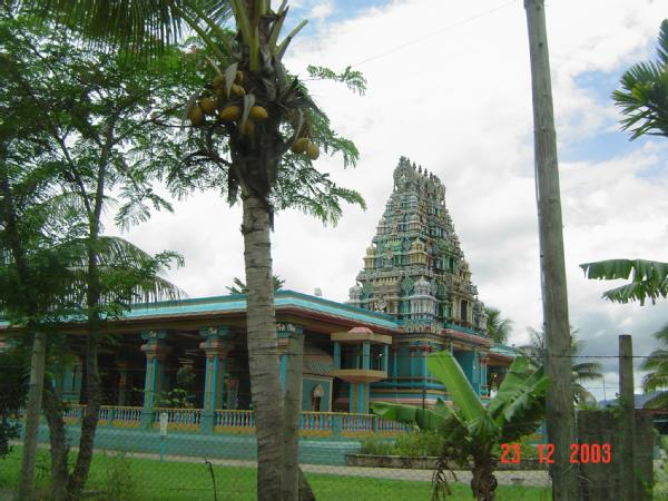
Swami Temple in Fiji


----------------------------------------
2006-03-03 12:54:01 5.8 20.84S 178.95W Fiji Islands Region
MAP 6.1 2006/03/05 08:07:56 -20.077 -175.667 197.2 TONGA

Chile/Argentina border region (Second day symptom - strong)
----------------------------------------
2006-03-05 04:44:56 5.5 24.17 S 67.11 W Chile-Argentina Border Region
MAP 4.7 2006/03/05 05:06:09 -23.747 -67.540 20.6 ANTOFAGASTA, CHILE

Flores, Indonesia (8.08 S 122.51 E)
----------------------------------------
04Mar2006 10:45:32.7 2.7S 104.2E 33 mb=5.0 M GSR SOUTHERN SUMATERA, INDONES

Hawaii(19.497 -155.326) (MEDIUM)
----------------------------------------
MAP 2.4 2006/03/04 01:35:35 19.437 -155.322 4.6 9 km ( 6 mi) W of Volcano, HI
MAP 2.9 2006/03/04 03:32:20 19.430 -155.318 4.2 9 km ( 6 mi) WSW of Volcano, HI
MAP 2.7 2006/03/04 03:36:50 19.432 -155.315 4.0 9 km ( 5 mi) WSW of Volcano, HI
MAP 1.8 2006/03/04 05:13:33 19.541 -155.163 44.0 2 km ( 1 mi) W of Mountain View, HI
MAP 1.8 2006/03/04 09:22:57 19.436 -155.317 4.0 9 km ( 5 mi) W of Volcano, HI
MAP 3.6 2006/03/04 10:19:59 19.439 -155.315 5.2 8 km ( 5 mi) W of Volcano, HI
MAP 1.7 2006/03/04 16:21:07 19.323 -155.232 4.1 14 km ( 9 mi) S of Volcano, HI
MAP 1.9 2006/03/04 23:23:15 19.444 -155.314 3.6 8 km ( 5 mi) W of Volcano, HI


MAP 2.0 2006/03/05 18:54:32 19.386 -155.285 3.0 9 km ( 5 mi) SW of Volcano, HI
MAP 1.7 2006/03/05 16:46:07 19.389 -155.284 2.7 8 km ( 5 mi) SW of Volcano, HI
MAP 2.5 2006/03/05 08:09:05 19.441 -155.325 5.1 9 km ( 6 mi) W of Volcano, HI
MAP 2.8 2006/03/05 04:58:13 19.434 -155.318 4.1 9 km ( 6 mi) WSW of Volcano, HI
MAP 2.0 2006/03/05 03:47:26 19.440 -155.316 4.1 8 km ( 5 mi) W of Volcano, HI
MAP 1.8 2006/03/05 03:18:42 19.366 -155.381 0.5 18 km ( 11 mi) WSW of Volcano, HI
MAP 1.8 2006/03/05 03:13:22 19.444 -155.316 4.1 8 km ( 5 mi) W of Volcano, HI
MAP 1.7 2006/03/05 02:00:59 19.441 -155.325 2.5 9 km ( 6 mi) W of Volcano, HI
MAP 2.9 2006/03/05 01:45:42 19.431 -155.322 5.9 9 km ( 6 mi) WSW of Volcano, HI
MAP 3.1 2006/03/05 01:45:19 19.431 -155.323 4.0 9 km ( 6 mi) WSW of Volcano, HI
MAP 3.8 2006/03/05 01:41:56 19.437 -155.319 6.3 9 km ( 6 mi) W of Volcano, HI
MAP 2.1 2006/03/05 01:33:35 19.432 -155.323 4.2 9 km ( 6 mi) WSW of Volcano, HI
MAP 2.6 2006/03/05 01:11:54 19.432 -155.324 4.1 9 km ( 6 mi) WSW of Volcano, HI

Northern Peru (-2.0855 -78.0944)
----------------------------------------
2006-03-05 05:28:21 5.6 3.52 S 76.75 W Northern Peru

North Pacific Ocean (42.11 N 159.44 W) (Strong)
----------------------------------------
(Nothing found)

Nepal (29.50N 81.44E)
----------------------------------------
(Nothing found)

Peace to all.