*For Wednesday, 16 August 2006.
LEGEND for OVERVIEW: Size = My surety of area for quake.
Red Circle = Probable quake to STRONG quake.
Triangle = Very Strong/Stronger quake (Usually takes extra days).
Blue Circle, etc. = Uncertainty of symptom area for probable quake.

Places to watch.
Good luck to all.
For Wednesday, 16 August 2006.
----------------------------------------
Guadalupe Victoria, Mexico (32.389 -115.254)
----------------------------------------
(Nothing found)
Alaska Peninula
----------------------------------------
2.6 2006/08/16 01:14:46 57.712 -155.373 15.0 ALASKA PENINSULA
Phoenix Islands, Kiribati Region (4.02S 171.43W)
(Something unusual. I usually don’t know the
area of a symptom until I transpose my notes
the next day and look them up in my database.
But I had a dream about a bright red bird with
green wings and a blue ruff around the neck and
got the word Kiribarti or Kribarry. When looking
up my left ankle outside symptom - it was Phoenix
Islands, Kiribati Region. Certainly the Phoenix
was a bright bird and the word was very close so
I am calling this - STRONG.)
----------------------------------------
(Nothing found)
(08-21-06 :5 days extra - 9 days from dream. Today the death of Joe Rosenthal who took the picture of the Marines raising the flag on the Island of Iwo Jima. Maybe this was the reason for the dream.)
Sicily, Italy/Ionian Sea
then
Northern Italy
and
Central/Southern Italy
(Separate symptoms)
----------------------------------------
2006-08-16 17:07:55.0 43.77N 10.21E 10 ML2.6 CENTRAL ITALY
2006-08-16 17:27:32.0 43.76N 10.21E 10 ML2.4 CENTRAL ITALY
2006-08-16 17:16:39.0 43.78N 10.23E 6 ML2.5 CENTRAL ITALY
2006-08-16 20:55:48.1 43.73N 10.21E 2 ML3.1 CENTRAL ITALY
(Nothing found for the other areas of Italy.)
Guatamala/El Salvador area
(Strong)
----------------------------------------
06/08/16 21:34:53 13.06N 88.69W 24.1 3.3ML Frente a El Salvador
06/08/16 05:59:39 12.28N 87.77W 9.6 2.8ML Frente al Cosigüina
06/08/17 05:51:51 12.02N 86.91W 75.0 2.8ML Frente a Puerto Sandino
Northern Sumatra (STRONG)
----------------------------------------
(Came in on the 18th and posted there.)
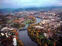
North of Canby, Oregon area
(45.304 -122.362)
or Scotts Mills, Oregon
or Eugene, Oregon
(These areas are all near each
other and I got 3 symptoms so
Very Strong.)
http://wrgis.wr.usgs.gov/wgmt/pacnw/canby/>wrgis.wr.usgs.gov
----------------------------------------
1.3 2006/08/17 12:07:27 45.348N 122.016W 3.6 3km(2 mi)W of Mount Hood Village, OR
1.3 2006/08/17 12:05:14 45.340N 122.062W 15.4 7km(4 mi)WSWof Mount Hood Village, OR
(Also posted on the 19th for specific pain for Mt. Hood. This “might” still be coming as late as 9 days extra - 25 August. Otherwise, I interpreted this wrong or things changed. Earth can do as she needs to do.)
WNW of West Yellowstone, MT
(44.776 -111.348) (MEDIUM)
----------------------------------------
1.8 2006/08/16 12:19:18 44.494 -111.123 13.1 17 km ( 11 mi) E of Island Park, ID
Mt. St. Helen’s (Medium)
----------------------------------------
1.2 2006/08/16 05:51:33 46.197 -122.196 0.8 1 km(1 mi) WSW of Mount St. Helens Volcano, WA
2.1 2006/08/16 08:34:33 46.197 -122.193 0.0 1 km(1 mi) WSW of Mount St. Helens Volcano, WA
1.9 2006/08/16 15:36:56 46.197 -122.194 0.6 1 km 1 mi) WSW of Mount St. Helens Volcano, WA
The Pyrenees/France-Spain
border on Mediterranean side.
(STRONG)
----------------------------------------
2006-08-16 04:16:40.1 48.34N 7.76E 10 ML2.7 FRANCE
2006-08-16 17:06:59.4 47.45N 1.22W 10 ML2.8 FRANCE
2006-08-16 19:09:12.5 41.55N 9.04E 10 ML2.6 CORSICA, FRANCE
Kamchatka and then
Eastern Siberia and then
Kurils
(Very Strong for Eastern
Siberia)
http://extreme.k2.omsknet.ru/eng/trekking/kodar/
extreme.k2.omsknet.ru

----------------------------------------
2006-08-17 01:40:26.5 52.42N 161.17E 33 Ms3.3 OFF E. CST KAMCHATKA PEN.
2006-08-17 01:22:48.4 52.78N 159.70E 60 mb5.1 OFF E. CST KAMCHATKA PEN.
2006-08-17 11:11:36.4 55.68N 161.82E 80 mb6.1 NEAR E. CST KAMCHATKA PEN.
2006-08-17 15:20:36 6.1 46.58N 141.98E 20 Sakhalin, Russia
Guerrero, Mexico (18.84N 100.43W)
(VERY STRONG)
http://www.tourbymexico.com/guerrero/guerrero.htm
----------------------------------------
2006/08/16 00:15:58 15.61 96.43 7 3.8 15 km al SUR de S PEDRO POCHUTLA, OAX
2006/08/16 07:47:05 16.37 94.577 7 3.7 30 km al SURESTE de UNION HIDALGO, OAX
2006/08/16 18:52:36 15.99 98.39 5 4.7 54 km al SUROESTE de PINOTEPA NACIONAL, OAX
Luzon, Philippines area (17.2N 120.0E)
(MEDIUM)
----------------------------------------
(Nothing found)
Turkey
----------------------------------------
2006-08-15 01:03:52.4 39.25N 42.75E 50 MD3.5 TURKEY
2006-08-15 02:24:53.2 37.15N 30.97E 100MD3.4 TURKEY
2006-08-15 04:57:55.7 37.01N 35.59E 23 MD3.2 TURKEY
2006-08-15 04:52:42.9 37.01N 35.61E 29 MD2.9 TURKEY
2006-08-15 04:28:44.1 39.47N 39.76E 5 MD3.6 TURKEY
2006-08-15 07:56:38.8 39.42N 33.16E 8 MD3.0 TURKEY
2006-08-15 16:08:26.6 39.47N 39.69E 17 MD3.3 TURKEY
2006-08-15 23:25:22.6 40.04N 34.65E 8 MD3.0 TURKEY
2006-08-16 00:26:39.4 39.39N 33.18E 5 MD3.2 TURKEY
2006-08-16 10:38:57.1 37.02N 38.94E 7 MD3.0 TURKEY
2006-08-16 10:14:20.0 39.01N 31.07E 8 MD2.8 TURKEY
2006-08-16 10:38:57.1 37.02N 38.94E 7 MD3.0 TURKEY
Strait of Gibraltar/Morocco/Algeria area
(MEDIUM)
----------------------------------------
2006-08-16 17:10:42.0 34.67N 5.70W mb4.2 MOROCCO
Romania (STRONG)
----------------------------------------
14Aug2006 11:50:02.6 47.0N 22.3E 0 ML=2.7 M ROM ROMANIA
14Aug2006 21:32:29.3 46.0N 27.4E 31 ML=1.1 M ROM ROMANIA
(2 days early)
2006-08-16 17:12:54.8 45.75N 24.80E 200 ML2.7 ROMANIA
Volcano Islands area (23.40N 143.14E)
(Strong)
----------------------------------------
2006-08-16 18:35:47.8 23.41N 142.23E 33 mb4.6 VOLCANO ISLANDS, JAPAN, REGION
Puerto Rico/Virgin Islands
----------------------------------------
3.1 2006/08/16 01:42:01 18.860 -67.176 12.4 43 km ( 27 mi) NNW of Isabela, PR
1.8 2006/08/16 08:22:01 17.943 -67.081 13.1 5 km ( 3 mi) SW of La Parguera, PR
3.1 2006/08/16 15:18:54 18.687 -66.569 17.0 26 km ( 16 mi) N of Garrochales, PR
Yukon/Northwest Territories
----------------------------------------
2006/08/14 20:51:23 61.58N 138.68W 1.0* 3.2ML 111 km NW of Haines Jct.,YT
2006/08/14 17:40:16 65.01N 134.04W 1.0* 3.0ML 270 km SE of Ft. McPherson,NT
2006/08/14 16:53:51 62.02N 124.05W 1.0* 2.6MN 149 km NW of Ft. Simpson,NT
(2 days early)
Peace to all.

posted by Unknown @ 2:22 PM
0 comments
![]()
![]()
